Osh Bazaar

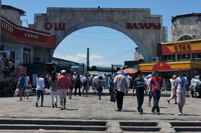
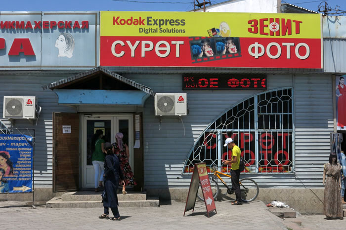
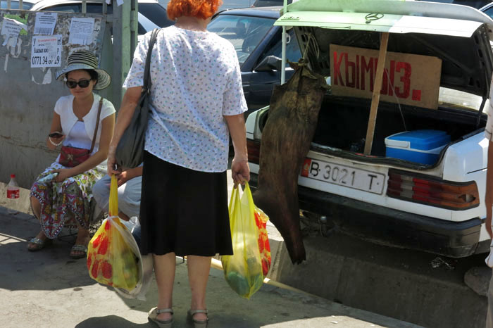
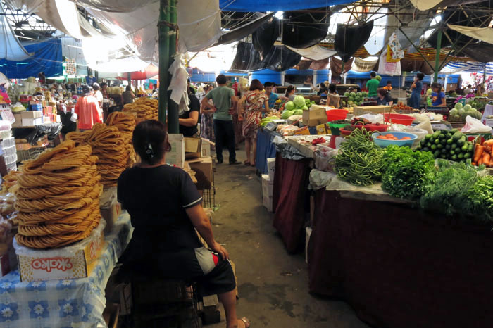
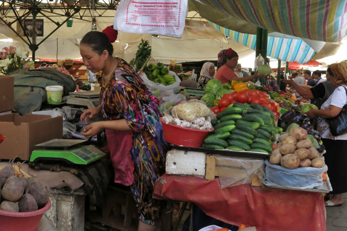
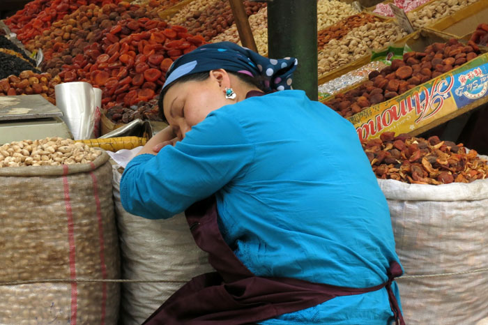
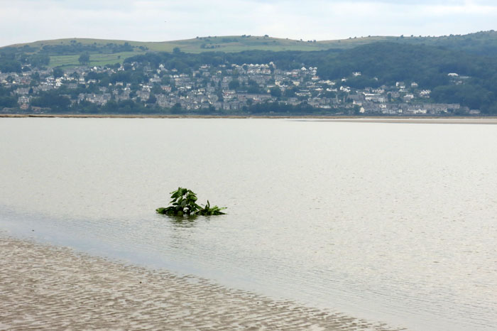
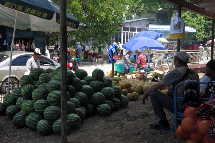
IMG_9760The first thing to know is that it isn’t in Osh. Rather, it is in the capital Bishkek. Why this bazaar shares the name of Kyrgyzstan’s second city is uncertain. Perhaps it’s because it is here that you come to look for a shared taxi ride south to Osh; or maybe it is something to do with the shout of the porters as they work their way through the crowd asking shoppers to move out of the way – “(b)osh, (b)osh”? No matter, there is no confusion when you get here as the bazaar’s name is spelled out in big red letters on the large arch that marks its entrance. In Cyrillic script OSH looks more like OW, but there’s no exclamation mark à la Devon’s Westward Ho!IMG_9761Osh Bazaar, just west of the city centre near the main bus station is Bishkek’s best known market, although not its largest – for that you need to travel just north of the city limits to Dordoi Bazaar where you’ll find thousands of stacked shipping containers serving as shops. Osh Bazaar is more traditional – no shipping containers, just hundreds of small shops and a couple of huge hangars that have stalls selling everything that you might imagine along with a few items that you might not. Mostly though, it is food and drink – fruit, vegetables, meat, dairy and baked goods. This is the place to come for Kyrgyz specialities like kumys (fermented horse milk) or kuruut (sour yoghurt balls) but pretty well anything can be found here with diligent searching. If it is angels’ tears or unicorn ham that you need then Osh Bazaar is probably your best bet in the city.IMG_9763My last visit was early last summer on a scorching day with temperatures nudging 40 degrees centigrade. Osh Bazaar has something of a reputation for dodgy plainclothes policemen who home in on obvious foreigners to ask for passports and the handing over of foreign currency ‘to count’. Perhaps it was just too hot to bother that day – or maybe I just looked like an ethnic Russian local (unlikely) – but there was no sign of them. Just heat-frazzled shoppers and exhausted stall holders dozing between customers.IMG_9737IMG_9756IMG_9753IMG_9748untitled


The third edition of my Bradt Kyrgyzstan guide will be published later this week.


Thingvellir

IMG_4329a

The winter solstice marks the dark frontier of the annual cycle: that time of year when days are at their shortest; the period of feasting before the corner of the year is turned and daylight and warmth return to awaken barren nature with voluptuous spring. Perhaps it is appropriate to represent this seasonal turning point with images of another type of frontier – a geographical one?

Thingvellir in southern Iceland lies at the meeting point of two continents and two major tectonic plates – the Eurasian Plate and the North American Plate. Rather than a violent collision of rock, as in the case of great mountain ranges like the Andes or Himalayas, here the plates are pulling apart in opposite directions – the rift valley between the two is actually becoming wider by approximately 7 mm every year. This is, in fact, the only place on earth where seafloor spreading of a mid-ocean ridge can be seen on solid land rather than at the bottom of an ocean. Elsewhere in the world this might seem remarkable but in such a newborn baby of a landmass as Iceland, where it is possible to witness the creation of new terra firma before your very eyes, such phenomena seem almost commonplace.

IMG_4352a

By what we can only imagine was serendipity the earliest Viking settlers in Iceland chose this very place for their annual outdoor assembly. Thingvellir and the beautiful lake of Thingvallavatn, the largest lake in the country, lie at a natural crossroads that connects the south and west of Iceland and so make for a convenient location for large gatherings. It was undoubtedly a pragmatic choice but, even so, the landscape here seems to glow with an inherent magic that goes beyond mere aesthetic appeal. Such magic of place seems to be at its most powerful during the short days of mid-winter when these images were taken. Those early Icelanders clearly knew what they were doing.

Happy Christmas

IMG_4356a

Snettisham

IMG_3195

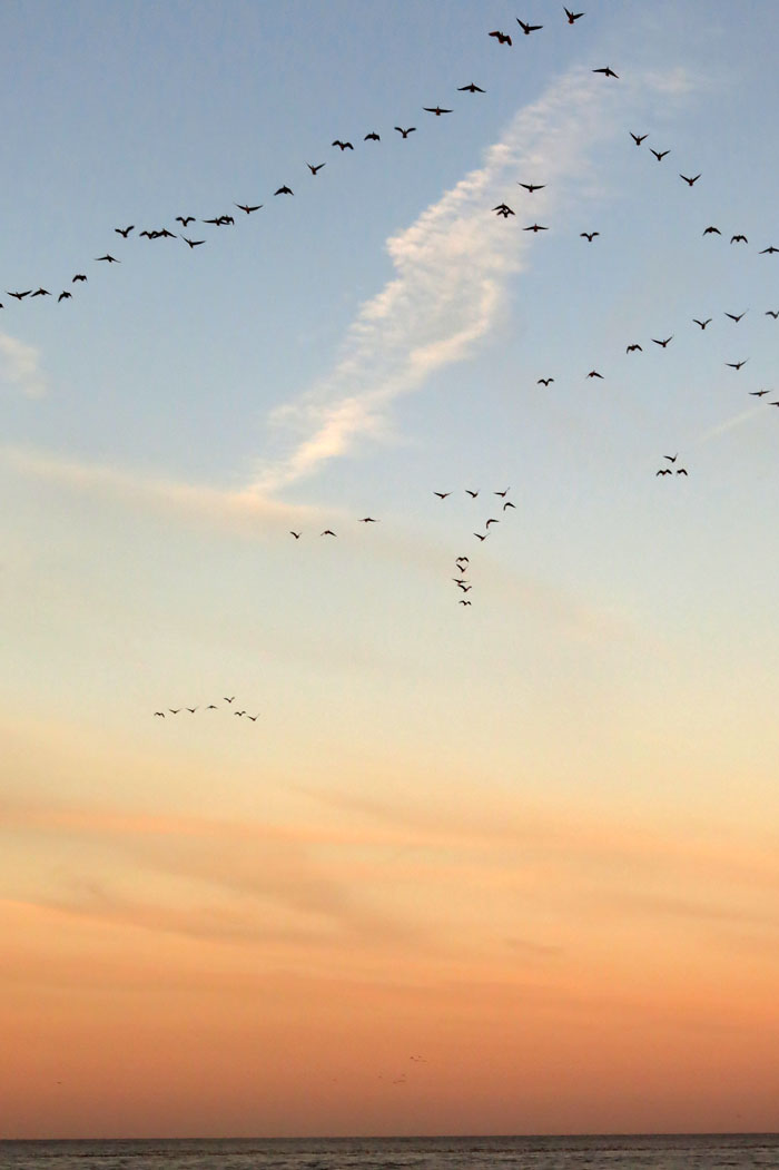
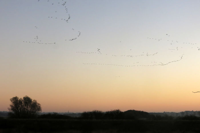
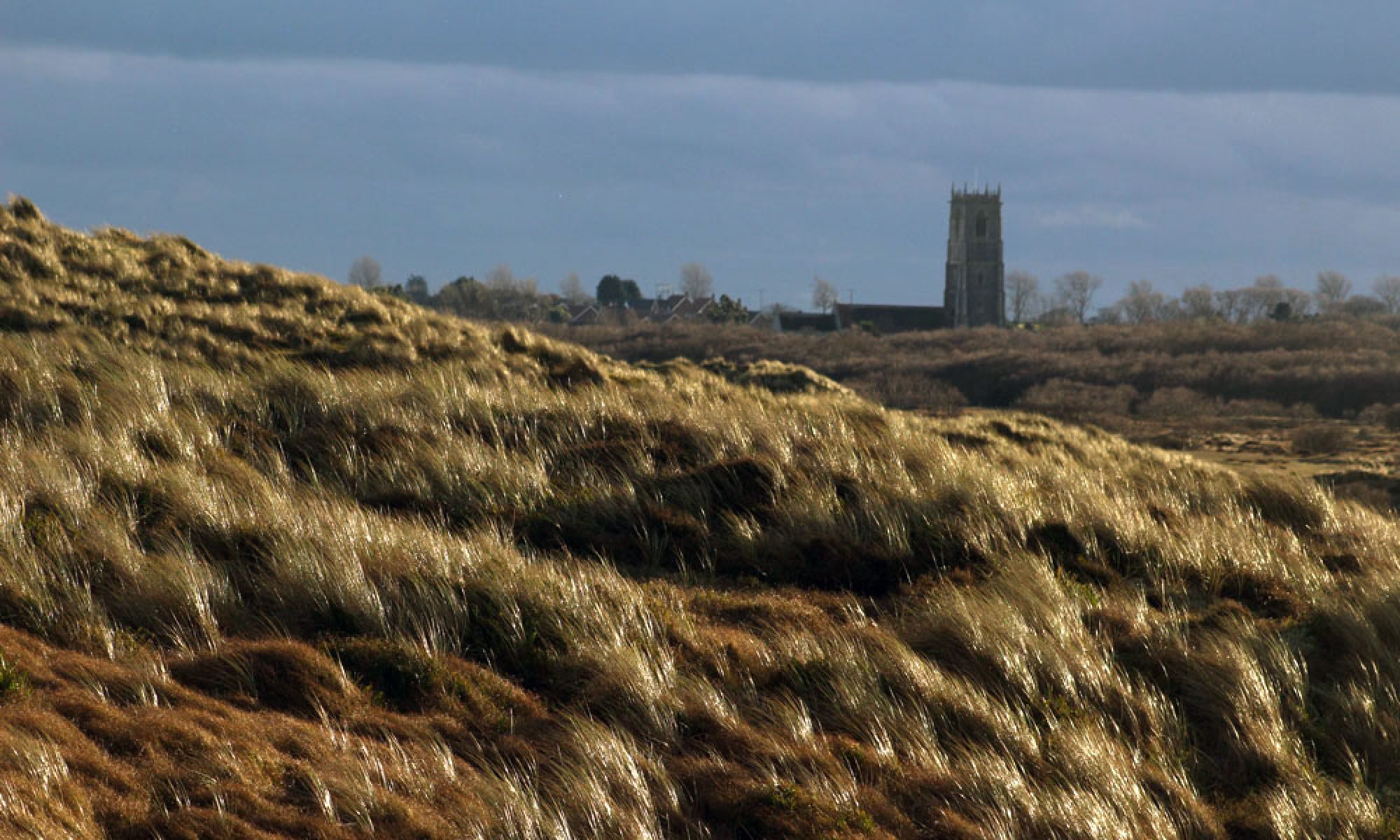
There’s a good omen as we leave Heacham before dawn: the sharp cry of a tawny owl emanating from somewhere in the woods. Fifteen minutes later, walking from Snettisham RSPB car park towards the beach at The Wash, there are already a  few skeins of geese in the sky, flying west, ready to breakIMG_3208fast on sugar beet fields.

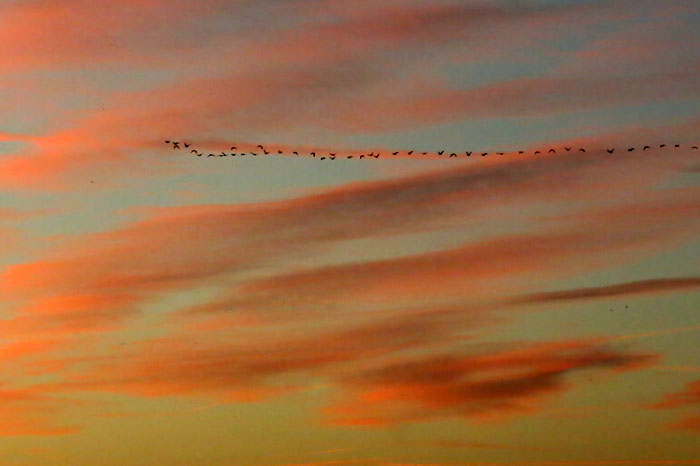
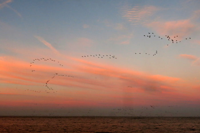
Mostly though, you hear them before you see them – a noisy gabbling racket coming from dark rafts of life out on the water. Tens of thousands of pink-footed geese overwintering from Greenland and Iceland – west Norfolk must seem like Shangri-La after all that tundra and icy water. The geese peel off in groups at regular intervals, forming fluid arrowheads as, honking excitedly, they fly west inland.

IMG_3247

There is an unwritten discipline at work, and every bird seems to know its place in the squadron. Flapping inland, the geese merge loosely with other groups before they eventually disappear from view. To our human eyes, Snettisham church rising out of the mist is the only recognisable local landmark; perhaps its steeple serves as a beacon to the geese too, as they seem to know exactly where they are going. IMG_3218

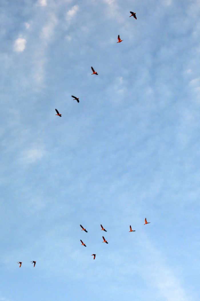
The sun rises over the land, a brilliant orange fire that lights the birds as they fly over head, turning their underbelly pink, orange, red. Momentarily they almost resemble flamingos.

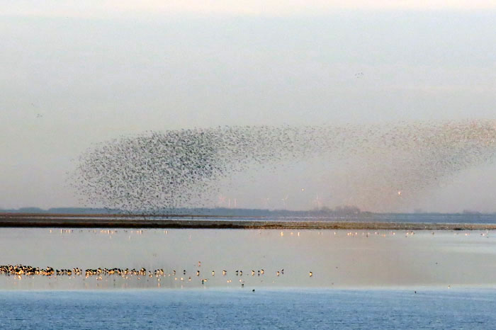
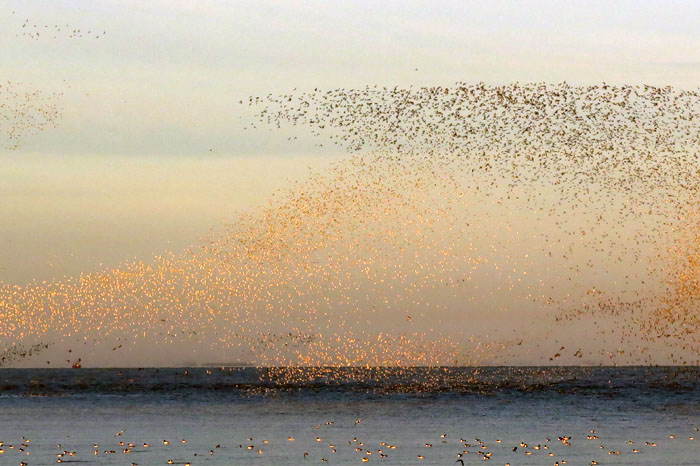
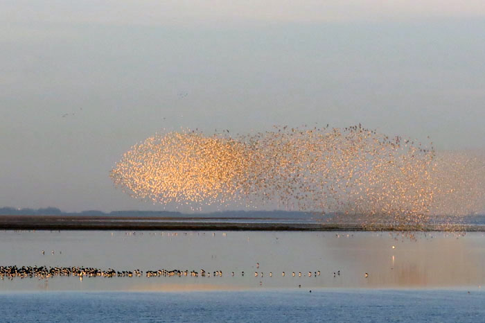
IMG_3244The tide is turning quickly and hidden sandbanks are revealed as the unseen moon sucks water from the land. As dawn-pink drains from the sky our attention is drawn to an untold number of hyperactive waders a little way to the south. Mostly dunlin, curlew and knot, it is the latter, another Arctic winter visitor, that are the most extraordinary as dense clouds of them rise sporadically into the sky, tightly grouped like starling murmurations. As they swiftly weave and turn, shifting the angle of their wings, the colour of this mass organism transforms dramatically from black to white to golden – the avian equivalent of a firework display. Such fleeting serendipity of form and colour: a photograph can hardly do this justice. As with the pink-footed geese, the Arctic’s seasonal loss is Norfolk’s gain.

IMG_3282IMG_3269IMG_3265

IMG_3267

IMG_3313 IMG_3344

Kyrgyz Graveyards

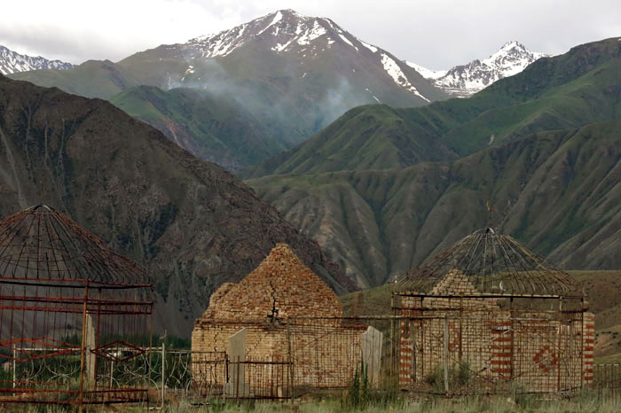
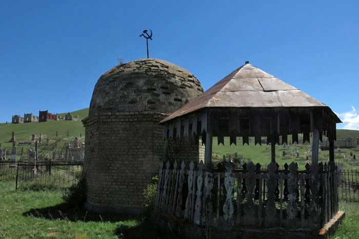
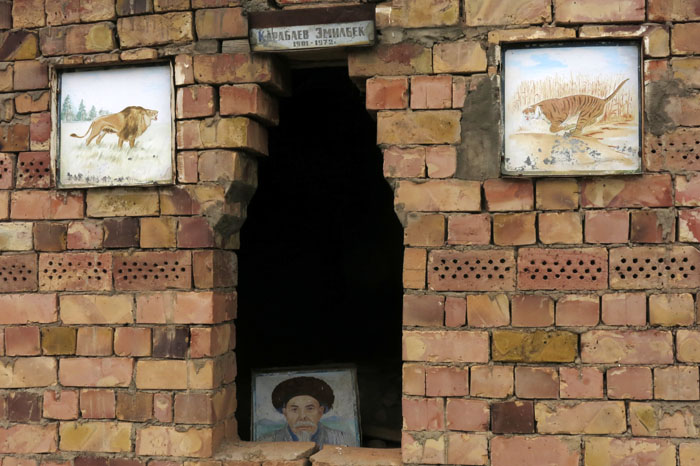
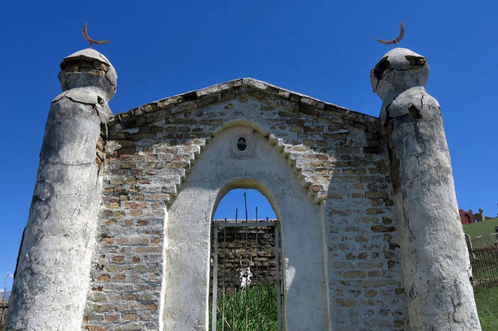
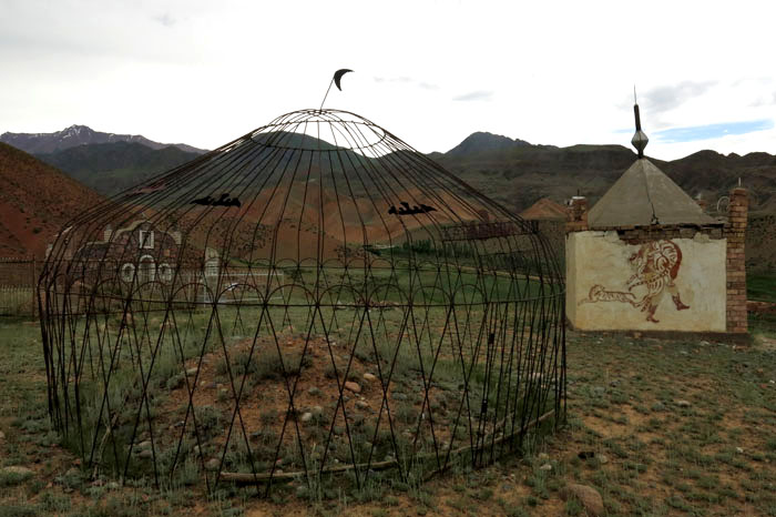
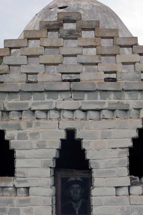
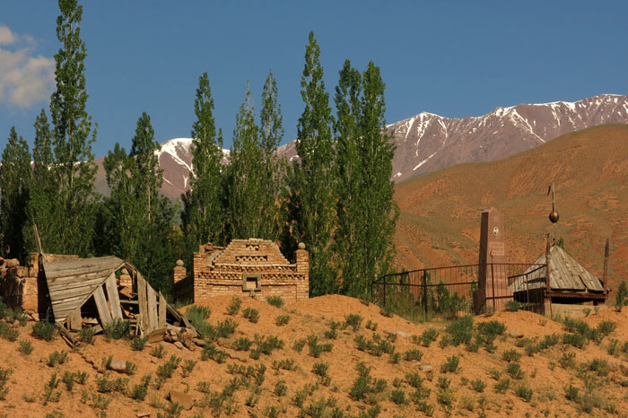
IMG_8525You see them everywhere in Kyrgyzstan. From afar they resemble hillside villages of mud-brick dwellings but a closer look reveals them to be cemeteries. Usually located a little way outside a village, sometimes on top of a low bluff, they are often more impressive than the villages they serve. With a mixture of mud-brick, shrine-like tombs, gravestones with etched images of the deceased, and Islamic crescent moons intermixed with communist five-pointed stars, they represent an odd amalgam of funerary styles. What makes them unmistakably Kyrgyz, though, are the large, wrought-iron, yurt structures that mark many of the graves.

IMG_8249

A nomadic people until well into the 20th century, the Kyrgyz used to be buried without fuss wherever they died. Although important nobles and warriors were sometimes honoured with showy mausoleums, most Kyrgyz graves were simple and basic. However, when this nomadic lifestyle was forcibly abandoned during the Soviet period the erection of large memorials to the dead started to become fashionable with the newly sedentary Kyrgyz. It may seem ironic that a wandering people like the Kyrgyz should choose such an earth-bound dwelling after death but a new practice emerged in the 1930s of erecting monuments that recalled their former nomadic lifestyle. As well as the wrought-iron yurt frames that reflected nostalgia for the old way of life, etched portraits – a Russian custom – also started to feature on gravestones. Traces of an altogether more ancient culture became prevalent too: the tradition of pre-Islamic shamanism in which antlers, animal skulls and horses’ tails are used to decorate tombs.

IMG_8530In Kyrgyz graveyards disparate traditions – shamanistic, Islamic, communist – intermingle freely. Gently crumbling as their mud-brick mausoleums slowly decay back into the earth, such cemeteries can be seen far and wide in this central Asian country. Some of the finest are those that can be seen in villages along the Suusamyr Valley in Chui Province. The photos here were taken in two villages in this isolated valley – Kyzyl-Oi and Suusamayr.

IMG_8229IMG_8545IMG_8536IMG_8240IMG_8247IMG_8340

untitled

There will be more on graveyards and many other aspects of Kyrgyz culture in the forthcoming third edition of my book Kyrgyzstan: the Bradt Travel Guide, which will be published early next year.

More information on Kyrgyzstan, including photographs and extracts from the forthcoming book, is available on the Kyrgyzstan page of the Bradt website.

Crossing Morecambe Bay

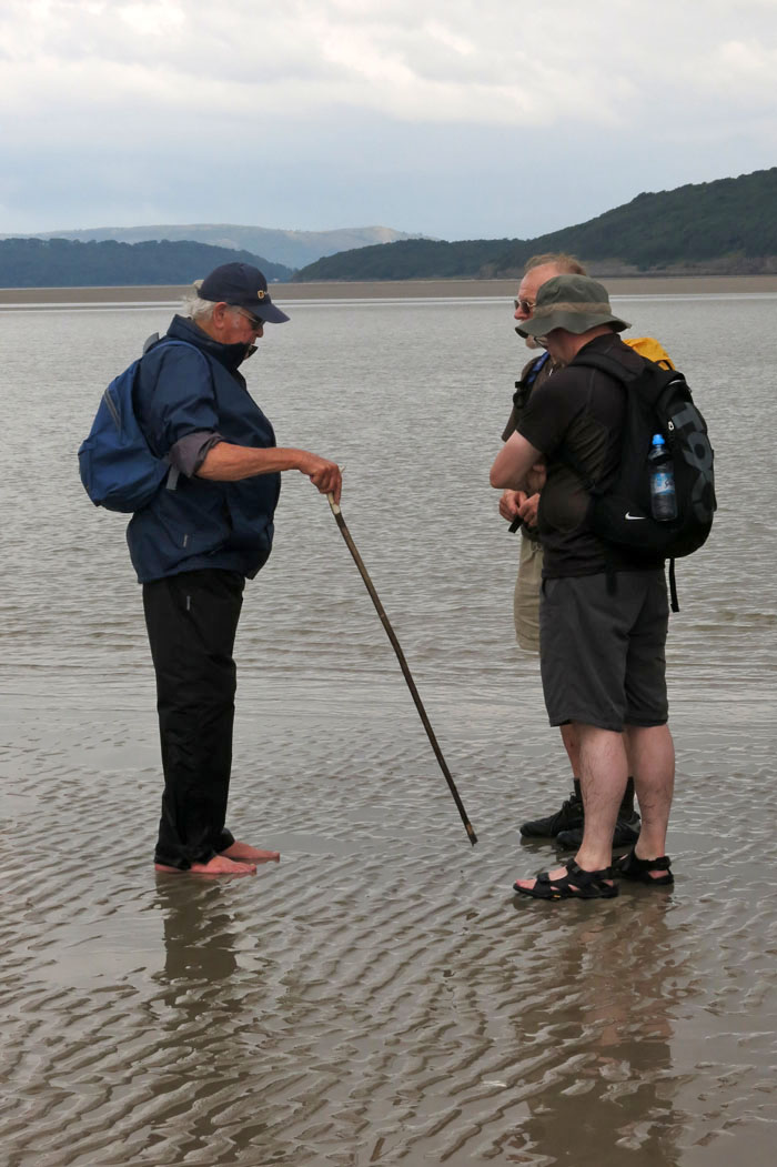
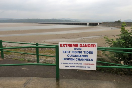
IMG_0733Of all the footpaths and byways that criss-cross our ancient landscape probably the most enigmatic are those that cannot be mapped because of their very impermanence. Such routes can only be defined by their start and end points rather than the space that lies in between. These conduits of human movement are impermanent in the sense that their course is forever obliged to change with the whims of nature. What is fixed is the historical notion of the route rather than the precise territory that has been traversed. Like shipping routes that must studiously avoid rocks but which have a freer rein in safe channels, footways across tidal estuaries are fluid and everchanging. One celebrated historic route is that which crosses Morecambe Bay on the south Cumbrian coast.
IMG_0757

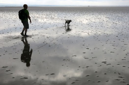
IMG_0859Men and women have been crossing Morecambe Bay for centuries, millennia even, but the passage has always been fraught with the danger of quicksand and fast-moving incoming tides. The tragedy that befell a group Chinese cockle diggers stranded here a decade ago is still fresh in the national psyche. Caught by the perfidious tide, abandoned by unscrupulous gangmasters, the poor migrants that perished here were caught out by both nature and the greed and indifference of their exploiters.
IMG_0791

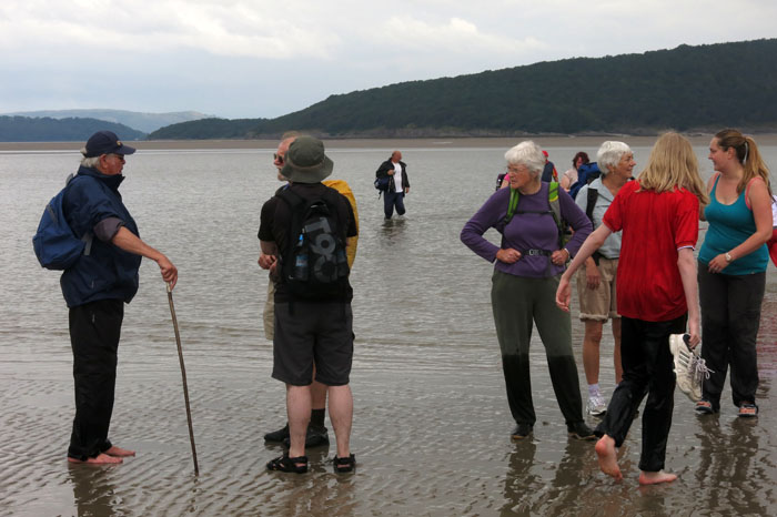
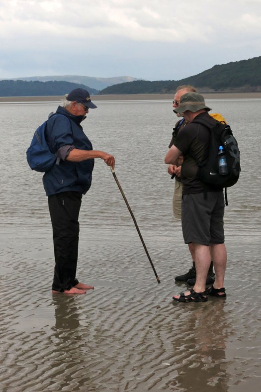
While Morecambe Bay’s dangers are apparent enough, there is one man who, given time, can always find a way across between the south and north shores of the bay. Cedric Robinson MBE is the official ‘Queen’s Guide to the Sands of Morecambe Bay’ and receives the princely sum of £15 annually from the Crown (and a virtually rent-free cottage) for performing this duty. Formerly a fisherman and farmer, Cedric is the 25th custodian of the the title having performed the role since 1963. The first official guide was appointed by the Duchy of Lancaster back in the mid 16th century. Prior to this, it was the monks of Cartmel Priory who escorted travellers across the sands. No doubt little has changed in the way that the guides read the landscape – assessing the movement of the sands, the shift of the channels, the whereabouts of treacherous quicksand and the height of the river water. In a grudging nod to modernity, Cedric also has a tractor at his disposal.
IMG_0800

The weather forecast for our crossing from Arnside to Kents Bank was anything but auspicious, with predictions of heavy rain and the threat of the summer storms that had already tormented the south of England making an unwelcome appearance. Come the day though, there seemed to be nothing worse than light drizzle and low cloud.
IMG_0809

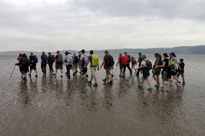
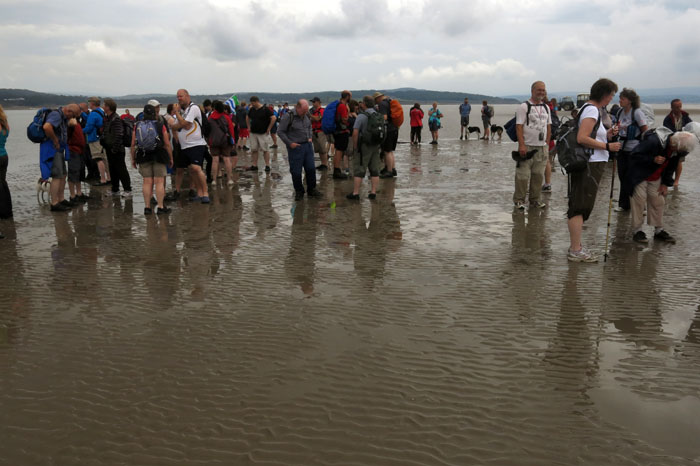
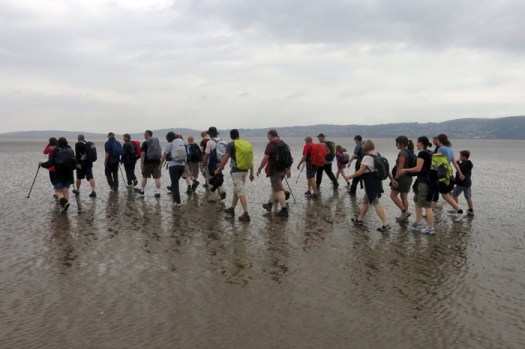
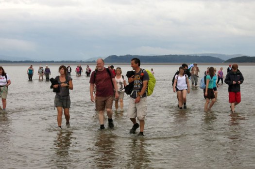
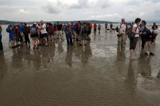
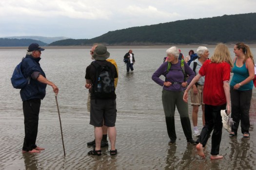
Something of the order of one hundred people had assembled at the jetty at Arnside for the 11am start across the bay. Cedric appeared on cue to blow his whistle and lead a colourfully (yet sensibly) clad crocodile of hikers, geocachers, dog-walkers and other outdoorsy types along the high street and past a caravan site before venturing out across the estuary. Leaving dry land behind, the group soon becomes an ambulant community, a walking-talking organism worming its way west across the sands. Crossing is exhilarating rather than a solemn trudge and the next three hours pass quickly as we walk briskly over rippled sand and wade through knee-high through channels of the River Kent, its fresh water surprisingly warm.
IMG_0797

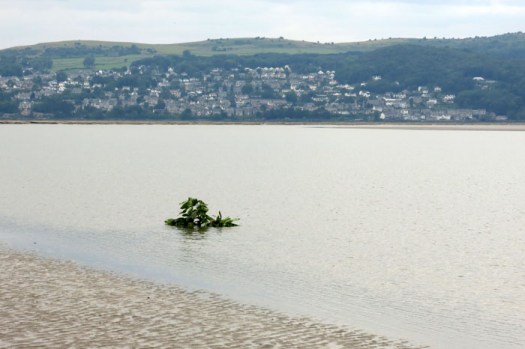
It all seems surprisingly straightfoward, even crossing the river channels where there is a distinct undertow. Such ease of passage is thanks to Cedric who has already been out the previous day weighing up the options and marking the ever-changing route with laurel branches (‘brobs’, cut close to Cedric’s Kents Bank home at Guides Farm) that he has wedged into deep holes crow-barred into the mud. The markers are good for the next couple of days but when Cedric next takes a group out in a fortnight’s time he will need to do the pathfinding and route-marking all over again – nothing is permanent here. In Morecambe Bay the fluidity of time is all-apparent.
IMG_0760

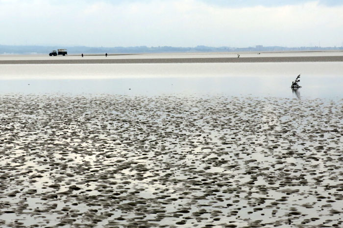
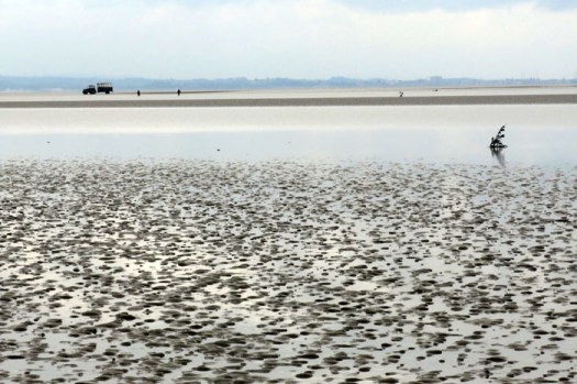
IMG_0806Halfway across, the light rain eases and the sun appears, albeit dimly like a ghostly face through frosted glass. In the distance, a tractor and trailer driven by Cedric’s assistant can be seen on the bank of the River Kent, our first serious wade. The shoreline now seems a distant and untrustworthy illusion, the glimpses of Morecambe seen to the southeast, a phantasmagorical will-o’-the-wisp beyond a hazy threshold to another world. Once across the second of the deeper channels we wait while Cedric does some last minute route-finding, walking some distance towards the houses of Grange-over-Sands on the north shore before returning to give us the all-clear.
IMG_0851

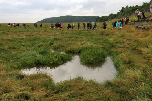
Just before we reach the sheep-grazed marshes that fringe the shoreline, there is a moment of high drama as an area of sand the size of a car wobbles alarmingly like a jelly fish to warn of its danger: unstable quicksand with water beneath that could swallow a horse (indeed, Cedric has actually witnessed such a thing). Even the most maverick among us need no reminding to skirt this and keep moving until we are on firmer ground. A little further on and the scattered buildings of the shoreline assert themselves from behind the trees and we find ourselves climbing up to the platform of Kents Bank railway station. A southbound train is due and after bidding Cedric farewell (and purchasing a ‘Certificate of Crossing’ and a signed copy of his Time and Tide book) we climb on board for the two-stop, ten-minute journey back to Arnside. The train itself is bound for Manchester Airport, an altogether more obvious starting point for journeys to other phantasmagorical worlds that lie beyond the threshold of our imagination.
Arslanbob – In Walnut Tree Shade

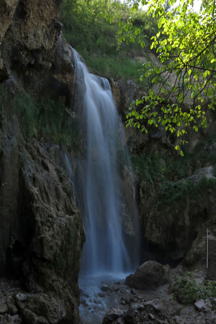
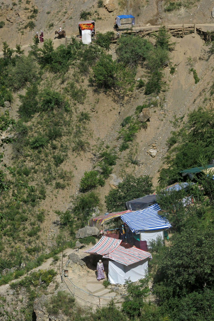
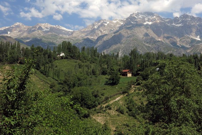
IMG_9321It had been almost eight years since I was last in Arslanbob, a tantalisingly spread-out settlement in Kyrgyzstan’s Jalal-Abad province. As before, I had arrived at the start of Ramadan – the moon was new, the mosque was full; a holiday mood gripping the steep rocky streets of this sprawling mountain village. This time though, it was stifingly hot late June rather than pleasantly cool mid September, and the walnuts that the area is famous for were still forming on the trees – ovoid green jewels dangling from silvery branches, their sweet ripeness yet to develop. The last time I was here it was during harvest season and walnuts were everywhere – stacked in pyramids at the bazaar, piled in dishes in every home, filling pockets, bags and every potential container. To walk in Arslanbob at such a time was to invite walnut generosity – for foreign visitors even the shortest excursion into the streets resulting in bulging pockets, stuffed rucksacks and camera bags. Walnuts even appeared to serve as legal currency – on first arriving in the village I witnessed a pair of laughing schoolgirls paying their minibus fare with a handful of nuts; the driver didn’t seem to mind at all.IMG_9163IMG_9394Of course, Arslanbob is not just about walnuts: the village has multiple identities. A relatively conservative Uzbek enclave in a predominantly Kyrgyz nation, Arslanbob has strong historical ties with Uzbekistan’s Fergana Valley that lies not so very far away over gerrymandered Soviet-period borders to the south (never was the political strategy of ‘divide and rule’ more apparent than with the convoluted and sometimes utterly nonsensical lines of demarcation that separate the now independent republics of Central Asia – Kyrgyzstan, Uzbekistan, Tajikistan). Almost totally Uzbek in population and culture, Arslanbob is also a spiritual centre of sorts, with holy rocks and sacred lakes in the mountains above the village and religious shrines in the surrounding forest. Islamic it may be, but there are strong animist and shamanist overtones too – the peoples of Central Asia have always had a strongly developed sense of place that has its spiritual expression beyond the normal confines of formalised religion.IMG_9172IMG_9597So walnuts and sacred shrines . . . there are another elements too. Since Soviet times the village has had a turbaza, a sanatorium that provides R&R for weary city folk. These days it is predominantly Uzbeks from the sweltering cities of Kyrgyzstan’s southern basin – Jalal-Abad and Osh – that come to stay. There is local sightseeing too – a scenic waterfall against the backdrop of a ravine lies quite close to the village centre. When I first visited this eight years ago, there were almost no visitors and little to be seen apart from plummeting water against a rugged rock face; the votive rags tied to the branches of a tree above the waterfall, the only evidence of human interest. Now things are rather different: a dust-cloud of lumbering Toyotas ferries visitors up from the bazaar where, after paying a token entrance fee, they pass through a phalanx of makeshift wooden stalls en route to the falls. The stalls sell all manner of tourist tat – plastic trinkets, cheap jewellery, carved wooden souvenir eagles and lions, souvenir Astanbap (Arslanbob) hats, medicinal mountain herbs in cellophane packets, lengths of fruit leather like seaweed and ‘I heart Islam’ T-shirts.IMG_9225IMG_9280It is easy enough to escape though. Take the path beyond the falls and the tawdry commercialisation swiftly drops away as a dazzling landscape reveals itself – towering snow-capped peaks, emerald pastures and farmhouses peeping through poplars on steep ridges. To the east and south extends a vast green swathe of walnut forest that stretches sublimely to vanishing point. Just two minutes beyond the falls the only sounds to be heard are those of running water, rustling leaves, birdsong, a distant complaining donkey and perhaps the woody squeak of a horse-drawn plough. All is transformed, and this is a heart-gladdening landscape to behold.IMG_9304IMG_9446Having struggled up to the Holy Rock before (at 2,900 metres elevation it lies at 1,600 metres above the upper part of the village), a long walk through the walnut forest seemed the sensible thing to do this time round. I set out with two German cyclists and a local guide from the uppermost part of the village, our starting point reached by means of a redoubtable ex-Soviet Army UAZ, which, although uncomfortable, you feel could go almost anywhere with a skilled driver and plenty of vigorous wheel twisting. From our dropping-off point a shady woodland path runs all the way to the settlement of Dashman in the heart of the forest. Along the way, we enjoy the unparalleled dappled sunlight – perfect camouflage for the green, yellow and black of golden orioles (which, sadly, we don’t manage to see). Here and there we pass through clearings filled with flowers – clary, marjoram, orchids, bugloss and tall yellow daisy-like blooms whose names we will never know.IMG_9530IMG_9554Dashman could hardly be described as a village, more just a scattered collection of houses each with its own bit of land in a clearing. This isolated settlement was, however, once home to displaced Chechens, uprooted and displaced from their Caucasus homeland by Stalin during World War II. The Chechens have long gone (one solitary Chechen remained in Arslanbob I was told, ‘a good man but too much drinking problem’) and now the houses are occupied by a handful of locals who keep animals to graze in the forest. There is a crossroads of tracks close to Dashman. Today it was a quiet place, with just a woman out fetching water, a beautiful blonde-maned horse wafting flies way and the liquid song of a blackbird trilling from the bushes. But it was at this very same location, our guide told us, that things came alive during the September walnut harvest. Many villagers would come from Arslanbob to camp here for a few days, gathering nuts by day and celebrating and socialising by night. There would be music, dance and laughter; traders from Arslanbob would set up temporary stalls; shashlyk would be grilled, much chai would be consumed. Naturally enough, the main currency of exchange would not be Kyrgyz som or US dollars but freshly harvested walnuts: a timely opportunity for nature’s bounty to show its true worth and for just a brief few days turn capitalism on its head.IMG_9573IMG_9563IMG_9510
Yuri Gagarin’s Holiday

Image

When Soviet cosmonaut Yuri Gagarin returned from the first successful manned space flight in 1961 he took a well-deserved holiday. We can only assume that this took place after a considerable debriefing by the Soviet military – it was, after all, a highly significant achievement and overnight he found himself to be the most famous living Russian after Nikita Khrushchev. The place he chose for his vacation – or rather, was chosen for him – was close to a large alpine lake in what was then the Kyrgyz SSR in Central Asia. This was a forbidden zone at the time and so safely well away from the prying eyes of Western journalists.

Image

Image

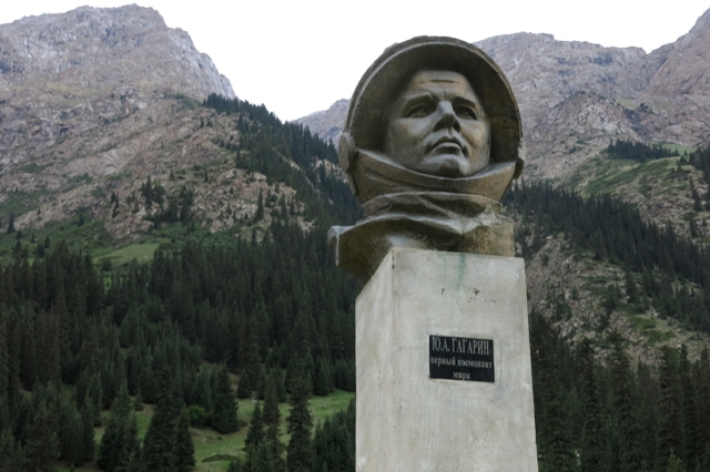
Tamga is a small, dusty village close to the southern shore of Lake Issyl-Kul in what is now Kyrgyzstan. Tamga still has its sanatorium, formerly a Soviet military R&R facility, and it was here that Gagarin stayed for a while, strolling the pine-shaded paths, bathing in the lake perhaps, no doubt eating shashlyk and contemplating his short but epoch-making sojourn in space. The camp is still popular with visiting Russians in high summer. While not deliberately nostalgic there is plenty to remind of its Soviet past – statues of military heroes tucked away between the conifers and stirring murals of proletarian power in the Soviet realist style. There is nothing to record Gagarin’s time here, no plaque or monument, but head a dozen or so kilometres up the neighbouring Barskoon Valley, and you will find a bust of the world’s first space traveller on a plinth. It stands beneath a lofty waterfall and Gagarin, of course, is depicted wearing a space helmet. On the road nearby stands another rather more colourful memorial to the cosmonaut, although damaged around the time of Kyrgyzstan’s independence in 1991 it has since been repaired. Although he belongs to another era, and another country, Gagarin remains a hero to many.

Image

San-Tash: The Riddleof the Stones

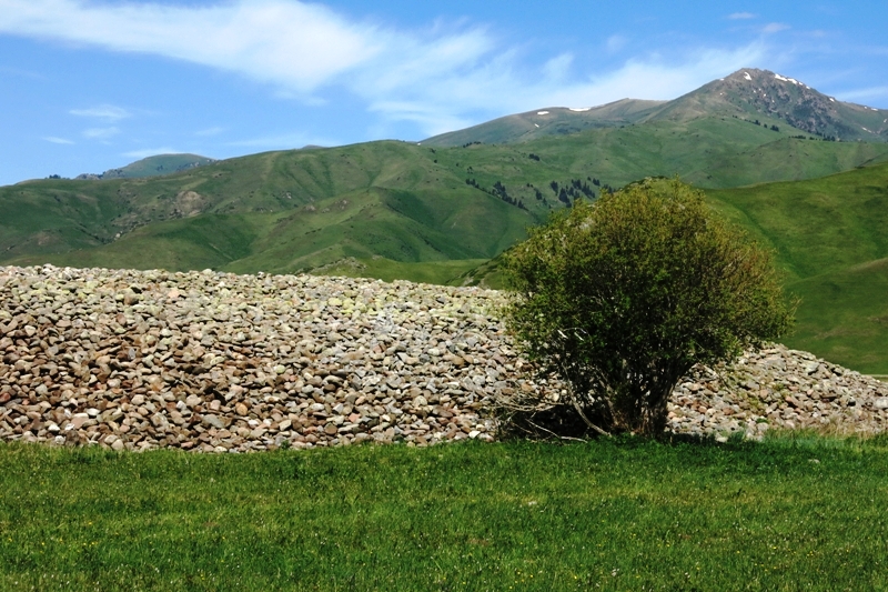
New Image7A large pile of stones in the Karkara valley: in the far northeast of Kyrgyzstan, close to the Kazakhstan border, San-Tash is an enigma. What can this pile alongside one of the ancient Silk Road routes possibly represent? Who placed them here, and why? One popular legend relates that the stones were deposited here by Tamerlane’s troops whilst they were on their way to battle in China. Tamerlane instructed each of his soldiers to bring a stone from Lake Issyk-Kul and leave it here, removing a stone on the way back if they had survived the conflict. But most of the stones are far too large to make this at all believable, and the number far too large – for an army to lose so many men in a battle, or even have this many men at arms to begin with, defies credibility. A more likely theory is that they are the stones left over from the excavation of a large burial mound – the region abounds with large kurgani (tumuli associated with Saka warriors, otherwise known as Scythians) constructed around two millennia ago. Either way, San-Tash (‘counting stones’) is an evocative sight tucked away far up this beautiful valley of horses and horsemen – a veritable piece of super-sized landscape art.

New Image5Strolling around the stones, absorbing the atmosphere and enjoying the heady, herb-tinted breeze, we see a young Kyrgyz women walk determinedly across the jailoo (alpine meadow) towards the other side of the valley. Suddenly she stops and stands motionless as if rooted to the spot by some powerful unseen force. Her arm is raised as if cupping her ear to listen to the wind. Binoculars reveal that the woman is holding a mobile phone in her hand – her purposeful walk to the centre of this wide valley was simply to pick up a signal. The unseen force was Beeline KG.New Image9

Ho, Ho, Ho Chi Minh!

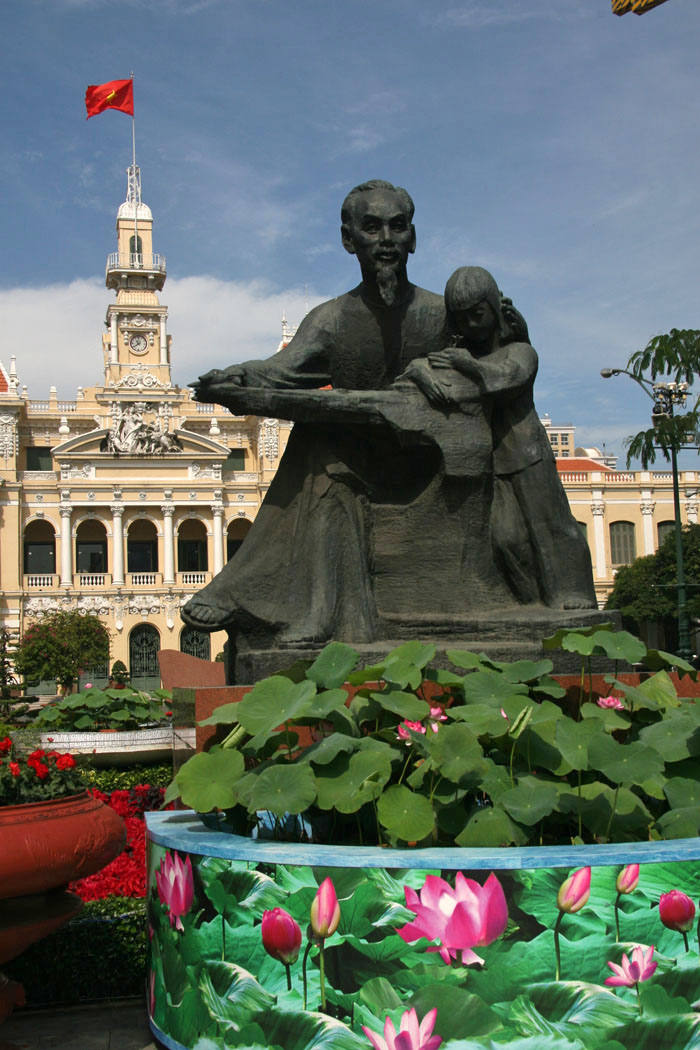
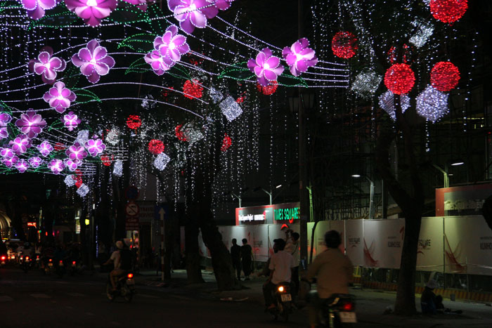
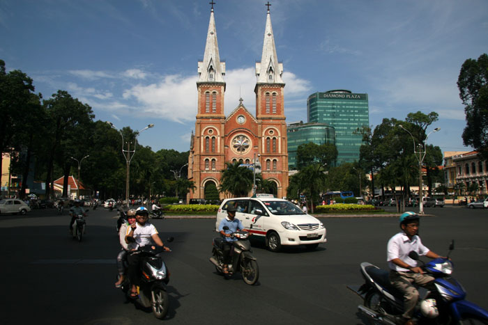
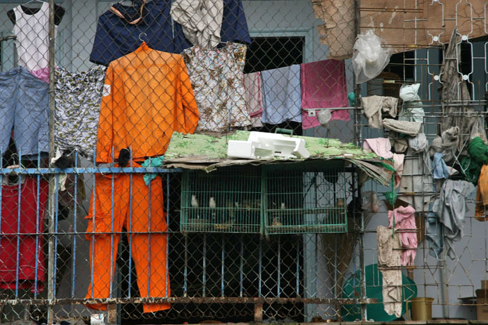
IMG_6854I don’t quite know what it is that has made me think of Vietnam recently. Maybe it was a casual mention in a conversation that made me realise that I don’t have a very vivid memory of the short time I spent in that country a couple of years ago. It was, after all, just a fleeting glimpse of the fat bottom end of a long thin country – a day in Ho Chi Minh City (Saigon) and a few days up the Mekong River.IMG_6933I wandered Ho Chi Minh City in a jet-lagged daze, stupefied by a body clock that badly needed winding and oppressive tropical heat that clung like a blanket. What did I do? I gaped at a few of the tourist sites I was told to look at. I dodged road-wide flanks of manic motorbikes (just wait until they get cars!), ate fishy, chilli-spiked noodles and bought, of all things, a copy of David Copperfield in a savagely air-conned bookshop (an unconscious hankering for the fictionalised Yarmouth coast perhaps?). The rest is a sleep-deprived blur, although I do remember Christmas lights – it was early January – incongruous as a Santa suit in steamy Indochina. The city, as I remember it, seemed an awful long way from the imagined sinful metropolis of Apocalypse Now and The Deer Hunter.IMG_6811I am also struck by the visa in my passport that reads: Socialist Republic of Vietnam. Ho Chi Minh City/Saigon – despite the reinvented name and the occasional remnant image of a wispy-bearded Uncle Ho, it was hard to imagine anywhere more unashamedly capitalist. The new moniker foisted on the city in 1976 seemed an ironic rebranding for a city that was firmly in the US camp throughout the war (The American War, the Vietnamese call it). One can only imagine the victors’ delight in defiantly renaming this southern capitalist city after their erstwhile northern communist leader. But a name is just a name – the USA may have lost the war but it was the West that inevitably won in the end. IMG_6844

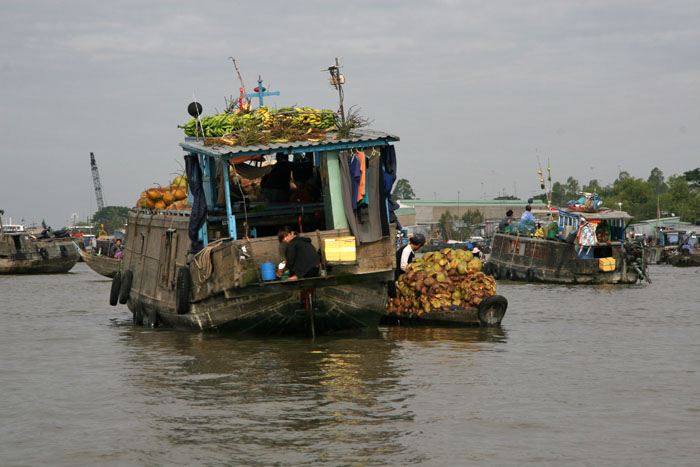
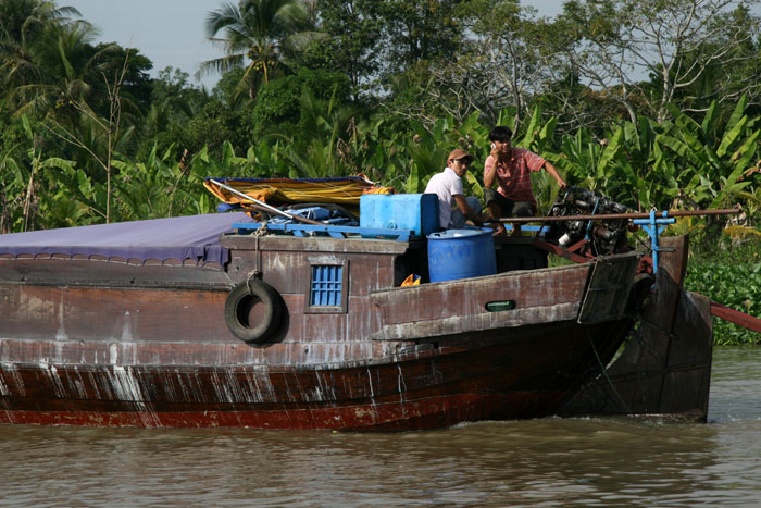
IMG_6919As for the Mekong, what stays with me most is its murkyy lifelessness. It took a day or two along the river before it dawned on me: despite fisherman eking a living from the river’s grey waters and insects aplenty, I slowly realised that there were almost no birds to be seen. No dipping kingfishers, no fish-spearing herons, no skeins of geese overhead; just an occasional swallow flitting nervously above the water. The first egrets I saw were dead: a sorry pair on display in a food market, a meagre meal for a poor family. Uncontrolled hunting and trapping, along with severe habitat depletion, appear to be the main reasons for this sad depletion of what, in a previous life, would have surely been a tropical paradise. IMG_7043A river without birds is a like a song without a melody. Things improved slightly as we approached the Cambodian border but really not that much – for the most part, the river remained the ideal film setting for a tropical version of Rachel Carson’s Silent Spring.IMG_7187IMG_7149IMG_7255

Mildred Holland’s Seven-year Task

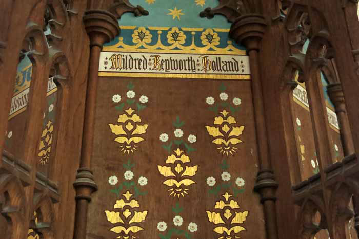
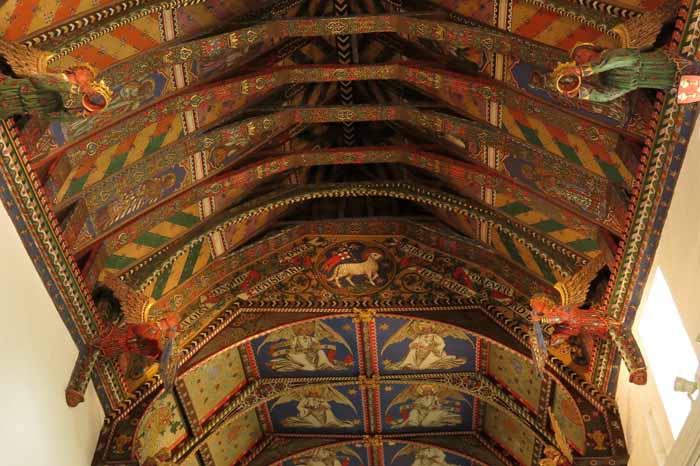
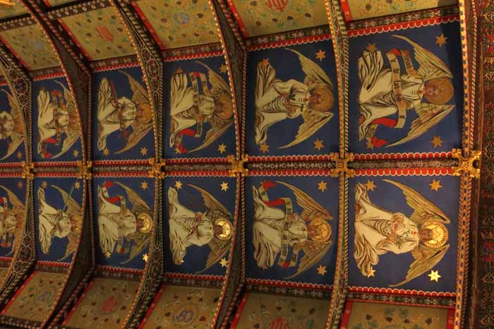
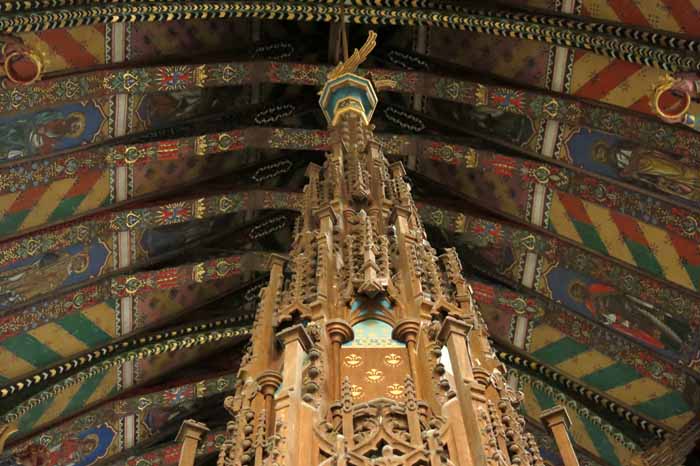
IMG_3824Mildred Holland was an unusual and determined woman. Not content with  being merely the new rector’s wife at St Mary’s, the parish church at Huntingfield in northeast Suffolk, Mildred took it on herself to singlehandedly repaint the ceiling of the church’s hammerbeam roof. This enormous labour took seven whole years between 1859 and 1866, a period in which spent she much of her time on her back atop scaffolding wielding a paint brush. First she painted the chancel, then the nave. A novice to church painting, Mildred was given some advice by E L Blackburne FSA, an expert on medieval decoration, but other than this and the help she received from workmen erecting the scaffolding she had no assistance whatsoever. Naturally, such arduous toil took its toll and Mildred died in 1878, a relatively young woman, not so many years after completing her task.

IMG_3812

There may be those who will find the roof decoration here far too bright for their taste –  the colours are brilliant and vibrant, the overall affect almost psychedelic. But if you have  a plentiful supply of pound coins  – there is a cash-hungry slot for inserting coins to supply short-lived electrical illumination – you can see for yourself the sort of church decoration that might have held illiterate medieval peasants in awe. True, Mildred’s work was a Victorian makeover but it was probably quite faithful to the original paint job – the bling of medieval church decoration was often far more garish than many of us imagine it to be.

IMG_3800

To find the church you must first venture down winding narrow lanes southeast of Halesworth in Suffolk, a modest adventure in its own right. There is a monument to Mildred and her husband in the churchyard close to the gate. The dedicated font cover, a sort of internal church steeple, is rather impressive too.

IMG_3821

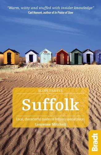
St Mary’s, Huntingfield and the story of Mildred Holland makes an appearance in my new book Slow Travel Suffolk, a companion volume to the recently published Slow Travel Norfolk, although the book is by no means solely about churches, medieval decoration or single-minded determined women.

51O4sulwLyL__