Beneath a Concrete Sky – to Gravelly Hill Interchange by canal

IMG_0016

Where’s Birmingham river? Sunk.

Which river was it? Two. More or

Less.

 Birmingham River Roy Fisher

The idea was to follow the Birmingham canal system north to Spaghetti Junction. I had already traversed the city by means of the Grand Union Canal a couple of years earlier, following the canal path west to arrive at the meeting of the waters at Gas Street Basin. That time I had turned left at Aston Junction but I knew that returning to that same point it would be possible to follow the Birmingham & Fazeley Canal north to reach Salford Junction directly beneath the Gravelly Hill Interchange.

IMG_9962

Accompanying me on this venture was my friend Nigel Roberts, a fellow Bradt author devoted to Belarus and Blues (Birmingham City FC) in equal measure, who gamely agreed to come along despite our planned route veering close enough to Aston Villa’s turf to risk bringing him out in hives.

We rendezvoused in the gleaming concourse of New Street Station before making our way to Gas Street Basin by way of Victoria Square with its Queen Vic and Iron:Man  statues. A notice on the ever-present temporary fencing that characterises Paradise Circus gave notice that Antony Gormley’s  Iron:Man was soon to be moved to a new home. How, I wondered, might this effect the city’s sacred geometry, its unchartered leys that converged at Victoria Square? But Birmingham (motto: ‘Forward’) was always a city that messed with its past, forever rearranging the deckchairs, refurbishing the urban fabric, reinventing the wheel and then re-forging it by means of a Brummagem hammer. It always seemed a place where time not so much stood still as had a frequent lie-down, a place that lump-hammered the past into something that never quite made it to the future.
IMG_9971

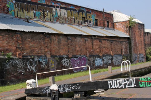
After a swift half-pint and perusal of the map at the Malt House pub opposite the geographically incongruous Sealife Centre we set off along the Birmingham & Fazeley branch towards Aston Junction. The day is atypically glorious, warm, blue-skied – peak May, the time of year you might happily be time-locked in were it at all possible. Cow parsley froths alongside the canal path, complimenting the blossoming hawthorn. Oxlips, red campion and broom compete for attention with the lurid graffiti that seems to embellish almost any available wall space. Above a lock, daubed high on a factory wall, eponymous Roof Top Vandals have left their mark in neat, bold lettering – a noteworthy combination of art and athleticism. Passing beneath the bridge that feeds railway lines into Snow Hill Station, the shimmering reflected light from the water dances like an electrocardiograph on the concrete above.

IMG_9966

Approaching Aston, we pass the red and blue holders of the Saltley Gas Works, scene of the Battle of Saltley Gate some 46 years earlier when the fuel storage depot was mass picketed during a national miners’ strike.

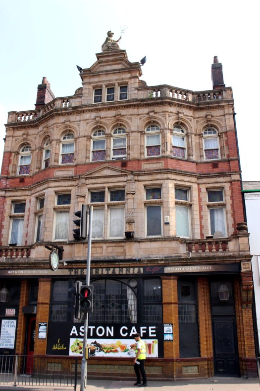
A little further on, we become aware of a familiar figure atop a building – Britannia, complete with trident, excised from the back of a fifty pence piece, supersized and raised to roof level. It seems churlish not to investigate. We detour from the canal to seek out the building and head for the Lichfield Road in the wake of two teenage girls who swig beer from cans and swap yarns in rich Brummo-Caribbean argot. It is, as we thought, a pub; no longer operating as The Britannia but as The Aston Cafe. We are now perilously close to Villa Park, or Vile Park as my companion prefers to call it. It does not bother me either way – I am agnostic in such matters – but Nigel has started to sense that he is well behind enemy lines.
IMG_9982

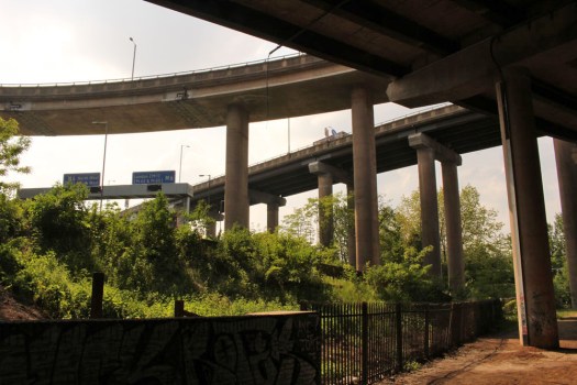
Returning to the canal to press on north, the Gravelly Hill Interchange aka Spaghetti Junction is already clearly visible ahead. The last house before the tangle of overlapping roadways takes over has iron railings decked in Union Jack flags – patriotism doing battle with traffic pollution. Just beyond, a defiant stand of purple lupins, garden escapes gone feral, announces our arrival at Salford Junction. Here we detour left for a short distance along the Tame Valley Canal, the curving multi-carriageway of the M6 immediately above us, articulated lorries flashing by half-seen above the barriers as they career along in compulsive centripetal motion. Above, spanning the roadways, blue signs point the way to London (M1) and The North (M6), while beside the water a navigational signpost for boats shows the various routes out of here – west to Tipton in the Black Country, north to Tamworth in north Warwickshire, back to the City Centre and Gas Street Basin (3½ miles) from whence we have come. But there are no boats today: the troubled pea-green waters beneath the Gravelly Hill Interchange fail to match most people’s criteria of what constitutes an ideal boating holiday.
IMG_9996

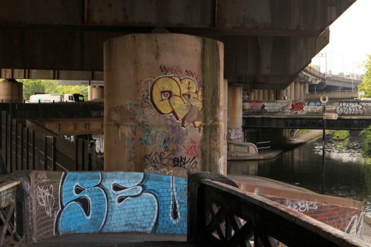
Huge concrete pillars support the roads overhead – 559 in total if you were foolhardy enough to count them. The pillars bring to mind Pharaonic temples in Upper Egypt – Luxor, Karnak – although hieroglyphs and carved lotus capitals are noticeably absent. But this whole chaotic enclave of concrete, water and channelled momentum is an unintentional temple of sorts – a nexus of late capitalism; a dinosaur footprint of transport and industry, an entropic sump. The water beneath, largely deprived of direct sunlight, is an opaque soup that looks incapable of supporting anything other than menace and monsters but here and there the light sneaks in to highlight graffiti, reflect on the water and cast shapes on the wall that mutate with the sun’s arc: accidental light sculpture, the oeuvre of James Turrell; found land art.

IMG_0030

Locked between the various roadways, the trees and bushes of a green island rise defiantly within its looping concrete confines. It is home, no doubt, to all manner of wildlife – birds, pioneering cats… foxes. A Ballardian realm of preposterous nightmares and Sci-fi imaginings, there are probably parts of the Amazon rainforest that are better explored than this singular non-place.

IMG_0022

Satiated with the chiaroscuro experience of this interchange underworld, we return to Salford Junction and take the Grand Union Canal south through Nechells to return to the centre via a route best described as elliptical. We pass the vast entertainment complex of Star City, another latter-day temple to mammon; then an enormous recycling plant that has a conveyor belt receiving the load from a Sisyphean procession of tipper trucks, each crushed metal parcel crashing onto the hill-high mound with a shrill clatter. In uncanny juxtaposition to this unholy clamour, set back from the water is a small pond with reeds, yellow iris, water violet and water lilies – a Monet garden awaiting its artist. But for the deafening backdrop, this might be a scene in leafy Warwickshire. Indeed this whole stretch of canal, just a few minutes’ walk from Spaghetti Junction, has a disconcertingly rural feel to it. What is more, it seems almost completely deserted of people.

IMG_0032

Reaching Garrison Lane in Bordesley we make another brief detour so that Nigel can show me the location of The Garrison, the pub whose fictional 1920s counterpart is centrepiece to the Peaky Blinders television series. There’s not a peaked cap or Shelby brother to be seen but it offers an opportunity for Nigel to fill his lungs with the right sort of air – St Andrews, Birmingham City’s home ground is only a little way up the hill.
IMG_0054

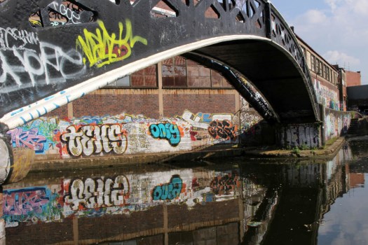
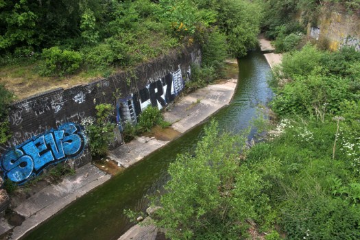
Approaching Digbeth, we finally come upon the elusive River Rea – a shallow, sluggish channel beneath the canal viaduct. One of Birmingham’s two rivers, the other being the River Tame that it merges with close to Gravelly Hill Interchange, the Rea (pronounced ‘Ray’) spends much of its course through the city below ground out of sight. As the poet Roy Fisher claims in Birmingham River, the Rea does little to draw attention to itself: a ‘petty river’ without memory seems about right.

a slow, petty river with no memory

of an ancient

 name;  a river called Rea, meaning

river,               

and misspelt at that.
IMG_0057


The Tyranny of the Horizon by Laurence Mitchell

For this post I am reblogging something I recently wrote for The Arsonist, the webzine of Burning House Press.

ccohanlon's avatarBURNING HOUSE PRESS

“A frontier region… the resort of brigands and bandits”
– Sir Clifford Darby, from The Medieval Fenland

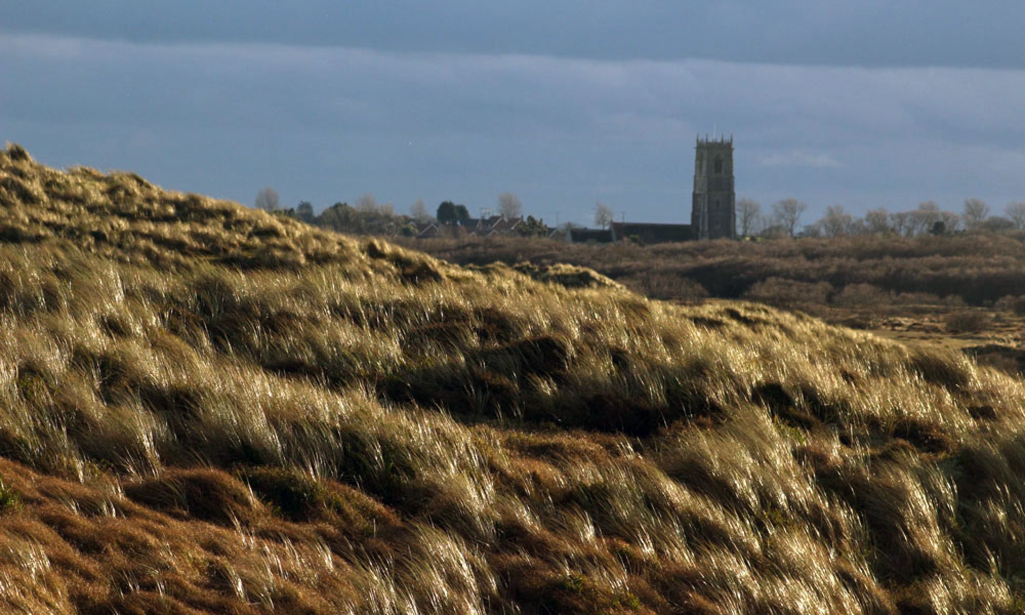
Two summers ago I walked coast to coast across England and Wales, from Great Yarmouth in Norfolk to Aberystwyth on the Welsh coast. The idea was to etch a furrow in the map along a route that traced familiar haunts and places of personal significance. My aim was to rekindle the memory of places I once knew in East Anglia and the Midlands; join up the dots, to connect all the places along the way with a line made by walking – a pagan pilgrimage, if you like, a personal songline.

View original post 1,359 more words

Kyrgyzstan railway wagons

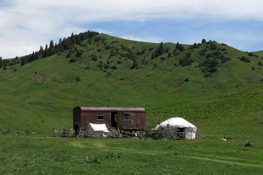
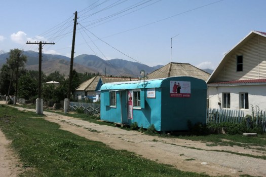
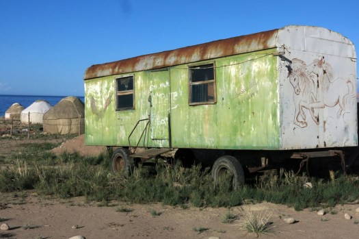
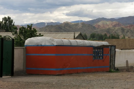
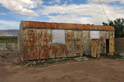
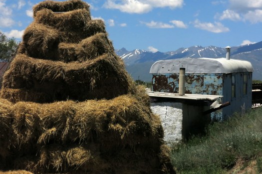
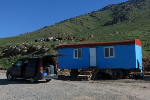
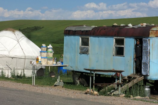
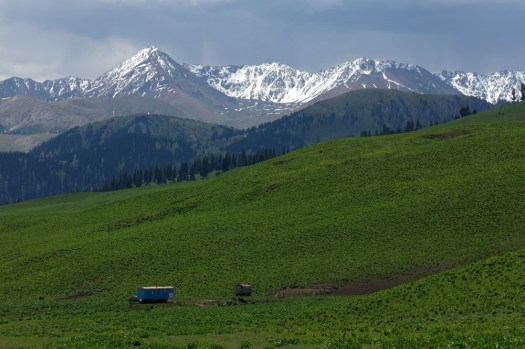
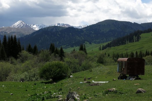
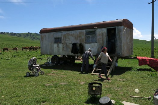
IMG_7265Kyrgyzstan does not have much of a railway system. A branch line from Moscow extends down from Kazakhstan to Bishkek, the Kyrgyzstan capital; another offers an excruciatingly slow service to Balykchy on Lake Issyk-Kul. Another line extends from Jalal-Abad in the south into Uzbekistan, although trains no longer run on this one. All of these routes date back to Soviet times but even then, Kyrgyzstan, or the the Kyrgyz Soviet Socialist Republic as it was in those days, sat on the outer fringes of the USSR, closer to China than to Moscow. All the more surprising then that, wherever you go in post-independence Kyrgyzstan, you tend to see Soviet-era railway carriages re-located and re-purposed as dwellings, shops, storerooms and even roadside tea-houses. What is most striking is how these are often located far away from a railway line or anything that even resembles a serviceable road. Bump along a rough stony track up to an isolated jailoo (alpine meadow with summer grazing) and the chances are that the nomadic family you meet there will have use of a rusting railway wagon parked somewhere near their yurt. Yurts are ubiquitous in the mountains in summer, and so central to the Kyrgyz way of life that the tunduk, the circular wooden centrepiece  of the roof, appears on the national flag.  But recycled decommissioned railway wagons have their part to play too, even if rusted metal is less aesthetically pleasing than white felt. In poor countries undergoing rapid transition like Kyrgyzstan, such a resource is too useful to be wasted.
IMG_7308IMG_7317IMG_7352IMG_7623IMG_7822IMG_7987IMG_7996IMG_8572IMG_8701IMG_9678

All the above images ©Laurence Mitchell.

From top to bottom: 1 – 4  Karkara valley, close to Kazakhstan border; 5 Tamga village, Lake Issyk-Kul ; 6 Bel-Tam, Lake Issyk-Kul; 7, 8 Kochkor, Naryn province; 9 Suusumayr village, Chuy province; 10 Roadside near Too-Ashuu Pass; 11 Roadside near Ala-Bel Pass


The Bridge to Nowhere and the Bays Road

IMG_7499Just three main roads radiate out of Stornoway, the capital of the Isle of Lewis. One heads across mountains towards Tarbet and Harris to the south; another goes east past the island’s airport and along the Eye Peninsula to come to halt at the lighthouse at Tiumpan Head, while a third leads across the island’s moorland interior to reach its west coast. A little way along this last road is the turn-off to Tolsta, a minor road with the most unexpected of endings. The road passes bungalow settlements and sea-facing graveyards as it leads north. In Hebridean terms, this is relatively densely populated terrain — one settlement merging into the next in a loose sprawl known collectively as Back. This stretch of Stornoway’s hinterland might elsewhere be termed green belt were it not a fact that pretty well anywhere on Lewis and Harris could be described as ‘green’.
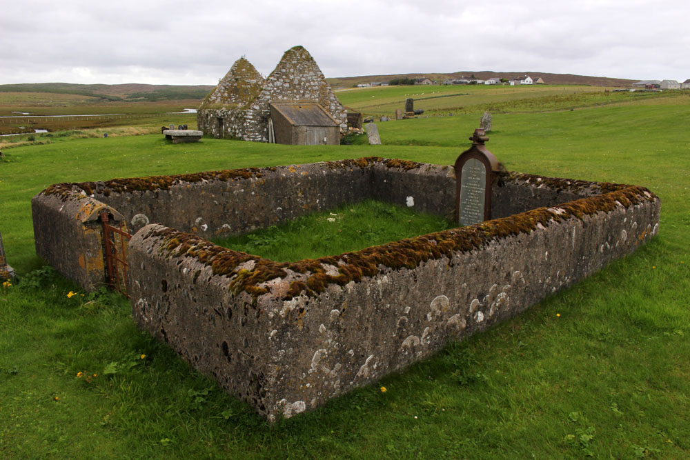
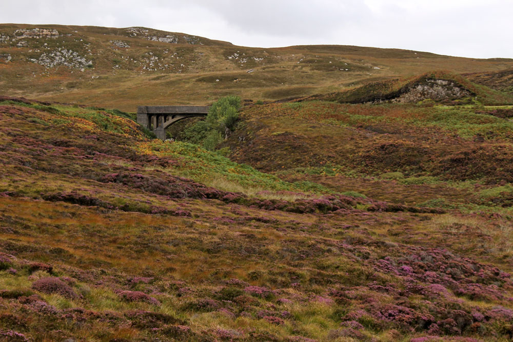
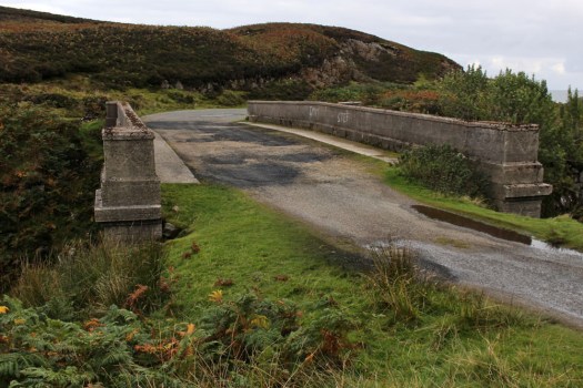
Some fifteen miles from Stornoway, a little way beyond the small coastal village of Tolsta, is Garry Beach, a quiet sandy beach with its own car park. A few campervans are parked up here and a rusty caravan is tethered in a boggy field alongside, more likely a base for itinerant workers than a low-rent holiday home. A couple, well wrapped-up against the cool on-shore breeze, are exercising their dog on the beach. A couple of jagged sea stacks rise vertiginously just offshore; half a dozen oystercatchers methodically work the tideline, red beaks wrestling with molluscs. The asphalt road, single track since Tolsta, ends abruptly at the car park and continues only as a rough peat-digging track that winds up the hillside towards a concrete structure. Walk up here and you soon come to it — a bridge over a narrow gorge that, counter-intuitively, appears to be the very end of the road.

The Bridge to Nowhere, as it is generally known, was constructed by Lord Leverhulme, one-time owner of the island, as part of a project to build a road that connected Stornaway with Ness, a fishing village at the northern tip of the island. Like many of Leverhume’s ambitious schemes, good intentions went awry and for a number of reasons the road was never completed. Even today, the only direct way between Tolsta and Ness is on foot, a weary ten-mile slog through soggy moorland that for most people makes the longer, circuitous trip by road via Stornaway and Barvas a more attractive option.  The original vision was to build three large farms that would provide dairy produce for fish cannery workers. Alas, the fish canning empire never came to fruition and a lack of both funds and enthusiasm resulted in the road never extended beyond the bridge at Garry Beach.

IMG_7517IMG_7522

Head south of Stornoway, over the North Harris Hills to Tarbet and then across the isthmus into South Harris, and you have two options to reach to the ferry port of Leverburgh at the southern tip of this, the largest of the Hebridean islands. The road that skirts the west coast is relatively wide and easy to navigate but the road that runs parallel to the east coast, circumscribing many rocky inlets along the way, is of a very different character. The two coasts of South Harris have strikingly contrasting landscapes. While the west road swoops smoothly past enormous tidal sandy beaches like that at Luskentyre, the narrow east road weaves erratically around rugged inlets and rocky outcrops.

IMG_8170

Rough country, largely soil-less, infertile, with very little land suitable for grazing or farming — you might wonder why people might live here in the first case. The reason, of course, as in so many places in the Scottish highland and islands, is because of widespread clearance in the late 18th and early 19th centuries. The extensive land clearances of Harris were enforced by the Macleod family who once owned the island and who, to make way for their profitable sheep enterprises, forcibly moved many crofters off the relatively fertile land of the west coast to the far poorer, rocky terrain of the east. As a result, many families migrated to Canada to seek a better, more secure life, while those who remained struggled to survive by digging ‘lazy beds’ for potato-growing — labour-intensive raised beds in which the thin poor soil was bulked out and enriched with seaweed and straw. Never was the word ‘lazy’ so misappropriated.

IMG_8213

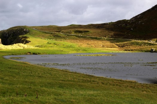
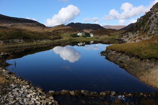
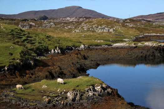
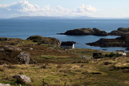
To travel the Bays Road, as the C79 east coast road is better known, is to witness a dramatic sweep of exposed gneiss, sky and water, with ever-changing glimpses of narrow rocky inlets, dark reed-filled pools and peat-stained streams the colour of strong-brewed tea. The road is not for drivers of a nervous disposition – narrow even for a single lane, with a general allocation of passing spaces, it is a constantly winding tour-de-force where each mile covered seems more like five. Stark, barren, primeval: the landscape is far from bucolic but it is undeniably beautiful. Sheep wander across the road with impunity; white-tailed eagles and buzzards spiral slowly overhead; curious ravens perch on rocks eyeing the sporadic passing traffic like pensioners on a park bench. For the briefest of moments, a pair of golden eagles make an appearance silhouetted high above a ridge. At the road’s highest point, the peaks and headlands of the Isle of Skye show themselves to the east across the wave-flecked Little Minch. The sea is translucent, deepest blue; a CalMac ferry is halfway across the channel steadfastly plying its twice-daily journey to Uig on Skye. In the diamond-clear light, the far-distant Cuillin Hills can be seen glinting crystalline in the sun. Deprived of a decent livelihood by uncaring landlords, you can only reflect that the crofters who were banished to this unwelcoming, unworkable terrain were at least given possession of some of the finest viewpoints in the kingdom.

IMG_8214IMG_8218

San rock art – Drakensberg, South Africa

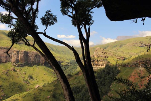
IMG_9016One of the highlights of my recent trip to South Africa was to see some really well-preserved rock art. The cave paintings were made by the San people, the hunter-gatherers who inhabited the Drakensberg mountain region in KwaZulu-Natal province close to the Lesotho border before the  incoming Zulus drove them from the land. The rock paintings date from between 2,000 and 200 years ago and the best preserved are those found in south-facing caves where there is never any direct sunlight. One such cave is that found beneath Lower Mushroom Rock in the central Drakensberg.
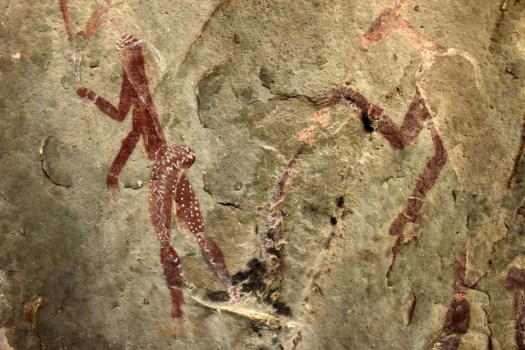
IMG_9026The figures show hunting scenes involving various animals indigenous to the region, like eland, which are still numerous, and lions, which are no longer found here. Other paintings depict animal skin-wearing shamans in trances, a state of mind artificially (and partially chemically) induced to connect them with the spirit world in order to foresee the future and cure illnesses.
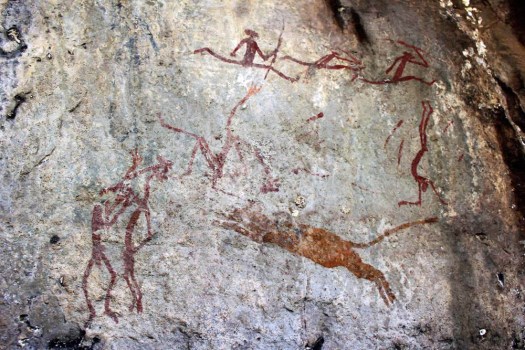
IMG_9025The paintings were made using brushes made from animal hair and dyes and pigments extracted from indigenous plants and mineral-rich rocks. The colour and attention to detail of the paintings are remarkable, and even depict the typically steatopygic buttocks characteristic of the San bushmen who nowadays mostly occupy the arid regions of Botswana and Namibia.
IMG_9028

IMG_9023


Arslanbob – In Walnut Tree Shade

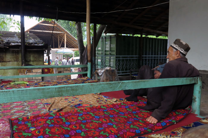
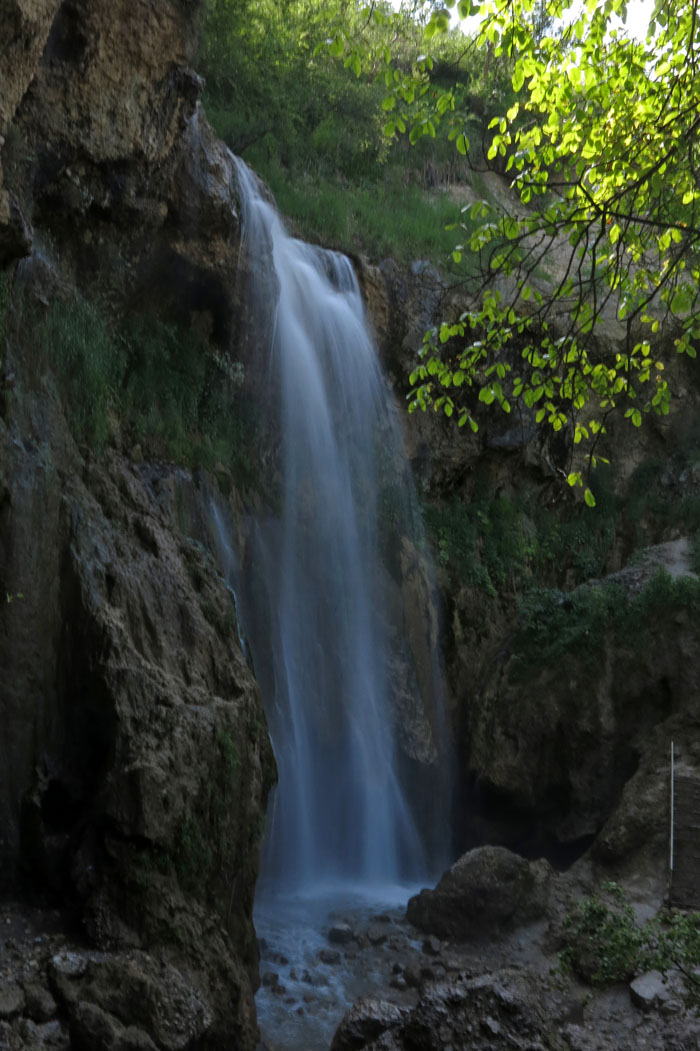
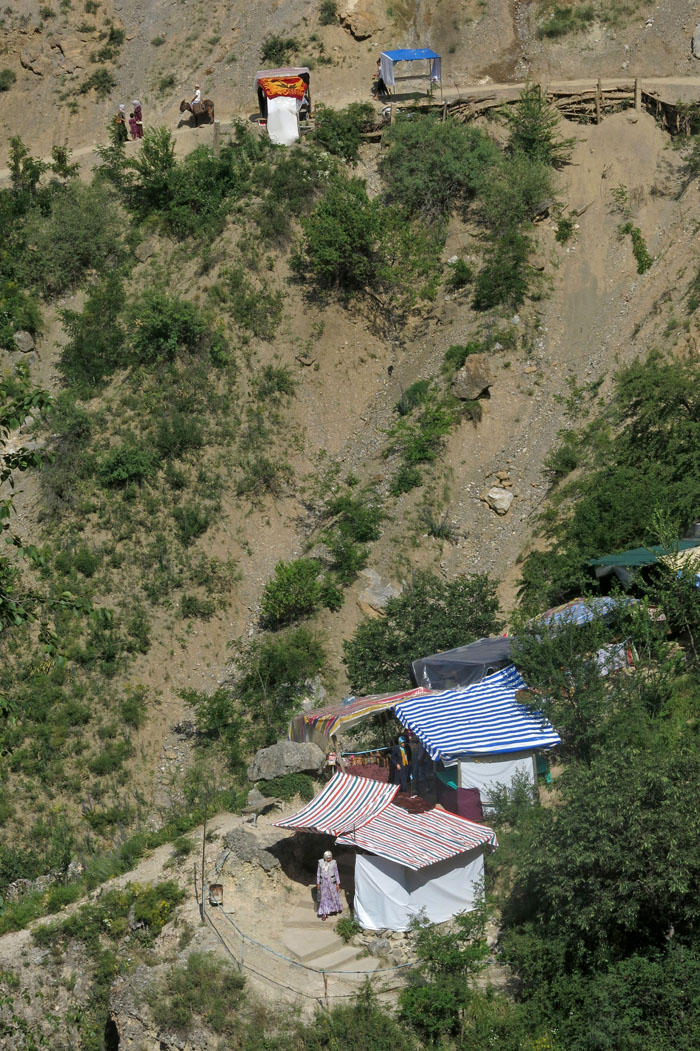
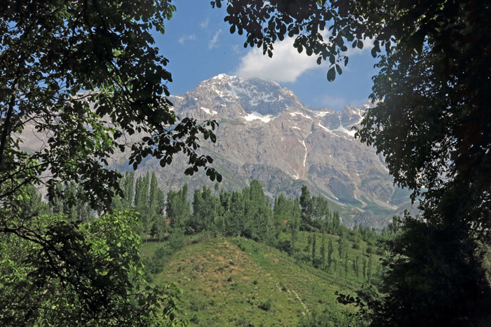
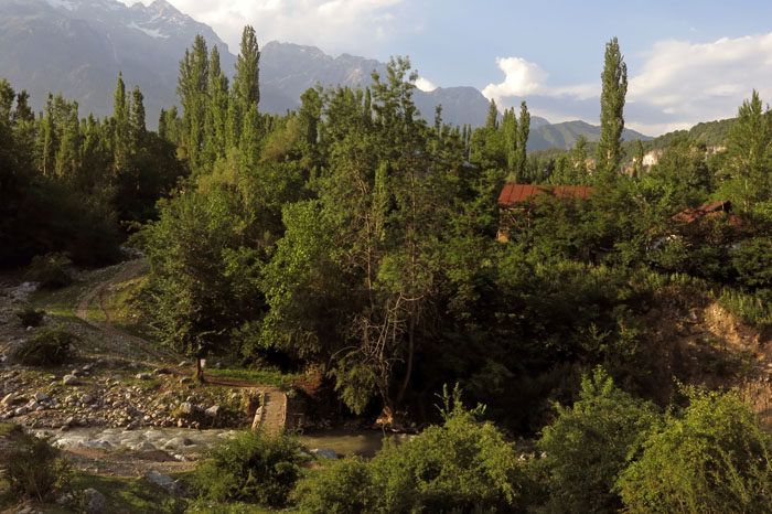
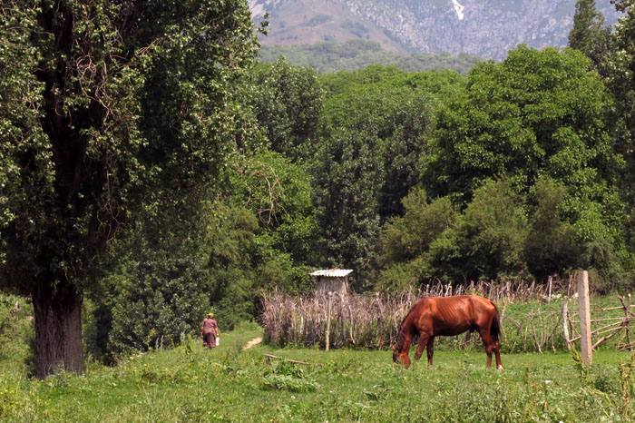
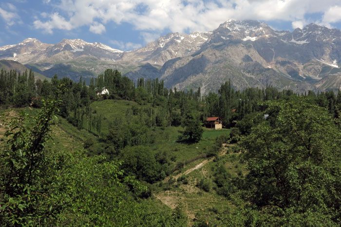
IMG_9321It had been almost eight years since I was last in Arslanbob, a tantalisingly spread-out settlement in Kyrgyzstan’s Jalal-Abad province. As before, I had arrived at the start of Ramadan – the moon was new, the mosque was full; a holiday mood gripping the steep rocky streets of this sprawling mountain village. This time though, it was stifingly hot late June rather than pleasantly cool mid September, and the walnuts that the area is famous for were still forming on the trees – ovoid green jewels dangling from silvery branches, their sweet ripeness yet to develop. The last time I was here it was during harvest season and walnuts were everywhere – stacked in pyramids at the bazaar, piled in dishes in every home, filling pockets, bags and every potential container. To walk in Arslanbob at such a time was to invite walnut generosity – for foreign visitors even the shortest excursion into the streets resulting in bulging pockets, stuffed rucksacks and camera bags. Walnuts even appeared to serve as legal currency – on first arriving in the village I witnessed a pair of laughing schoolgirls paying their minibus fare with a handful of nuts; the driver didn’t seem to mind at all.IMG_9163IMG_9394Of course, Arslanbob is not just about walnuts: the village has multiple identities. A relatively conservative Uzbek enclave in a predominantly Kyrgyz nation, Arslanbob has strong historical ties with Uzbekistan’s Fergana Valley that lies not so very far away over gerrymandered Soviet-period borders to the south (never was the political strategy of ‘divide and rule’ more apparent than with the convoluted and sometimes utterly nonsensical lines of demarcation that separate the now independent republics of Central Asia – Kyrgyzstan, Uzbekistan, Tajikistan). Almost totally Uzbek in population and culture, Arslanbob is also a spiritual centre of sorts, with holy rocks and sacred lakes in the mountains above the village and religious shrines in the surrounding forest. Islamic it may be, but there are strong animist and shamanist overtones too – the peoples of Central Asia have always had a strongly developed sense of place that has its spiritual expression beyond the normal confines of formalised religion.IMG_9172IMG_9597So walnuts and sacred shrines . . . there are another elements too. Since Soviet times the village has had a turbaza, a sanatorium that provides R&R for weary city folk. These days it is predominantly Uzbeks from the sweltering cities of Kyrgyzstan’s southern basin – Jalal-Abad and Osh – that come to stay. There is local sightseeing too – a scenic waterfall against the backdrop of a ravine lies quite close to the village centre. When I first visited this eight years ago, there were almost no visitors and little to be seen apart from plummeting water against a rugged rock face; the votive rags tied to the branches of a tree above the waterfall, the only evidence of human interest. Now things are rather different: a dust-cloud of lumbering Toyotas ferries visitors up from the bazaar where, after paying a token entrance fee, they pass through a phalanx of makeshift wooden stalls en route to the falls. The stalls sell all manner of tourist tat – plastic trinkets, cheap jewellery, carved wooden souvenir eagles and lions, souvenir Astanbap (Arslanbob) hats, medicinal mountain herbs in cellophane packets, lengths of fruit leather like seaweed and ‘I heart Islam’ T-shirts.IMG_9225IMG_9280It is easy enough to escape though. Take the path beyond the falls and the tawdry commercialisation swiftly drops away as a dazzling landscape reveals itself – towering snow-capped peaks, emerald pastures and farmhouses peeping through poplars on steep ridges. To the east and south extends a vast green swathe of walnut forest that stretches sublimely to vanishing point. Just two minutes beyond the falls the only sounds to be heard are those of running water, rustling leaves, birdsong, a distant complaining donkey and perhaps the woody squeak of a horse-drawn plough. All is transformed, and this is a heart-gladdening landscape to behold.IMG_9304IMG_9446Having struggled up to the Holy Rock before (at 2,900 metres elevation it lies at 1,600 metres above the upper part of the village), a long walk through the walnut forest seemed the sensible thing to do this time round. I set out with two German cyclists and a local guide from the uppermost part of the village, our starting point reached by means of a redoubtable ex-Soviet Army UAZ, which, although uncomfortable, you feel could go almost anywhere with a skilled driver and plenty of vigorous wheel twisting. From our dropping-off point a shady woodland path runs all the way to the settlement of Dashman in the heart of the forest. Along the way, we enjoy the unparalleled dappled sunlight – perfect camouflage for the green, yellow and black of golden orioles (which, sadly, we don’t manage to see). Here and there we pass through clearings filled with flowers – clary, marjoram, orchids, bugloss and tall yellow daisy-like blooms whose names we will never know.IMG_9530IMG_9554Dashman could hardly be described as a village, more just a scattered collection of houses each with its own bit of land in a clearing. This isolated settlement was, however, once home to displaced Chechens, uprooted and displaced from their Caucasus homeland by Stalin during World War II. The Chechens have long gone (one solitary Chechen remained in Arslanbob I was told, ‘a good man but too much drinking problem’) and now the houses are occupied by a handful of locals who keep animals to graze in the forest. There is a crossroads of tracks close to Dashman. Today it was a quiet place, with just a woman out fetching water, a beautiful blonde-maned horse wafting flies way and the liquid song of a blackbird trilling from the bushes. But it was at this very same location, our guide told us, that things came alive during the September walnut harvest. Many villagers would come from Arslanbob to camp here for a few days, gathering nuts by day and celebrating and socialising by night. There would be music, dance and laughter; traders from Arslanbob would set up temporary stalls; shashlyk would be grilled, much chai would be consumed. Naturally enough, the main currency of exchange would not be Kyrgyz som or US dollars but freshly harvested walnuts: a timely opportunity for nature’s bounty to show its true worth and for just a brief few days turn capitalism on its head.IMG_9573IMG_9563IMG_9510

Edgeland

IMG_4934Edgelands are everywhere, orbiting our towns and cities like unbeautiful rings of Saturn: non-places, junkspace, transitory transition zones that lie between that which is unequivocally urban or rural. Transitory because they are spaces in flux, with fluid geography that today may be brownfield site or landfill but tomorrow could be new housing, an out-of-town shopping emporium or a bypass. I hesitate to use the term ‘liminal’ here, that overused adjective beloved of psychogeographers, but … oh go on, I will. Edgelands are, if you’ll excuse the trope, zones of liminality, thresholds of the urban world. They might also be defined as those places that people pass through but do not usually stop at. They represent the view from the car  on the daily commute, that untidy marginal landscape glimpsed flashing by through the grimy window of the morning train.

IMG_4921Paul Farley and Michael Symmons Roberts in Edgelands, their definitive book on the subject, quote a long list of names associated with waste landscapes of this type in the United States, a lexicon that starts with ‘boomberg’ and ends with ‘world city’. My favourite though is ‘stimdross’, which sounds like some sort of propriety brand of exfoliant cream.

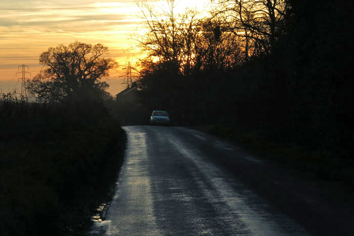
IMG_4944Like anywhere, Norwich, the city where I live, has its own edgelands. These take on a different character depending on which side of the city you look. To the north, the city sprawls for miles through ‘30s council estates, Tudorbethan suburbs and rural fringe new-build with leadlight windows and double garages. Heading in this direction from the centre, it is only after the airport is passed that the city finally gives way to the arable farmland that continues all the way to the Norfolk coast.

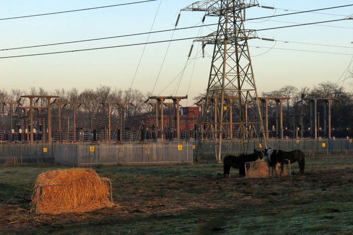
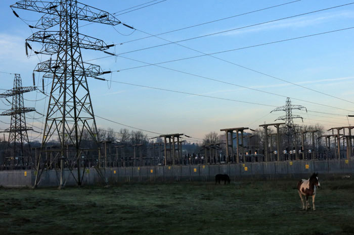
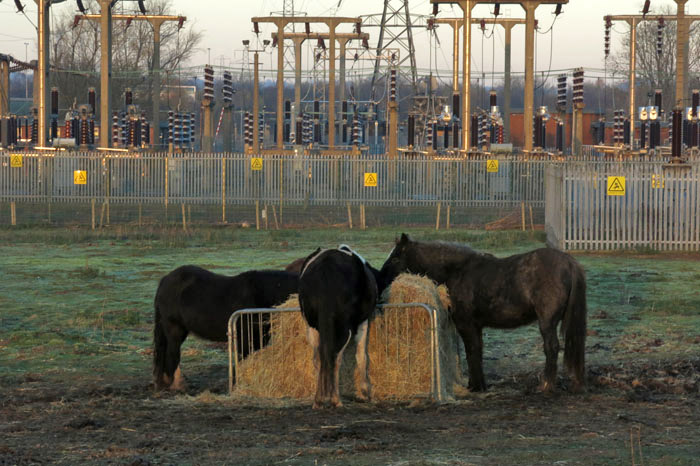
IMG_4946Heading south, the transition comes much sooner. A little way beyond the ring road the landscape changes abruptly as it crosses a railway line and the River Yare. Here, where the traffic of the southern bypass creates an ever-present thrum, is an edgeland par excellence: a territory that has elements of both urban and rural but belongs to neither camp. The rough grassland here is too poor for arable crops but supports both grazing horses and a vast imposing electricity substation. Lofty pylons march across the landscape, dwarfing the horses. The scene is a strange juxtaposition that shouts of marginalisation but the horses do not seem to mind. Who owns them? Travellers probably, or is it wrong to make such an assumption?

IMG_4926

The OS map of the territory reveals a henge in the field here, right next to where the electricity substation and horses are. The Arminghall Woodhenge, which was discovered in 1929 thanks to crop marks on an aerial photograph, was excavated in 1935 and discovered to be a Neolithic monument orientated on the mid-winter sunset. All that remains now is a vague bump and dip in the ground but once this was a place of power, a place of knowledge, ritual and observation. Now that power is reduced to a ghost of landscape, forgotten, returned to the earth – a palimpsest overlaid with electrical distribution hardware and grazing horses. Most of the motorists speeding by on the southern bypass avert their eyes from the unsightly pylons and transformers and do not give these fields a second glance. How can they ever know of the henge if they do not even notice the horses?

IMG_4951

Botanising the asphalt

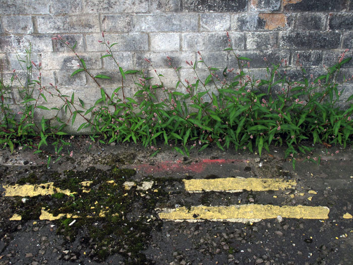
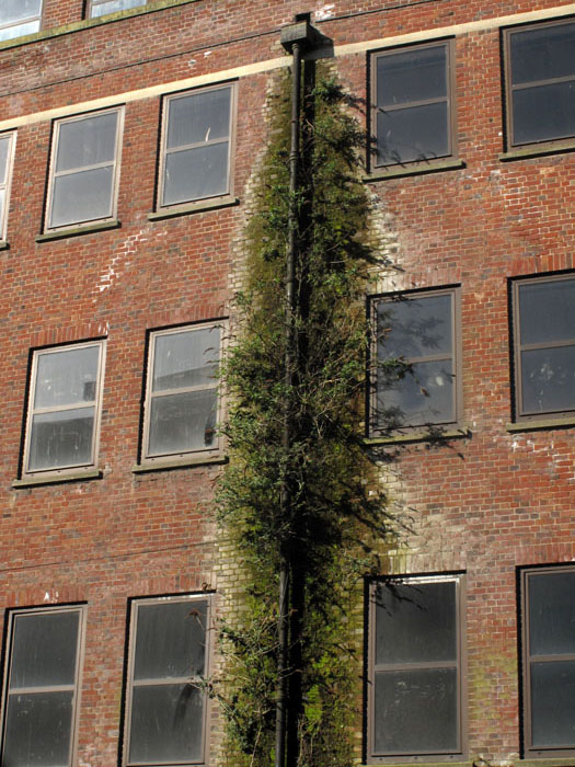
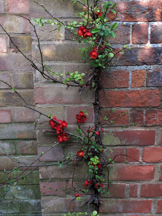
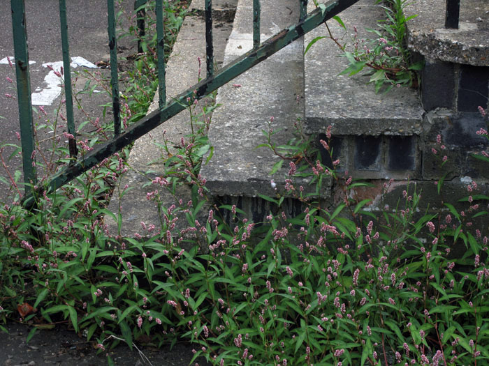
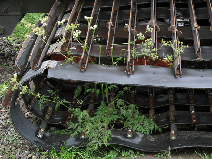
The German philosopher and literary critic Walter Benjamin referred to the unwitting psychogeographical practices of the urban flâneur as that of ‘botanising the asphalt’: a way of experiencing the city as a repository of collective memory by means of a dérive. For Benjamin, the landscape in question was the Paris of his Arcades Project but what if we took this expression a little more literally and paid closer intention to both botany and tarmac? Do the weeds themselves have no tale to tell? After all, a country road with grass growing in the middle is a common rural trope that speaks of lonely byways and car-shunned back roads. Do the plants that find a foothold in the neglected marginalia of city streets not have as much to tell us as a cacophony of road signs or the ciphers of graffiti?

In UK cities, hollyhocks, buddleia, sycamores and ink cap mushrooms all manage to find footholds in the unlikeliest of places, in the latter case even breaking through the asphalt like a Sci-fi horror, as if tarmac and gravel were its life blood. Some weeds – often alien interlopers – flourish best in the improbable niches of foot-worn pavements and industrial brickwork. They remind us with nose-thumbing disdain that we are disposable as a species and in the event of a hastily pressed nuclear button, a manmade climate crisis or inevitable decline brought about by unflinching hubris, it is they that will thrive and not us.

The photos above were taken in Norwich and London, UK and Abisko, Sweden.

Jezero to Jajce

Incompetence can have its benefits, it can even sometimes lead to adventure – that is my experience. A simple small error or misunderstanding can lead the way to the unexpected: an experience that perhaps you did not plan for but which you are grateful for in hindsight. This is how I came to walk from Jezero to Jajce in central Bosnia, from the Republika Srpska  (RS) to the Bosnian Federation.

In Jajce I had enquired at the bus station about transport to the nearby Pliva Lakes. I used the Serbian/Bosnian/Croat word for lake, ‘jezero’, and was sold a ticket for a bus that was leaving almost straight away. Getting on the bus, I also checked with the driver – I wanted to go to ‘Jezero’. Sure, no problem.

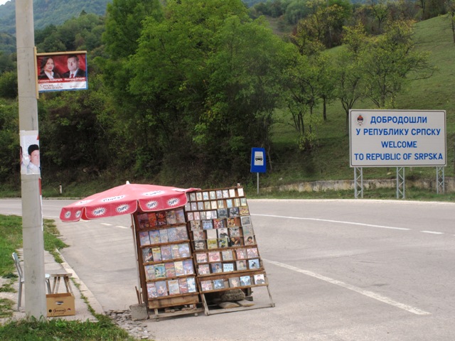
We set off out of town and very soon a large body of water became visible through the trees beneath the road. After a while the lake petered out and we followed a river along a narrow gorge. By this stage it was clear that we had already travelled considerably further than the five kilometres I had been told it would be. I mentioned this to the driver but he just motioned that ‘Jezero’ lay a little further on. A few minutes later, a large sign at the roadside announced in English and Serbian Cyrillic, WELCOME TO THE REPUBLIC OF SRPSKA and then, shortly after, a town sign that simply said JEZERO. Then it dawned on me what had happened – in these parts ‘Jezero’ was not just some generic geographical feature but the name of a small town, although calling a town ‘lake’ when it is not actually next to one seemed odd to me.

Stepping down from the bus, a road sign pointing back the way we had just come announced that Jajce was 12 kilometres distant. There was nothing else to but to start walking.

Passing a busy café-bar full of men drinking Jelen beer and a Bosnian Serb policeman who eyed me suspiciously I retraced my steps eastwards along the road. At least the road was quiet, with only an occasional lorry or speeding car to break the silence every few minutes or so. Back at the sign that announced the RS border were a handful of roadside stalls selling cut-price CDs and DVDs, and even tape cassettes with unreadable sun-bleached covers. Why the stalls had set up here was a mystery. Was it some sort of legal loophole, free-trading in the no man’s land that lay between the RS and the Federation, or does some sort of psychogeographical phenomena exist in which motorists entering the Republika Srpska develop a sudden unexplained hankering for Ceca ’Live in Concert’ and Turbo-folk CDs?

The road back to Jajce followed the river closely, steep wooded slopes rising to a high ridge on the opposite bank. Like much of central Bosnia, it was a landscape of prodigious beauty – lush, green and bursting with bucolic bountifulness – a countryside so gorgeous that the notion of any sort of violent conflict ever taking place against such an exquisite backdrop seemed unlikely, almost impossible. But appearances can be deceptive –this was not only Bosnia but a region that straddled one of the country’s fragile ethno-political fault-lines.

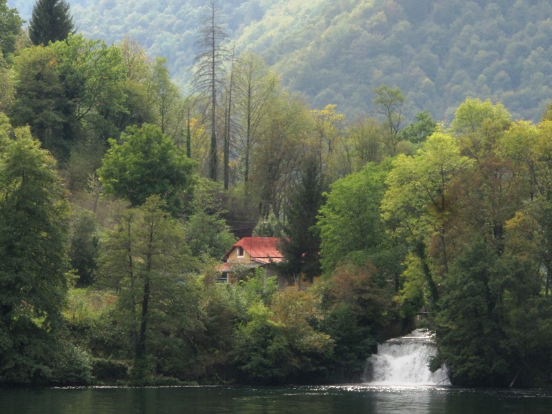
An hour’s brisk walk brought me to the edge of the lake close to where a large abandoned glass building rose above trees at the roadside – once a fancy restaurant with a panoramic view perhaps? Now it was unloved with shattered windows and rampant weeds colonising its stairway. From here a track lead away from the road to follow the lake shore and then a series of weirs until the separate channels eventually converged to revert back into a river once more. It was along this stretch that a picture-perfect cluster of small wooden water mills stood, lovingly preserved as quaint rustic heritage.

Venturing a little further east, the main road became visible once more high above the river. The track soon passed directly underneath it and little by little the steep-pitched roofs of Jajce started to reveal themselves on the hillside ahead, although, as yet, there was no sign of the town’s fortress or its famous waterfall.

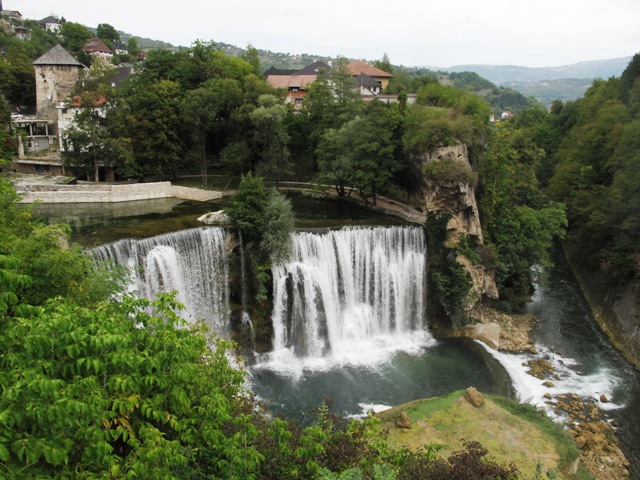
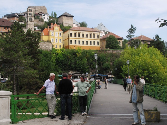
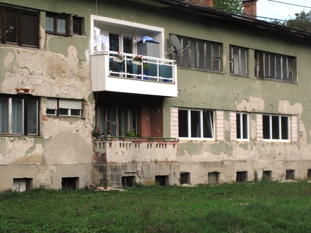
Jajce always was Bosnia’s poster girl. Quite literally: the town’s famous waterfall appears on numerous tourist posters and did so even in the days of package-holiday Yugoslavia back in the 1970s. But this western approach to the town revealed a side of Jajce’s history that does not appear in conventional tourist literature. Walking through the town’s outskirts I passed the ruined shells of houses and long-abandoned orchards, while bullet-scarred walls provied further evidence of recent conflict if ever there was any doubt. This, I suspected, was the part of town where Jajce’s Serb population probably used to reside. These days some of them no doubt live just up the road, across the RS border in Jezero. This is just inference on my part but the reality is what was once a town with a mixed population of Serbs, Muslims and Croats is now overwhelmingly Croat and Muslim. Nearly every town in Bosnia has a similar tale to tell, although the demographic changes vary depending on whoever had the upper hand in a three-sided ‘ethnic cleansing’ war of attrition. Often this was the Serbs but not always.

A positive note though: in one battle-scarred apartment block on Jajce’s outskirts someone had clearly recently moved back in, as a brightly painted new balcony complete with satellite dish now stands out defiantly from the bullet-wracked front wall. Bosnia needs its optimists.

North-South divide?

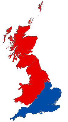
Back in 2007, Danny Dorling of the University of Sheffield wrote a piece on the nature and geographical extent of the so-called North-South divide in Britain. This was nothing new: as most of us already knew, the north-south socio-economic divide was not simply a matter of drawing a horizontal line through Watford, nor was it a case of delineating the southern boundaries of Yorkshire, Lancashire and Cheshire. Rather, it was more complex – a meandering line between the River Severn to the southwest and the Humber to the northeast.

According to Professor Dorling, the transition from north to south is not as gradual as one might expect, and shows little sign of that psychogeographic favourite, a borderline ‘zone of liminality’. The imagined divide is, in fact, a fractal line sharply defined by all manner of factors – voting patterns, house prices, wealth, health (average life expectancy is a year less north of the line), life chances, Oxbridge university access, language – particularly vowel sounds – and even preferences for flat or sparkled beer. Of course, the line roughly follows distinct features of physical geography too – the division between upland and lowland Britain, and pastoral and arable farming – features that have stongly influenced British history and culture. The divide also delineates the territory colonised by Saxon invaders and follows uncannily close to the route traced by the Roman Fosse Way.

I was reminded of this theoretical divide twice this week. First, by an article in the Big Issue written by Professor Dorling to accompany a feature on George Orwell and then by a BBC Radio 4 programme, the second part of a documentary called North and South: Across the Great Divide presented by Ian Marchant, in which the writer travelled to various places either side of this imaginary line to investigate what local people thought of the notion.

What was pleasing was that Marchant looked closely at some of my own old stomping grounds. I was born in Stourbridge in the West Midlands and grew up in Redditch, a small town just north of the divide that became a new (and suddenly much larger) town just before I left (and which earned the dubious honour of once being dubbed ‘the most boring place in the known universe’). Marchant interviewed people in Henley-in-Arden, a posh, leafy Tudor-beamed town that lies just south of Redditch across the north-south frontier in Warwickshire. The view of the Henleyites was that people from Redditch tended to be more common, while that of the Redditchers was that they would love to live in Henley given half the chance but they simply could not afford to. Hardly groundbreaking stuff but, certainly, growing up in workaday Redditch, places like Henley – and Stratford upon Avon and Warwick – did seem to belong to another, altogether more glamorous world despite their relative proximity. But then, so did Worcester (which actually lies north of the line) and even some parts of Birmingham.

If this north-south orientation is correct then, having journeyed east and slightly north in adult life to move to Norwich from the West Midlands, I have actually crossed the divide – the Tudor line, as Dorling sometimes calls it – southwards. A geographical paradox perhaps – West Midlands to East Anglia, sort of north to kind of south. I still say bath not ‘barth’ but, there again, I do prefer my ale unsparkled.

Marchant ended the program in Gloucestershire’s Forest of Dean, a small but very distinct enclave, squeezed between the Severn and Wye, which stands at the most southerly ‘northern’ point of this cultural divide. I used to know this area quite well and was always impressed by its strong sense of place, wilful isolationism and warm-hearted yet tough natives. To me it always seemed somehow closer to the spirit of South Wales than to the rest of Gloucestershire. Despite having the same latitude as Watford, with working-class forestry and mining traditions, and hardly a trace of tweeness in its villages, there are plenty of stereotypical ‘northern’ characteristics on display here. The ‘Forest’, as natives always call it,  really does seem a very different place compared to the opulent sandstone villages of the Gloucestershire Cotswolds just across the River Severn.

In essence, the BBC4 programme is as much about social class as it is about geography but it raises some interesting points. You can listen again here. For a very different point of view, you can read what Simon Jenkins makes of Dorling’s analysis here. The fact that he scathingly dismisses the Sheffield professor as ‘geographer royal by appointment to the left’ might give you some idea as to what to expect.