Another London

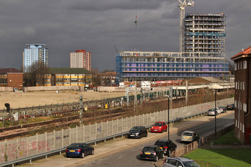
Trinity Buoy Wharf, down by the River Thames on the Leamouth peninsula in Poplar, is a place where the past is deeply layered. It is also somewhere that seems to beckon an uncertain future. Even to reach it is to cross some sort of temporal boundary, from humdrum modern metropolis to another London where the past and future converge. Waters come together here too: Trinity Buoy Wharf lies at the end of Bow Creek, the meandering estuarine section of the River Lea, the city’s largest tributary. Here, at London’s eastern edge, is its confluence with the Thames. To reach the wharf on foot from East India, the closest DLR station, you are obliged to trace a dual carriageway through an anonymous, rather faceless part of the city. The only thing that holds any sort of familiarity is the logo of a Travelodge glimpsed in the distance across the busy highway.
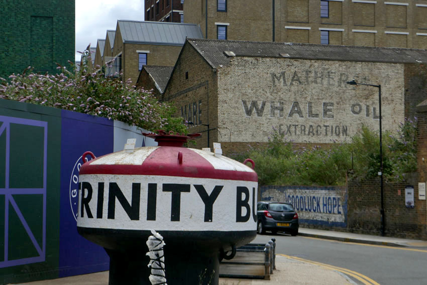
The entrance to the wharf announces itself with a large red-painted buoy. It is an apt introduction, as, in a previous life, this was a place centred upon the manufacture and repair of buoys. Further along Orchard Place, the almost traffic-free main thoroughfare, are the high brick walls of old warehouses and industrial buildings. One bears the ghost lettering: Mathers Whale Oil Extraction. It feels almost a little too self-aware, as if history has been carefully curated to engender a tangible sense of place in this heavily revamped zone of erstwhile maritime London. A couple of information boards do much the same thing, expanding on the theme of whale oil production that dominated this neighbourhood in the late 18th century. But such industry is now a thing of the past and the new focus is on comfortable living in a post-industrial setting.
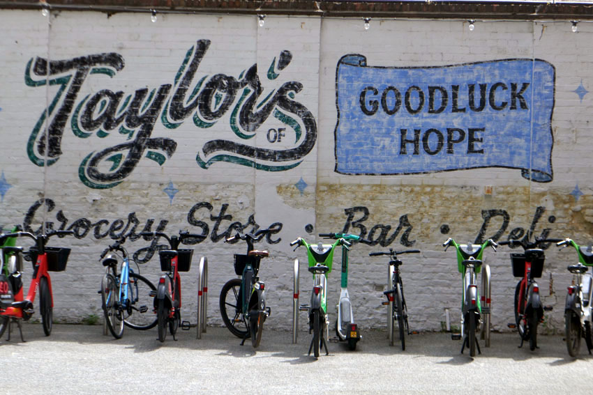
You can tell that estate agents and developers have already been busy here, doing their utmost to create a desirable brand that combines housing, place and historical context. The bakers and baristas have already moved in, and so we spend a pleasant half-hour sipping cappuccinos at a newly opened artisan bakery. Sitting outside, shaded by geometrically spaced trees and new-build apartments with balconies, I wonder who actually lives here; or, more to the point, who is meant to live here. I suspect that many of the properties have already been snapped up by members of the owner-occupier niche that estate agents term ‘young professionals’.
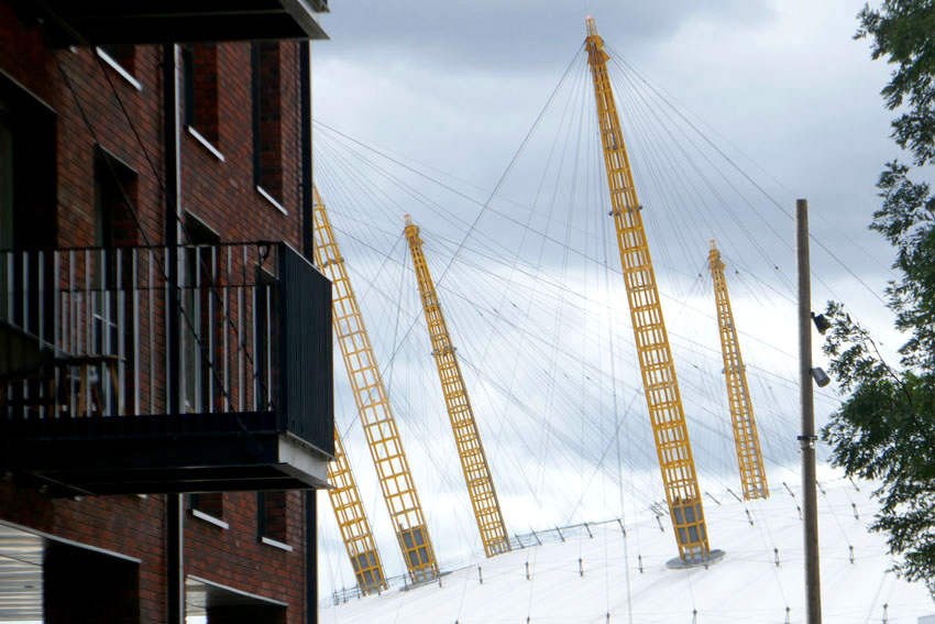
In plain sight, immediately across the Thames, is the O2 arena on the Greenwich Peninsula. The view is telescopic; the O2, née Millennium Dome, a semi-collapsed Bedouin tent (or ‘sorry meniscus’ as Iain Sinclair has more scathingly described it) seems almost close enough to touch. At the next table a young couple in wedding outfits greet a photographer before they leave together to find a suitable backdrop for shots for their nuptial photo album. The O2 is clearly a romantic location as well as a capacious centre of entertainment, which brings to mind couples in Eastern Europe doing much the same with historic churches, castles and mosques in their country: the notion of iconic viewpoint as wedding photo setting.
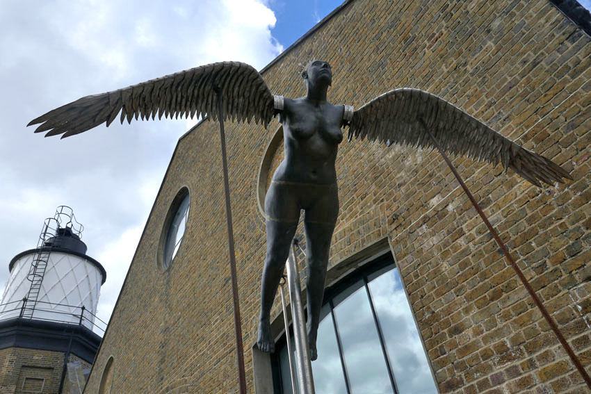
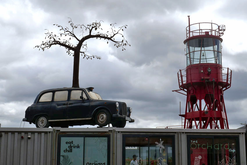
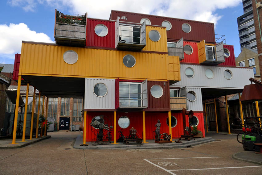
Trinity Buoy Wharf is more than simply a photogenic backdrop and fresh location for city living, it is also an artistic hub, something apparent in the quirky statuary and murals that abound here. A little further on along Orchard Place is a café housed in a shipping container that has a black cab taxi with a tree sculpture growing out of it on its roof. What does it signify: green roots taking hold of familiar London emblems, or a post-apocalyptic vision of an abandoned city of the future? The same artist, Andrew Baldwin, has several more works around the wharf, and art is clearly encouraged here, with a choice of galleries and workshops available for hire. Most eye-catching is a colourful ziggurat of repurposed shipping containers that serve as offices and arts studios.
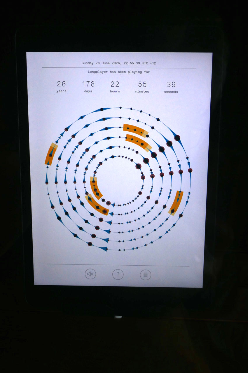
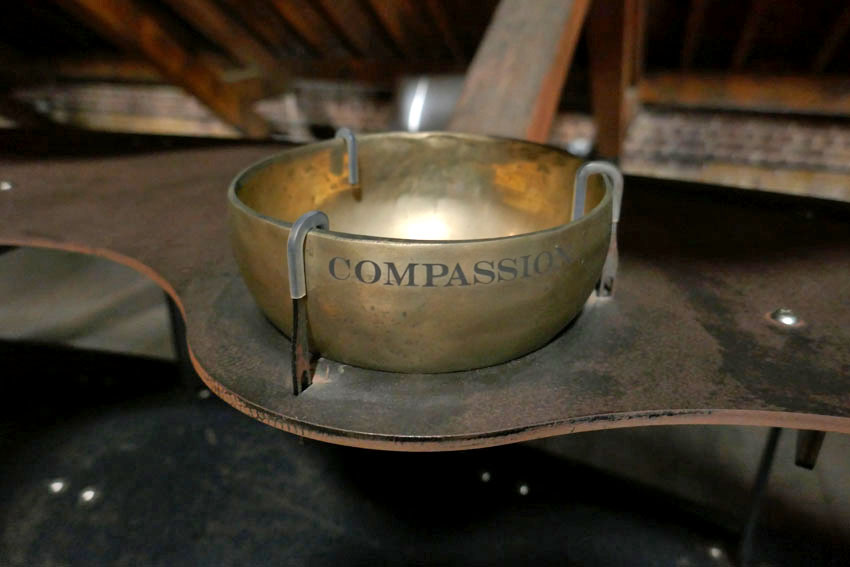
But we are here for something else; something that will outlive all of this worthy but ephemeral creativity. If the past has been remodelled to provide a new vision of the present, then what of the future? At the end of the wharf, occupying the upstairs space of the Bow Creek Lighthouse, is Longplayer. Longplayer utilises an instillation conceived and designed by former Pogues banjoist, Jem Finer. Materially, it consists of 234 brass ‘singing’ bowls and gongs of various size and pitch, although Longplayer in essence is actually a musical composition designed to last for a thousand years. Based on an original piece of music recorded in December 1999, just twenty minutes long, the composition is processed by an algorithm to self-generate a piece that will continue until midnight December 31, 2999 CE. A glacially slow build of subtle musical variation, Longplayer will never repeat itself. Naturally enough, given its planned longevity, the piece is aimed at reflecting the concepts of time and impermanence from a cosmological and philosophical perspective. To house such a conceptual work of art in a redundant lighthouse seems somehow wholly appropriate.
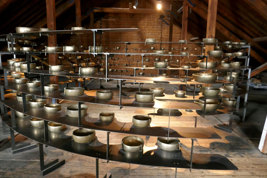
The brass bowls, arranged in a swirling, concentric pattern are beautiful in their own right. Many are adorned with discrete messages or the names of sponsors. Longplayer can be heard best upstairs, where the latticed lantern glass looks out across the river to the high-rises of the Greenwich peninsula. As we view and listen, the ethereal ambient ring of metal is embellished percussively by workers banging on wooden beams elsewhere in the building. The uninvited drummers will soon stop, of course, but the composition will go on, inexorably, chiming with the ever-changing tide lapping the foreshore. A question lingers: where will the river be when the composition finally draws to its millennial conclusion? Will the lighthouse itself be high and dry above the water, or drowned in the Thames? And who will be here to listen?
Through Sarsen Fields – Avebury revisited

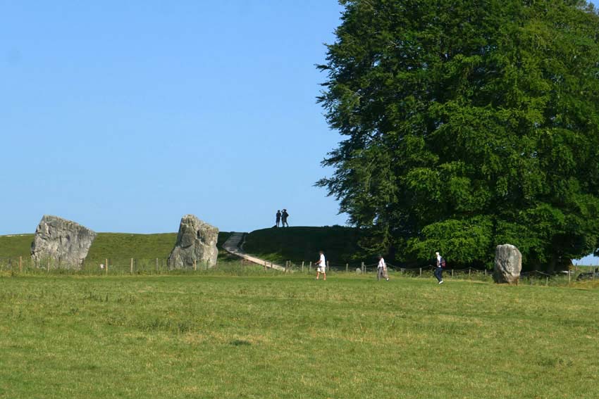
I had been keen to revisit Avebury for a while. This Neolithic stone circle, a World Heritage Site set within the rolling chalk country of north Wiltshire, holds a special place in my heart. This time I planned to approach it differently. Rather than just park up at the English Heritage car park and do the usual day trip thing, I wanted to arrive there on foot by way of the ancient ritual landscape that held it. I had originally intended to come three weeks earlier but the threat of prolonged rain made me postpone my visit. This time, as it turned out, I would have to contend with a very different kind of weather: the highest UK May temperatures on record.

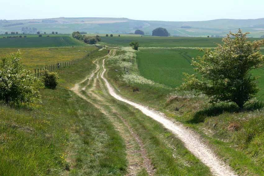
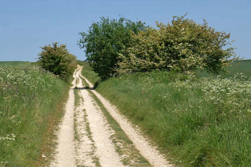
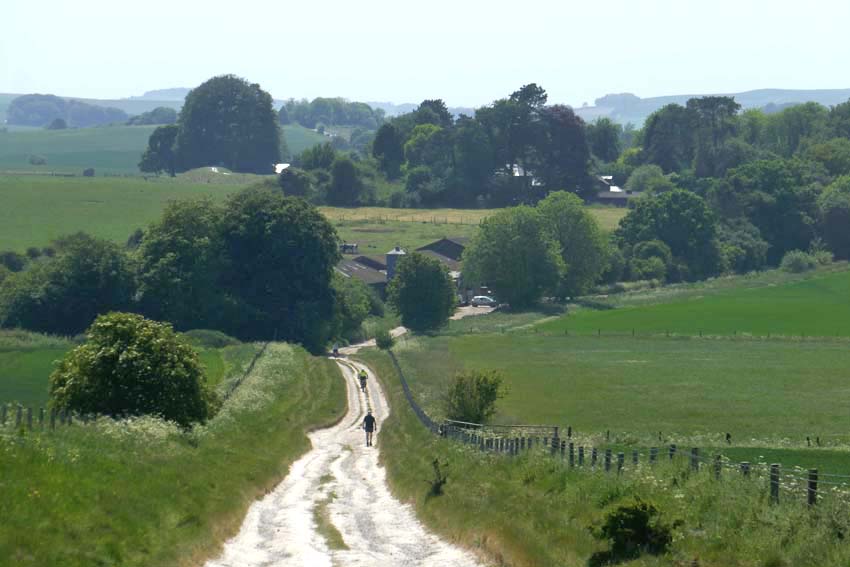
It was no doubt the unseasonably warm, 31°C degree heat that explained why the Ridgeway was almost completely deserted as I set off south along the Ridgeway towards Avebury from Barbury Castle just south of Swindon. Barbury is not actually castle at all but an Iron Age hill fort. From a drone’s-eye view it looks impressive with its double ditch and banks but on the ground there is not much to be seen other than a circle of chalky earthworks. The car park is close to the site, and a couple of families had come to fly kites on top of the raised bank, but as soon as I walked through it to continue along the Ridgeway I found myself more or less entirely alone. From this point on, I only saw a handful of walkers and cyclists all the way to Avebury – perhaps all the more surprising for a sunny Bank Holiday Monday.

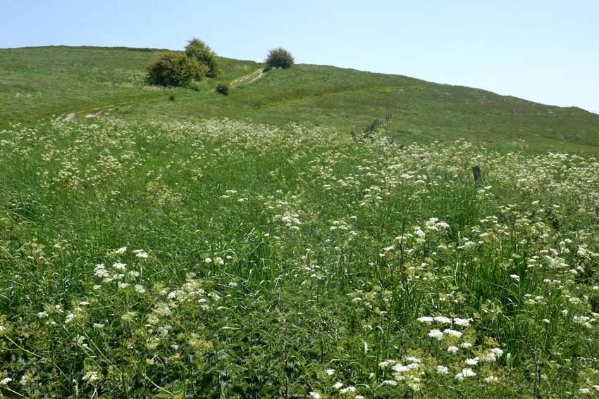
Following the Ridgeway, I made my way downhill before climbing again to the summit of Hackpen Hill, where I was relieved to find marginally cooler, patches of shade beneath the trees that crowned the top. The path levels out here, giving expansive views over Marlborough Down to the east. Here on the open down, skylarks were abundant, their clattering song cascading down from the cloudless blue. Whitethroats, blackcaps and chiffchaffs could be heard warbling unseen, wherever there were patches of hedgerow. The occasional red kite also put in an appearance. One swooped so low that I only became aware of its presence when I saw its bulky, fork-tailed shadow crossing the path in front of me. I looked up to see the bird close overhead, tail twisting to finesse its position as it checked me out, perhaps assessing if my overheated shuffling form was potential carrion in the making.

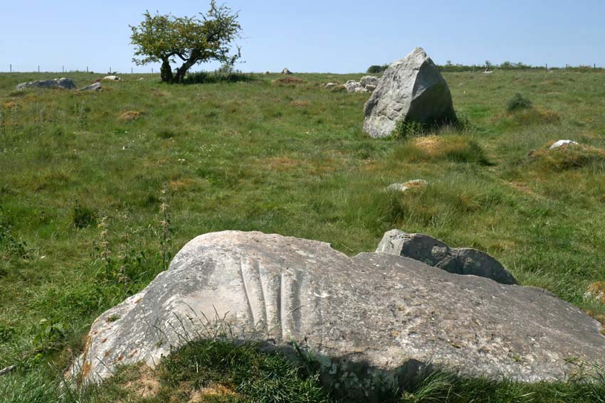
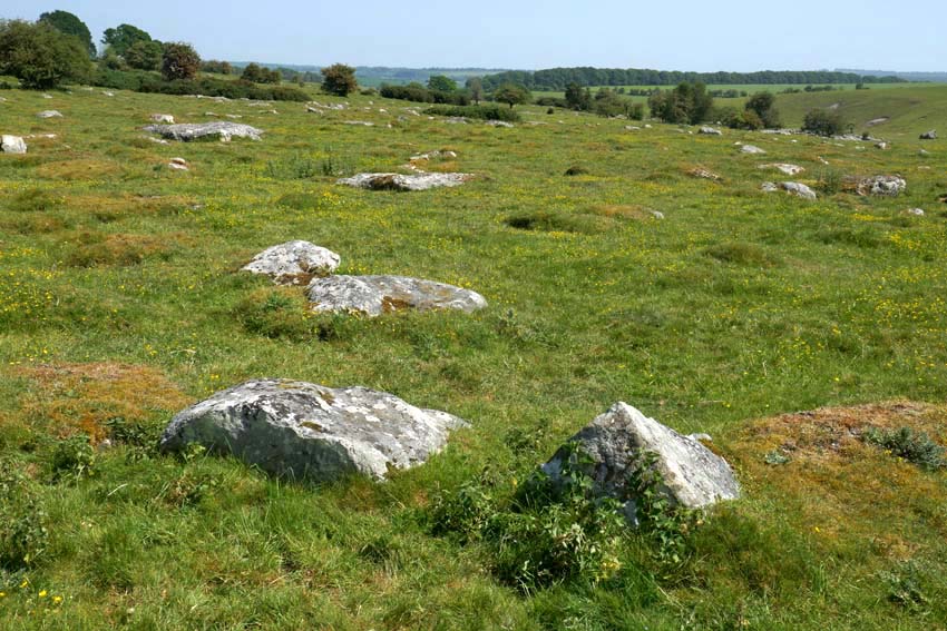
A scattering of recumbent sarsens by the wayside gave the clue that I had reached Fyfield Down. Sarsen is the name given to a locally abundant silicified form of sandstone that was formed by weathering tens of millions years ago. Fyfield Down has the largest collection of sarsens in England and it was these same stones that were used for construction of the megalithic monuments at Avebury, Stonehenge and other Neolithic sites. While here is some doubt about the name’s origin it most likely derives from a diminution of ‘Saracen stone’. Harking back to the time of the Crusades, Saracen was once a generalised term used for Muslims, which by extension came to mean almost anything that was non-Christian or pagan in character. Given their close association with ‘pagan’ monuments like Avebury and other megalithic sites it is easy enough to see how the name stuck.

I wanted to see the so-called Polisher (or ‘polissoir’), which was marked on my map as lying a few hundred metres to the left of the Ridgeway. I found the stone easily enough by means of the tracking app on my phone and it occurred to me that here was an odd juxtaposition of technologies: using 21st century satellite technology to detect the position of something that was associated with one of the earliest tool-making techniques – the shaping of flint into blades and axes. Flint: a versatile material whose use for blade and fire-making saw early humans through two million years of slow-burn development, from the earliest hunter-gathering Palaeolithic hominids to the homo sapiens farmers and herders of the Neolithic. The Polisher was a touchstone, quite literally. With four deep parallel grooves, like the gills of a shark, this singular stone was the product of incessant sharpening and polishing of numerous hand axes in the Neolithic period. To run your fingers along these ancient grooves is to make a tangible connection with the deep past. A repository of time and undocumented prehistory, how many other fingers had done the same before? How many polished axes had been patiently and laboriously shaped here, and how many generations had passed by in the interim?
The arrival of the farming in the Neolithic came with very different requirements to the simpler hunter-gathering which had preceded it in the Mesolithic period. Forests had to be cleared to make room for crops and livestock; trees need to be felled in bulk. New technology was required: flint axes that could be attached to a shaft. As a result, Neolithic axes took on a more elongated shape, and a polishing resulted in more durable cutting edges for the work involved. What had these people thought as they worked the stone? And what was significant, if anything, about this particular spot? The archaeological evidence suggests that the Polisher had originally stood upright.

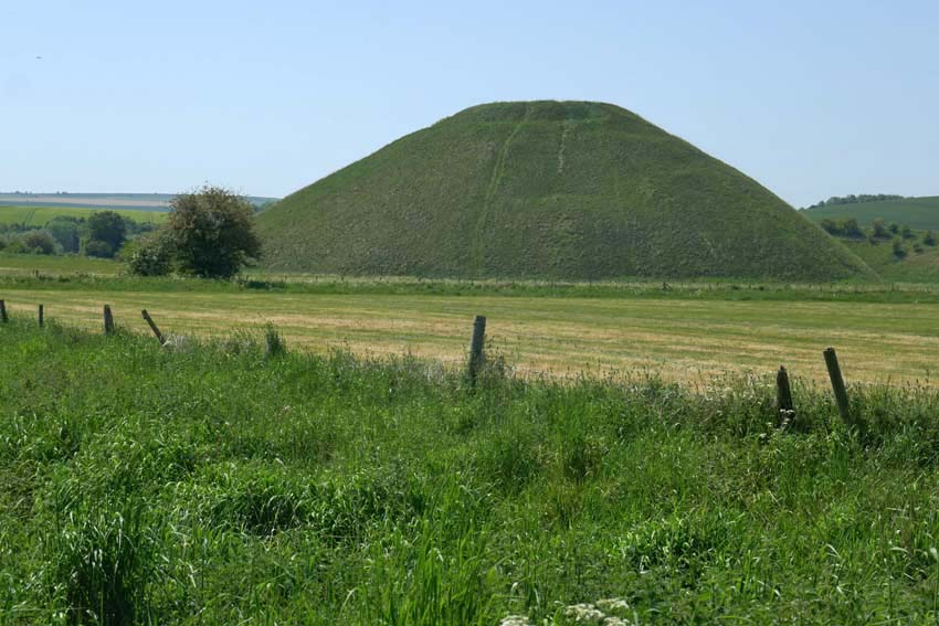
It is hard to imagine the task of stone polishing without some sort of ritual being involved – this whole landscape breathes ritual and ceremony – but perhaps that is to extrapolate too much from the little we can actually be sure of. We can probably never really know. What is certain is that during the Neolithic not all physical tasks were performed for purely practical outcomes – the Sisyphean feats of the dragging of sarsens overland to Avebury and the baffling, generation-spanning construction of nearby Silbury Hill are both testament to this. In the light of this it should also be mentioned that some especially refined polished axes, particularly those of rare exotic stone like greenstone or jadeite sourced from well beyond the local region, appear to have been made solely for ritual purposes or as value-rich objects for exchange denoting power and status.

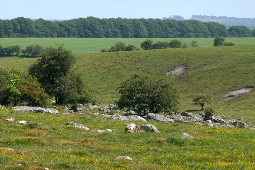
A little further on, I make another detour from the Ridgeway to venture deeper into Fyfield Down, where an extensive scattering of sarsens cover the ground. The greatest concentration of such stones in England, here they lie sprawled across the chalk grassland like tumbled dominoes. A few of them look like the sheep that they take their local name from (‘Grey Wethers’, meaning grey sheep, which they are supposed to resemble when seen from a distance).

Seeking a place to sit for a while, I squat in the thin ribbon of shade that runs alongside a fenced patch of woodland. The ground is bare of grass, churned and trodden down, and covered in dried cow shit, an indication that cattle, thankfully now absent, had recently sought much the same sort of relief from the heat. Thousands of years ago, this sarsen field must have been a hive of activity as monument-building folk selected and prepared stones for transportation to Avebury. Today it is eerily silent: not an utterance other than crow-caw and sporadic insect buzz. Even the usually omnipresent sound of distant motor traffic is spookily absent. This is Bank Holiday Monday in southern England, I remind myself one more time. Disparate thoughts coalesce awkwardly, of post-apocalyptical landscapes and prelapsarian times – it is just the heat playing tricks, of course.

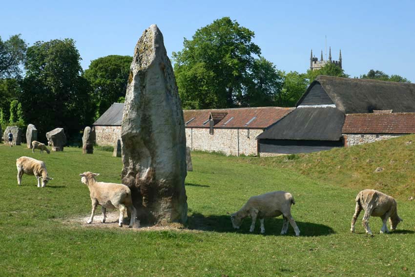
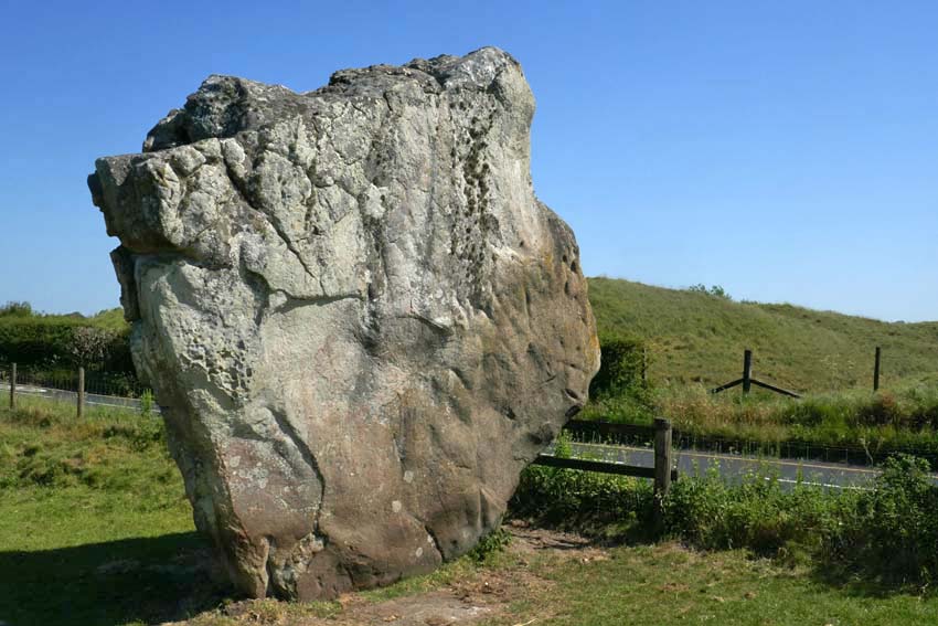
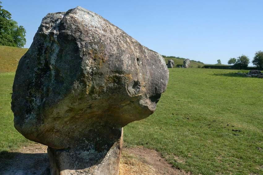
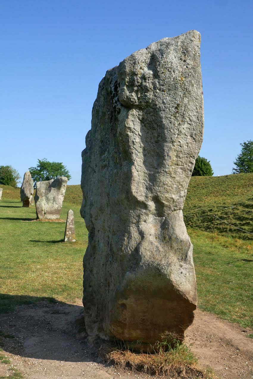
Returning to the Ridgeway I cross the path to descend into Avebury. The village can be seen ahead now, huddled in the valley bottom shrouded by trees. From this viewpoint, there is no sign of the megalithic circle that surrounds it. This does not become evident until two miles further on at the edge of the village when, after passing a few farm buildings and dusty cattle yards, I see a raised bank ahead. The first of the stones lies beyond this, over the fence – one of the many (originally 98) that constitute the outer circle. Ahead is the Red Lion, the village pub, which like most of the village cottages and the church, is unique in lying inside a Neolithic circle of megaliths. But compared to the 4,600-year-long presence of the henge, Avebury, the village, is little more than an afterthought, even if some of its construction owes a debt to the stones as conveniently-placed raw material.

I join the stone circle from the gate by the pub and trace the megaliths as far as the English Heritage barn where there is a café. Tea, ice cream and a seat in the shade brings some welcome respite. I have about an hour until my bus to Swindon leaves and so I go off in search of Avebury’s somewhat elusive rivers. There are two, although ‘river’ is perhaps too grand a title for what are effectively narrow streams. It has been noted that several of Britain’s henge monuments are located close to the confluence of rivers*. Avebury is a case in point, as both village and henge lie just a little way east of the confluence of the River Oslip and the River Winterbourne. Here, they combine to become the River Kennet, which flows south past Silbury Hill before veering east in the direction of Marlborough. Both rivers are considered to be ‘winterbournes’, which tend to be seasonal and usually dry up in summer. One actually bears the name.

*Exploring Avebury: The Essential Guide Steve Marshall 2016

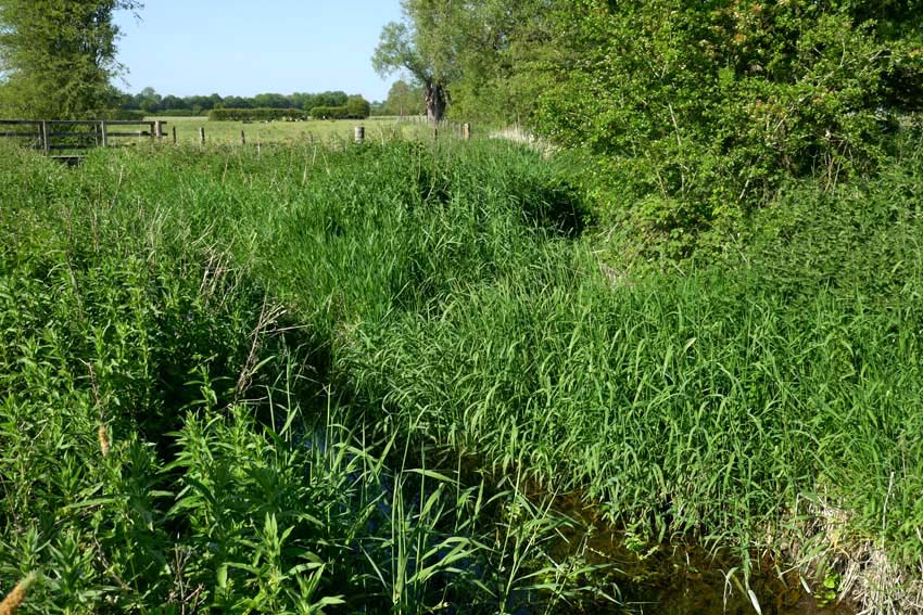
A footpath leads from the church to cross a wet meadow to the spot where the two streams combine. The Oslip has something of a flow to it, while the Winterbourne is little more than a boggy ditch. Both join at a ‘V’ thick with sedge and reed, from which emerges the incessant scratchy song of a reed warbler. In the distance I can hear a cuckoo. (I hope that the two never get to meet, but nature is what it is and who am I to judge its sometimes heartless ways?)  The confluence is discernible but unimpressive. I conclude, though, that this same scene might look quite different in winter, especially after heavy rain or snow-melt when the meadows would flood.

My bus beckons. Tomorrow, I will return to pay my respects to the stones properly – they can wait another day; after all, I have been here enough times before. The henge – the village, the stones, the ditch and bank – already have a well-established place in my memory bank. Like old friends, it is always good to see them again.

Dudley Ay It

We were driving home from North Wales, and it is a long way to East Anglia from there. So we were looking for a break in the journey somewhere: a place to rest overnight before A14-ing onwards to Norwich? While it might not be everybody’s destination of choice, Dudley, de facto capital of England’s Black Country, has some points in its favour, its West Midlands location midway between coasts being one of them. Besides, I wanted to have a look at Wren’s Nest, the geopark on the town outskirts, where all manner of weird and wonderful fossils from the Silurian period might be found.

I had been here before, several years earlier, a brief stop on a coast to coast pilgrimage that I wrote about in my book Westering. Back then I had passed through Dudley as I traced my way through the Birmingham – Black Country conurbation by way of its extensive canal network; an interesting route, although Venice didn’t spring very much to mind as I traipsed westwards through a decayed, post-industrial landscape.

I wrote then:

I arrived at a large, five-way roundabout and a dual-carriageway, which I followed further uphill towards Dudley Castle, which I could see, noble but not entirely fairytale, flying its flag on top of the hill ahead. The next roundabout held several large, Black Country-themed sculptures: a steel crucible, bronze cannon, heraldic lion and medieval plough. It looked as if Dudley was doing its best to make the most of its industrial heritage.  I wanted to take a closer look but was stuck on the wrong side of the dual carriageway with no safe means of crossing. Eventually, I spotted a footbridge ahead that conveniently led me straight to Dudley’s bus station at the foot of Castle Hill, an outcrop of the Wenlock Group limestone that had played a significant part in the town’s industrial development.

This time, coming from Wales by way of Shrewsbury and Telford, we came upon this same roundabout as we were driving around looking for the hotel we had booked for the night. Travelodge found, and bags deposited, we went off in search of food and drink. A peremptory Google search of the vicinity revealed a pub close to the castle that might be a possibility but when we arrived at the Fellows things didn’t look very promising. A tribute singer was belting out a cover of Red Red Wine by UB40 at deafening volume and the courtyard was packed with smokers who were intent on avoiding the aural onslaught inside. Besides, it was Sunday evening and the availability of lunchtime roasts had been and gone. It looked as if we would have to try elsewhere.

On the way up to the Fellows we had passed an even more unpromising establishment on Castle Hill, a single-roomed place that called itself the Star Bar, which resembled more a garage lock-up than a place for food and drink, although the former was clearly available as boisterous yam yam* voices echoed from behind it half-closed metal portal. Also on Castle Hill was a once-splendid Art Deco cinema that now served as a Jehovah’s Witness Kingdom Hall. Next door, a Tudor Gothic pile had similarly been converted to serve as a place of worship for the town’s Muslim community: Dudley Central Mosque. The building, I found out later, was Grade II-listed and had once been a school.

* yam yam = Black Country dialect

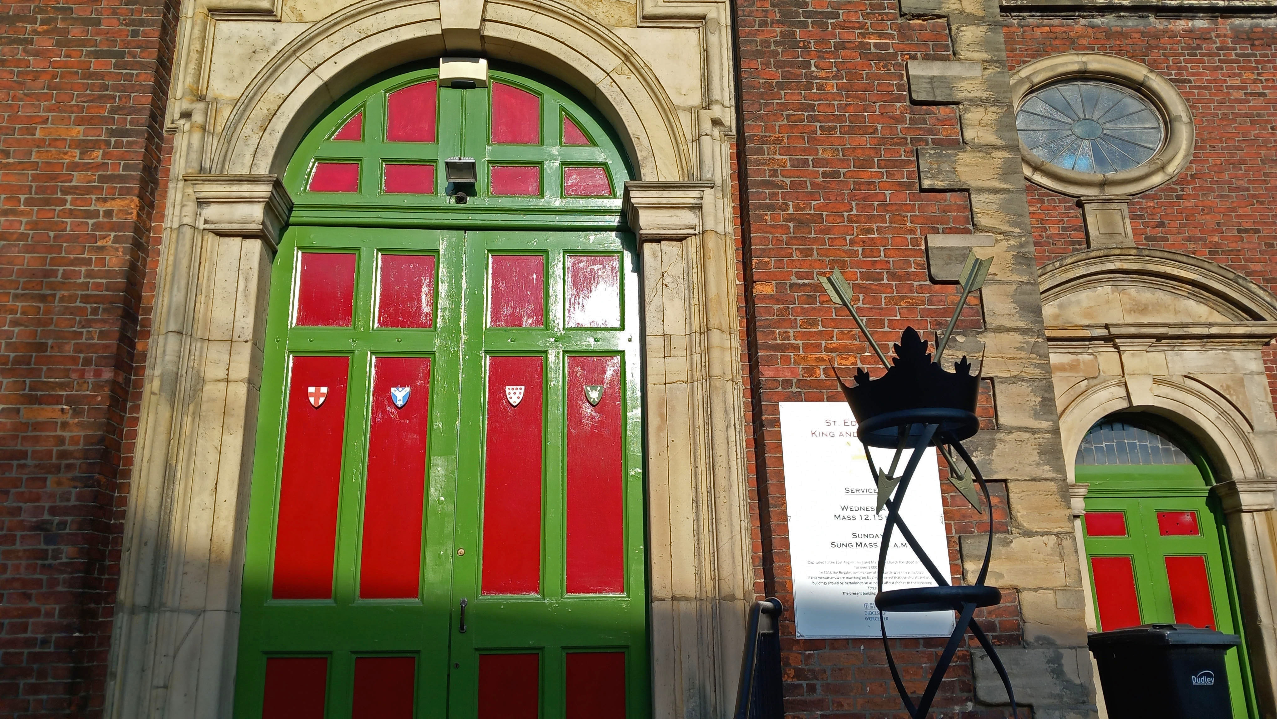
Across the road from the Fellows, a grand statue of the First Earl of Dudley stood at the top of the town’s pedestrianised shopping zone and market place. A little further on we passed St Edmund’s Church, an 18th-century replacement of earlier place of worship of Anglo-Saxon origin destroyed in the Civil War. To symbolise its dedication, twin crowns and the arrows of the saint’s martyrdom were on display in front of the church entrance.

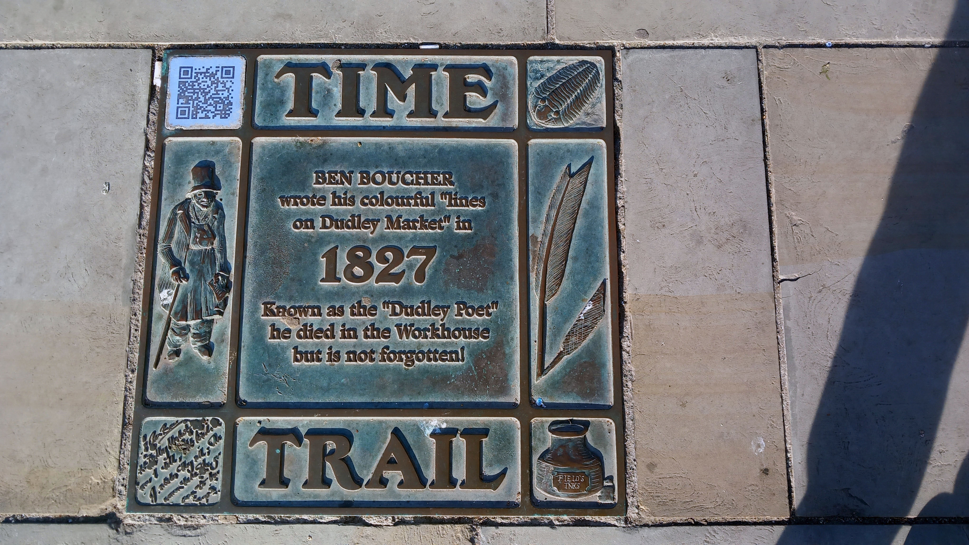
This being Sunday evening, the area was largely deserted; its market stalls locked up, although some of the shop fronts gave the impression of having been closed up for some time. There were several interesting statues scattered about to restore some sense of civic pride. Most notable of these was that of local football hero Duncan Edwards. Born in Dudley in 1936, Edwards had been a Manchester United ‘Busby Babe’ and highly respected England defender before dying tragically, aged just 21, from injuries sustained in the 1958 Munich Air Disaster. Further down, just beyond the market place, was a life-size bronze statue of a top-hatted Victorian gentleman sitting on a bench: the poet Ben Boucher (1769 – 1851), who wrote ‘Lines on Dudley Market’, some of which were etched into the curved Portland stone bench. While Boucher lived a much longer life than the unfortunate footballer, the Dudley Poet’s own sad fate was to end up impoverished in the town workhouse.

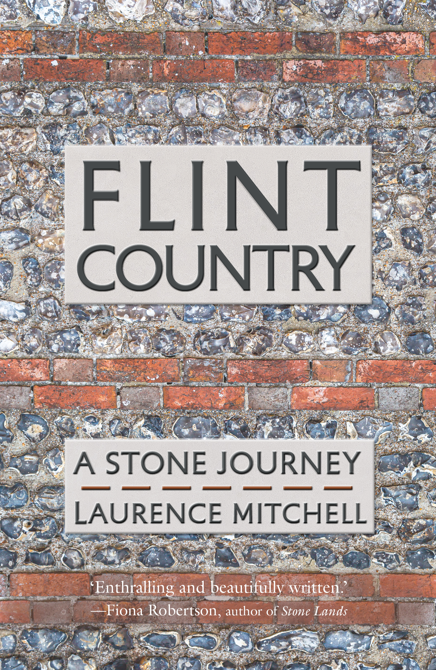
This brief glimpse of the town centre reinforced the impression I had taken from my previous visit: one of decline and closure, one of faded glory. The re-purposing of grand old buildings; the closure of town centre shops and department stores – out-competed ever since the opening of Merry Hill Shopping Centre at nearby Brierley Hill towards the end of the last century. Counter to this sense of decline were the upbeat Town Trail pavement plaques that told with pride the town’s unique geological and industrial history. It was here in the Black Country that the Industrial Revolution had originated and then swiftly gained momentum in the late 18th century. A serendipitous convergence of factors had come into play. The area had all the necessary raw materials – coal, limestone and iron ore. It had – or, rather, soon acquired – the labour, skills and engineering talent. It also had the means of distribution – canals, and later railways. It could even be argued that the Anthropocene – the recent epoch in which human activity has been the dominant factor in changing the world around us – began hereabouts. I touch upon this in the final chapter of my recent book Flint Country, where I write:

The precise date of its onset remains a matter of debate. James Lovecock, originator of the Gaia concept, claims that the Anthropocene started with the Industrial Revolution in the early nineteenth century, the period in modern history when the use of fossil fuels for manufacturing and transport got fully underway. Fine-tuning this connection between the dominance of human influence and technological progress, it could even be said that the Anthropocene began with the invention of Thomas Newcomen’s steam-powered pump, a machine first used to remove water from a coal mine near Dudley in the English Black Country in 1712.

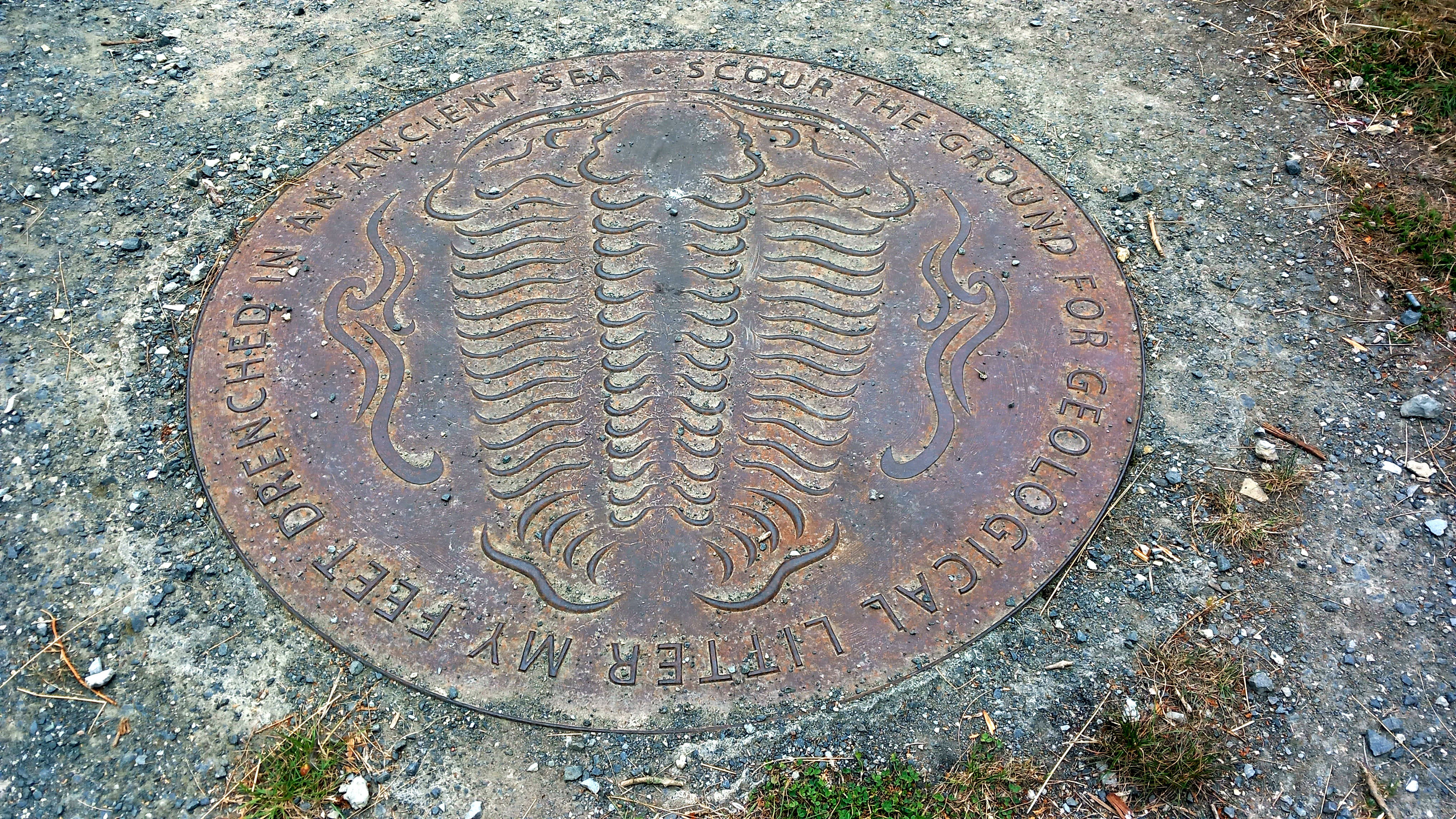
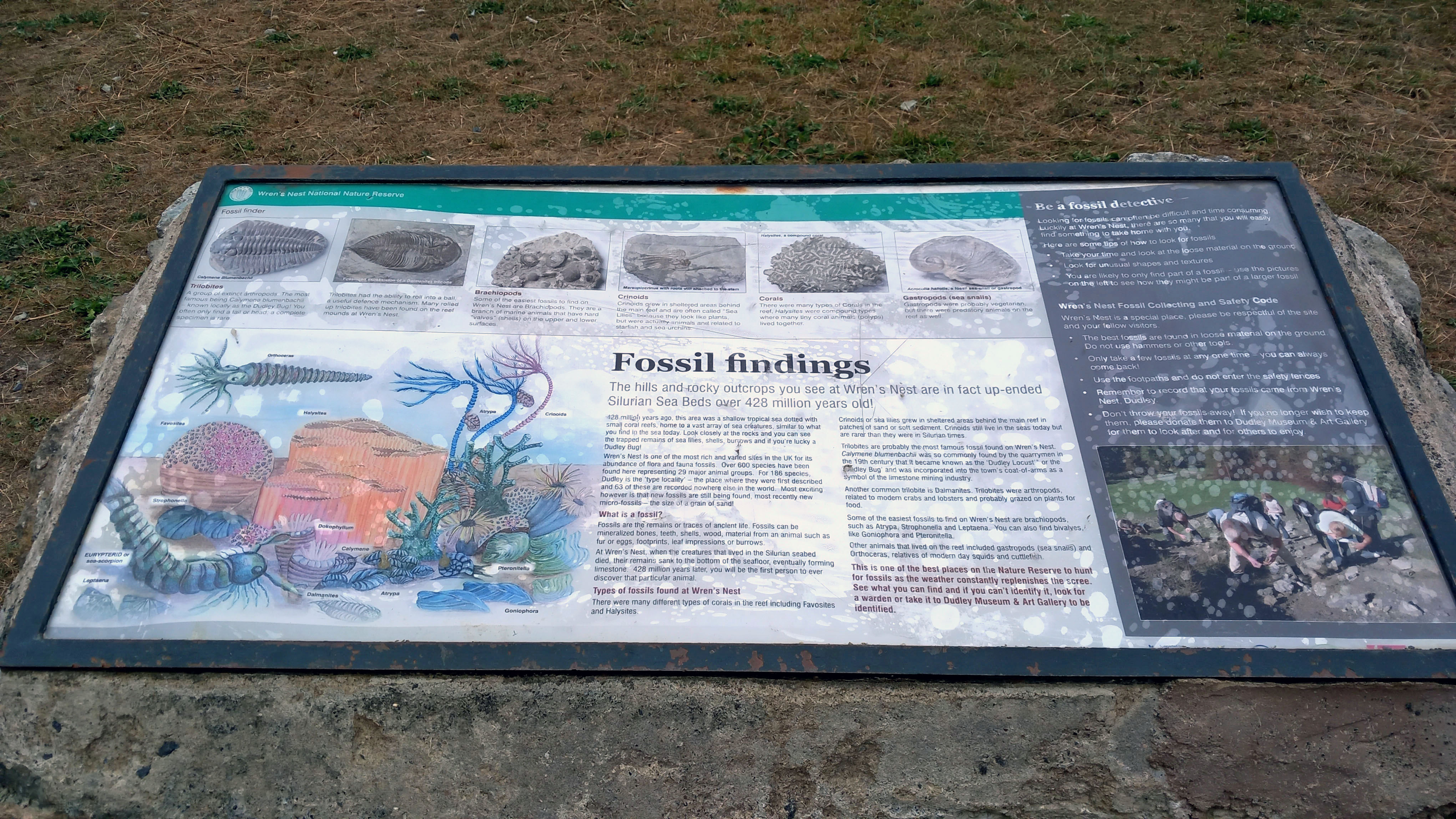
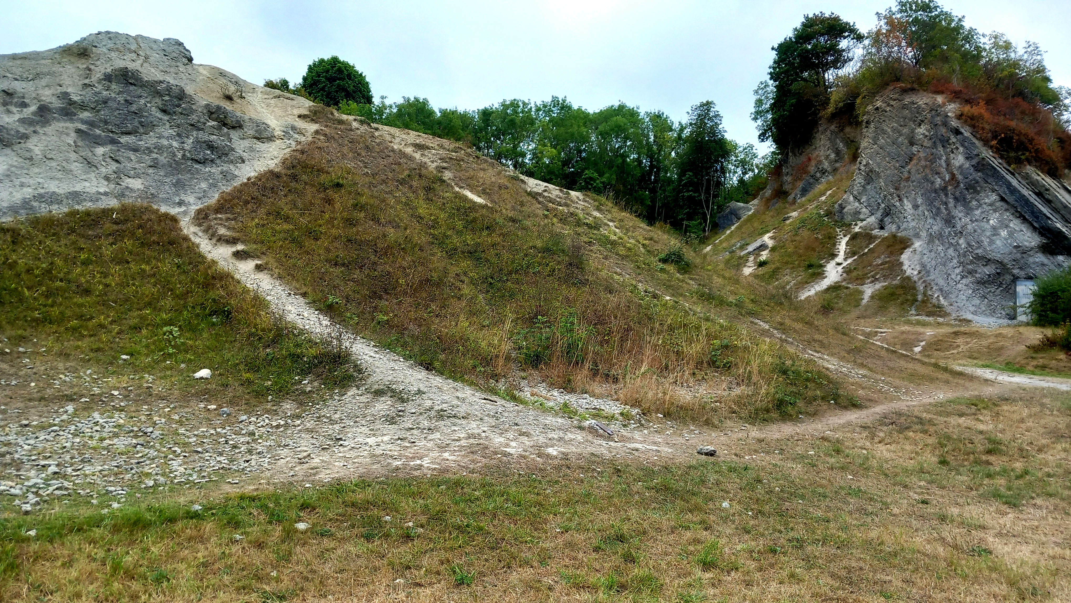
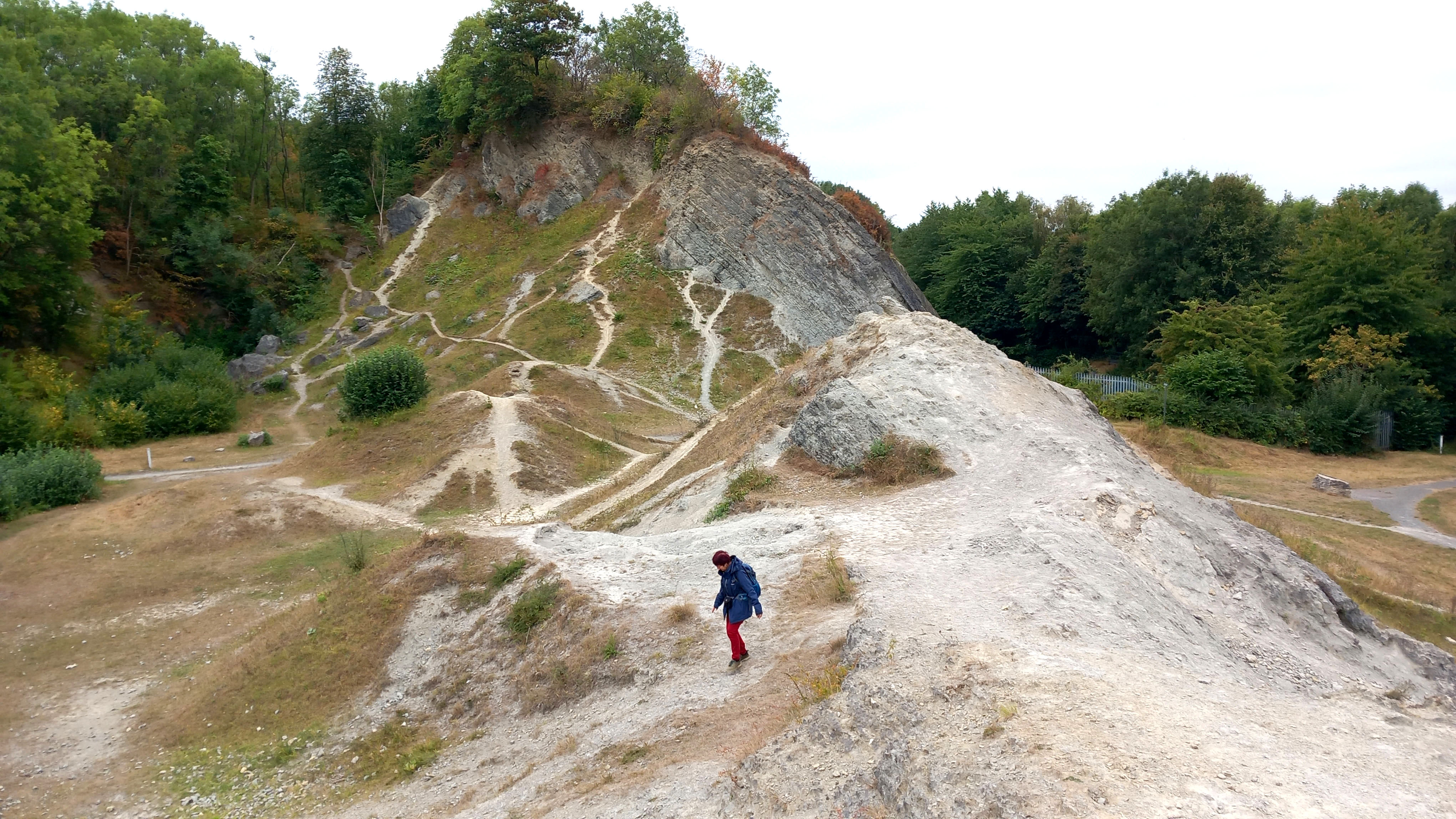
Next morning we made our way to Wren’s Nest, where I noticed that the suburban streets approaching the site had pleasingly apposite names like Silurian Mews and Fossil View. It was a grey, overcast, not-very-warm-for-August sort of day, and the site was fairly quiet apart from a couple of dog-walkers and kids on bikes. At the entrance, an information board gave us the lowdown on the site’s remarkable geological pedigree. Wren’s Nest is effectively a 428 million-year-old tropical seabed that was once covered by coral reefs and uplifted within the Much Wenlock limestone that gifted this region its industrial resources.

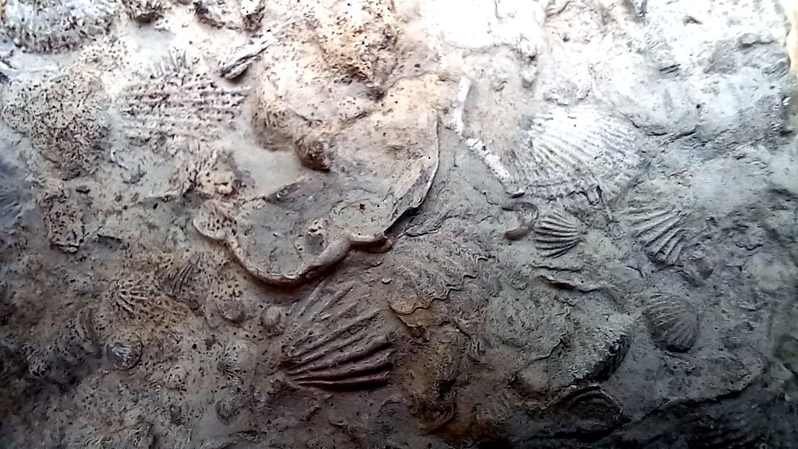
The prize fossil here is a species of trilobite, Calymene bumenbachii, known colloquially as the ‘Dudley Bug’, which looks like a scarily, super-sized woodlice, although it is more closely related to modern day crabs. To find one of these would have made me very happy but they proved to be elusive. What I did find after an hour and a half of turning over scree were several bits of coral and all manner of fossilised brachiopod shells. Best of all was a small flat piece of rock embedded with dozens of tiny shells: a fragment of ancient sea floor that revealed a microcosm of life 428 million years ago, a time when the existing continents were yet to separate and the territory of what would become the British Isles lay south of the Equator. To contemplate such scales of time and distance takes the breath away. William Blake wrote of seeing ‘the world in a grain of sand’. Here you could see a long-vanished world in a small piece of rock.

We left the car park and drove northeast through Tipton and Wednesbury to reach the M6 with its relentless parade of thundering traffic. It was a timely reminder that we were now firmly back in the age of man and machine, the Anthropocene. In comparison with the aeons that had passed since the fossils of Wren’s Nest were deposited at the bottom of a tropical ocean, the 19th-century heyday of the Industrial Revolution in the Black Country with its smoke, red-sky furnaces and metal-clanging workshops was as if just yesterday.

Flint Country by FabFourBlog

My latest book Flint Country was published a couple of weeks ago. I would just like to share this generous blog post about it by Klausbernd Vollmar and Hanne Siebers. It also includes some of Hanne’s lovely images of Cley next the Sea on the North Norfolk coast.

The Road to DirÄ“ Dawa

The road to Dirē Dawa is a long one: an eight-hour drive from Addis Ababa, or so we are told.

We left Addis Ababa at dawn, our bus rattling through empty streets shadowed by new-build office blocks. As with almost everywhere currently in Ethiopia, the pavements were piled with concrete rubble, the result of Prime Minister Abiy Ahmed’s ambitious nationwide road-widening project, a controversial scheme that had already demolished parts of some poorer city districts and displaced many residents in its wake.

For the first hour or so we sped along a pristine tarmacked dual carriageway, the brightening horizon ahead weighed down by clouds the colour of watermelon juice. We could have been almost anywhere; or, at least, anywhere that comes blessed with a backdrop of purple-shadowed mountains and lush tropical greenery. Eventually the freeway morphed into a narrow two-lane highway, which meandered around the heads of valleys as we plied our way eastwards. Traffic was heavy in both directions. Coming towards us was an endless stream of heavily laden trucks from Djibouti, each one towing a trailer, vehicle and driver bonded in lockstep like driven cattle. We slotted into a gap in the fast moving crocodile of trucks that were heading east towards the coast, some of which were piggybacking another truck strapped to their flatbed.

As elsewhere in the country there were checkpoints and roadblocks to slow things down. We had already experienced these travelling the roads of the south, especially in Oromia state, although they had rarely delayed us for long. Sometimes they were administered by the Ethiopian army but more often than not they were manned by local militia who wanted to keep an eye on who was coming into their territory. It had not taken long in the country to come to the conclusion that, rather than the unified sense of national identity promoted by the government, Ethiopia was in the process of becoming increasingly fragmented by region, language, culture and political persuasion.

Before our arrival in Ethiopia we had made firm decisions as to our itinerary. These were based on information gleaned from online travel forums and British FCO warnings regarding more unstable areas of the country. Much of the north – the highlands of Amhara and part of Tigray – was considered unsafe because of rebel activity and kidnappings. Similarly, part of the large sprawling region of Oromia that fans south, west and east from Addis Ababa also came with similar warnings about safety. The FCO had produced a map of the country that divided the country into three zones according to perceived safety: red (‘Advise against all travel’), amber (‘Advise against all but essential travel’) and green (‘see our travel advice before travelling’). I had consulted the updated map frequently throughout the second half of 2024 in the vain hope that brotherly love might prevail throughout the land but the map did not appear to change very much. Much of the south, in particularly the area around Hawassa where we had spent the previous week, was largely amber and therefore considered relatively safe. The highway between Addis Ababa and Dirē Dawa appeared to pass through both amber and green zones, nudging the red briefly between the Oromia towns of Welenchiti and Metehara.

Road blocks and heavy traffic aside, the other barrier to easy progress was roaming animals – donkeys, goats and camels. The donkeys especially were a law unto themselves, totally unfazed by the vehicles that swerved around them as they pottered along oblivious to any danger. It seemed almost as if the animals understood the fast and loose rules of the road – fully aware that if they were harmed then their owners would require compensation from the guilty driver. On a couple of occasions I actually saw one cross the road using a zebra crossing. Camels were a different matter though, large enough to call the shots, they were generally unwilling to step aside or allow any vehicle to manoeuvre past them.

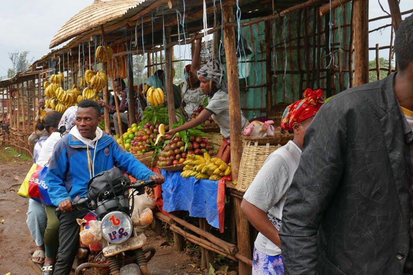
We passed through an endless parade of villages that had little to differentiate themselves from one other: a blurred flash-by of roadside settlements, all flimsy housing and lean-do shops thrown together out of scrap wood, plastic sheets and corrugated iron. The goods on sale – fruit and vegetables, flyblown meat, second hand clothes, spare parts for vehicles – were the bread and butter (or, perhaps, injera) of everyday life. As always in the Global South, it was intriguing how such a base-level financial system managed to thrive, a poor man’s economy in which ragged ten birr notes continually changed hands until all the value had been squeezed out of them.

There was another product on sale that seemed to be ubiquitous in this part of the world – we had seen it on display along almost every roadside in southern Ethiopia the previous week. Khat, the stimulant of choice across much of the Horn of Africa, is an innocuous looking leaf that resembles bay or privet. Legal throughout the region, khat is, as many Ethiopians will attest, less a stimulant, more a way of life. Our driver was clearly an aficionado; as was our guide, a young man who kept his own counsel throughout the journey and did not utter a word of information about the foreign (to us) country that lay beyond the window. The pair just stared ahead for the whole way, locked in herbal reverie as they slowly worked through the pile of leaves that lay at their elbow.

Khat seems to be very much a driving drug, an herbal alternative to the so-called energy drinks whose slim cans over-caffeinated motorists toss out of their windows along Britain’s motorways. It might even be considered to be a green alternative to caffeine, although there is absolutely no shortage of coffee in this land of stay-awake plenty. A week earlier, motoring through the coffee-rich Sidama region of the south, our previous guide, Wonde (‘Wander’), had regaled us with horror stories about khat-crazed drivers careering off the road due to lack of sleep and/or poor decision-making. It seemed perfectly believable. Between Addis and Dirē Dawa I counted at least eight trucks that had crashed and gone off-the-road; some lay forlornly on their side, while others had ended up completely upside down with wheels akimbo. It was unclear as to what had become of the drivers, although it did not look as if they would have escaped unscathed.

One crashed truck that we passed had unleashed a load of crated beer bottles onto the slope beside the road. Slowing down to make our way around the crowd that had gathered around the wrecked vehicle, the air smelled as malty as a Sunday morning pub. A couple of armed men were guarding the booty as approved wreckers sifted through the debris, placing the unbroken bottles in crates ready for resale. Who the men with guns were was anybody’s guess. It was the same at some of the checkpoints we were obliged to stop at, where youths with rifles peered inside the bus before lowering the barrier – no more than a rope stretched across the road – to allow us to pass. A single word from the driver, ‘Turist’, and a glance at our pale well-fed faces within, was usually sufficient for us to be waved on.

While khat consumption is widespread, it was something that was shared with other countries in the region like Somalia. Other aspects of Ethiopian culture are decidedly more unique. One is the country’s unorthodox calendar, which is seven or eight years behind the rest of the world. While the year elsewhere might be 2024 according to the Gregorian calendar, in Ethiopia it is currently 2017. ‘Welcome to Ethiopia, and congratulations,’ we had been told more than once, ‘here you are seven years younger.’ Another Ethiopian curiosity is the music that is played loud and proud almost everywhere, which whether traditional, pop, or the rather wonderful Ethio-Jazz that I had already developed a taste for, uses a pentatonic scale that has a distinctive modal sound to it. A world away from other African music that is generally more accessible to Western ears, Ethiopian music has a tendency to sound rather other-worldly and even a little Chinese at times.

Another facet of Ethiopian culture that sets the country apart is the food, which is quite unlike anywhere else. The mainstay of the diet is a sour spongy pancake called injera, which is made from an ancient indigenous grain called teff. This is eaten along with small helpings of spicy vegetable or meat sauces. For many Ethiopians, if they can afford it, kitfo (spicy raw beef) is the preferred accompaniment, although, perhaps counter-intuitively, there are actually two days of the week, Wednesday and Friday, when restaurants are obliged to serve only ‘fasting’ food, which is strictly vegan. Whether meat or vegetable, raw or cooked, freshness is probably the most important factor in regards to health, and I believe it was the suspicious, rather tired-looking sauce that came with the injera I had eaten the previous night in Addis that had been the cause of the stomach cramps that troubled me throughout the long journey.

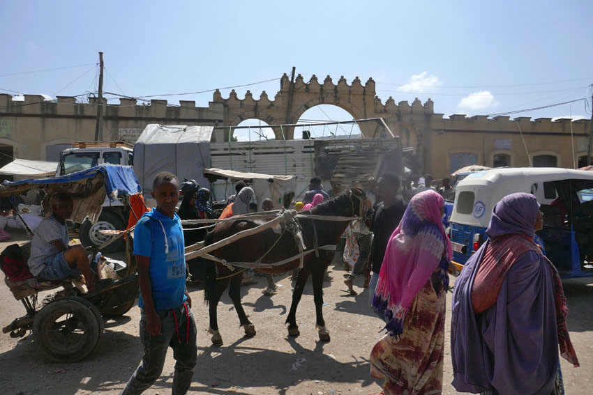
We pulled into DirÄ“ Dawa just as it was becoming dark, the onset of the city’s flickering neon countering the rapid tropical plunge into night. The journey had taken twelve hours – sunrise to sunset. Considerably lower in altitude than where we had come from, the city felt hot and humid compared to Addis’s fresher, spring-like climate. But it was as bustling and noisy as the capital, with a honking stream of three–wheel bajajs (tuk-tuks) plying DirÄ“ Dawa’s wide boulevards. Tomorrow there would be the opportunity to visit the city’s sights, such as they were. Tonight though, after a day of unremitting motion, it was the promise of laying still on an immobile bed that held the greatest appeal.

Dungeness

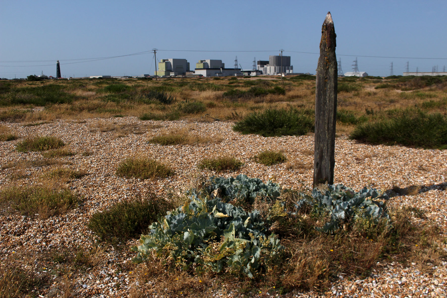
Now, with the promise of autumn in the air, it feels almost nostalgic to look back on those hot days of just two months ago: the end of July, record temperatures; the countryside baked and arid. A visit then, to Dungeness on the Kent coast, a headland jutting out to sea just to the east of the Sussex border. One of the largest expanses of shingle in Europe, it is a fabled place. Hitherto unknown, my only reference points are those places closer to home like Norfolk’s Blakeney Point and Suffolk’s Sizewell and Orford Ness where, until recently at least, there was a lighthouse. Dungeness, I learn, has two – an old and a new; like Sizewell, there is a nuclear power station. Like both, there is shingle galore.

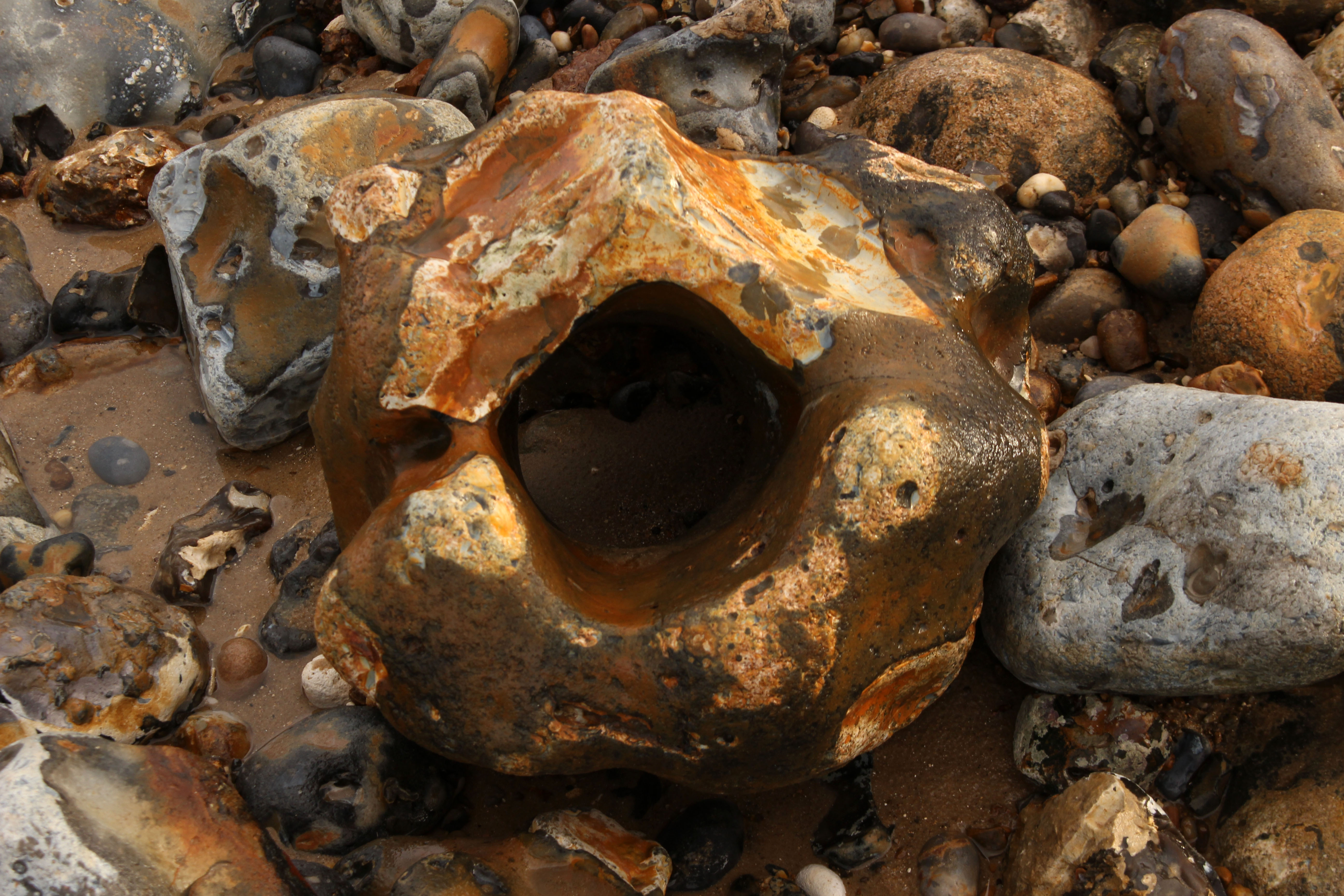
The modern mythology of Dungeness precedes it. Much of it is connected with the filmmaker Derek Jarman, who lived here in a fisherman’s cottage in the 1990s. We arrived on what was predicted to be the hottest day on record and stayed overnight at a B&B on the coast road at nearby Lydd-on-Sea. The shelved beach was entirely of pebbles, nearly all flint, most of which were black although some were a warm shade of amber. I clambered awkwardly across loose, sun-blasted stones to take a swim, glad of the water’s relative coolness. The sea was tepid mulligatawny, warmed by the incoming tide flowing over hot pebbles. Across the bay lay the white low-rise of Folkestone, and beyond this Dover’s celebrated cliffs. Later, when the air cleared a little, we could see Boulogne gleaming across the Channel. Boulogne-sur-Mer: another country, closer here than even the horizon, although we, as a nation, were allowing it to drift from view. The water, the English Channel, had become both a salty barrier that kept us apart us as well as a fluid channel that connected us. The French, always better dressed, call it La Manche, ‘the sleeve’. Language has its own agenda; language slips from tongues and connives to confuse – La Manche: c’est la mer. La Manche: c’est le mur. La France: c’est l’amour.

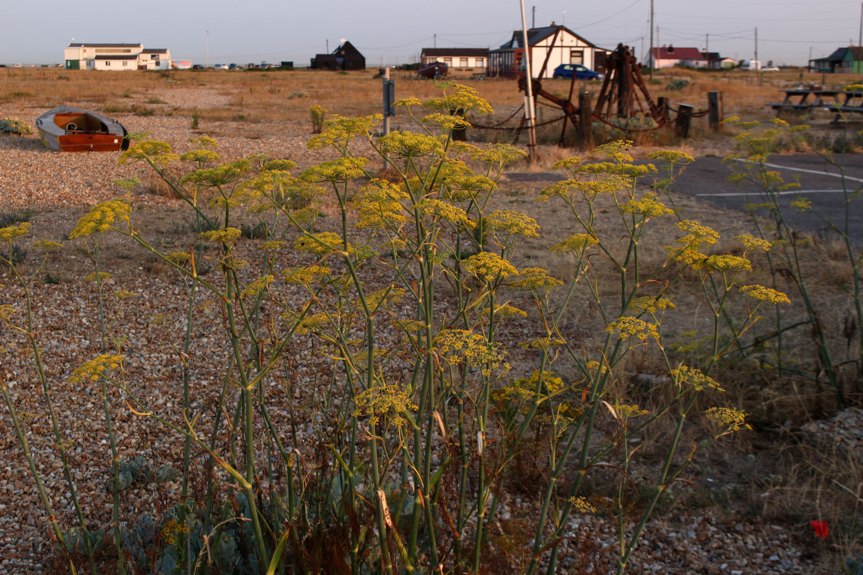
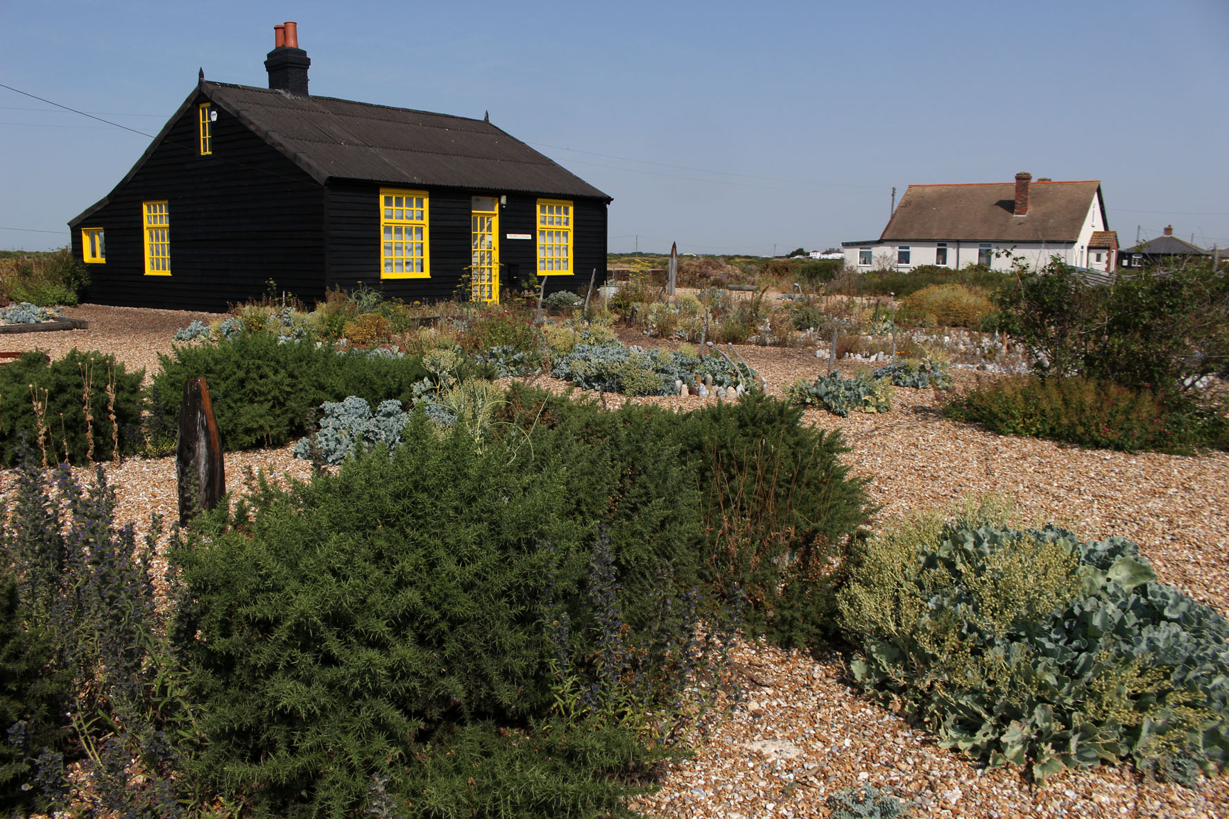
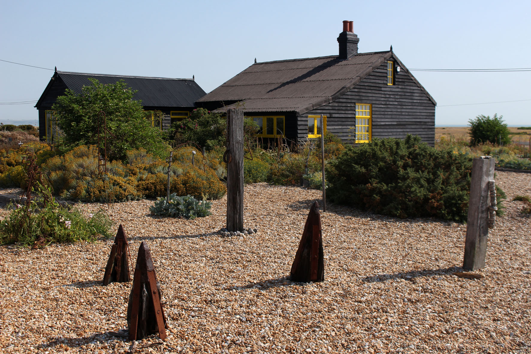
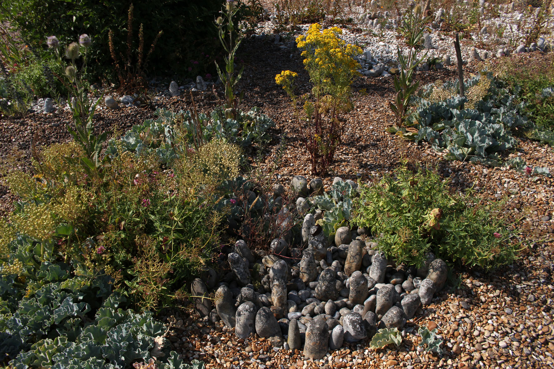
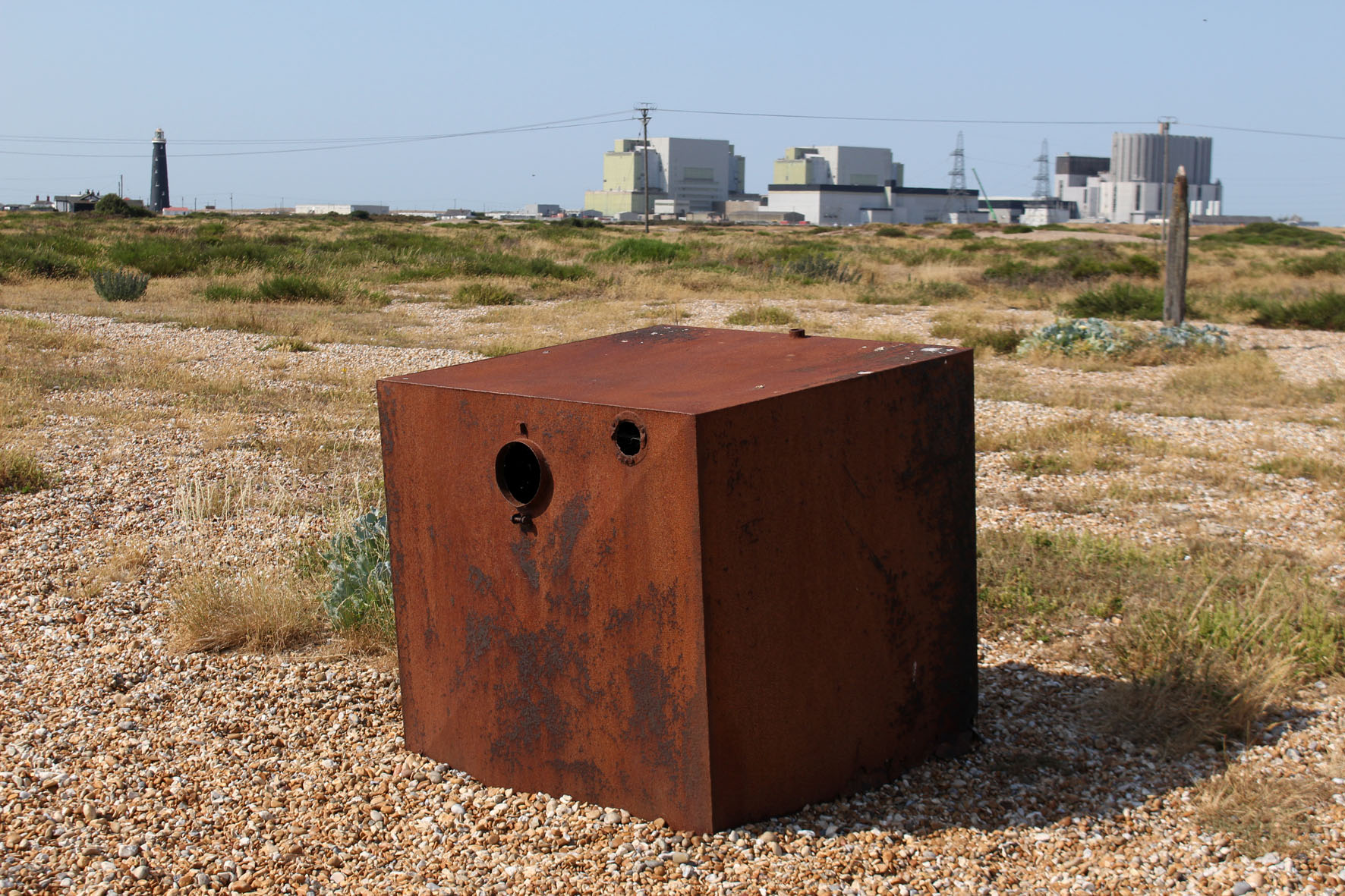
The next day really was the hottest day on record. We drove to Dungeness to find Jarman’s house. Prospect Cottage, black-painted wood with bright yellow window frames, looked to be in excellent condition. The cottage was close enough to Dungeness Power Station to be within the acoustic shadow of the menacing clang and whir of its machinery. The garden was clearly a work of love, a metaphor for Jarman’s dwindling years, an exercise in making the most of limitations: a temple to pebbles and the salt-tolerant flora that would grow in their presence – sea kale, yellow-horned poppy, red valerian, fennel and clumps of tough spiky grasses. Beach debris, like sea-bleached driftwood, provided makeshift statuary, while circles of larger pebbles were arranged like henges. Unlike most gardens it seemed an extension of the landscape rather than any sort of imposition on it.  Here on a bleak shingle spit, framed by the terrifying machinery of nuclear fusion, was, as the title of Jarman’s book suggests, modern nature.

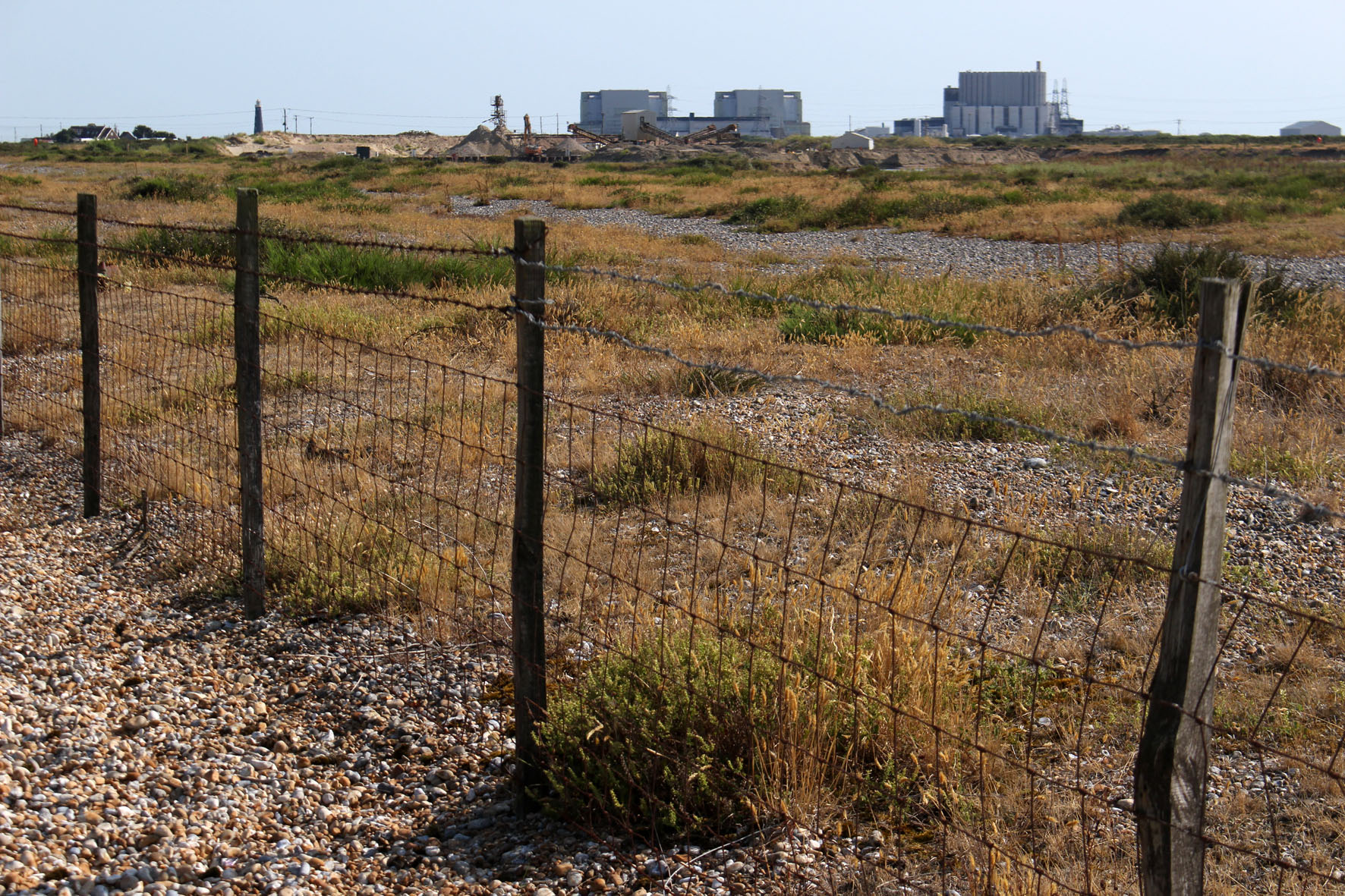
We drove on past the red and white banded new lighthouse to a pub close to the old lighthouse and the power station – the Britannia Inn (‘Fish & Chips, Pizza’), which had trestle tables lined up outside in its car park that afforded unbroken views to the concrete edifices of Dungeness B. It was hard to imagine something that could simultaneously be both so English and so weirdly incongruous. Signs in the shingle across the road warned of the necessity of a licence for filming and photography in specific areas. Like Orford Ness in Suffolk, Dungeness has become a brand with associated commercial interests. Membership cards of any psychogeographic-inclined affiliation were invalid here.

A boardwalk led across the shingle to a bench. Coming along it back towards the road were two policeman carrying binoculars. We had already noticed a large police presence in the area – patrol cars, transit vans with anti-riot shields poised above windscreen. At first, perhaps naively, I had thought it was a matter of security – keeping an eye on the power station, an obvious if not particularly vulnerable target for would-be terrorists. Then it dawned that they were here to watch the sea for migrant rafts. France was at its closest here and the English Channel was about as calm as it ever gets. It was high season for people smuggling.

Some of the houses that lined Marine Drive in Lydd had first floor balconies that looked out to sea. A few had flagpoles with flapping St George or Union flags. Here at England’s south-eastern edge, the Continental ‘other’ in plain view, expressions of nationalism appeared to be defiant and full-throated. I wondered what sort of welcome any raft voyager who successfully beached here would receive from those who had seen them approach through the telescope mounted on their verandas. Somehow I doubted that many would have the kettle boiling and the Hobnobs ready on a plate.

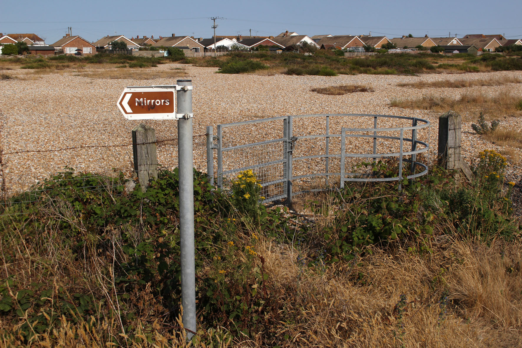
Dungeness’s watchfulness is nothing new. In the heat of the first afternoon I had taken a walk to see the Denge sound mirrors located on an island in what had recently been designated an RSPB reserve. Now designated Scheduled Ancient Monuments, the sound mirrors, constructed of concrete in three radically different designs, were built between 1928—1935 and were an intriguing precursor to the invention of radar just before World War II. Strange objects to find in any landscape let along here among the shingle and marshes of the West Kent littoral, the idea was that they would detect the sound coming emanated by low-flying enemy aircraft coming across the channel – an early warning system of ‘Listening Ears’ as they became known.

It was a historical fact, dictated by location and landscape, that Dungeness had long been keeping its ears and eyes open to intruders from across the sea. If such liminal places were ever to participate in a twinning scheme then Orford Ness in Suffolk, with its secret bomb testing facilities and comparable edge of the world atmosphere, would be a natural contender. Both Dungeness and Orford Ness watch and listen as the flint pebbles grind and roll on their beaches in ever-shifting Heraclitean flux. Panta rhei: ever moving, never the same, always the same.

The Greenway

Picking up from where we left off, back in November, my friend Nigel Roberts and I travelled to London on Wednesday* to walk Section 14 of the Capital Ring. We arrive at our starting point at Hackney Wick by way of the 26 bus from Liverpool Street Station, whose upper deck gives excellent views of upwardly and downwardly mobile Shoreditch and Hackney along the way.

Hackney Wick, an East London zone heavily revamped by the 2012 Olympics, is already starting to develop a distinct patina – a place that is part bohemia and part industrial estate, with pleasing, professionally executed murals amid rag-tag graffiti.  We require sustenance before we set off, so bacon and egg rolls are purchased from a snack van near the station. The rolls, amply filled and luxuriously lubricated with brown sauce, are excellent value and of sufficient deliciousness that I am tempted to adopt them as an alternative monetary unit – a BER (Bacon and Egg Roll), a benchmark by which to compare prices. As I sit on a bench gnawing away, Nigel – always one to document every detail en route – Milibands me with his phone camera, capturing my awkward mastication for the benefit, no doubt, of his thousands of Facebook followers and leaving my political career in tatters even before it is begun.

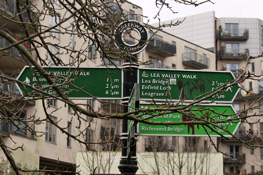
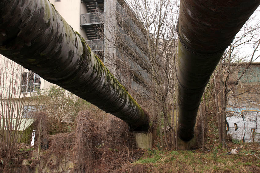
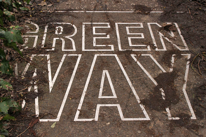
From the station we cross a bridge over the Lea Navigation (Hackney Cut) and follow the towpath south for a short distance before veering off left to join the route of The Greenway. The Greenway, well signposted and walker-friendly, is a six-mile-long pedestrian and cycle route that sits on top of the Northern Outfall Sewage embankment (N.O.S.E), directly above the 1860s Joseph Bazalgette-built sewer that shifts vast quantities of London sewage to a treatment plant in Beckton where, once purified, it is released into the Thames. Had Situationists ever trodden its well-maintained path they might have declared, ‘Sous les pavés, la merde!’ While Tony Blair once recommended a centrist Third Way, here, we are following something akin to a turd way, although the official name, The Greenway, undoubtedly has a more fragrant ring to it. 

Queening it over Queen Elizabeth Olympic Park to our left is the London Stadium, now the claret and blue home of West Ham FC, along with the fantasy fairground ride that is Anish Kapoor’s ArcellorMittal Orbit sculpture. Further on, just before reaching the railway line, we come to the View Tube Café & Bar, where we stop for a coffee (1.2 BER for a polystyrene cupful) but pass on the cocktails on offer (1 mojito = 4 BER).

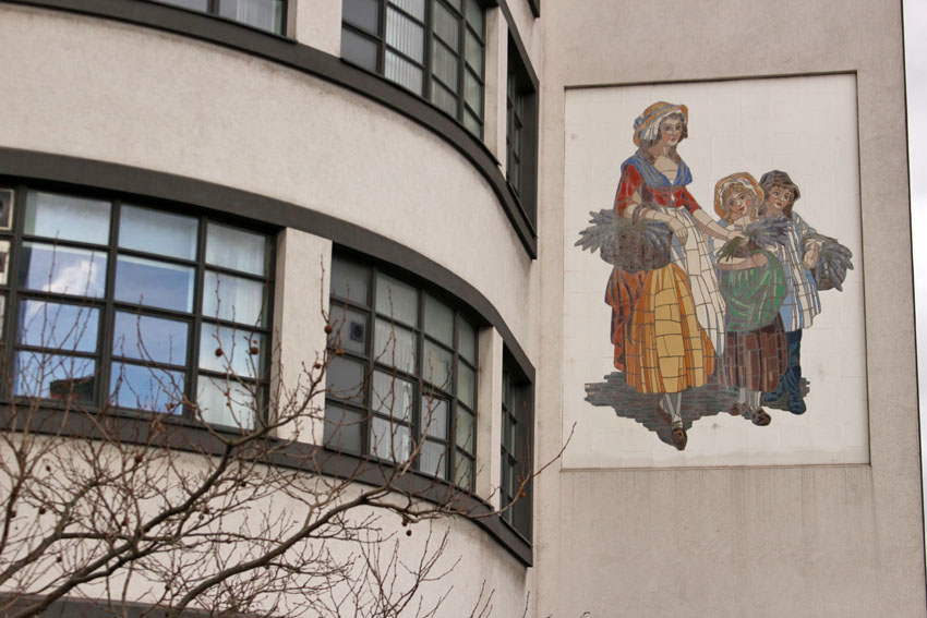
Suitably caffeinated, we follow the ramps that take us beneath the multiple tracks of the former Great Eastern Railway before returning to The Greenway again. We cross Waterworks River and then Stratford High Street, which is busy with traffic and lined with gleaming new office blocks. One of these bears a mural of a Victorian woman with baskets of lavender – a memorial to the onetime Yardley soap factory that stood nearby. Equally intriguing is a strange tower that stands a little way down the street by the river. It is something I have seen from the train many times before and had always wondered about. The Stratford East Tower, on close inspection, is built of timber and mimics an elongated (and leaky) ice cream cone. What it really represents, of course, is an Olympic torch – another architectural heirloom of the glory days of 2012. These days, more prosaically, it also houses a mobile phone mast hidden within.

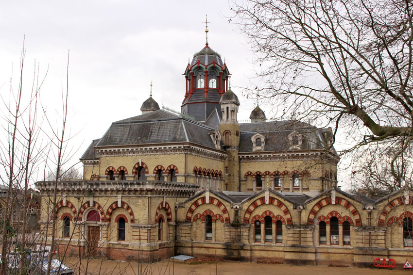
Back on The Greenway, a Thames Water crew is carrying out some sort of maintenance of the sewer below. Aluminium ladders lead underground through open manholes that offer our noses a mild hint of that which flows beneath. Just beyond here, down a slope to the right, stands the quite magnificent edifice of the Abbey Mills pumping station behind high razor wire fencing. Constructed by Bazalgette in the 1860s, it originally housed the beam engines required to pump city sewage 40 feet up to the height of the Northern Outfall Sewer. Byzantine-style, and yellow brick with cupolas, it resembles nothing less than a cathedral, Bulgarian Orthodox perhaps? St Bazalgette’s? Or maybe even Catholic? – Spain already has its own Our Lady of the Sewers**, so it is not such a far-fetched notion.

A little way beyond the pumping station is Abbey Creek The tide is out, leaving a grey expanse of mud stippled with fragments of wire netting, dead shopping trolleys and other Anthropocene detritus. Overlooking the creek is another relic of the pumping station: a curious piece of ironwork that resembles a giant nautilus fossil… or maybe a super-sized tuba, a fiendish instrument that can only be blown by the foul breath of the sewer beneath.

Back on The Greenway itself, a little further on, large white letters on the wall spell out:

L O N G   L I V E   C O M M U N I S M

Nigel, channelling revolutionary БРСМ*** spirit, poses for a photograph with a raised fist. It feels anachronistic. Perhaps, by way of balance, or simply to bring it up to date, there should also be another that says:    

D E A T H   T O   N E O L I B E R A L I S M    and/or 

O B S E R V E   T H E   D E A T H   T H R O W S   O F   

L A T E   C A P I T A L I S M

Such slogans are absent, although they are easily brought to mind by a head swivel across to the silhouetted high-rises that mark the distant City of London – the sky-piercing monoliths of Canary Wharf Tower and The Shard being the most familiar of the cluster. Here, encapsulated in glass, steel and concrete, are the architectural marker stones of the London Launderette, the machinery of which is currently rinsing roubles on fast cycle. Londongrad: an established playground for oligarchs, kleptocrats, KGB cathedral fanciers and Premiership billionaires – bullion for bricks, gas for glass, irony for iron, gold for goalkeepers; cash for condos, cash for honours, cash for tennis. Another hidden sewer: the secret culvert of dirty money that seeps unseen into The City.

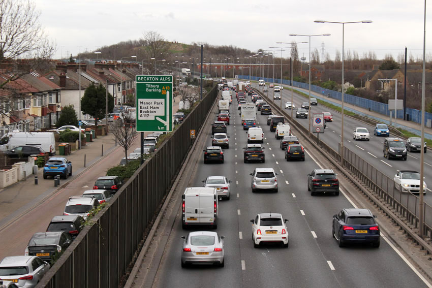
We cross another railway line and then have views through trees to the stones and avenues of the East London Cemetery. Next we pass Newham University Hospital and some giant concrete balls at the junction with Boundary Lane. At a primary school playground a little further on we leave The Greenway behind, heading south to reach the ramps that take us across the dual-carriageway of the A13. Looking east beyond the red brake lights of queued traffic is the modest rise of Becton Alp, a fake hill made by piling the toxic spoil of a former gas works. It is no Silbury but at 36 metres is still the highest artificial mound in London.

Our walk ends with a meander through Beckton District Park. This area feels more Ballardian suburb than gritty city edge. Nigel observes, ‘This could be Worcester, you know.’ And he is right, it could be almost anywhere. The trees planted in the park come from far and wide, each bearing a sign to identify species and provenance. Tired and footsore by now, we forget to look until the last one – Algerian Ash.

The DLR from Royal Albert Station speeds us back into central London – a driverless train through the heart of The City providing all the metaphors you might possibly need. Later, over beers in a Soho pub (1 pint = 2BER), we discuss prog bands we saw back in the glory days of the last century. A man at the next table joins in the conversation. He tells us he likes visiting pubs that come with a bit of history. Currently he is on a tour of George Orwell haunts in the city. After a quick chat about The Road to Wigan Pier, a book we both admire, I ask: ‘So did Orwell used to frequent this place.’ His reply was unexpected, ‘No, but Dennis Nilsen used to come here to look for victims, I think.’

* Wednesday, February 23 – the day after ‘Palindrome Day’ 22.02.2022; the day before Russia’s invasion of Ukraine 24.02.2022

** see Paul Richardson’s Our Lady of the Sewers and other Adventures in Deep Spain 1998

 *** БРСМ = Belarusian Republican Youth Union (…only kidding, although Nigel is undoubtedly a Belarus pioneer of sorts)

Walking the Ring: Stoke Newington to Hackney Wick

Stoke Newington, London N6. We are here to walk part of the Capital Ring that circuits the capital by way of 15 stages. Slightly perversely we decide to begin at Stage 13, which links Stoke Newington with Hackney Wick by means of a park and a path alongside the River Lea and Lea River Navigation. Less defiantly, we will follow the overall route clockwise as suggested. To go widdershins might be an enticement but we are civilised men not maniacs.

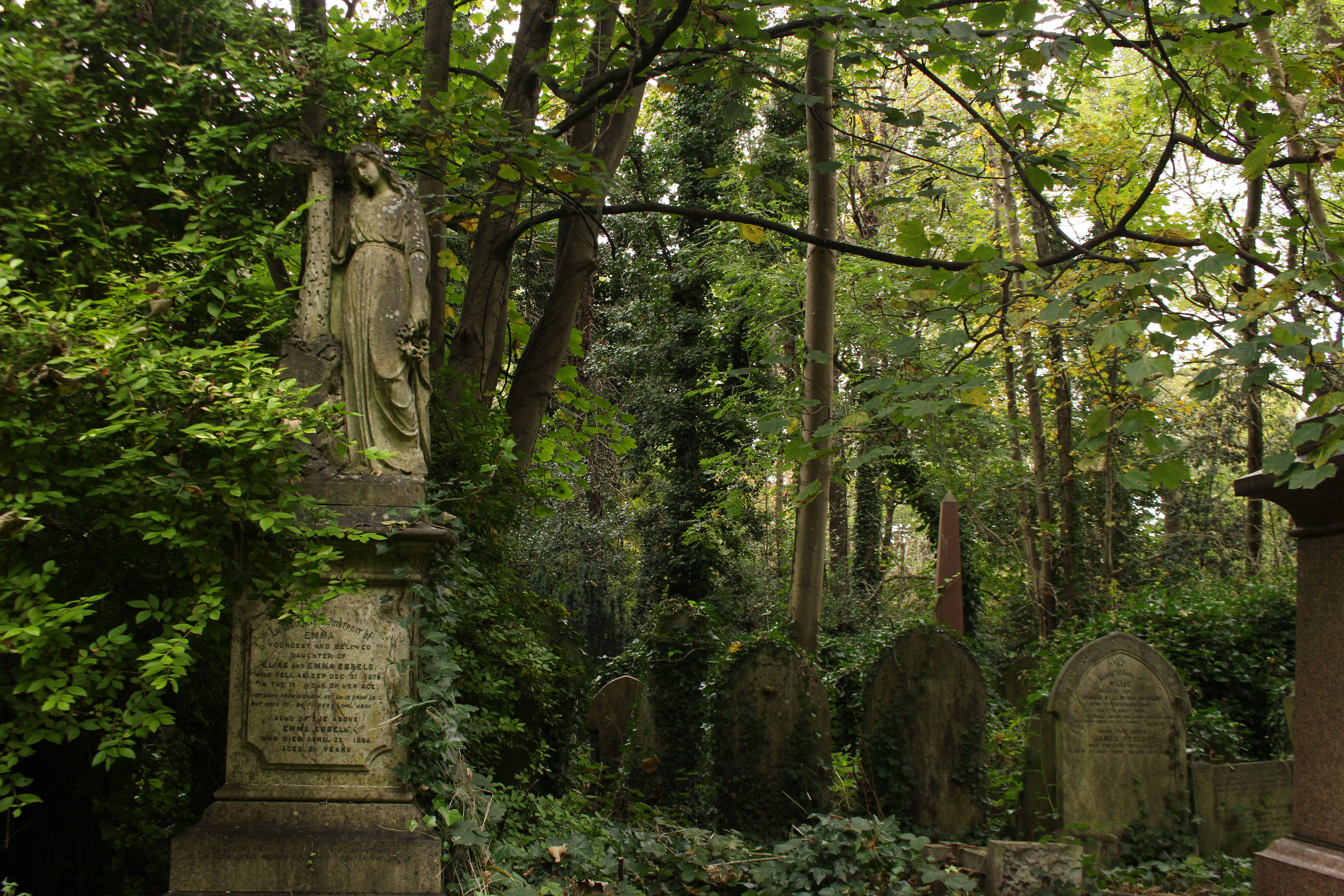
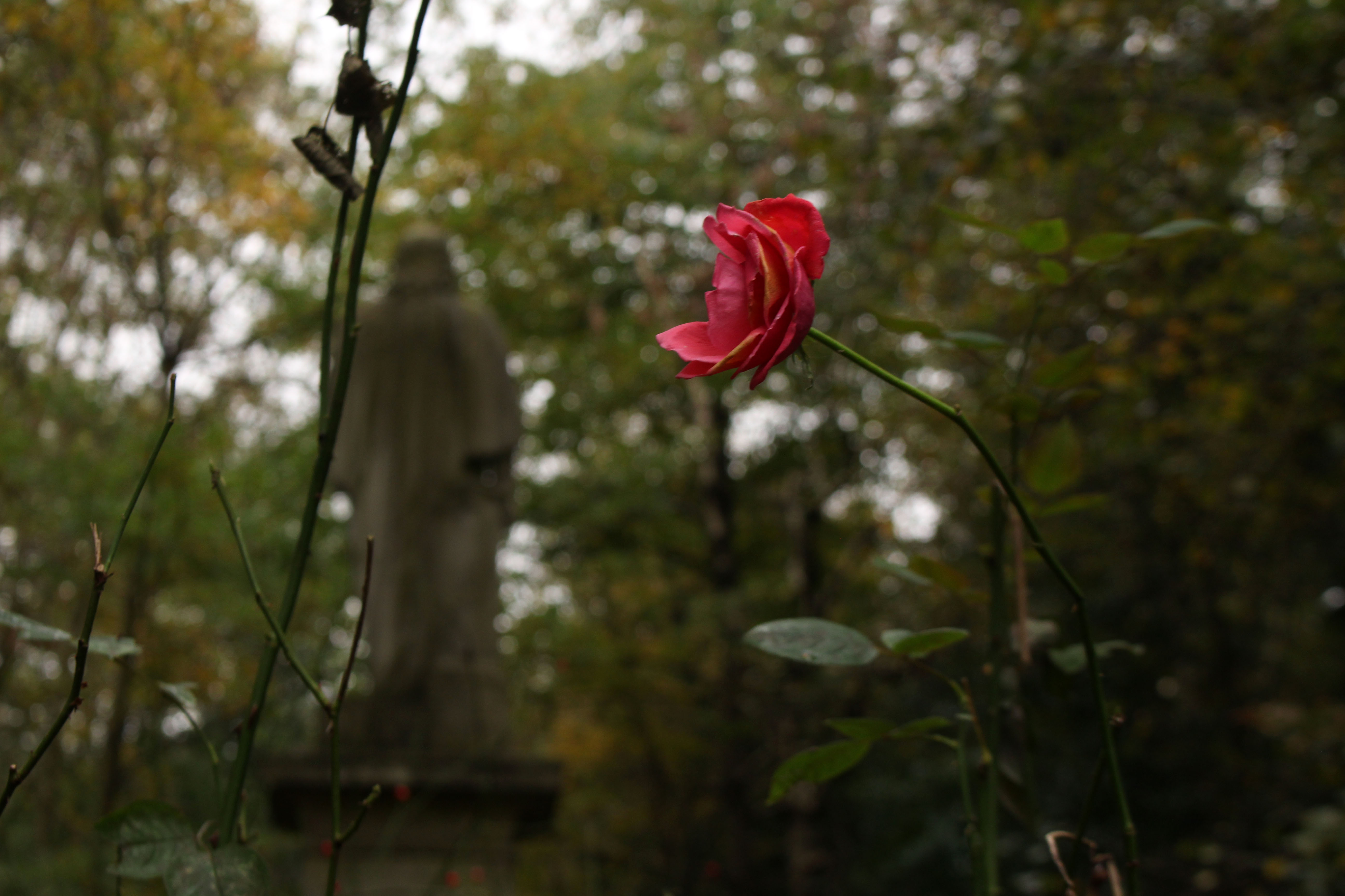
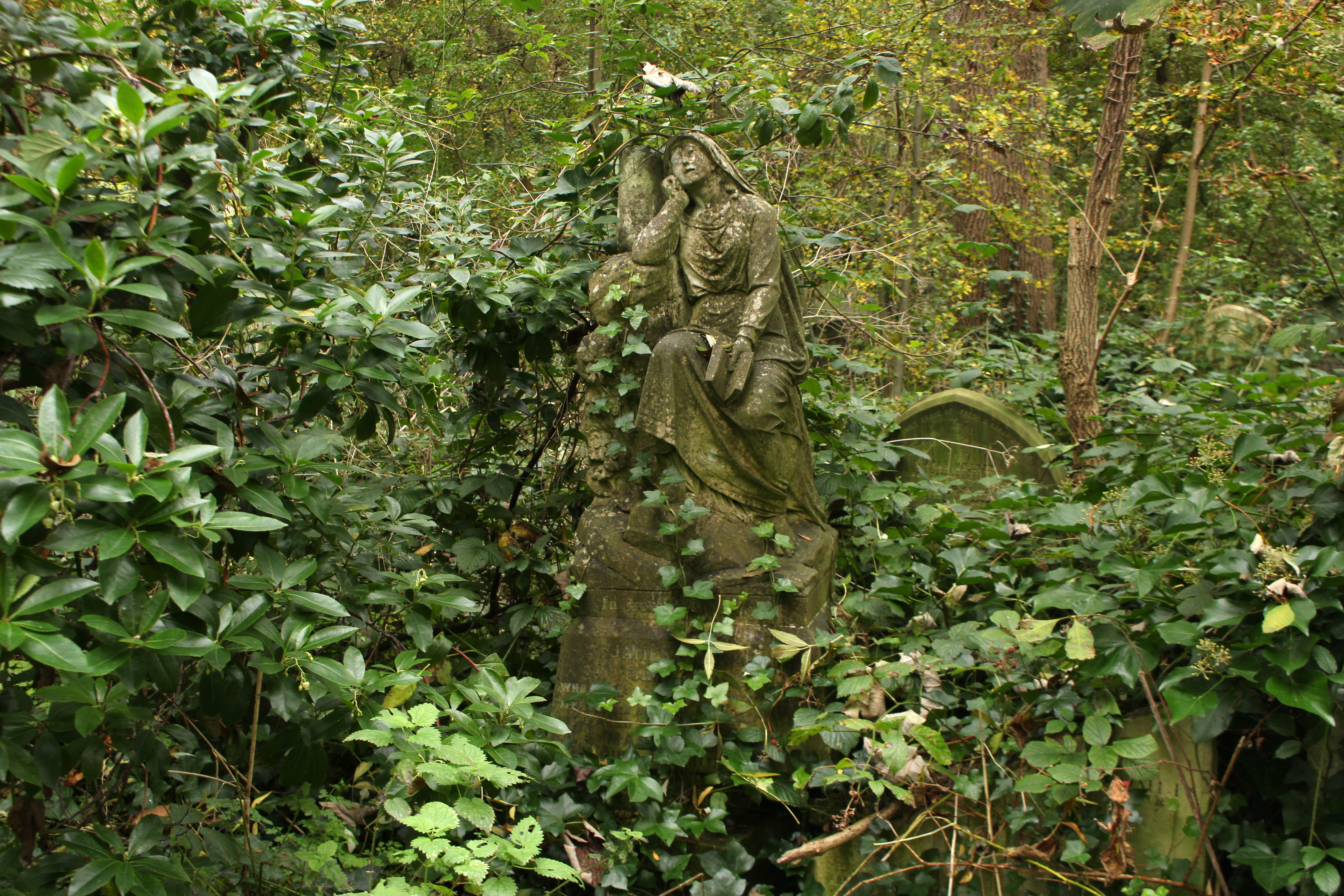
Firstly though, Abney Park cemetery beckons. The main Egyptian Gate on the high street is closed but there is a way round the side that funnels us between barriers into the non-conformist boneyard. The park, as much arboretum as cemetery, is quiet – dense foliage neutralising the din of traffic from the roads that surround it; just a few muffled barks from exercising dogs and the jungle shriek of an unseen parakeet. Quiet or not, the tree-lined paths are fairly busy with strollers and dog-walkers. We come across one woman who has no less than seven small lead-dragging dogs in her charge, including a one-eyed pooch that clearly bears a grudge against binocular humans.

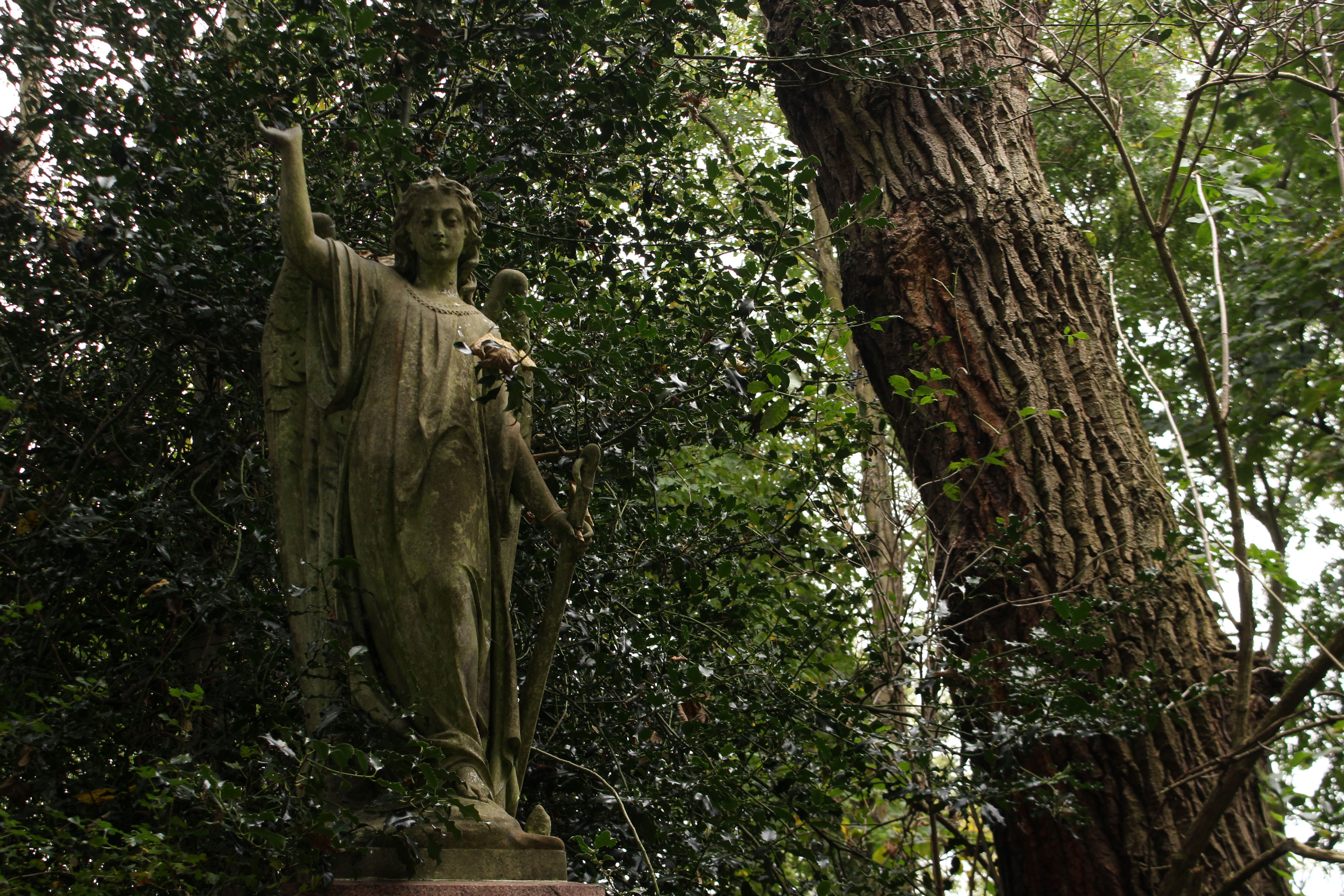
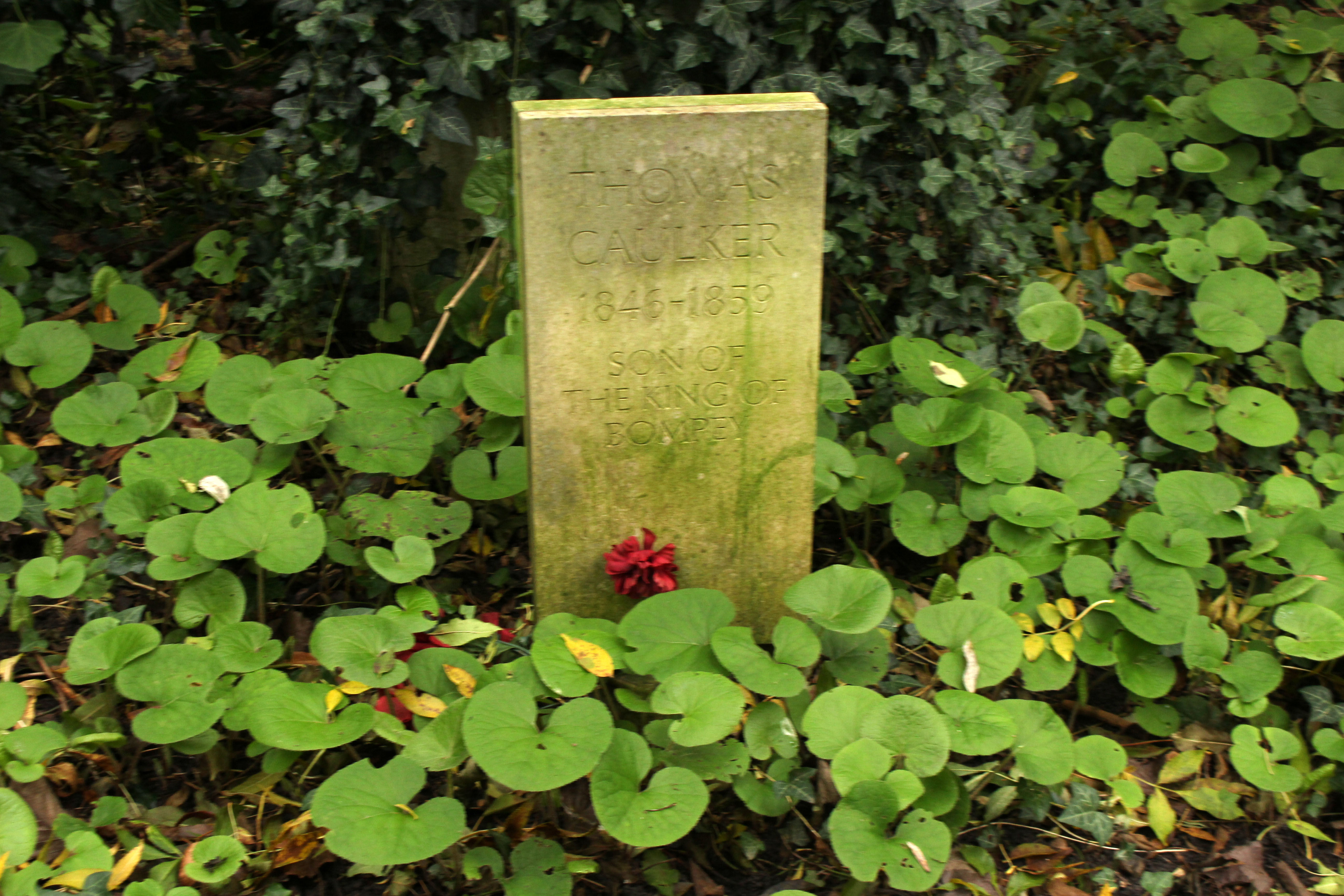
We have no purpose or aim other than just to wander and take it all in – the trees, the gravestones, the gothic atmosphere, the knowledge that this cemetery was the inspiration for the hidden fragment of Paradise that Arthur Machen wrote about in his short story N. We find no such paradise garden but instead plenty of interesting angel-perched tombs and several oddities – a wooden marker that asserts mysteriously ‘Elvis put his hand on my shoulder’ and the simple stone gravestone with the legend: ‘Thomas Caulker 1846—1859 Son of the King of Bompey’. Bompey, we later discover, was an early 19th century West African chiefdom that was eventually incorporated into Sierra Leone in 1888. The stone looks like a fairly modern replacement. What is curious is that the 160-year-old grave is still attended – a single flower has been recently placed upon it.

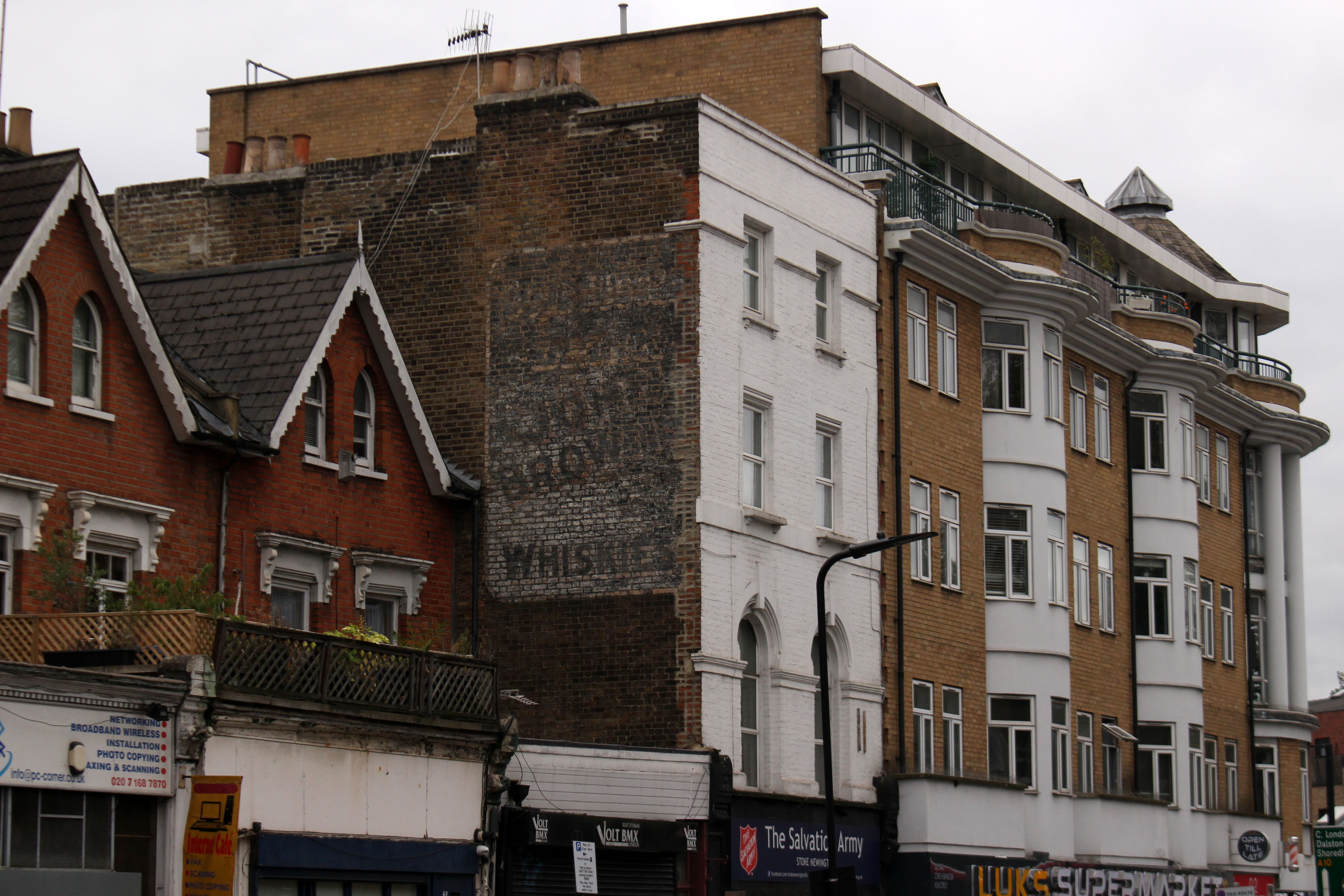
We exit the park to join the Ring; a sign right outside the cemetery confirms we are on the right path. My companion Nigel takes a photograph of me in front of the sign and as he does this a cheerful Black woman pushing an empty shopping trolley offers to take a snap of the two of us – she assumes we are tourists, and in many ways she is right. We head up Cazenove Road, where a fading ghost sign on a gable advertises a discontinued brand of whisky and an abandoned charity shop, as niche as you like, boasts a Bosnia & Herzegovina connection. It is all comfortingly multicultural – orthodox Jewish men in black hats and long coats rub shoulders with Muslims in white skullcaps and shalwar kameez. Looking at our map to check the route, one of the latter, a helpful elderly Pakistani, asks if we need directions and points us towards Springfield Park. There is no denying it – we really do look like tourists.

At the rise of the park the Lea Valley suddenly comes into view beyond – a proper valley, a river-carved ha-ha that slopes down to the water and sharply up again. A sign at a viewpoint helpfully informs us that we are standing on Hackney gravel, below that is London clay. Another parakeet screeches, this one perched in a tree, lurid green, channeling the tropics.

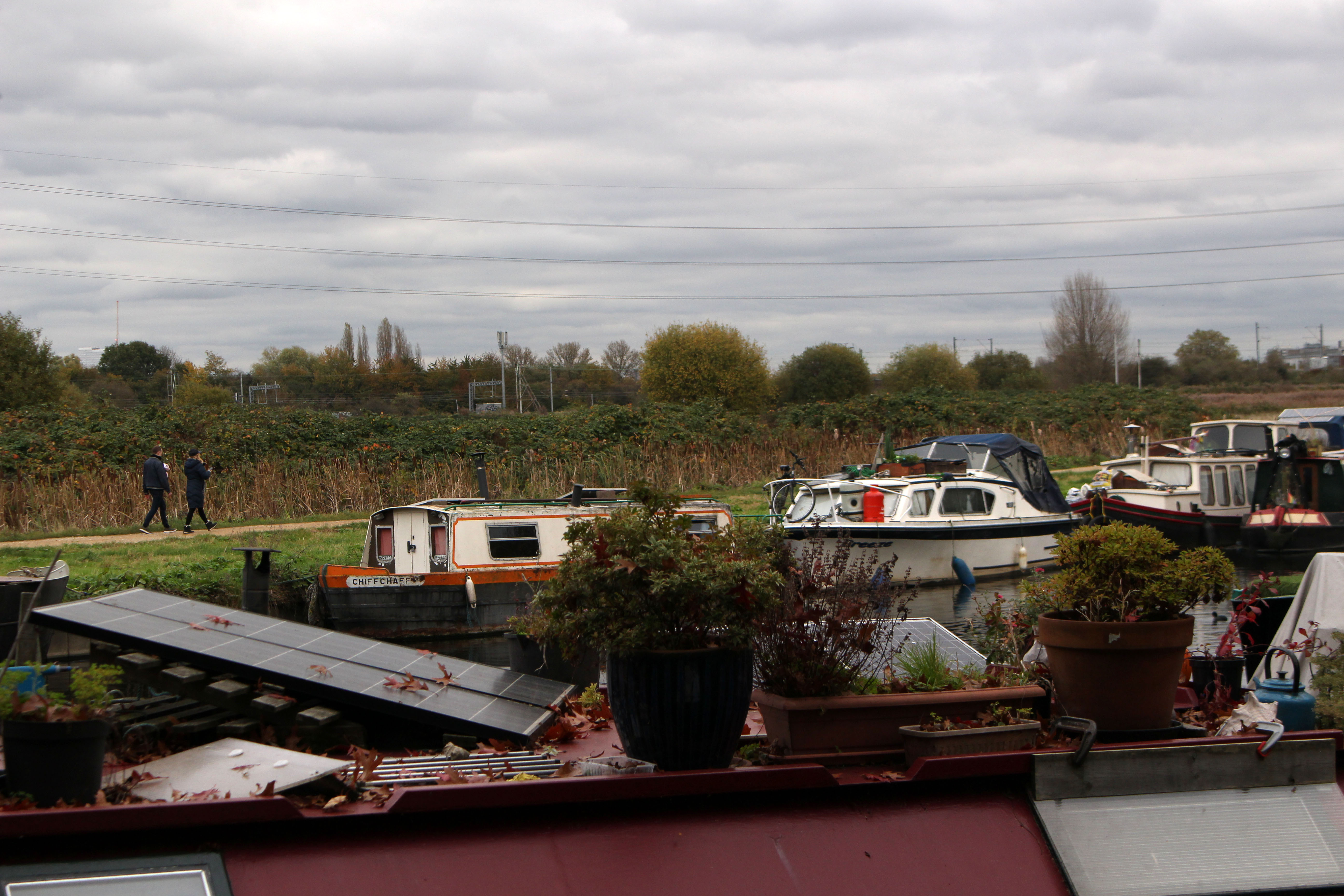
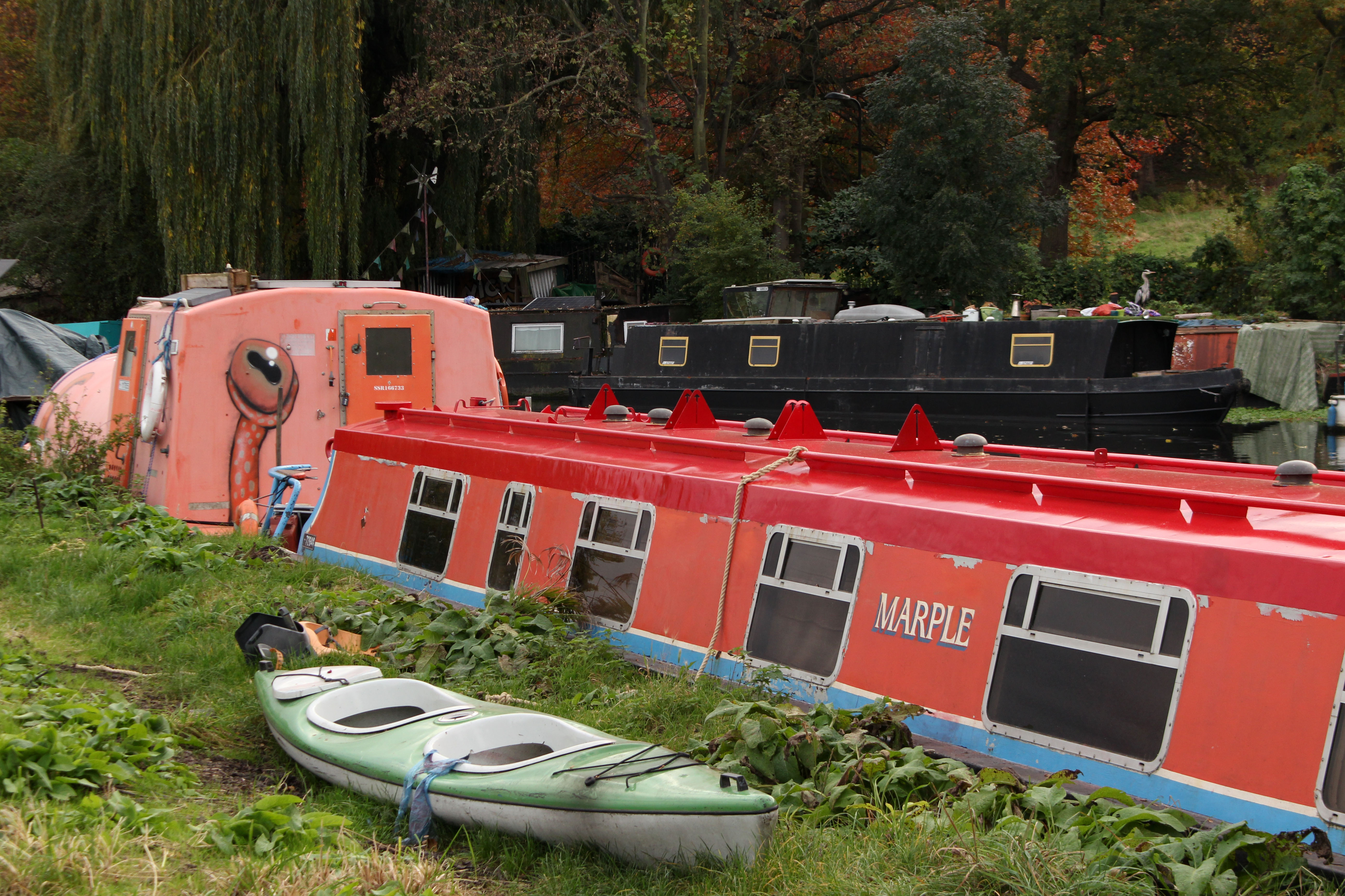
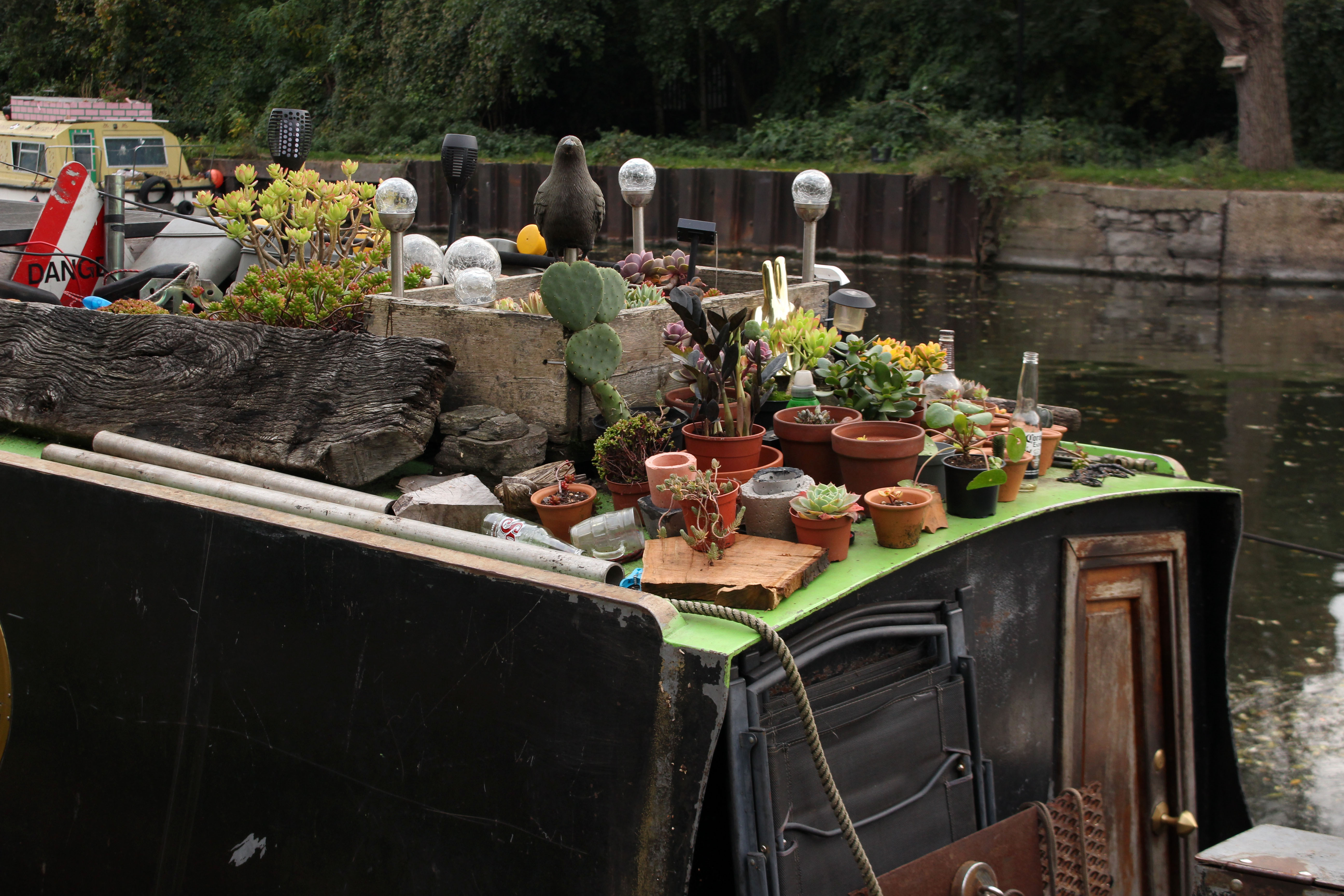
A more at home, native species – a heron – stands guard on a houseboat close to the footbridge at the bottom of the park. It sees us but looks unperturbed. We cross over the river to the east bank and start walking south. Walthamstow Marsh stretches away to the east, all reed, sedge and soggy pasture; rising above the marsh, beyond the railway, stands an island of modern development that may or may not be offices. There is an almost endless line of houseboats moored to both banks. Nothing too chi-chi – vaguely counter-cultural but mostly no-nonsense make do and mend: heaps of burner firewood, car batteries, plants in plots, well-used bicycles; a few seasoned boat dwellers going about daily chores, clenched roll-ups, dreadlocks piled high.

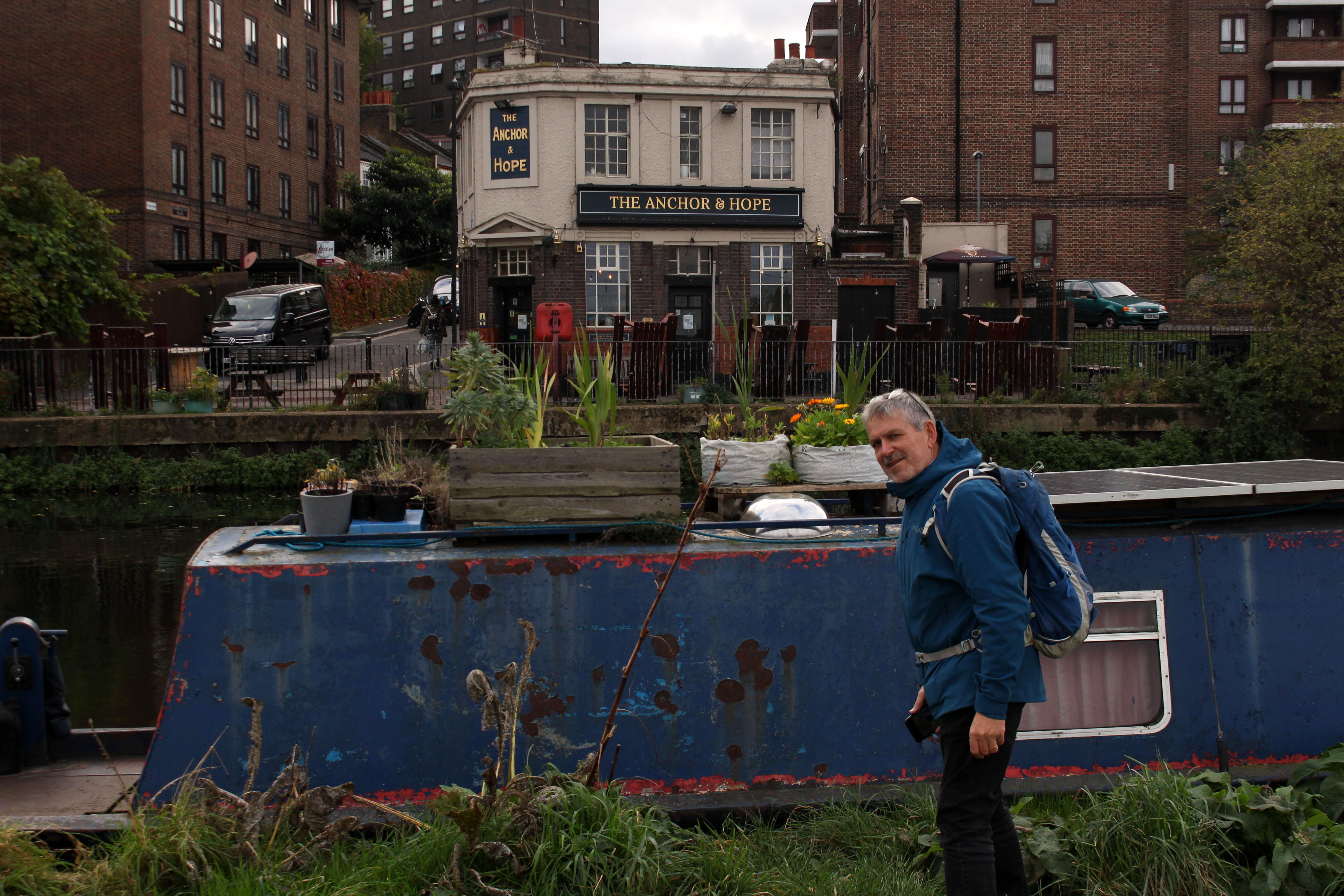
Across the water, a little further along, is a pub with outside trestle tables stacked for winter: The Anchor & Hope. Not the Hope & Anchor, the historic pub rock venue in Islington that we remember hearing tales of in our youth. Anchor & Hope – Anchor (or at least moor) and Hope your boat doesn’t sink? Anger and Hope maybe? There seems to be plenty of anger about but hope can be elusive; as they say, it is the hope that kills.

Approaching Clapham Junction Viaduct we hear the two-stroke put-put of a barge on the move. Another barge comes from the rear to slowly overtake and the two boatmen exchange chummy bargee greetings as they pass on the water. A sign under the viaduct arches indicates that this is the original location of A V Roe’s workshop where the first all-British powered flying craft, a precarious-looking tri-plane held together with wire and glue, was built in 1909. Inspired by the Wright Brothers’ achievement of just six years earlier, the aeronaut successfully managed a short wobbling flight across the adjacent marshes, a sight that must have given the local herons quite a start.

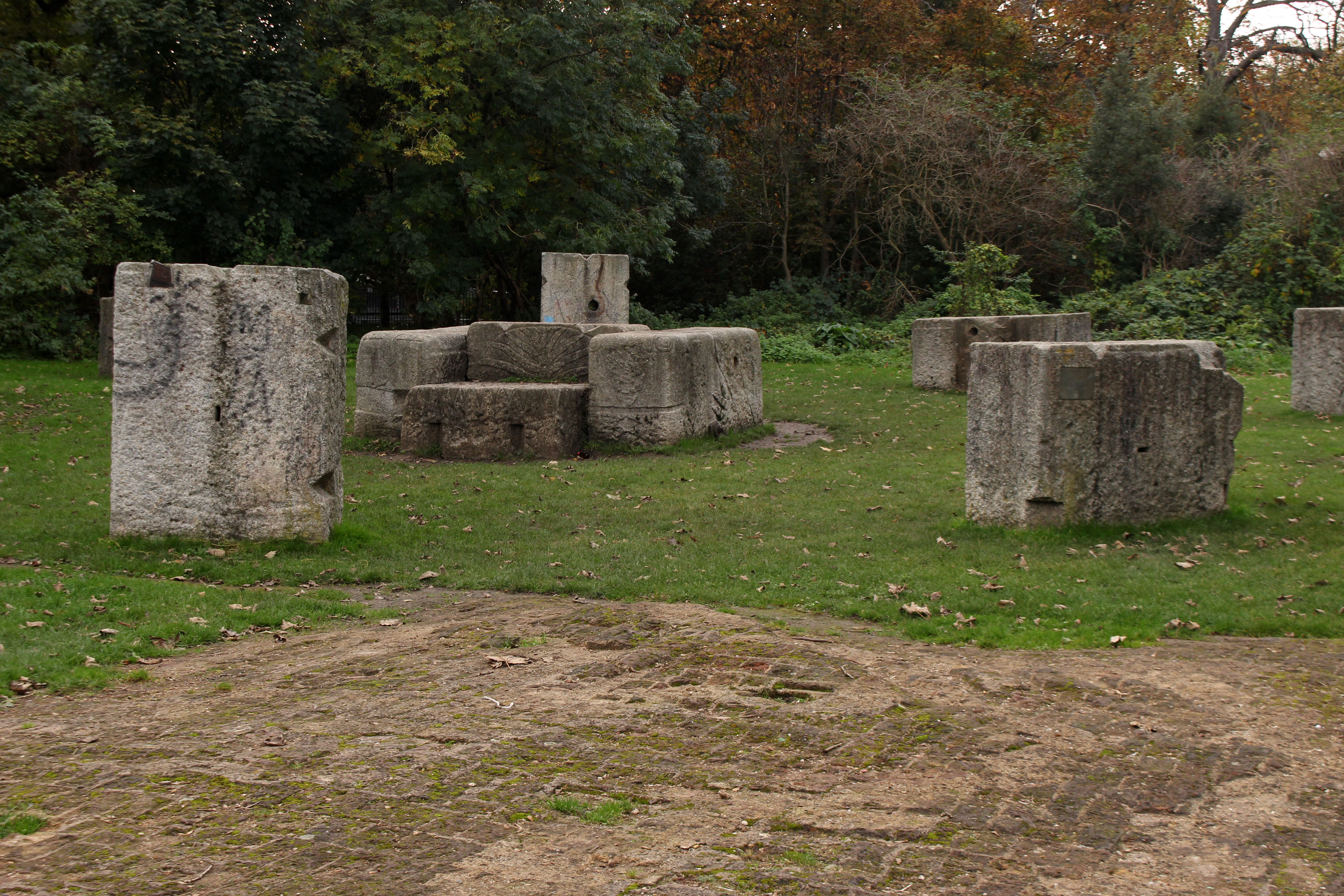
At Lea Valley Ice Centre the path diverts along the canalised Lea River Navigation, the wide green expanse of Hackney Marshes stretching invitingly to our left. We detour briefly to view the former site of the Middlesex Filter Beds, now a designated nature reserve, where we find the granite blocks that once held the pumping engine in place rearranged into what has become known as the ‘Ackney Enge’. A little further on we find the hope we had been looking for back at the waterside pub: a footbridge over the water has a draped banner that proclaims BELIEVE IN OUR COLLECTIVE IMAGINATION on one side, and on the other, DARE TO DREAM BEYOND CAPITALISM. Hope indeed.

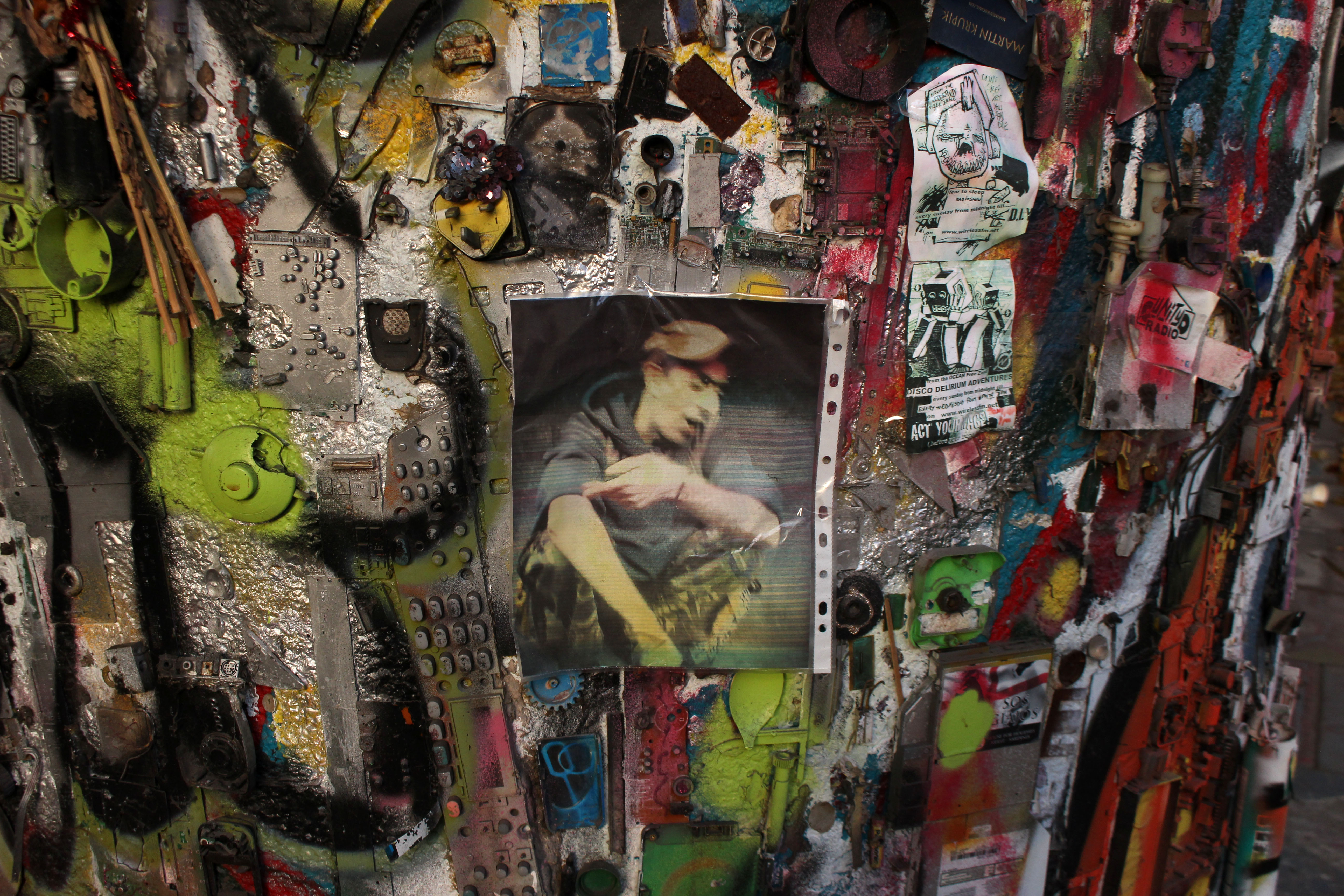
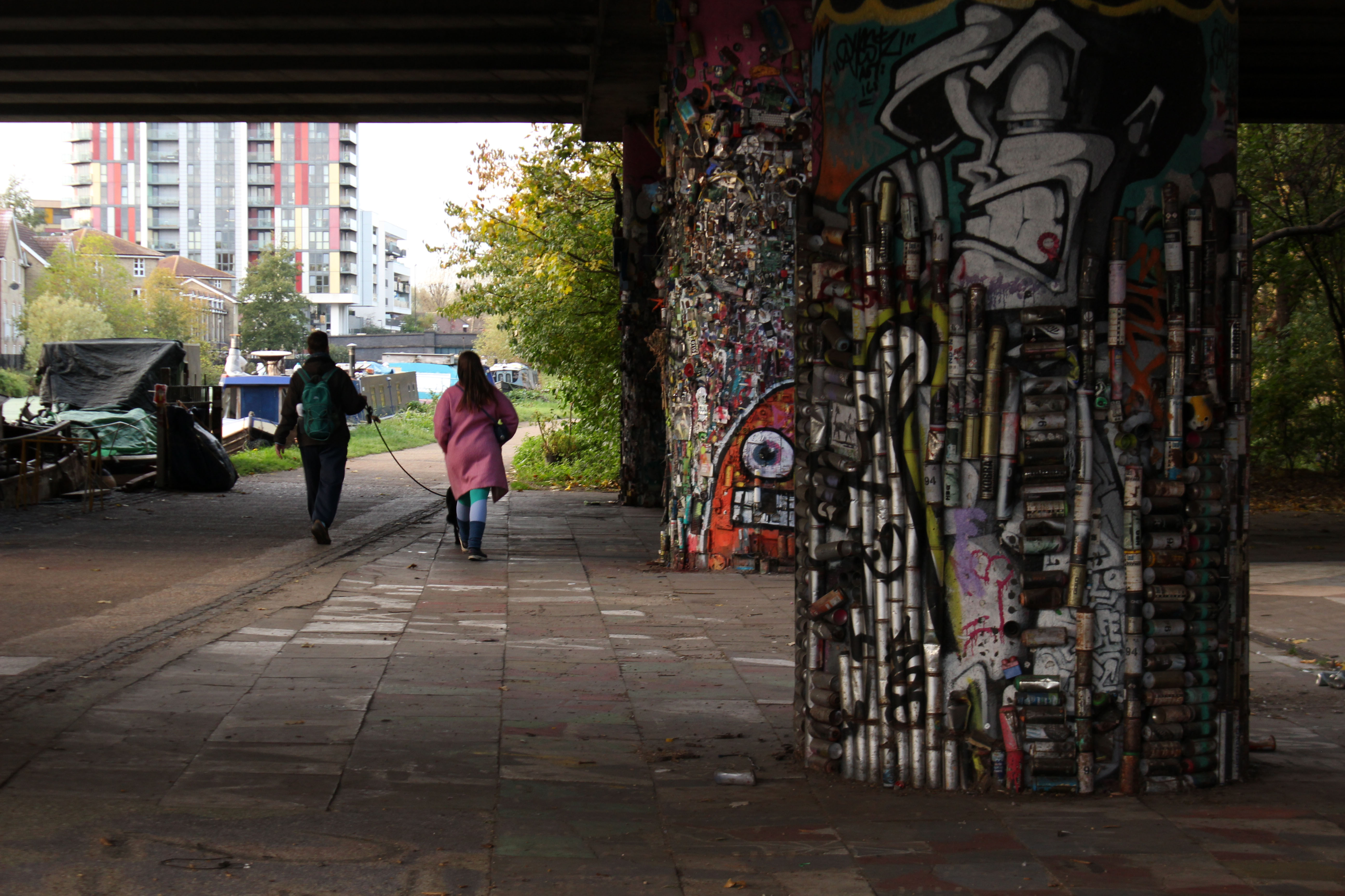
Shortly before reaching Hackney Wick we pass beneath a roadway where the supporting concrete arches have been comprehensively decorated with all manner of found objects – bottle tops, cans, bits of wire, keys, keyboards, electronic components, beer cans – all lovingly glued in place and spray-painted. As I stop to take a photograph, a man on a bike appears out of nowhere to inform me that the artist, a lovely fellow by all accounts, was a friend of his who had died quite recently. He pedals off back into the shadows as quickly as he arrived. Then I notice a portrait of the artist attached to the second of the pillars. The artist in question looks remarkably like the man I have just spoken to. Could this be a ghost artist obliged to return and show visitors around his urban art gallery, a revenant on a bicycle?

Our walk ends at Hackney Wick. We know we have arrived when we see West Ham’s London Stadium at Queen Elizabeth Olympic Park in the distance, the deranged helter-skelter of Anish Kapoor’s ArcelorMittal Orbit alongside it. Somewhat disoriented by the glare of the new development that engulfs us on all sides, we look for the bus stop we need for the service back to central London. I know that it is close to the Church of St Mary at Eton but its location proves to be elusive. My A to Z is well out of date, the streets marked on it have since been redacted; new ones with new names have taken their place. Nigel employs his smart phone to engage with a satellite to find the correct route and we beat a path past Hackney Wick Overground station and along streets parallel to the thrumming A12. Despite the nearby traffic frenzy, the area is relatively quiet and uncluttered by commerce, just a scattering of car body repair shops and the occasional cafe. A random sign offers sourdough pizza – you can almost hear self-respecting Neapolitans crying in anguish. But nothing is sacred and change is inevitable: the deeply layered lasagne that is East London has had its time-honoured béchamel topping scraped away and replaced with something considered to be more wholesome. As ever, the city is a palimpsest.

Westering

My book Westering is published this week by the award-winning independent publisher Saraband. Beginning in Great Yarmouth and meandering to Aberystwyth, the book describes a coast-to-coast journey on foot traversing the Fens, East Midlands, Birmingham, the Black Country and central Wales.

Here is a brief extract from the first chapter. It should be noted that the accompanying photographs shown here are NOT included in the book.

Extract from Chapter 1: Red Herrings

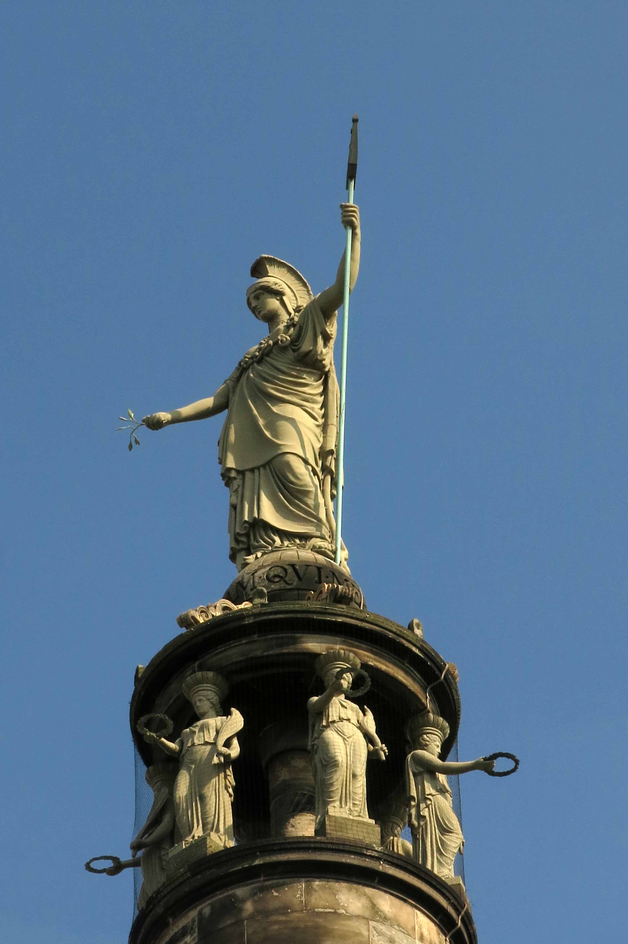
From our high viewpoint it was clear that Yarmouth developed on a sand spit, a narrow finger of land squeezed between the North Sea and the River Yare that points accusingly southwards in the direction of Lowestoft. Modern housing and light industry have long filled in the space between the river and the sea, and an industrial estate now surrounds the base of the column, but when the monument was first erected in the second decade of the 19th century, to commemorate Nelson’s maritime victories, it stood alone on a fishing beach, isolated from the town to the north.

Looking south, we could see the mouth of the River Yare at Gorleston. Just beyond were the Suffolk border and a cluster of holiday villages before the sprawl of Yarmouth’s historic rival, Lowestoft, Britain’s most easterly town. Further south still was the prim resort of Southwold, which, like its neighbours Dunwich and Walberswick, was once a mighty port before silting and coastal erosion took their toll. To the east lay the taut curve of the North Sea – a wave-flecked, grey-green expanse that diminished to a hazy vanishing point. A cluster of wind turbines, their blades almost immobile on this calm late-summer day, stood someway offshore at Scroby Sands. Across the water, far beyond the horizon, unseen even from our elevated viewpoint, were the polders and dykes of the Netherlands, a country that once had close economic ties with this easternmost part of England.

Some impulse had me imagining a time before the rising sea levels that followed the last glacial period, a time when a land bridge still connected Britain to Europe. Doggerland, as the territory has become known, now lies beneath the waves but it was a land of plenty just a few thousand years ago, roamed by mammoths, bison and small bands of Mesolithic hunters.

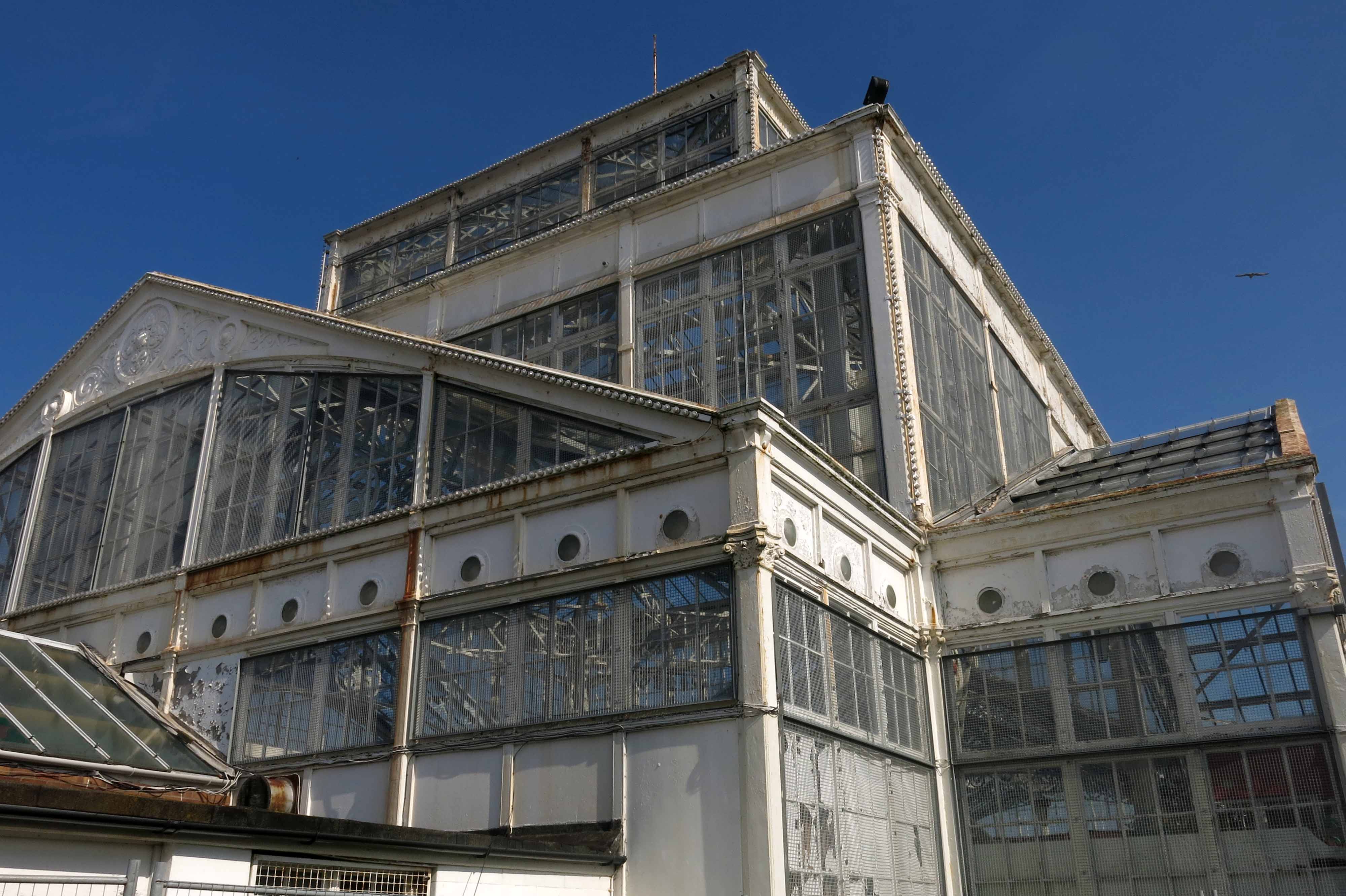
A little way beyond the entrance to Wellington Pier stands the intricate Victorian wrought-iron framework of the Winter Gardens, the last remaining building of its type in the country. Impressive but now empty and neglected, the structure resembles a giant multi-storey conservatory in need of a paint job: a potential future Eden Project in waiting (this is still one council member’s dream), if only the necessary funding could be raised. Although it looks perfectly at home here on the North Sea coast, the building was a blow-in from the southwest. Originally constructed in Torquay, it stood in that resort for twenty-four years before being carefully dismantled and barged around the coast in 1903 to take up residence here alongside Yarmouth’s then brand-new Wellington Pier.

Across the road from the Winter Gardens, the Windmill Theatre has a facsimile set of sails attached to its façade in impersonation of the Moulin Rouge in Paris, although it is doubtful if the floor show here was ever quite as racy as its French equivalent. Back in the 1950s, this building – which started life as The Gem, the country’s first electric picture house – hosted George Formby summer residencies. The Norfolk coast and the nearby Broads had become a second home for Formby in his twilight years when, rather than old-fashioned variety, public taste was starting to demand a more exciting, rock n’ roll flavour for its entertainment. But the entertainer and his ukulele always had a loyal following here on the Norfolk coast, where tastes were more down to earth. It did not take much imagination to turn the clock back to Yarmouth’s heyday and picture a grinning, Brylcreemed Formby strolling along this very same seafront in pullover and baggy flannels as he dreamed up double-entendres in the briny air.

Much of the Yarmouth that would have been familiar to Formby is still evident: the beach, the town’s ‘Golden Mile’ of amusement arcades, the miniature golf courses and pleasure gardens, the fast food outlets that gift the seafront a pungent cocktail of chip fat and fried onions (with notes of biodegraded phytoplankton from the beach and horse shit from the pony-drawn landaus). Such attributes are not as popular as they once were, but the town’s latter-day decline is the familiar story of many English seaside resorts in the late 20th century. The beach is still as pristine as ever, but a number of the town’s once-flourishing entertainment palaces now lie empty and abandoned. The Empire was one such place, a former theatre that lacked both audience and, until recently, a full complement of letters above its art nouveau doorway, its former terracotta cladding stripped and once-proud colonial name reduced by weathering and gravity to read ‘EMPI’. Although touted by some as an ideal venue for a future art gallery, it still stands empty and unloved.

A Welsh Chapel

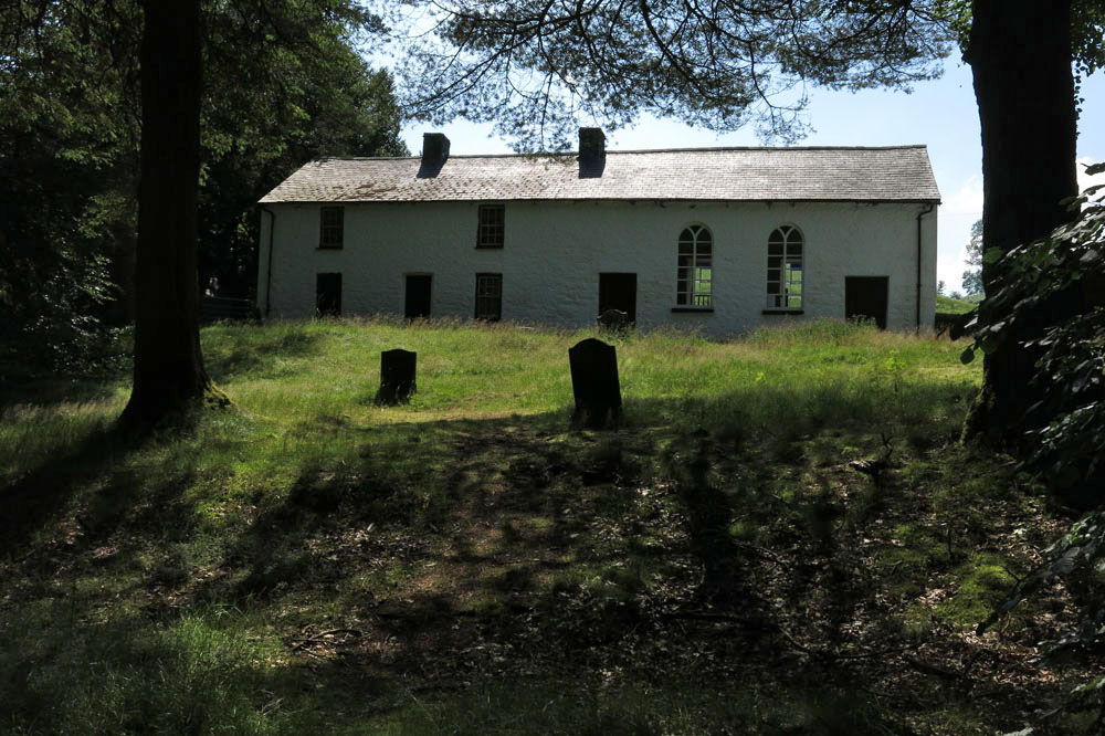
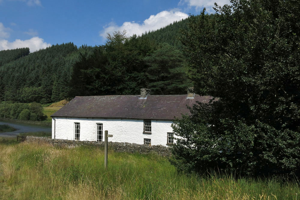
The isolated Calvinist Methodist chapel of Soar-y-mynydd is often claimed to be the remotest in all of Wales. Certainly, it lies in a very quiet spot: close to the eastern limit of Ceredigion, eight miles southeast of Tregaron within the parish of Llanddewi Brefi (of Little Britain fame)

Built in 1822 to serve a widely scattered congregation of farmers and sheep drovers, it would have originally stood close to the road to Llandovery that followed the Cammdwr valley south. Like many other central Welsh valleys, this was flooded in the 1970s to provide a reservoir that now extends close to where the chapel stands.

Despite its relative isolation the chapel has seen illustrious visitors over the years. Many poets and artists have been inspired by its whitewashed simplicity and even former US President Jimmy Carter was impressed when he visited on a fishing holiday in 1986. (A painting of the chapel by Ceredigion artist Wynne Melville Jones was subsequently presented to the former president in appreciation of his visit.)

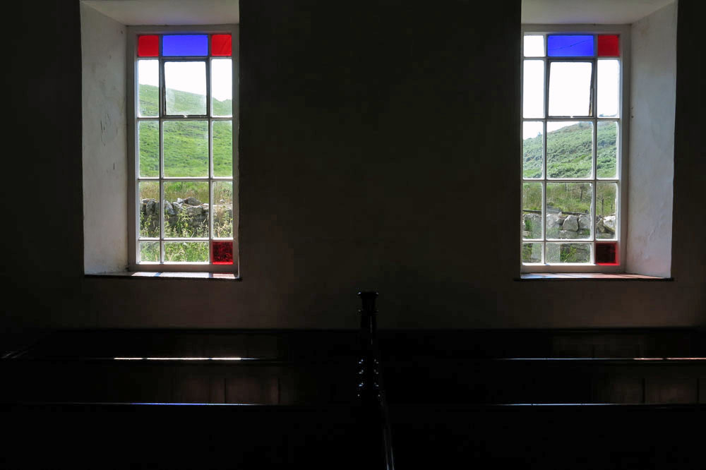
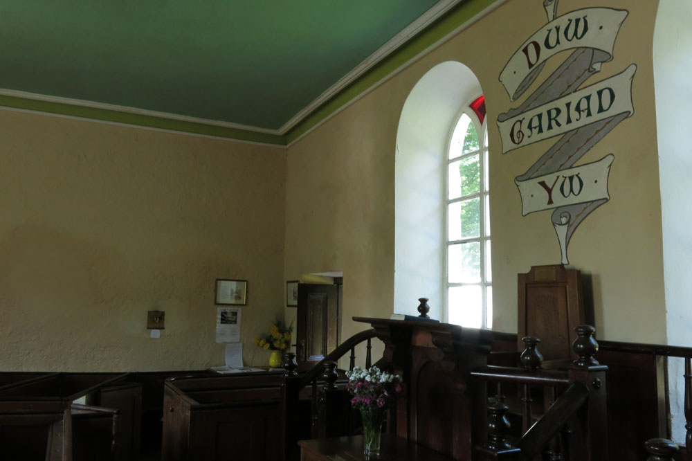
The chapel interior is simple, not exactly austere but unfussy: tightly packed wooden benches dappled with red and blue light from the Mondrian-esque stained glass; plain walls that seem to resonate with earnest drovers’ prayers and ancient Welsh voices. On one of the walls a painted scroll bears the simplest of messages: Duw cariad yw (‘God is love’).

Â