 The small city of Kruševac in south-central Serbia is probably best known for its fortress and 14th-century church, a fine example of the highly decorative Morava school. This was Prince Lazar’s capital in the late 14th century and it was from here that the Serbian army under the command of Prince Lazar set off to fight the ill-fated Battle of Kosovo in 1389. The Turks won yet it still took another 60 or so years for the city to fall under Ottoman control. Later on Kruševac became known as the ‘city of the sock-wearers (čarapani)’ because of an incident during the First National Uprising when Serbian rebels removed their boots to slip silently into town at night unheeded by the Turkish guards. Today Kruševac is an easy-going sort of place that, church aside, serves as a textbook case of Tito-era urban planning with its extensive use of concrete and scattered high-rises that loom like grey termite mounds over the city centre.
 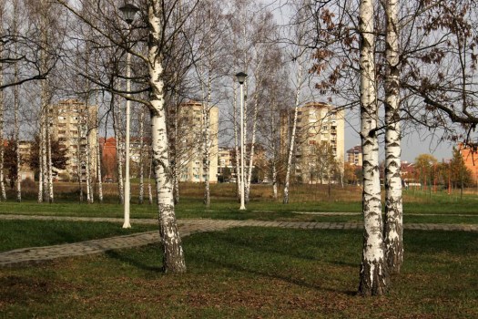 This was my third visit in a decade and on this occasion I was prompted to seek out something that I had hitherto not even been aware of. A short distance out of town to the south lies a monument park dedicated to the victims of Nazi shootings during World War II. This was close to a former German prison camp and the scene of mass shootings between 1941—4, most especially in the summer of 1943 when over a thousand Serbs partisans and civilians were executed mostly by Bulgarian and Albanian troops. The Slobodište Memorial Complex, designed in the early 1960’s by architect, politician, one-time Belgrade mayor and anti-nationalist critic of Slobodan Milošević, Bogdan Bogdanović (1922—2010), occupies the same low hill just outside the city where the killings took place. The monuments of the complex serve as focus for a location already tainted with dark memory and collective suffering.
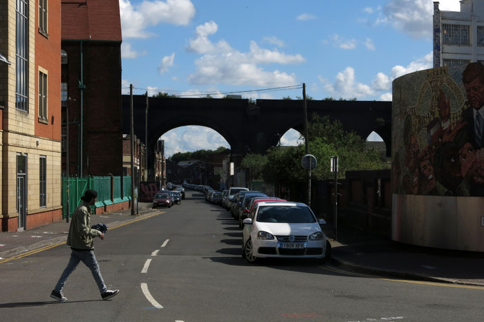
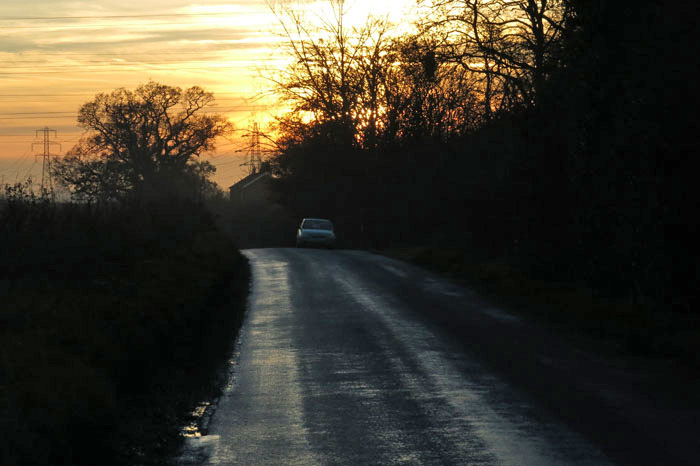
 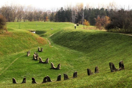 The monument park is reached on foot by way of a route through Kruševac’s outskirts. The city edgeland arrives suddenly: a roundabout, a small airfield marked by a jet fighter on a plinth, an out-of-town retail hangar with supersized advertising depicting super-fit sportsmen. As elsewhere in Serbia, the edgeland is the realm of Roma – the poorest of the poor in this none-too-wealthy country – who, as always, are involved in the recycling business. Perpetually sorting through waste – paper, metal, plastic – skilfully assessing its value, their make-do shanty shelters seem barely separated from the middens of 21st-century detritus that they live among.
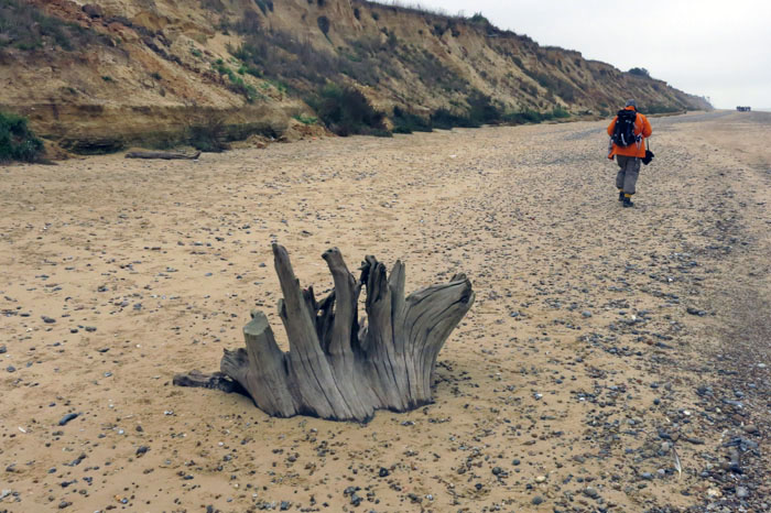
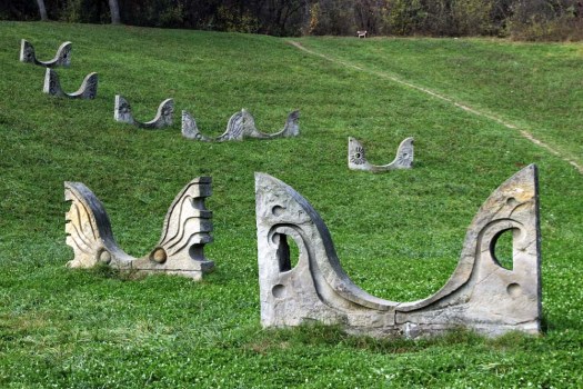
In an instinctive trade-off of safety for freedom, a few of the free-ranging Roma chickens stray across the pavement onto the perilous dual-carriage highway that leads out of town. I follow the pavement alongside the highway for a while before veering off right when a footpath into the trees suggests that the memorial park lies just beyond.  At first there is nothing to see other than landscaped grassy mounds in the distance. Walking through a birch plantation I am entertained by the head-cracking antics of a Syrian woodpecker that hammers away remorselessly at a tree stump. Crows in all their variety – rooks, jackdaws, magpies and jays – call harshly, their voices like creaking tree trunks in a gale. I make for the grassy mound ahead and from the top can see a curved chain of stone sculptures stretched up the hollow of a hillside. The monuments resemble birds – owls to be precise – buried up to their beaks in the earth, but rising from rather than sinking down into it. They might also be angels. As I walk closer to investigate I notice a man with a bicycle at the top of the rise who is waving and beckoning to me. We manage some sort of rudimentary conversation using an inelegant polyglot mixture of German, Serbian and what might be Russian, and I learn that he lives locally in one of the housing estates that fringe the park and uses its pathways as a shortcut to the shops.
  Conversation, and commonality of language, exhausted the man cycles off and I turn round to trace the pathway back to its beginning. What is actually supposed to be the entrance to the memorial complex – the ‘Gate of the Sun’ – serves as my exit: an incomplete arch reminiscent of an Andy Goldsworthy dry-stone creation. Flanking the entrance just beyond this are two pyramidal mounds like Neolithic cairns. In front of each is a low stone funerary slab upon which rest wreaths and polythene-wrapped flowers. Whether or not these are actual burial mounds or merely a symbolical representation does not really seem to matter – this whole site is a memory field of death and the act of remembrance is the important thing. And remembered it is: memory is honoured; this site still holds melancholic charge for townsfolk and visitors alike despite its mundane use as a place for cycling, exercising and walking dogs.
I think about leaving and then am distracted once more by the same woodpecker that has taken a liking to a nearby tree and pounds away tenaciously with its beak despite the seeming reluctance of the bark to yield to the hammering. I put my ear to the trunk and think this is what the grubs within must hear whenever their woody sanctuary is threatened by a predator; the tree, like the memorial park itself, is a microcosm of both life and death. 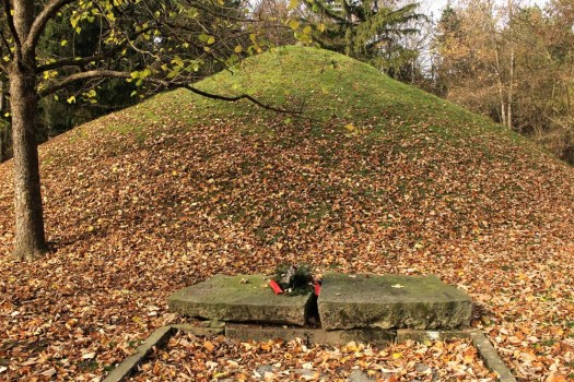 There is one more monument to see: the cenotaph. I find a curious, vaguely zoomorphic statue that brings to mind a Mayan glyph, or a totem – or perhaps another owl. It stands alone and inscrutable in front of some administrative offices that have been landscaped into the naturalistic contours of the park. Within one of the offices I spot a man working on a computer. I cannot decide whether I am envious of his workplace or not. No doubt it is peaceful enough tucked away in the folds of this green domain but the heft of dark memory weighs heavy here – a place to visit certainly but not one in which to repose.
For an excellent account of memorial parks and spomeniks (memorial monuments) throughout the countries of the former Yugoslavia take a look at this post on The Bohemia Blog.
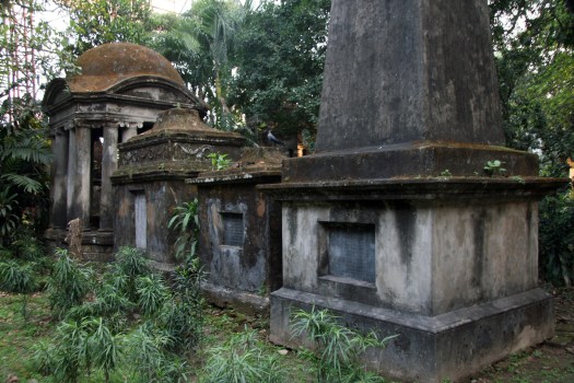
 One way of looking at this evocative, if mildly disturbing, place is as a hidden enclave populated with the ghosts of colonialism. Situated right in the middle of Kolkata, tucked away purdah-like from the mayhem of the city streets, the Park Street Cemetery seems like another world. It really is another world: one in which time has coalesced to leave a thick patina on the colonnades and obelisks that commemorate the colonists who created this tropical city in their own image. The colonials mostly died young – easy victims of the disease-ridden, febrile climate that characterised this distant outpost of the East India Company. In true Victorian manner, those who were unfortunate enough to die young and never be able to return to their temperate homeland were interred here in magnificent mausoleums among lush, very un-British vegetation – a tropical Highgate transposed a quarter-way round the world. The cemetery is reputed to be the largest Old World 19th-century Christian graveyard outside Europe. It is also one of the earliest non-church cemeteries, dating from the 1767 and built like much of Kolkata/Calcutta on low, marshy ground. The overall effect is one of Victorian Gothic, although there are also some notable flourishes of Indo-Saracenic vernacular that reflect the influence of Hindu temple architecture.
  Arriving at the gatehouse my name is recorded in a ledger by a lugubrious guard, an action that in itself carries the hint of entering some sort of forbidden zone, a place where the living are only tolerated and should not outstay their welcome. The cemetery seems largely deserted of visitors, although I do inadvertently stumble across a spot of surreptitious man-on-man action taking place in the deep shade of one of the tombs. Despite the funerary setting, there is nothing occult at work here, and I conclude that the young men are simply taking advantage of the privacy offered by the cemetery in this most crowded of all India’s overflowing mega cities. There are signs prohibiting ‘committing nuisance’ attached to some of the trees and I wonder if this is a warning against this sort of clandestine liaison, although in India the expression is usually a euphemism for public urination.
 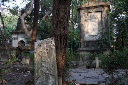 There are, of course, those who take full advantage of the cemetery’s concentrated occult power – fakirs who use it for training apprentices by making them spend the night here alone, an experience that could never be a comfortable one however much one was inured to the idea of djinns being hyperactive after dark. Even for hard-nosed rationalists, the sense of the numinous here is quite tangible, and the cemetery is without doubt a thoroughly spooky place. This is true even in broad daylight when the taxi horns and traffic thrum from the manic thoroughfare of Mother Teresa Sarani (formerly Park Street; before that, Burial Ground Road) cuts through the trees to provide a background drone for the tuneless squawks of the urban crows and parakeets that loiter here.
 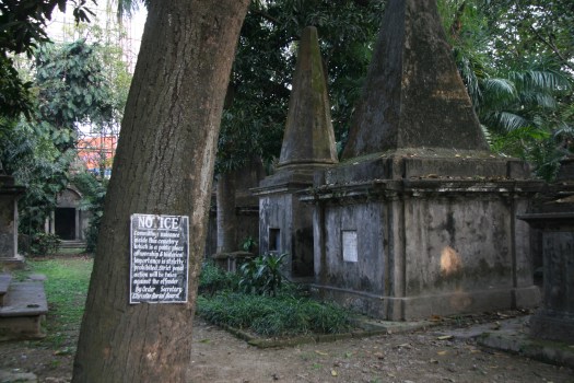 Not requiring of any such thaumaturgic rite of passage, a short afternoon visit suits me just fine. I am left alone with just the crows for company – dark portentous forms that swirl and scatter in the trees above, occasionally coming down to perch scurrilously on the sarcophagi as if they were extras from an Edgar Allen Poe film adaptation. Indeed, this would be the perfect location for a Gothic horror film, especially one that required a steamy colonial setting. Park Street Cemetery is the sort of place where dead souls rising from the ground can seem a distinct possibility – an eerie realm where the hubris of the Raj confronted its own vulnerability and the sad ghosts of empire still linger.