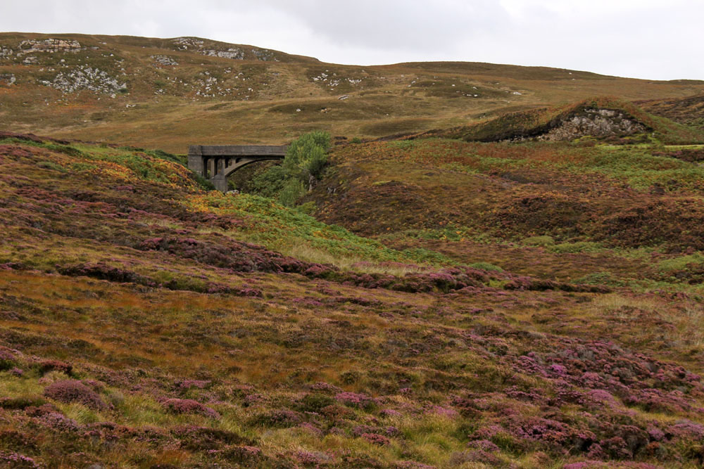
An island. A loch. An island — South Uist — that forms a link in an archipelago that lies off a much larger island, which in turn lies to the northwest of the world’s largest continental landmass. If the world has an edge, a legendary place for ships to plummet off the rim, then this is as good a contender as any.
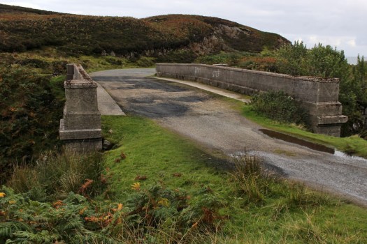
A loch that shares its name with an insect but there the comparison stops: Loch Bee (in Gaelic, Loch Bì). The shallow loch extends across the northern reaches of South Uist, joined to the sea on both coasts by a floodgate at a narrow inlet. A causeway traverses the loch, north to south. There’s a road sign here that says, Caution: Otters Crossing — photographic click-bait for any visitor in thrall to the sheer otherness of these islands. There are no otters today, nor on any other occasion that we motor across the water in the direction of Benbecula, but their existence seems tangible enough.

Venture a little further south beyond the loch and you soon reach a tall imposing statue on a hillside, a modernist rendition of Madonna and child, a reminder that this is around the point where the Wee-Free north of the archipelago morphs into the Catholic south. Not that it matters that much, it would seem that the people who inhabit this landscape share a mutual islander mentality that rises above any petty sectarianism.
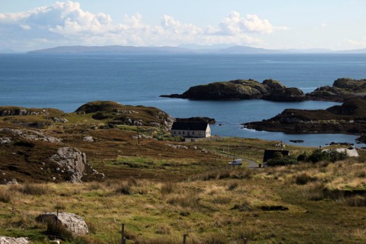
Our rented house lies just beyond the causeway, its lounge window gazing east towards the water of Loch Bee, the far-distant Cuillin Hills of Skye across The Minch providing an impressive backdrop, a jagged wall of limestone in a world of water, peat and gneiss. The loch’s brackish water changes colour with the light and the play of clouds. In late April the heather is black and withered, still reeling from winter, the moorland devoid of flowers other than tiny violets. For the few days of our stay it is bright and sunny, not a cloud in the sky. The brilliant sunshine, although welcome, seems like an interloper so far north and so early in the season.
The sunshine and translucent sky engenders a clarity of air that reverses the wing-mirror axiom that objects may be closer than they appear. Even the Cuillin Hills, which given the curvature of the Earth, must be teetering on the brink of the horizon, look reachable in a stiff day’s walk were in not for the inconvenience of The Minch. The weather eventually turns of course, giving way to showers and scudding clouds; then uniform dreich, a grey eiderdown of cloud hauled over the land to render it almost monotone. As each day passes, the wind grows a little stronger, un-sensed behind the double-glazing until sight is caught of the wind turbine blades spinning like dervishes. Whipped up by the strengthening southwesterly, the surface of the loch transforms from glass to whisked meringue, its colour darkening azure to peat black.

The loch is home to a large population of mute swans that float regally around on the far shore, occasionally taking to creak-winged flight in search of better pickings. Greylag geese honk by in small squadrons, while lapwings and oystercatchers pipe wistfully above the heather of the loch shore. A small group of red-breasted mergansers in the middle of the water, their handsome plumage reduced to piebald by distance, take turns to dive down in search of trout. Almost overlooked close to the shore, a solitary raven appears reluctant to stray far from a group of plastic-bound hay bales next to a gate. The mystery of this is revealed with a stroll down to the water, where the corpse of a young deer is found lying behind the bales, its ribcage already exposed to the elements in a slow exposition of sky burial — a mortal slur on the tranquility of the scene, perhaps a necessary one. There are other predators at large. As dusk descends, a glimpsed crepuscular flurrying may or may not be a short-eared owl in search of voles — this is indeed their territory, as it is for hen harriers, which we do see several times elsewhere on the islands although not here.
Early evening is also the time when the red deer usually make an appearance, arriving in view by nonchalantly leaping over fences that pose not the slightest barrier to them. A small herd of females and a lone stag nervously stray between the house and the loch shore, ever vigilant, their heads bobbing erect and watchful between mouthfuls. Our human smell is masked by brick and glass but can they see us, recognise our human outlines, curious figures with protruding metal and glass eyes that gawp at them from behind the window pane?

 Just three main roads radiate out of Stornoway, the capital of the Isle of Lewis. One heads across mountains towards Tarbet and Harris to the south; another goes east past the island’s airport and along the Eye Peninsula to come to halt at the lighthouse at Tiumpan Head, while a third leads across the island’s moorland interior to reach its west coast. A little way along this last road is the turn-off to Tolsta, a minor road with the most unexpected of endings. The road passes bungalow settlements and sea-facing graveyards as it leads north. In Hebridean terms, this is relatively densely populated terrain — one settlement merging into the next in a loose sprawl known collectively as Back. This stretch of Stornoway’s hinterland might elsewhere be termed green belt were it not a fact that pretty well anywhere on Lewis and Harris could be described as ‘green’.
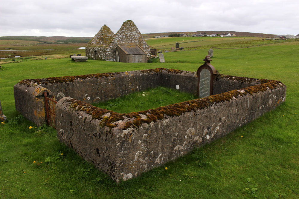


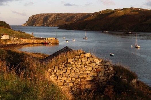 Eleven miles east of the main road, six from the nearest shop (closed on the Sabbath), two miles from the open sea as the raven flies. Glen Gravir – a slender thread of houses stretching up a glen, just four more unoccupied dwellings beyond ours before the road abruptly terminates at a fence, nothing but rough wet grazing, soggy peat and unseen lochans beyond. This was our home for the week, a holiday rental in the Park (South Lochs) district of the Isle of Lewis in the Outer Hebrides.
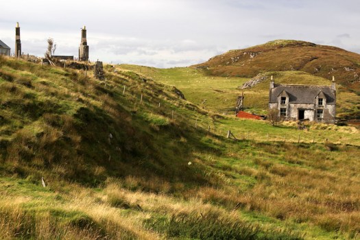
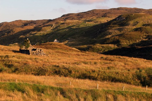 Gravir, of which Glen Gravir is but an outpost, is large enough to feature on the map, albeit in its Gaelic form, Grabhair. The village – more a loose straggle of houses and plots – possesses a school, a fire station and a church but no shop. A road from the junction with Glenside next to the church winds its way unhurriedly downhill to the sea inlet of Loch Odhairn where there is a small jetty for boats. Some of the houses are clearly empty; others occupied by crofters and incomers, their occupants largely unseen. Others are long ruined, tenanted only by raven and opportunist rowan trees, with roofs absent and little more than chimney stacks and gable walls surviving. It is only a matter of time before the stones that have been laid to construct the walls will be indistinguishable from the native gneiss that underlies the island, surfacing above the bog here and there in outcrops like human-raised cairns. Lewisian gneiss is the oldest rock in Britain. Three billion years old, two-thirds the age of our planet, it is as hard as…well, gneiss. It is the same tough unyielding rock that five thousand years ago was painstakingly worked and positioned at the Callanish stone circle close to Lewis’s western shore; the same rock used to build the island’s churches, which occupy the same sacred sites, the same fixed points of genii loci that had been identified long before Presbyterianism or any another monotheistic faith arrived in these isolated north-western isles.
 Ancient hard rock (as in metamorphic) may underlie Lewis, but religion is another bedrock of the island. Despite a respectable number of dwellings the only people we ever really see in the village are those who come in number on Sunday. The Hebridean Wee Free tradition guarantees a full car park on the Sabbath when smartly and soberly dressed folk from the wider locality congregate at Grabhair’s church, which, grave, grey and impressively large, is the only place of worship in this eastern part of the South Lochs district.
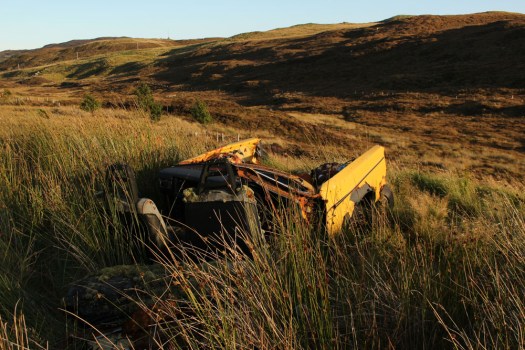
 At the bottom of the lane beneath the hillside graveyard next to the church are a couple of recycling containers for villagers to deposit their empties and waste paper. Larger items of material consumption are left to their own devices. Rain, wind and thin acidic soil are the natural agents of decay here. Beside the roadside further up from our house lie four long-abandoned vehicles in various stages of decomposition. Engines are laid bare; bodywork and chassis, buckled and distressed, rust-coated in mimicry of the colour of lichen and autumn-faded heather. Cushions of moss have colonised the seating fabric. The rubber tyres remain surprisingly intact, the longest survivor of abandonment. Sharp-edged sedges have grown around the rotting car-carcasses as if to hide them from prying eyes, preserving some modicum of dignity as the wrecks decay into the roadside bog, all glamour expunged from a lifetime spent negotiating the island’s narrow single track roads. On Lewis, vehicles die of natural causes, not geriatric intervention.
 Our cottage was rented as an island base: a place to eat, rest and sleep before setting off each morning on a long drive to visit one of Lewis’s far flung corners. Happily, it feels like a home, albeit a temporary one – a domestic cocoon of cosiness with all the modest comforts we require. Its small garden is a haven. As everywhere on the island, tangerine spikes of montbretia arch like welder’s sparks from the grass. Rabbits scamper about on the lawn, colour-flushed parties of goldfinches feed on the seed heads of knapweed outside the kitchen window. Robins, wrens and blackbirds flit around the trees and shrubs that envelop the cottage – non-native plants that have adapted to the harsh weather conditions of this north-western island, softening an outlook that on a grey, wind-blown day, with a gloomy frame of mind, might be considered bleak.
 Most days on our jaunts around the island we would see an eagle or two, golden or white-tailed, sometimes both. The majority of these sighting are in more mountainous Harris, or in that southern part of Lewis that lay close to the North Harris Hills, but on our last day on Lewis we see a white-tailed eagle fly over Orinsay, a village relatively close to where we have been staying. An hour later we spot another bird swoop along the sea loch at Cromore, a coastal village that lies a few miles to the north. It might well be the same bird. White-tailed eagles are very large and hard to miss, and their feeding range is enormous. But that is exactly how Lewis seems – enormous, almost unknowable despite its modest geographical area. A place larger than the shape on the map – a mutable landscape of rock, sky and water that does not easily lend itself to the reductionism of two-dimensional cartography.