

They are taking the lighthouse down. It was really just a matter of time. Time and tide, it is said, wait for no man, and the two make for a powerful combination on this rapidly changing shoreline. The Orford lighthouse has stood here on the Suffolk coast since 1792, the 11th to stand on the same spot. All the previous lighthouses, mostly flimsy wooden structures, were lost to the sea; this one built by Lord Braybrooke of Audley End has lasted longer than any before it.
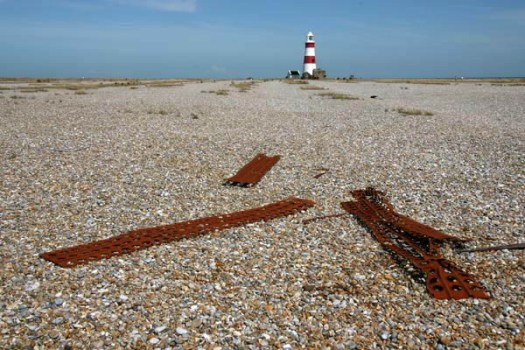
The ongoing demolition is simply a matter of being one step ahead of what will happen naturally as a result of longshore drift. Built as a very necessary warning for shipping and continually in service until its decommission in 2013, in more recent times the lighthouse has served as a bold territorial marker for this curious – and one-time secretive – strip of coastline. What it stands upon is not an island as it may seem but a spit – a long stretch of shingle, marsh and sand that sits between the estuary of the River Alde and the North Sea like a curving finger pointing south. Along with an expanse of pylons and weapon-testing ‘pagodas’, this red-and-white band structure has been an icon for the territory of Orford Ness, a place of Cold War secrets, sea-scraped shingle, wildlife and, in recent years, National Trust day trippers. Because of its dark history and evocative, lonely location, the Ness has also seen service as an unsanctioned psychogeographical theme park, a go-to liminal zone for enraptured lone males and Sebaldian shore-shufflers (myself included).
While we are all losing a lighthouse, I am losing a gravatar for my blog and twitter feed. I suppose I ought to replace it with something new but I will keep it for a while as a tribute to the lighthouse’s ghosted memory. As for the lighthouse itself, it is hoped that the lantern will be reused to form part of a memorial structure on land across from the Ness on Orford Quay.
Not for the first time have iconic buildings world vanished overnight. The lighthouse’s destruction is, at least, planned and been a long time coming. Other well known places I have visited have met more violent ends – vicious executions rather than gentle euthanasia. I refer to some of these in a post on Palmyra from five years ago. Syria seems like a dream now; something I might have imagined. The reality is that the country I experienced as a welcoming place nearly twenty years ago has since become a land of nightmares.


Going further back in time, it feels equally strange to recall having once spent several days in a hotel that overlooked the enormous sandstone Buddhas of Bamiyan in central Afghanistan. This was back in the halcyon days when the country was a way-station on the so-called Hippie Trail to India, long before the Taliban decided to blow the Buddhas up as blasphemous objects of idol worship (even then, the statues’ faces had already been disfigured by angry iconoclasts).
To continue a tally of Zelig-like appearances at places associated with doomed futures, I might also mention a visit to the World Trade Centre in New York on my first visit to the city in 1986 – of having once stood in a small room at the very top of the structure, a space that now existed as just a cube of empty sky above a disaster zone. Or a visit to a place that languished in a void between destruction and repair: Mostar in Bosnia and Herzegovina, still a broken city when I visited in 2003, the absence of its beautiful 16th-century Ottoman bridge hanging like a question mark above the rubble-filled turquoise of the River Neretva. The bridge was faithfully rebuilt with foreign investment and reopened in 2004. As beautiful as before but somehow sad and perhaps even futile, the reconstruction was a gesture of hope more than anything else — the Muslim east and Croat west banks of the river would remain as places apart in terms of religion, culture and political allegiance.
Less exotically, I also recall the cooling towers that used to stand next to the M1 in Tinsley, Sheffield – twin behemoths that could be seen from the windows of the school where I did my first teaching practice in the city. The towers, devoid of function since 1980, possessed a grace and heft that seemed to perfectly symbolise Sheffield’s industrial past (as did the abandoned steelworks of the Don Valley, which were eventually cleared to provide the land for the inevitable – a massive shopping complex, Meadowhall). Like the Orford lighthouse, and also the equally iconic cooling towers that stood at Ironbridge until last year, the Sheffield towers were finally expunged from the landscape. It took just seven seconds to reduce the 76 metre towers to rubble. For now, like the Orford lighthouse, they remain as a memory, a ghost of landscape that will fade with time.


