Passing through Birmingham recently I had a little time on my hands and so decided to visit the Digbeth area, a shortish walk from New Street Station. Head south from the futuristic silver button bulwark that is the Selfridges building and you will soon arrive here. Hitherto, I had known of Digbeth coach station – which is still here, revamped and now known as Birmingham Coach Station (opened by Fabio Capello, no less, in 2009) – but somehow whatever else lay in this industrial area close to the city centre had mostly escaped my attention.
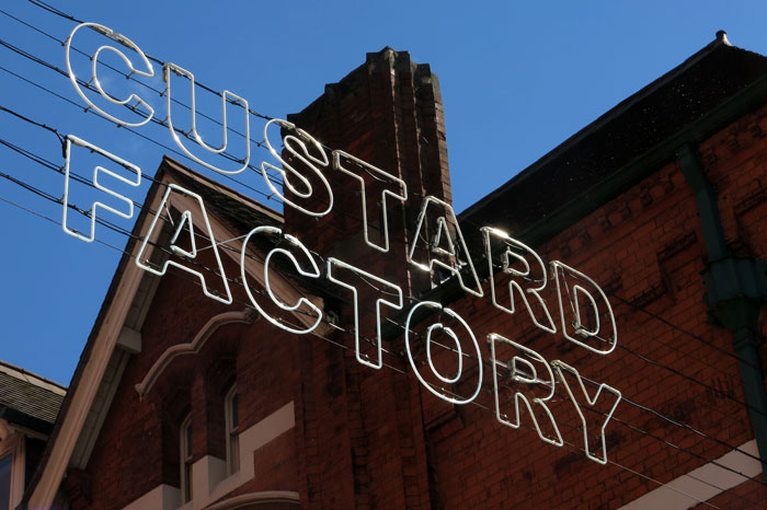
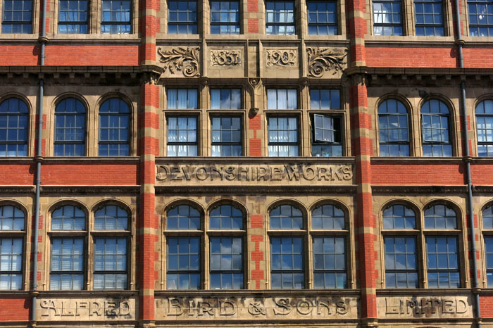
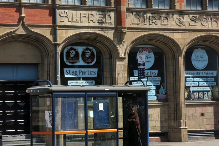
 Typhoo Tea once had a factory here, as did the Birmingham Battery and Metal Company before it decamped to Selly Oak, but probably the most famous of Digbeth’s buildings is the imposing Devonshire Works, better known as The Custard Factory. It was here that Alfred Bird & Sons manufactured their innovative egg-less custard powder, a buttercup-coloured product, which combined with hot milk, provided the nation with the necessary lubricant for its stewed rhubarb and apple crumble. An illuminated sign still hangs over its entrance to remind us of the building’s former use, although these days the complex has found new life as a centre for arts, small businesses and independent retailers.
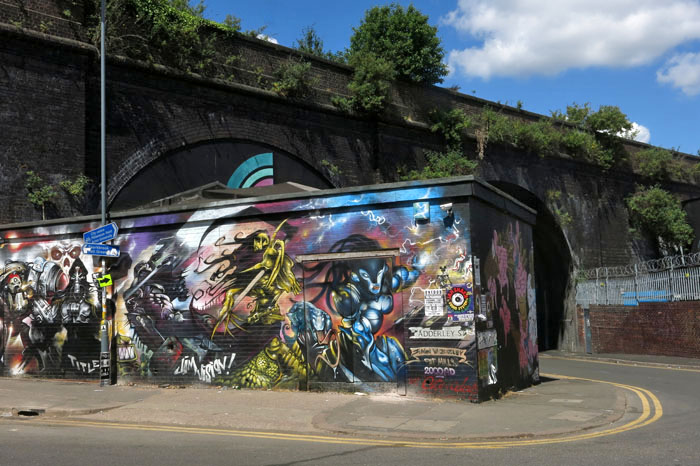
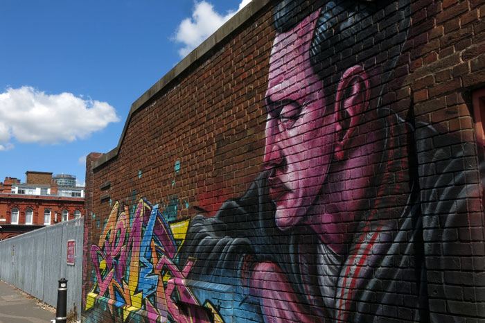
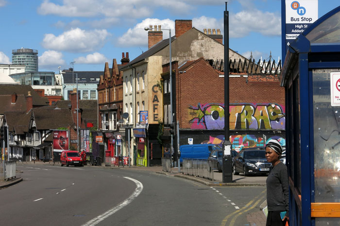
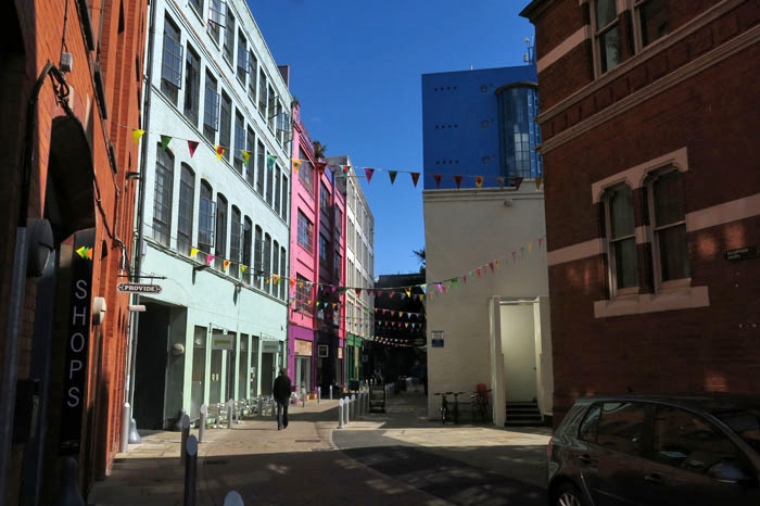
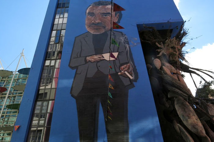
 The Custard Factory stands as a slightly self-consciously gritty beacon of culture amidst the quotidian surroundings of Digbeth High Street. Digbeth, which clearly still has some industrial dirt beneath the finger nails of its clever hands, does ‘gritty’ quite well. Beyond the high street, narrow streets lead down to the railway bridges and embankments that bisect the district east to west. The tropes of inner city cultural re-purposing are clear to see: the graffiti is mostly of a high standard; the converted galleries have a homespun, do-it-yourself air about them; the pubs remain authentic-looking despite their reinvention as hip places to drink.
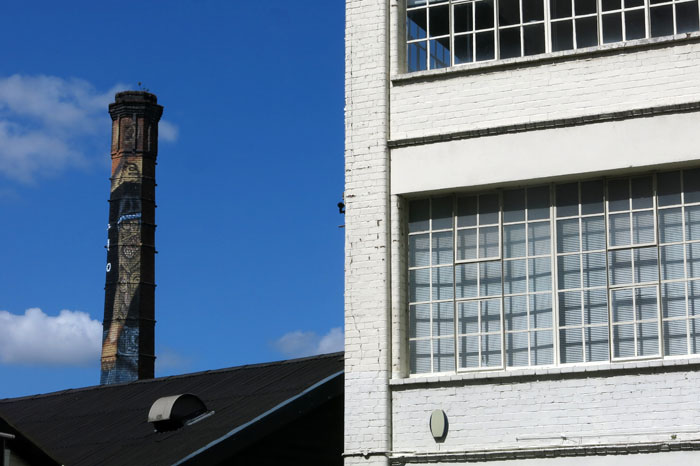
 It is widely thought that Digbeth was the focal point from which England’s second city developed when Berma’s Saxon tribe chose to settle the valley of the River Rea in the 7th century. Digbeth, which now tends to incorporate the old parish of Deritend at its eastern end, later became the manufacturing heart of the city when Birmingham rapidly expanded during the Industrial Revolution. Evidence of this industrial heritage can still be seen everywhere, although these days it is marked more by conspicuous absence than thriving activity.

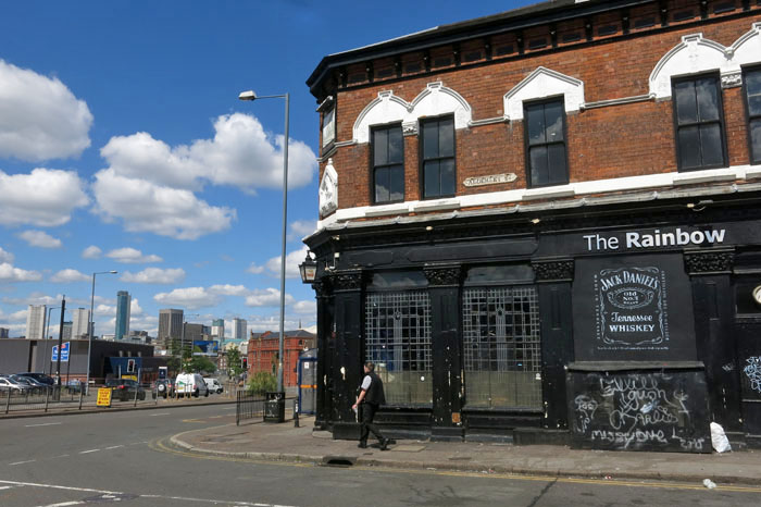
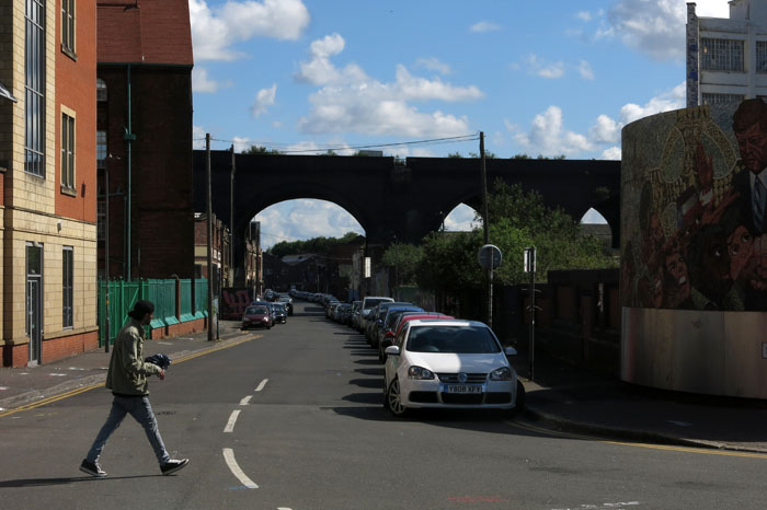
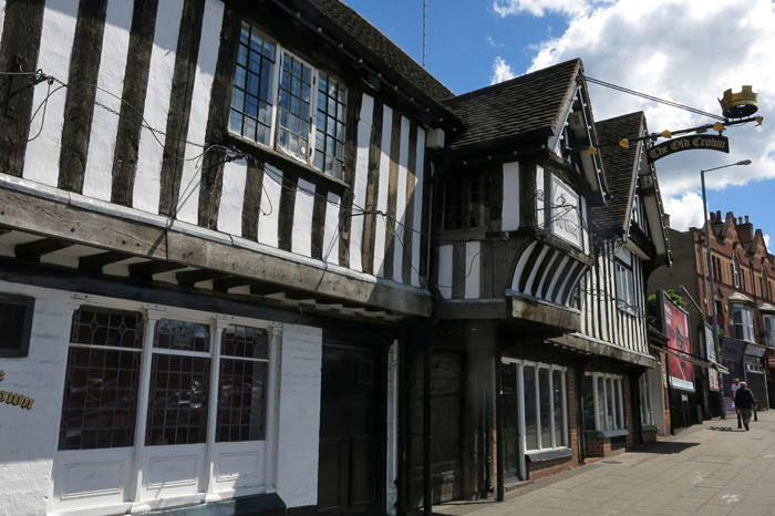
 Flanked by the Irish Quarter to the south and Eastside to the north, Digbeth was mostly cleared of its poor housing in the 1950s and ‘60s to become a factory zone that has slowly atrophied into a wasteland of disused industrial buildings and car parks, some of its more edgy-looking pubs now standing solitary and alone like isolated fortresses. Now, the area is an edgeland of sorts – a buffer zone between the shiny new architecture of the CBD and the residential areas of the inner city. Surprisingly, this formerly industrial quarter is also where Birmingham’s oldest secular building, The Old Crown, may be found: a Tudor period timber-framed inn that began life as a private house and would look more at home in genteel Stratford-upon-Avon than here wedged between the old factories and viaducts. There is more pre-industrial history if you look for it: a blue plaque next to the Irish Centre commemorates Bible translator John Rogers, who was born in Deritend in 1507 and burned at the stake at Smithfield, London in 1555, the first victim of the Marian persecution waged during Queen Mary’s reign. Whether or not a plaque that commemorates a Protestant martyr should be placed quite so close to a (Catholic) Irish institution is perhaps a moot point.
 For all its atmosphere of gentle dereliction, Digbeth is clearly on the rise once more. The Custard Factory has its shops, studios and workshops, its bars are busy at weekends and there’s a burgeoning electronic music scene centered around some of the clubs. On the up, certainly, but Hoxton-style hipsters have yet to take over (better try Moseley instead) and, rather than fashionable full beards, most of the facial hair that you will witness on the street here tends to be the henna-died chin whiskers of elderly Pakistanis who pass through Digbeth on their way to the Southside markets.