
 Just three main roads radiate out of Stornoway, the capital of the Isle of Lewis. One heads across mountains towards Tarbet and Harris to the south; another goes east past the island’s airport and along the Eye Peninsula to come to halt at the lighthouse at Tiumpan Head, while a third leads across the island’s moorland interior to reach its west coast. A little way along this last road is the turn-off to Tolsta, a minor road with the most unexpected of endings. The road passes bungalow settlements and sea-facing graveyards as it leads north. In Hebridean terms, this is relatively densely populated terrain — one settlement merging into the next in a loose sprawl known collectively as Back. This stretch of Stornoway’s hinterland might elsewhere be termed green belt were it not a fact that pretty well anywhere on Lewis and Harris could be described as ‘green’.
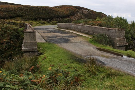
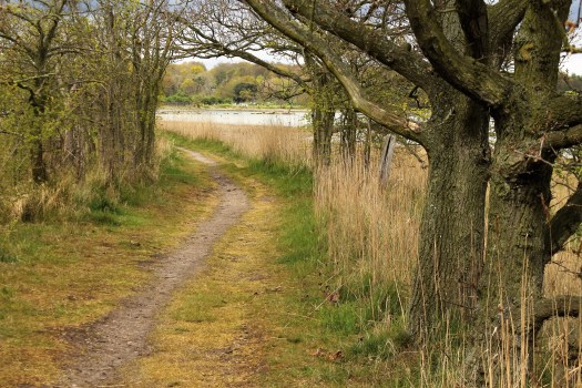
Some fifteen miles from Stornoway, a little way beyond the small coastal village of Tolsta, is Garry Beach, a quiet sandy beach with its own car park. A few campervans are parked up here and a rusty caravan is tethered in a boggy field alongside, more likely a base for itinerant workers than a low-rent holiday home. A couple, well wrapped-up against the cool on-shore breeze, are exercising their dog on the beach. A couple of jagged sea stacks rise vertiginously just offshore; half a dozen oystercatchers methodically work the tideline, red beaks wrestling with molluscs. The asphalt road, single track since Tolsta, ends abruptly at the car park and continues only as a rough peat-digging track that winds up the hillside towards a concrete structure. Walk up here and you soon come to it — a bridge over a narrow gorge that, counter-intuitively, appears to be the very end of the road.
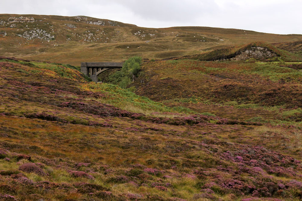
The Bridge to Nowhere, as it is generally known, was constructed by Lord Leverhulme, one-time owner of the island, as part of a project to build a road that connected Stornaway with Ness, a fishing village at the northern tip of the island. Like many of Leverhume’s ambitious schemes, good intentions went awry and for a number of reasons the road was never completed. Even today, the only direct way between Tolsta and Ness is on foot, a weary ten-mile slog through soggy moorland that for most people makes the longer, circuitous trip by road via Stornaway and Barvas a more attractive option. The original vision was to build three large farms that would provide dairy produce for fish cannery workers. Alas, the fish canning empire never came to fruition and a lack of both funds and enthusiasm resulted in the road never extended beyond the bridge at Garry Beach.

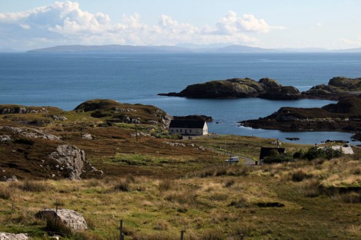
Head south of Stornoway, over the North Harris Hills to Tarbet and then across the isthmus into South Harris, and you have two options to reach to the ferry port of Leverburgh at the southern tip of this, the largest of the Hebridean islands. The road that skirts the west coast is relatively wide and easy to navigate but the road that runs parallel to the east coast, circumscribing many rocky inlets along the way, is of a very different character. The two coasts of South Harris have strikingly contrasting landscapes. While the west road swoops smoothly past enormous tidal sandy beaches like that at Luskentyre, the narrow east road weaves erratically around rugged inlets and rocky outcrops.
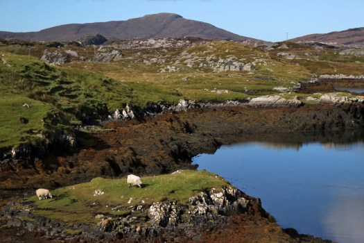
Rough country, largely soil-less, infertile, with very little land suitable for grazing or farming — you might wonder why people might live here in the first case. The reason, of course, as in so many places in the Scottish highland and islands, is because of widespread clearance in the late 18th and early 19th centuries. The extensive land clearances of Harris were enforced by the Macleod family who once owned the island and who, to make way for their profitable sheep enterprises, forcibly moved many crofters off the relatively fertile land of the west coast to the far poorer, rocky terrain of the east. As a result, many families migrated to Canada to seek a better, more secure life, while those who remained struggled to survive by digging ‘lazy beds’ for potato-growing — labour-intensive raised beds in which the thin poor soil was bulked out and enriched with seaweed and straw. Never was the word ‘lazy’ so misappropriated.

To travel the Bays Road, as the C79 east coast road is better known, is to witness a dramatic sweep of exposed gneiss, sky and water, with ever-changing glimpses of narrow rocky inlets, dark reed-filled pools and peat-stained streams the colour of strong-brewed tea. The road is not for drivers of a nervous disposition – narrow even for a single lane, with a general allocation of passing spaces, it is a constantly winding tour-de-force where each mile covered seems more like five. Stark, barren, primeval: the landscape is far from bucolic but it is undeniably beautiful. Sheep wander across the road with impunity; white-tailed eagles and buzzards spiral slowly overhead; curious ravens perch on rocks eyeing the sporadic passing traffic like pensioners on a park bench. For the briefest of moments, a pair of golden eagles make an appearance silhouetted high above a ridge. At the road’s highest point, the peaks and headlands of the Isle of Skye show themselves to the east across the wave-flecked Little Minch. The sea is translucent, deepest blue; a CalMac ferry is halfway across the channel steadfastly plying its twice-daily journey to Uig on Skye. In the diamond-clear light, the far-distant Cuillin Hills can be seen glinting crystalline in the sun. Deprived of a decent livelihood by uncaring landlords, you can only reflect that the crofters who were banished to this unwelcoming, unworkable terrain were at least given possession of some of the finest viewpoints in the kingdom.


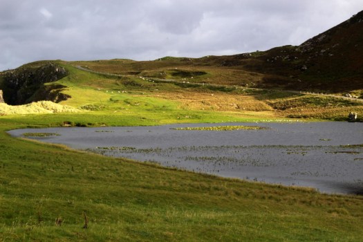
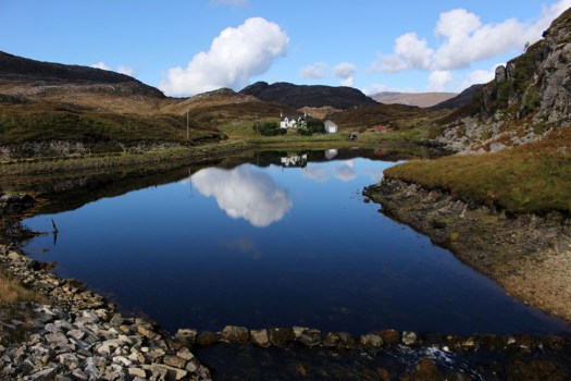
 Eleven miles east of the main road, six from the nearest shop (closed on the Sabbath), two miles from the open sea as the raven flies. Glen Gravir – a slender thread of houses stretching up a glen, just four more unoccupied dwellings beyond ours before the road abruptly terminates at a fence, nothing but rough wet grazing, soggy peat and unseen lochans beyond. This was our home for the week, a holiday rental in the Park (South Lochs) district of the Isle of Lewis in the Outer Hebrides.
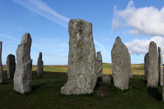
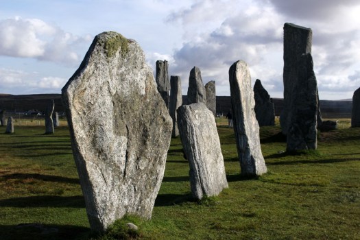
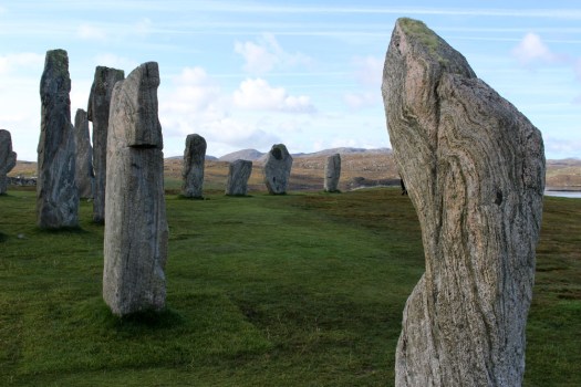
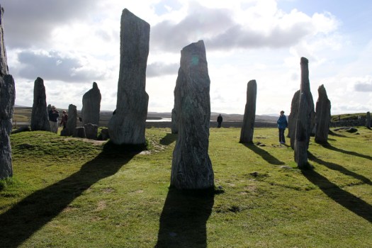
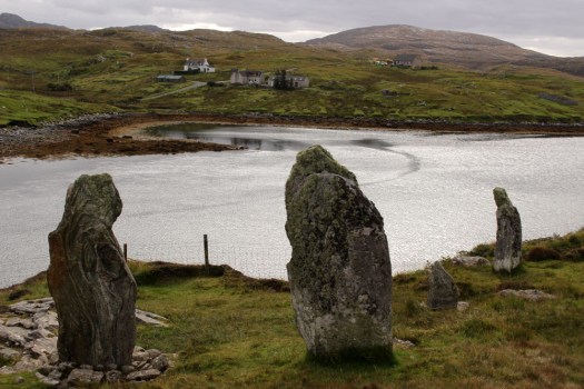
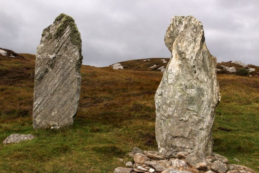
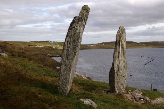
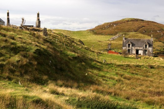
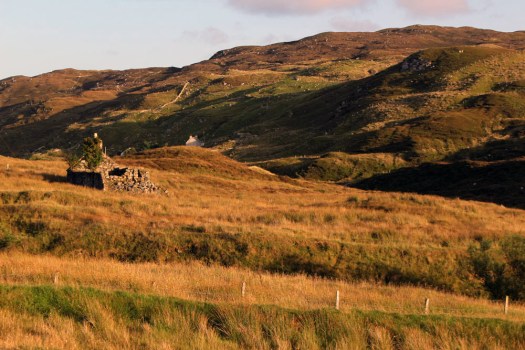 Gravir, of which Glen Gravir is but an outpost, is large enough to feature on the map, albeit in its Gaelic form, Grabhair. The village – more a loose straggle of houses and plots – possesses a school, a fire station and a church but no shop. A road from the junction with Glenside next to the church winds its way unhurriedly downhill to the sea inlet of Loch Odhairn where there is a small jetty for boats. Some of the houses are clearly empty; others occupied by crofters and incomers, their occupants largely unseen. Others are long ruined, tenanted only by raven and opportunist rowan trees, with roofs absent and little more than chimney stacks and gable walls surviving. It is only a matter of time before the stones that have been laid to construct the walls will be indistinguishable from the native gneiss that underlies the island, surfacing above the bog here and there in outcrops like human-raised cairns. Lewisian gneiss is the oldest rock in Britain. Three billion years old, two-thirds the age of our planet, it is as hard as…well, gneiss. It is the same tough unyielding rock that five thousand years ago was painstakingly worked and positioned at the Callanish stone circle close to Lewis’s western shore; the same rock used to build the island’s churches, which occupy the same sacred sites, the same fixed points of genii loci that had been identified long before Presbyterianism or any another monotheistic faith arrived in these isolated north-western isles.
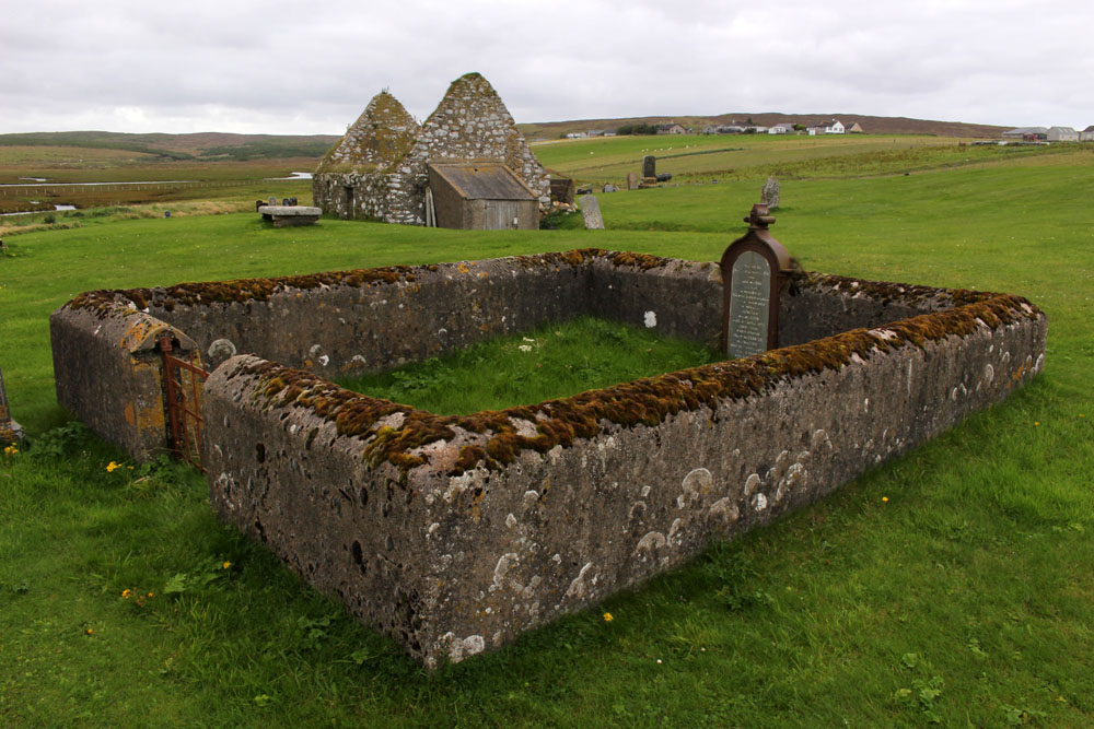
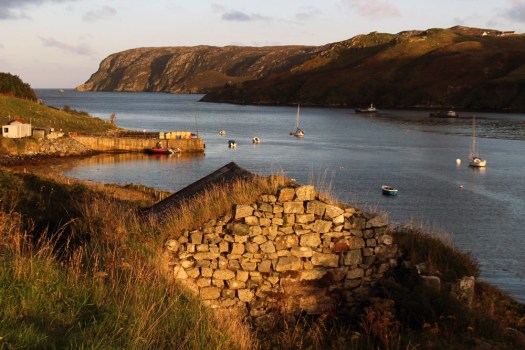
 Ancient hard rock (as in metamorphic) may underlie Lewis, but religion is another bedrock of the island. Despite a respectable number of dwellings the only people we ever really see in the village are those who come in number on Sunday. The Hebridean Wee Free tradition guarantees a full car park on the Sabbath when smartly and soberly dressed folk from the wider locality congregate at Grabhair’s church, which, grave, grey and impressively large, is the only place of worship in this eastern part of the South Lochs district.
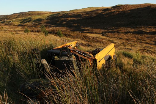
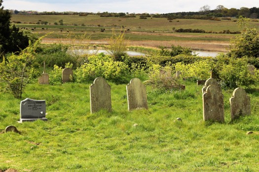
 At the bottom of the lane beneath the hillside graveyard next to the church are a couple of recycling containers for villagers to deposit their empties and waste paper. Larger items of material consumption are left to their own devices. Rain, wind and thin acidic soil are the natural agents of decay here. Beside the roadside further up from our house lie four long-abandoned vehicles in various stages of decomposition. Engines are laid bare; bodywork and chassis, buckled and distressed, rust-coated in mimicry of the colour of lichen and autumn-faded heather. Cushions of moss have colonised the seating fabric. The rubber tyres remain surprisingly intact, the longest survivor of abandonment. Sharp-edged sedges have grown around the rotting car-carcasses as if to hide them from prying eyes, preserving some modicum of dignity as the wrecks decay into the roadside bog, all glamour expunged from a lifetime spent negotiating the island’s narrow single track roads. On Lewis, vehicles die of natural causes, not geriatric intervention.
 Our cottage was rented as an island base: a place to eat, rest and sleep before setting off each morning on a long drive to visit one of Lewis’s far flung corners. Happily, it feels like a home, albeit a temporary one – a domestic cocoon of cosiness with all the modest comforts we require. Its small garden is a haven. As everywhere on the island, tangerine spikes of montbretia arch like welder’s sparks from the grass. Rabbits scamper about on the lawn, colour-flushed parties of goldfinches feed on the seed heads of knapweed outside the kitchen window. Robins, wrens and blackbirds flit around the trees and shrubs that envelop the cottage – non-native plants that have adapted to the harsh weather conditions of this north-western island, softening an outlook that on a grey, wind-blown day, with a gloomy frame of mind, might be considered bleak.
 Most days on our jaunts around the island we would see an eagle or two, golden or white-tailed, sometimes both. The majority of these sighting are in more mountainous Harris, or in that southern part of Lewis that lay close to the North Harris Hills, but on our last day on Lewis we see a white-tailed eagle fly over Orinsay, a village relatively close to where we have been staying. An hour later we spot another bird swoop along the sea loch at Cromore, a coastal village that lies a few miles to the north. It might well be the same bird. White-tailed eagles are very large and hard to miss, and their feeding range is enormous. But that is exactly how Lewis seems – enormous, almost unknowable despite its modest geographical area. A place larger than the shape on the map – a mutable landscape of rock, sky and water that does not easily lend itself to the reductionism of two-dimensional cartography.


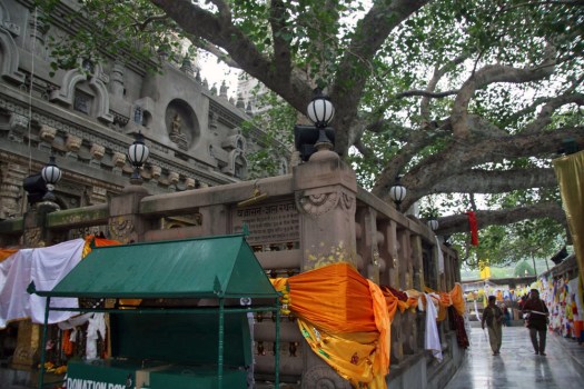
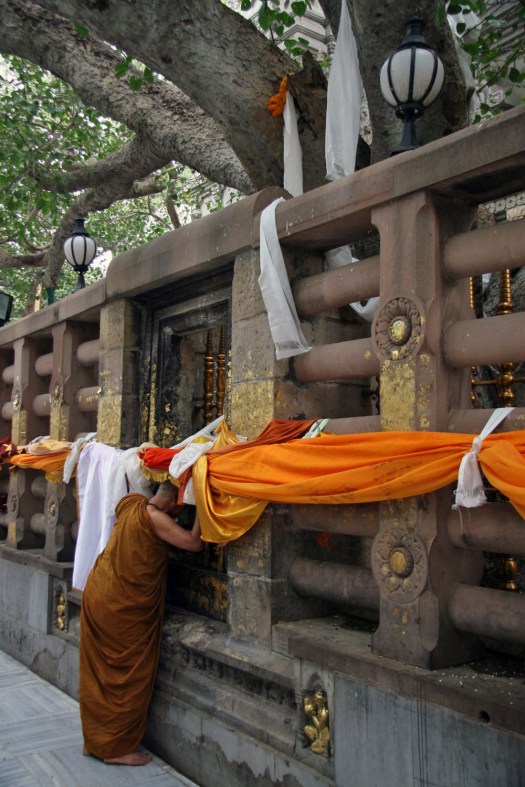
 The Japanese have an expression – shirin-yoku (‘forest bathing’) — which refers to time spent in a wood or forest for purposes of health and relaxation. Scientific field studies have demonstrated that spending even a short time among trees promotes a lower concentration of cortisones, lower pulse, lower blood pressure, decreased levels of stress and improved concentration. In Japan activities such as shirin-yoku are part of the culture and hold an important place in the national psyche. Modern Japanese culture is still rooted in ancient nature-worshipping Shinto beliefs that are expressed in a variety of ways. Perhaps the most striking of these for westerners is the annual celebration of the
 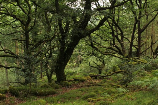 The forest, the greenwood, comes with cultural baggage. It is sensed to be a place of ‘the Other’, a place of wild things, of decay, of hidden danger; of runaway fugitives, mythical outlaws — Robin Hood being prime example — deserted children (Babes in the Wood), ghosts and malevolent spirits. There is no denying that some tracts of woodland are downright spooky, places where dark forces can be felt to be at large. Traditional children’s literature does not help much in mitigating this irrational if primal fear. In fact, it nourishes it — one of the very first books I remember reading as a small child was Winkie Lost in the Deep, Deep Woods, the very title of which suggests some sort of unspoken dark menace. As an archetype, a forest is perceived as an eldritch zone where wicked witches live alone in eerie hovels, where red-cloaked little girls are preyed upon by egregious wolves, and large gatherings of ursine cuddly toys attend sinister secret picnics. Go into the woods (today) and you might well be ‘sure of a big surprise’. In adult life the same fear is perpetuated as a trope of the horror genre — the psychological terror of The Blair Witch Project springs to mind. The forest is a place where bad things happen — a place to bury the bodies. Be afraid. Even Japan with its devotion to sakura and forest bathing traditions has its fair share of indigenous forest demons. The country even has its own haunted forest, Aokigahara, at the foot of Mount Fuji, which has the unenviable reputation of beings the world’s second most popular choice as a place for suicide.
 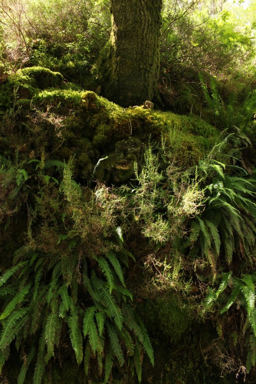 But let us embrace a positive outlook and view woodland as a place of wonder and nurture rather than fear and loathing, a place to breathe in the beneficial volatile oils emitted by trees and enjoy their beauty. Where better to delve into the greenwood in Britain than a tract of temperate rainforest that has hardly changed since the last glacial period? Coed Felinrhyd in North Wales has stood largely untouched since from this period and, although tracts of this woodland have been partially managed over the centuries, other parts have remained undisturbed for around 10,000 years. Coed Felinrhyd, owned by the Woodland Trust, is just a fraction of the remnant temperate rainforest found in this damp corner of Wales: a 90-hectare tract of woodland on the southern side of the narrow Ceunant Llennyrch gorge through which the mercurial Afon Pryser, a tributary of the Afon Dwyryd, flows. Coed Felinrhyd’s particularities of relief and climate, tucked away in a sheltered, virtually frost-free gorge close to the Welsh coast in a region where it rains on average 200 days a year, ensure that the ecosystem here is in many ways unique. Scarce plants and ferns thrive in the understory, rare lichens and mosses cloak the trees. But this is more than simply remarkable ecosysytem, this is also a place where geography and legend intertwine – the forest receives a mention in the ancient Mabinogion myths written down in the 12th century and is said to be the location where two warriors once fought to the death.
  The entrance is a little hard to find, hidden away just beyond the entrance to the Maentwrog power station on the Blenau Ffestiniog to Harlech road. A Woodland Trust notice board by the gate gives background information on Coed Felinrhyd and a signpost points out the direction of a well-defined trail that circuits the forest. The trail climbs steeply at first, then more gently before levelling off. The first thing to be noticed, other than the towering oaks that stretch in every direction, is moss. Although ferns are almost as prolific, sprouting like green shuttlecocks wherever they can secure a foothold, it is moss that is everywhere cloaking every surface — on the bark of trees, on the rocks that line the pathway, on the dry stone walls that partition the woodland; on any surface where moisture can collect. Even most of the tree stumps are upholstered with velvety jade cushions of moss, their cut surface having been rapidly colonised by the feathery fronds of bryophytes. Each of these is a pedestal-raised forest in miniature, a Lilliputian lost world — this small tract of woodland contains a million tiny moss forests within it. Some of the tree stumps have been cut mischievously into the shape of a chair or a four-legged stool, the work of a rogue woodsman with a sense of humour and an artistic streak. A few of are fresh enough to not yet sport the forest’s inevitable green uniform, although no doubt soon they will.
  Having reached a plateau in the woods we come across a ruined slate barn beside the trail, its roof long gone and ferns sprouting like bunting on top of the walls where the eaves should be. Long abandoned, the building is probably at least two hundred years old and a remnant of the old farming practice of ‘hafod a hendre’ in which shepherds would remain on higher pasture with their flocks during summer. The track continues past clumps of trees that seem to emerge directly from the moss-carpeted boulders at their base. The blanket of moss and lichens that covers both gives the impression that both tree and rock are born of the same material, something primal and green that is neither strictly vegetable or mineral but something in between.
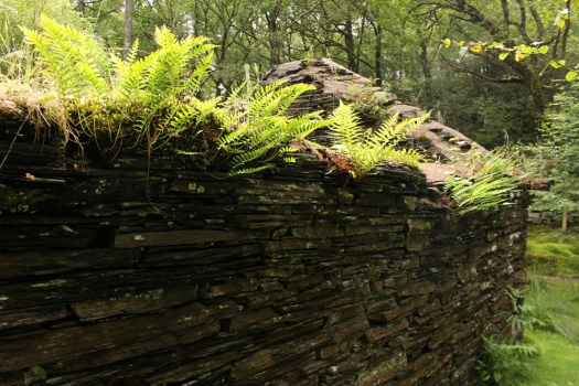 Descending back down into the valley we arrive at a dry stone wall that has a gate which leads into Llennyrch, a neighbouring tract of forest of similar pedigree to Coed Felinrhyd. We follow the wall to the left and the sound of rushing water becomes gradually louder as the gorge reveals itself. A small viewing platform gives a glimpse of the waterfall of Rhaeadr Ddu that plummets down onto the rocks below although the view is partly obscured by the dense foliage. The river is still some way beneath us but we draw closer to it as the path gradually descends. Finally we come to Ivy Bridge, which, true to name, is enveloped by long trails of ivy that hang over the edge almost touching the water and rocks beneath. Beyond the bridge, on the other side of the river, the unsightly machinery of an electricity substation can be discerned beyond a fence; beyond this, unseen from this position, lies the Maentwrog power station.
 After two hours of slow walking, looking, taking photographs and what can only be described as mobile ‘forest bathing’ we are back where we started. It suddenly occurs that we have met absolutely no one on our walk even though it is a relatively bright day with little threat of rain. No hikers or dog walkers, no botanists or tree-huggers, no Celtic warrior ghosts. And, to the best of our knowledge, no malevolent woodland sprites either.
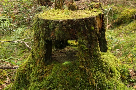


 The Saints is a small, loosely defined area of northeast Suffolk just south of the River Waveney and the Norfolk border. Effectively it is a fairly unremarkable patch of arable countryside that contains within it a baker’s dozen of small villages with names that begin or end with the name of the parish saint: St Peter South Elmham, St Michael South Elmham, St Nicholas South Elmham, St James South Elmham, St Margaret South Elmham, St Mary South Elmham, St Cross South Elmham, All Saints South Elmham, Ilketshall St Andrew, Ilketshall St Lawrence, Ilketshall St Margaret, Ilketshall St John and All Saints Mettingham. The area is bisected in its eastern fringe by the Bungay—Halesworth road that follows the course of Stone Street, a die-straight Roman construction, one of several that can still be traced on any road map of East Anglia. On the whole though the roads around here are anything but Roman in character: narrow, twisting, often bewilderingly changing direction, and marked with confusing signs (too many saints!), it is a good place to visit should you wish to humiliate your Sat Nav. John Seymour in The Companion Guide to East Anglia (1968) describes The Saints as ‘a hillbilly land into which nobody penetrates unless he has good business,’ which is perhaps hyperbolic but there is undoubtedly a feel of liminality to the area that persists to this day.
 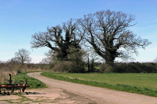 The village names conjure a medieval world where saint-obsessed religion loomed large. Such a tight cluster of settlements suggests a concentration of population where parishes might eventually combine to form a town or city – with 13 villages and the same number of churches (eleven of which are extant), there were more churches here than in all of Cambridge. But The Saints never coalesced to become a medieval city – none of the villages had a port, defensive structure or even significant market to its credit and consequently the area would slowly slip into obscurity as the medieval era played out and other East Anglia towns and cities – Cambridge, Bury St Edmunds, Ipswich and, of course, Norwich – took the baton of influence and power.
  It was not always so: one of the villages in particular held great significance in its day. The land covered by the South Elmham parishes was once owned by Almar, Bishop of East Anglia and the late Saxon Bishops of Norwich had a summer palace here at St Cross, now South Elmham Hall. The most intriguing of the churches lies within the same parish. It is not in any way complete but a ruin framed by woodland a good half mile from the nearest road. South Elmham Minster, although probably never a minster proper, is veiled in mystery regarding its origins but its appeal owes as much to its half-hidden location as it does to its obscure history. South Elmham may have once been the seat of the second East Anglian bishopric (the first was in Dunwich, the sea-ravaged village on the Suffolk coast), although North Elmham in Norfolk seems a more likely contender. Whatever the ruin’s original function – a private chapel for Herbert de Losinga, Norwich’s first bishop, is another possibility, or it may even be that a second bishopric was founded here – the church in the wood just south of South Elmham Hall dates back at least to the 11th century. It is probably older in origin – a ninth-century gravestone has been unearthed in its foundations. The site itself is undoubtedly of greater antiquity: a continuation of an earlier Anglo-Saxon presence that occupied the same moated site, which, earlier still, was home to a Roman temple and perhaps, even earlier, a pagan holy place.
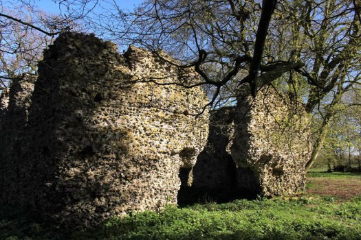
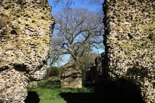
 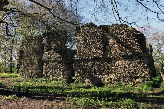 We leave the car in a muddy parking area alongside another vehicle and a dumped piece of agricultural machinery. Nearby stands a weather-beaten trestle table that suggests that this once might have served as a designated picnic spot. Now half-submerged in grass and thistles, the table did not look as if any sandwich boxes had been opened on it for some time. Things have changed here a little in recent years: the permissive footpaths that once threaded through the South Elmham estate are no longer available for the public, and the hall itself has been re-purposed for use as a wedding and conference venue. At least the minster was still accessible by means of a green lane and a public footpath across fields.
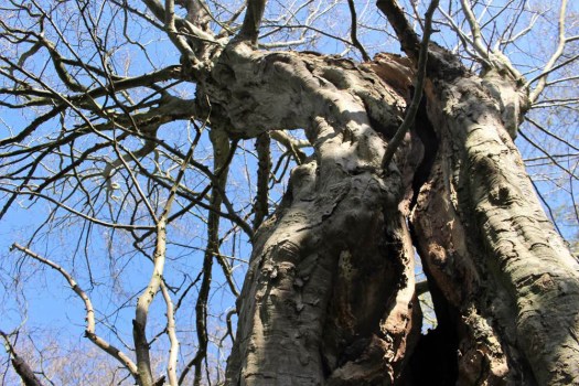
 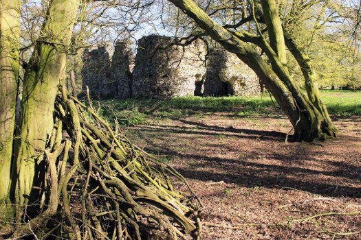 The green lane is flanked by mature hedges frothed white with blackthorn blossom. Reaching its bottom end we turn left to follow a footpath alongside a stream, a minor tributary of the River Waveney; strange hollowed-out hornbeams measure out its bank. Soon we come to the copse that contains the ruin, a rusty gate gives admission across a partial moat and raised bank into what can only be described as a woodland glade. The ancient flint walls of the church stand central, striated by the shadow of hornbeams still leafless in late March. There is no sign of a roof but the weathered walls of the nave are clear in outline, as is the single entrance to the west. On the ground, last year’s fallen leaves provide a soft bronze carpet that is mostly devoid of ground plants.
  Church or not, there is a timelessness to this place in the woods. And a strong sense of genius loci, the sort of thing that put the wind up the Romans with their straight lines and four-square militaristic outlook. I wander off to explore the bank to the west and discover the opening of a badger sett that looks to be newly excavated. Without much expectation, I rummage though the spoil musing that there might just be the remotest of chances that, burrowing deep beneath the mound, the animals have thrown up some treasure long buried in the soil below: an Anglo-Saxon torc, a Roman coin perhaps? I would even settle for a rusty button, but nothing. No matter, the mystery of the place is enough for now. We leave the bosky comfort of the site and retrace our steps along the beck and green lane back to the car. The other car has gone – we never did see its occupants.
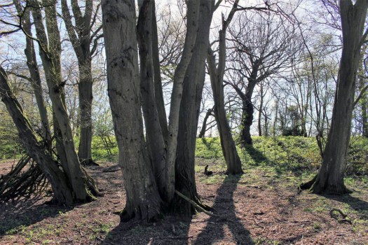
 Today is St Patrick’s Day and March 17 is the supposed date of the 5th-century missionary’s death. Patrick was the forerunner of many early missionaries who came to Irish shores to preach Christianity, the island more receptive to new ideas about religion than its larger neighbour to the east across the Irish Sea. Consequently Ireland abounds with relics and ruins of early Christianity, sometimes in the most improbable of places.
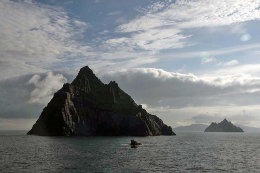
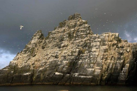 Sailing around Ireland’s southwest coast, skirting the peninsulas that splay out from the Kerry coast, the two islands of the Skelligs come into view after rounding Bolus Head at the end of the Inveragh Peninsula. Both islands are sheer, with sharp-finned summits that resemble inverted boat keels. The smaller of the two appears largely white at first but increasing proximity reveals that the albino effect is down to a combination of nesting gannets and guano. The acrid tang of ammonia on the breeze and distant cacophony announce the presence of the birds well before the identity of any individual can be confirmed by binoculars.
 As the boat draws closer, the sheer volume of birds – gannets, fulmars, puffins, terns – becomes plain to see. With something like 70,000 birds, Little Skellig is the second largest gannet colony in the world. But on the larger island of Skellig Michael, although seabirds abound here too, there is also the suggestion of a human presence, albeit an historic one. High up in the rocks, small stone structures can be discerned: rounded domes that are clearly man-made and which soften the jagged silhouette of the island’s summit. These are beehive cells, the dry-stone oratories favoured by early Irish monks for their meditation. Sitting aloft the island on a high terrace, commanding a panoramic view over the Atlantic Ocean in one direction and the fractal Kerry coast in the other, these simple stone cells came without windows – the business was one of prayer and meditation not horizon-gazing. Such isolation was necessary for reasons of both safety and spirituality. And Skellig Michael was the acme of isolation. In the early Christian milieu the Skellig Islands, facing the seemingly limitless Atlantic off the southwest coast of Ireland, were more than merely remote: they were at the very edge of the known world.
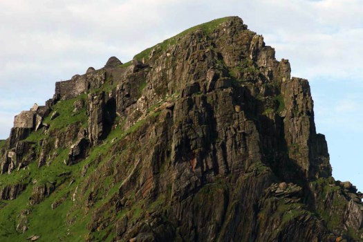 The island’s monastic site is infused with mystery, as all good ruins are, but is thought to have been established in the 6th century by Saint Fionán. Consisting of six beehive cells, two oratories and a later medieval church, the site occupies a stone terrace 600 feet above the swirling green waters of the sea below.
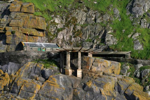 Skirting Skellig Michael, a landing stage with a helicopter pad comes into view. A vertiginous path of stone steps leads up towards the beehive huts close to the island’s mountain-like summit. We do not disembark. Instead we keep sailing, bound for a safer harbour in Glengarriff in County Cork. No matter, the sight of the rocks, the winding, climbing path and the austere cells on the terrace at the top is already imprinted on our memory.
 Without doubt this was a life of supreme hardship: the isolation, the relentless diet of fish and seabird eggs, the ever-battering wind and salt-spray. Such was the isolation, and so extreme the privations of this beatific pursuit, that one might assume that the monks would have been left in peace to practice their calling. This was not to be. Viking raiders arrived here in the early 9th century and took the trouble to land, scale the island’s heights and attack the monks. For most of us it is probably difficult to comprehend the blind-rage fury of the raiders, the wrath invoked in them by pious upstarts with their new Christian God. Easier perhaps is to imagine the dread that must have been felt by the monks as the Vikings approached their spiritual eyrie.
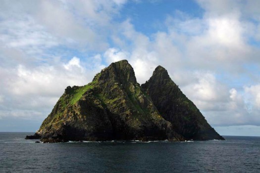
 If trees could only speak. If they had some semblance of sentience and memory, and a means of communication, what would they tell us? Ancient trees – or at least those we suspect to be very old – are usually described in terms of human history. Perhaps as humans it is hubris that requires us to define them in this way but the fact is that by and large they tend to outlive us: many lofty oaks that stand today were already reaching for the sky when the Industrial Revolution changed the face of the land over two centuries ago. This linkage of history and old trees has resulted in some colourful local history. The story of the future King Charles II hiding from parliamentarian troops up a pollarded oak tree in Boscobel, Shropshire carried sufficient potency for the original tree to have been eventually killed by souvenir hunters excessively lopping of its branches as keepsakes. Undoubtedly the stuff of legend, Royal Oak ended up becoming the third commonest pub name in England. A long-established folk belief also tells of the Glastonbury Thorn, the tree which is said to have grown from the staff of Joseph of Arithmathea whom legend has it once visited Glastonbury with the Holy Grail. What was considered to be the original tree perished during the English Civil War, chopped down and burned by Cromwell’s troops who clearly held a grudge against any tree that came with spiritual associations or historical attitude.
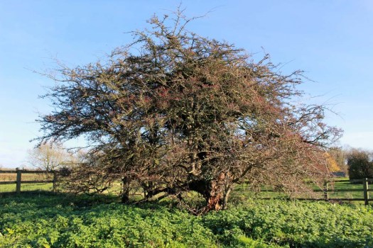
 There is an ancient thorn in Norfolk that is sometimes connected with the same Joseph of Arithmathea myth. Hethel Old Thorn can be found along narrow lanes amidst unremarkable farming country 10 miles south of Norwich. Close to the better known
 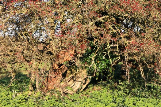 At an estimated 700 years old this is thought to be the oldest specimen of Crataegus monogyna in the UK. Like the nearby Kett’s Oak, the thorn was thought to be a meeting place for the rebels during
 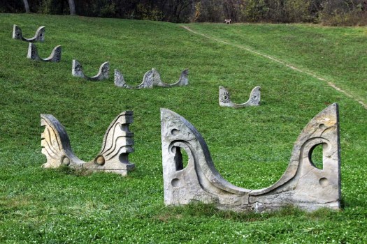 The small city of Kruševac in south-central Serbia is probably best known for its fortress and 14th-century church, a fine example of the highly decorative Morava school. This was Prince Lazar’s capital in the late 14th century and it was from here that the Serbian army under the command of Prince Lazar set off to fight the ill-fated Battle of Kosovo in 1389. The Turks won yet it still took another 60 or so years for the city to fall under Ottoman control. Later on Kruševac became known as the ‘city of the sock-wearers (čarapani)’ because of an incident during the First National Uprising when Serbian rebels removed their boots to slip silently into town at night unheeded by the Turkish guards. Today Kruševac is an easy-going sort of place that, church aside, serves as a textbook case of Tito-era urban planning with its extensive use of concrete and scattered high-rises that loom like grey termite mounds over the city centre.
 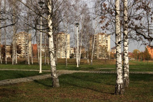 This was my third visit in a decade and on this occasion I was prompted to seek out something that I had hitherto not even been aware of. A short distance out of town to the south lies a monument park dedicated to the victims of Nazi shootings during World War II. This was close to a former German prison camp and the scene of mass shootings between 1941—4, most especially in the summer of 1943 when over a thousand Serbs partisans and civilians were executed mostly by Bulgarian and Albanian troops. The Slobodište Memorial Complex, designed in the early 1960’s by architect, politician, one-time Belgrade mayor and anti-nationalist critic of Slobodan Milošević, Bogdan Bogdanović (1922—2010), occupies the same low hill just outside the city where the killings took place. The monuments of the complex serve as focus for a location already tainted with dark memory and collective suffering.
 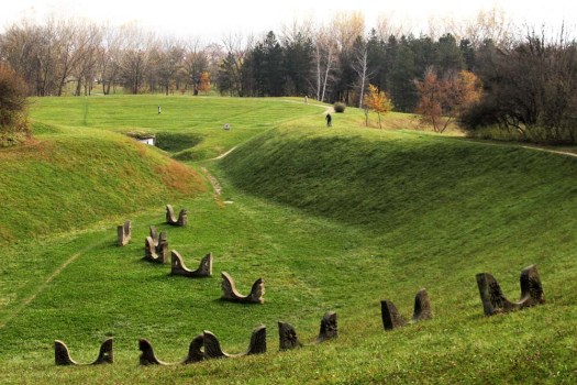 The monument park is reached on foot by way of a route through Kruševac’s outskirts. The city edgeland arrives suddenly: a roundabout, a small airfield marked by a jet fighter on a plinth, an out-of-town retail hangar with supersized advertising depicting super-fit sportsmen. As elsewhere in Serbia, the edgeland is the realm of Roma – the poorest of the poor in this none-too-wealthy country – who, as always, are involved in the recycling business. Perpetually sorting through waste – paper, metal, plastic – skilfully assessing its value, their make-do shanty shelters seem barely separated from the middens of 21st-century detritus that they live among.
 At first there is nothing to see other than landscaped grassy mounds in the distance. Walking through a birch plantation I am entertained by the head-cracking antics of a Syrian woodpecker that hammers away remorselessly at a tree stump. Crows in all their variety – rooks, jackdaws, magpies and jays – call harshly, their voices like creaking tree trunks in a gale. I make for the grassy mound ahead and from the top can see a curved chain of stone sculptures stretched up the hollow of a hillside. The monuments resemble birds – owls to be precise – buried up to their beaks in the earth, but rising from rather than sinking down into it. They might also be angels. As I walk closer to investigate I notice a man with a bicycle at the top of the rise who is waving and beckoning to me. We manage some sort of rudimentary conversation using an inelegant polyglot mixture of German, Serbian and what might be Russian, and I learn that he lives locally in one of the housing estates that fringe the park and uses its pathways as a shortcut to the shops.
  Conversation, and commonality of language, exhausted the man cycles off and I turn round to trace the pathway back to its beginning. What is actually supposed to be the entrance to the memorial complex – the ‘Gate of the Sun’ – serves as my exit: an incomplete arch reminiscent of an Andy Goldsworthy dry-stone creation. Flanking the entrance just beyond this are two pyramidal mounds like Neolithic cairns. In front of each is a low stone funerary slab upon which rest wreaths and polythene-wrapped flowers. Whether or not these are actual burial mounds or merely a symbolical representation does not really seem to matter – this whole site is a memory field of death and the act of remembrance is the important thing. And remembered it is: memory is honoured; this site still holds melancholic charge for townsfolk and visitors alike despite its mundane use as a place for cycling, exercising and walking dogs.
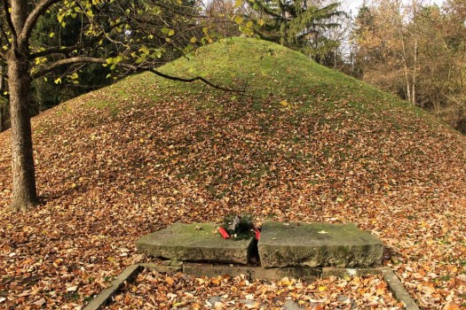 There is one more monument to see: the cenotaph. I find a curious, vaguely zoomorphic statue that brings to mind a Mayan glyph, or a totem – or perhaps another owl. It stands alone and inscrutable in front of some administrative offices that have been landscaped into the naturalistic contours of the park. Within one of the offices I spot a man working on a computer. I cannot decide whether I am envious of his workplace or not. No doubt it is peaceful enough tucked away in the folds of this green domain but the heft of dark memory weighs heavy here – a place to visit certainly but not one in which to repose.
