At Covehithe

IMG_1981The day before the autumn equinox: the setting, the beach at Covehithe. We have gathered here at the north Suffolk coast to walk and talk. A literary walk to celebrate W. G. Sebald’s The Rings of Saturn, no less, organised as part of the Waveney & Blyth Arts festival. The weather – hazy grey skies, mist, light drizzle – is suitably Sebaldian.

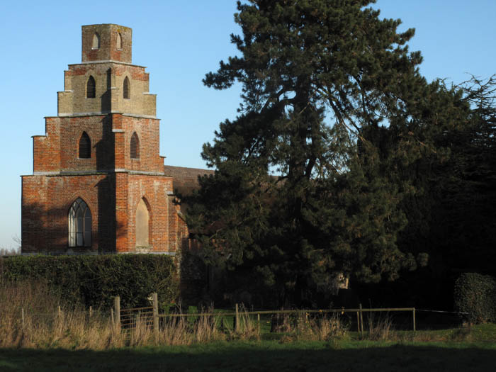
Proceedings begin at Covehithe’s St Andrew’s Church – itself a curiosity, a church within a church –the large medieval shell of the original church sheltering the tiny 17th-century thatched-roofed replacement that was built when the former became too expensive for villagers to maintain. The fine 15th-century tower abuts the later build, dwarfing almost mockingly its dinky proportions. Before taking a pew to hear an introduction by UEA lecturers Jo Catling and Barbara Marshall, who both knew and worked with W. G. ‘Max’ Sebald, some of us examine the font, recycled from the earlier church, which has stylised lions and hairy human-like figures that have had their heads chiselled off. Headless or not, these strange decapitated figures are recognisable as representations of the woodwose (wild man), a creature that belongs to the same fabulist stable as the Green Man, the crude anti-masonry no doubt the handiwork of William Dowsing’s men as it was these same arch-puritans who did for the stained glass windows that used to illuminate the original church.

IMG_1978

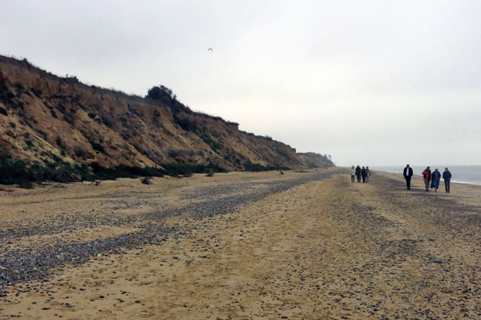
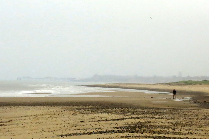
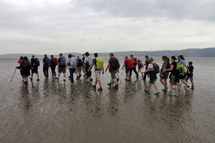
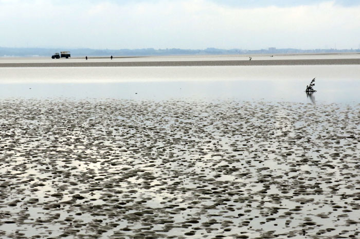
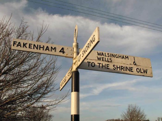
We drift down to the beach by way of Covehithe Broad – the direct road from Covehithe is closed and fenced-off these days thanks to the coastal erosion that constantly depletes this shoreline. The broad’s brackish water is alive with Canada geese that honk plaintively, their voices coming through the mist even before we can see them. The geese take off sporadically in small groups to circuit and survey the parish before returning to the watery comfort of the broad. At the shore, the tide is out and the beach is deserted but for the presence of a distant dog-walker and our own gaggle of muse-seeking Sebaldians. To the north, the curve of the coast at Benacre Ness near Kessingland can just about be discerned. Southwold lies to the south: a distinctive profile that stretches from sea to land – first pier, then low town roofs and blinking lighthouse before a water tower marks the point where the town ends and the Sandlings and marshes begin.

IMG_1984

We walk north along the beach in small amorphous groups exchanging thoughts on Sebald’s gloomy oeuvre. The cliffs of Covehithe feature in The Rings of Saturn, albeit briefly, which is of course why this was chosen as a suitable territory for the walk. It was here that the author stood on the cliffs and gazed out on the leaden-coloured water of what he describes as the German Ocean (a rather archaic term for the North Sea that went out of fashion at the end of the 19th century but chosen by Sebald for his own, anything but nationalistic, reasons). As he lowered his gaze to the beach below he inadvertently spied a couple making love and noted that “it seemed that the man’s feet twitched like those of one just hanged”. Overcome with panic at the sight of this “many-limbed, two-headed monster that had drifted in from far out at sea, the last of a prodigious species” he left to walk to Southwold.

IMG_1998

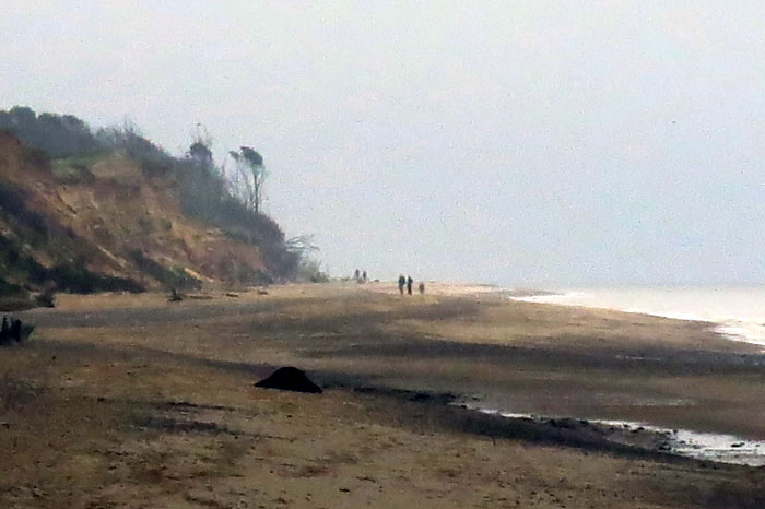
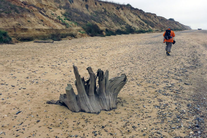
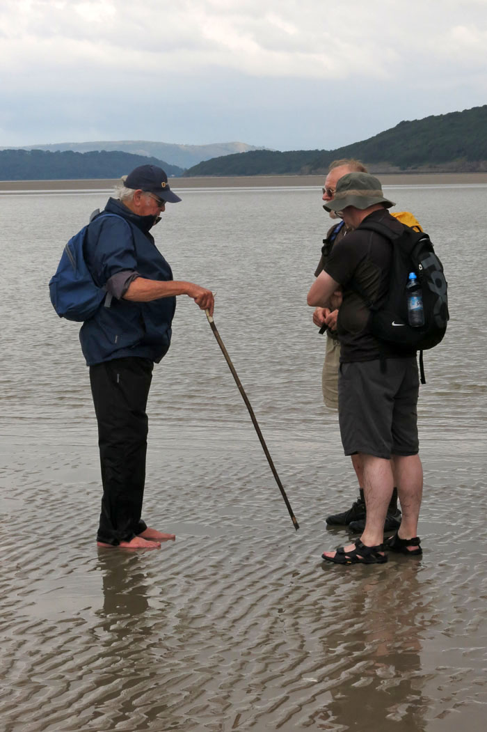
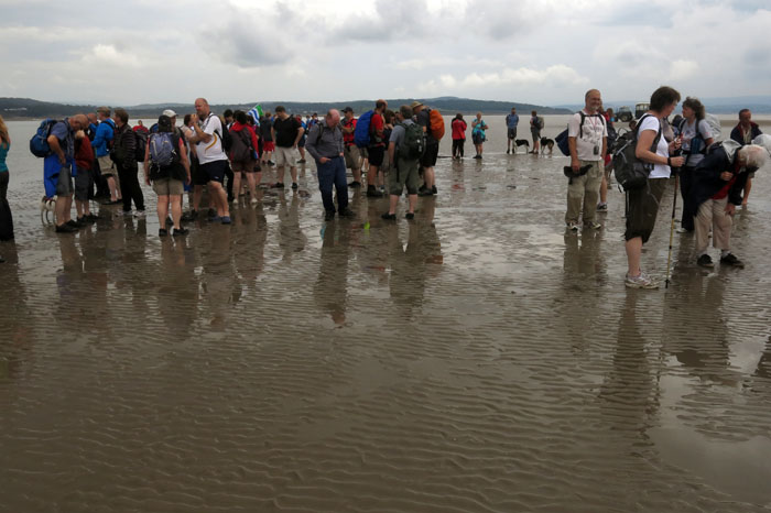
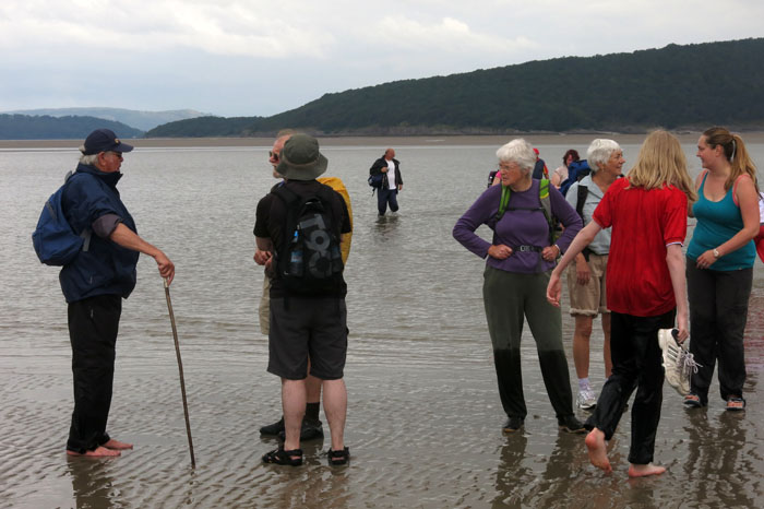
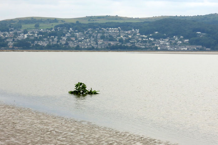
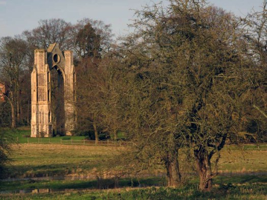
Thankfully, no such sexual shenanigans affronted us on Saturday. In fact, the only other living thing on the beach other than a desultory parliament of herring gulls was a lone figure scrutinising the foreshore for Paleolithic flint hand tools that we were assured sometimes turn up here. The walk’s turning point was probably somewhere in the shadow of Covehithe church, although we could not see its landmark tower from our position on the sand beneath the cliff. Having examined some of the evocative bleached tree stumps that decorate the beach here like Arts Council sculptures, looked at the ever-receding cliffs with their abandoned sand martin burrows and observed a solitary craft out to sea just as Sebald had done, we turned to face south. With Southwold’s low skyline now silhouetted on the brightening horizon we placed the North Sea/German Ocean to our left as we ruminated and slowly ambled our way back to Covehithe’s church within a church. In half a century or so, this may well be gone, a victim of the ferocious erosion that defines this coastline. Covehithe and its church will have vanished forever, living on only in memory and books – a place of legend.

Crossing Morecambe Bay

IMG_0733Of all the footpaths and byways that criss-cross our ancient landscape probably the most enigmatic are those that cannot be mapped because of their very impermanence. Such routes can only be defined by their start and end points rather than the space that lies in between. These conduits of human movement are impermanent in the sense that their course is forever obliged to change with the whims of nature. What is fixed is the historical notion of the route rather than the precise territory that has been traversed. Like shipping routes that must studiously avoid rocks but which have a freer rein in safe channels, footways across tidal estuaries are fluid and everchanging. One celebrated historic route is that which crosses Morecambe Bay on the south Cumbrian coast.

IMG_0757

IMG_0859Men and women have been crossing Morecambe Bay for centuries, millennia even, but the passage has always been fraught with the danger of quicksand and fast-moving incoming tides. The tragedy that befell a group Chinese cockle diggers stranded here a decade ago is still fresh in the national psyche. Caught by the perfidious tide, abandoned by unscrupulous gangmasters, the poor migrants that perished here were caught out by both nature and the greed and indifference of their exploiters.

IMG_0791

While Morecambe Bay’s dangers are apparent enough, there is one man who, given time, can always find a way across between the south and north shores of the bay. Cedric Robinson MBE is the official ‘Queen’s Guide to the Sands of Morecambe Bay’ and receives the princely sum of £15 annually from the Crown (and a virtually rent-free cottage) for performing this duty. Formerly a fisherman and farmer, Cedric is the 25th custodian of the the title having performed the role since 1963. The first official guide was appointed by the Duchy of Lancaster back in the mid 16th century. Prior to this, it was the monks of Cartmel Priory who escorted travellers across the sands. No doubt little has changed in the way that the guides read the landscape – assessing the movement of the sands, the shift of the channels, the whereabouts of treacherous quicksand and the height of the river water. In a grudging nod to modernity, Cedric also has a tractor at his disposal.

IMG_0800

The weather forecast for our crossing from Arnside to Kents Bank was anything but auspicious, with predictions of heavy rain and the threat of the summer storms that had already tormented the south of England making an unwelcome appearance. Come the day though, there seemed to be nothing worse than light drizzle and low cloud.

IMG_0809

Something of the order of one hundred people had assembled at the jetty at Arnside for the 11am start across the bay. Cedric appeared on cue to blow his whistle and lead a colourfully (yet sensibly) clad crocodile of hikers, geocachers, dog-walkers and other outdoorsy types along the high street and past a caravan site before venturing out across the estuary. Leaving dry land behind, the group soon becomes an ambulant community, a walking-talking organism worming its way west across the sands. Crossing is exhilarating rather than a solemn trudge and the next three hours pass quickly as we walk briskly over rippled sand and wade through knee-high through channels of the River Kent, its fresh water surprisingly warm.

IMG_0797

It all seems surprisingly straightfoward, even crossing the river channels where there is a distinct undertow. Such ease of passage is thanks to Cedric who has already been out the previous day weighing up the options and marking the ever-changing route with laurel branches (‘brobs’, cut close to Cedric’s Kents Bank home at Guides Farm) that he has wedged into deep holes crow-barred into the mud. The markers are good for the next couple of days but when Cedric next takes a group out in a fortnight’s time he will need to do the pathfinding and route-marking all over again – nothing is permanent here. In Morecambe Bay the fluidity of time is all-apparent.

IMG_0760

IMG_0806Halfway across, the light rain eases and the sun appears, albeit dimly like a ghostly face through frosted glass. In the distance, a tractor and trailer driven by Cedric’s assistant can be seen on the bank of the River Kent, our first serious wade. The shoreline now seems a distant and untrustworthy illusion, the glimpses of Morecambe seen to the southeast, a phantasmagorical will-o’-the-wisp beyond a hazy threshold to another world. Once across the second of the deeper channels we wait while Cedric does some last minute route-finding, walking some distance towards the houses of Grange-over-Sands on the north shore before returning to give us the all-clear.

IMG_0851

Just before we reach the sheep-grazed marshes that fringe the shoreline, there is a moment of high drama as an area of sand the size of a car wobbles alarmingly like a jelly fish to warn of its danger: unstable quicksand with water beneath that could swallow a horse (indeed, Cedric has actually witnessed such a thing). Even the most maverick among us need no reminding to skirt this and keep moving until we are on firmer ground. A little further on and the scattered buildings of the shoreline assert themselves from behind the trees and we find ourselves climbing up to the platform of Kents Bank railway station. A southbound train is due and after bidding Cedric farewell (and purchasing a ‘Certificate of Crossing’ and a signed copy of his Time and Tide book) we climb on board for the two-stop, ten-minute journey back to Arnside. The train itself is bound for Manchester Airport, an altogether more obvious starting point for journeys to other phantasmagorical worlds that lie beyond the threshold of our imagination.

Walking in Norfolk

51Ym0tIQenL__SY445_

My new Cicerone walking guide, Walking in Norfolk is going to be published in a week or two’s time and so here is a small taster of what to expect. The book contains 40 circular walks in all, and covers all parts of the county from northeast Norfolk to the Waveney Valley to the Fens.

Here’s a bit from the Introduction:

‘Very flat, Norfolk’, asserts Amanda in Noël Coward’s Private Lives, reflecting pretty much the commonly held view of the county: a place, with attitude perhaps (think of its heroes – Horatio Nelson, Thomas Paine, Delia Smith, Stephen Fry…Alan Partridge), but certainly not with altitude. The stereotyped view, although misleading, is understandable enough, as most people have some sort of image of Norfolk even if they have never visited the county. Many will have seen the vast sandy expanse of North Norfolk’s Holkham Beach in films like Shakespeare in Love or TV programmes like Stephen Fry’s Kingdom. Many more will think of boating holidays on the Norfolk Broads, or make associations with the low-lying Fenland region of the far west of the county: aspects of Norfolk, certainly, but not the full picture by any means.

…and here’s a snippet from Walk 10: Burgh St Peter and ‘The Triangle’:

039‘The Triangle’ is a local name that was sometimes used to refer to the parishes of Aldeby, Wheatacre and Burgh St Peter in southeast Norfolk. Bound on two sides by a bend of the River Waveney and on the other by the now-dismantled Beccles to Great Yarmouth railway, the triangle of land so defined has something of the feel of an island to it. There is no through road here, just a quiet single-track lane that links the farmsteads on the marshland edge. To the north, east and south a large flat area of marshes lies between the relatively high land of ‘The Triangle’ and the river itself.

041Burgh St Peter’s Church of St Mary the Virgin is one of Norfolk’s oddest churches as its tower is in the form of a five-section ziggurat (or, as some have fancied, a collapsible square telescope). The body of the church dates from the 13th century but the tower is an 18th-century addition, supposedly inspired by the Italian travels of William Boycott, the rector’s son. A dynasty of Boycotts served the church for a continuous period of 135 years and Charles Cunningham Boycott, the son of the second Boycott rector, gave the term ‘boycott’ to the English language when he behaved badly over absentee rents in Ireland and was socially ostracised as a result.

Orthodox Walsingham

IMG_4535A few months ago whilst travelling in central Serbia I met a nun at Manasija monastery near Despotovac. I was talking with my Serbian friends in the monastery shop when the nun behind the counter, hearing our conversation in English, started to chat with us. It turned out she was Irish, although she sounded Home Counties English to my ears, and had once taught Religious Education at the same school that Princess Diana had attended. The nun, whose name I never learned, was bright and engaging, and keen to hear news of the old country. “Tell me, is Mrs Thatcher still alive? Is it true that she’s gone a bit doolally these days?” I ventured to suggest that the Iron Lady always was quite doolally in my book and she laughed. “And how is the Duke of Edinburgh? He always had a twinkle in his eye. Quite an eye for the ladies, I fancy.”

IMG_4470We went on to talk about Norfolk and she mentioned Dame Julian of Norwich. When I said that I lived less than a mile from her chapel she went quite dewy-eyed before going on to talk about Walsingham and the time she had spent there many years ago. We talked more, about Norwich, about education (“Ah, I could tell you were a teacher”); about how the best books require an input of effort in order to get something back out of them. We also spoke of children’s expectations of instantaneous reward, and about delayed gratification, which I can only suppose,  given the sort of unshakable faith that its adherents generally have, is the essence of what the monastic life is all about.

It was starting to go dark outside and my friends were hovering at the doorway wanting to leave – clearly, it was time to go. I picked up the jars of honey I had bought and bade the nun goodbye. She smiled warmly as I made my exit. “Thank you for bringing me those wonderful memories of Walsingham. I will treasure them. God bless.” It was nice to be appreciated but I never did find out how a well-educated Irishwoman came to be an Orthodox nun in an isolated monastery in the middle of Serbia: I was too polite to ask.

IMG_4525Fast forward to December and I am back in Walsingham myself, researching for a forthcoming book on Norfolk walks that will come out next year. It is a beautifully bright day with a huge sky and green corduroy fields that gleam as spikes of newly emerged winter wheat catch the low-slung mid-winter sun. I walk up the east side of the valley from the village and then descend down to the Stiffkey River before going up the opposite side. At the valley bottom, the river is in flood, its ford almost impassable with the recent deluge. The landscape around here is perhaps Norfolk at its least typical (although some might argue that the nearby village of Great Snoring is quintessentially Norfolk in spirit). Undulating, lush and well-wooded, with discrete valleys and hazy horizons, it reminds me of the Welsh Borders in many ways – something distinctly Celtic, almost Byronic, about its folds and creases.

IMG_4596 I return to Walsingham from the west side of the valley, following a greenway that would  have been one of several pilgrimage routes to the village in the past. The track emerges at the edge of the village alongside the path of an old railway track that in recent years has found new use as a walking route for pilgrims from the Slipper Chapel, a mile away. It was always a tradition to walk this last stretch to Walsingham barefoot – even King Henry VIII once performed this act of humility before returning two decades later to trash the priory during the Dissolution. As I arrive at the track, a group of robed monks are silhouetted as they walk west; walking, quite literally, into the sunset.

IMG_4603Across the track, the original station building still stands next to its redundant platform. But something strange has happened. Now the small red-brick building sports a small silver onion dome with a cross above it: it has found a new life as an Orthodox chapel. Surely it is this humble chapel that my Manasija nun remembers so fondly? This modest converted building is her personal connection with Walsingham. Now, purely by chance, it is also mine.

Winterton-on-Sea, Norfolk

I did a circular walk at Winterton-on-Sea a couple of weeks ago, striking out from the beach car park that looked a little forlorn out of season – largely devoid of vehicles, its wooden hut cafe bolted shut for the winter.

Winterton Dunes immediately north of here is a nature reserve known for its natterjack toads but, this being November, the toad population was in deep amphibian sleep, no doubt dreaming of munching insects in warmer times to come. But, even without the toads, it’s an affecting place – an undulating swathe of sand and gorse, birch trees and heather; a border zone where sea meets land meets sky.  There are other animals to consider as well: over the dunes on the beach grey seals have arrived in number to pup, their sluggish forms slumped awkwardly on the sand – plump, blotchy grey and vulnerable.

At Winterton Ness, where I leave the dunes to venture inland, large concrete blocks flank the track, a reminder that invasion was a constant threat along this coast back in the dark days of World War II. I walk inland along a farm track, through an isolated cattle yard that has leaked several inches of malodorous slurry over the concrete, before heading across fields to walk south. Here, pheasants are so prolific that I soon become immune to the shock of their flying up unnanounced in my wake – an explosive flurry of undersized wings struggling to lift over-the-top plumage clumsily into the air. There are so many pheasants here. This year, they seem almost plague-like.Walking along a lonely concrete road in the general direction of Winterton I come across a man on a bicycle, who dismounts to walk and talk with me awhile. He is a font of local knowledge. According to him, the supersized pheasant population is the result of the local landlord releasing 15,000 chicks into the wild – an awful lot of shooting for even the most enthusiastic rifle-wielder. We talk of other wildlife: the cranes that breed around here, the red deer that rut nearby, the barn owls and hen harriers that quarter the winter marshes. Then, as we approach a corner ahead, he utters, “I won’t walk along here at night on my own. Even the beaters won’t come here at night – and they’re a pretty hard bunch on the whole.” Before I have time to ask why, he answers for me, “It’s haunted, and so is the house by the corner.”The man with the bike starts to relate a story about a local who lived around here a couple of centures ago. Like many along this eastern extremity of the Norfolk coast, he was given to  smuggling and shipwrecking but this particularly unpleasant individual was also reknowned for his cruelty to women and his wraith – a cold, shadowy presence that is said to follow anyone foolish enough to wander around here at night – still haunts this stretch of the road.

We go on to discuss Winterton’s shipwrecking tradition and reputation for lawlessness that persists to this day (“The Yarmouth police don’t want to know about any trouble here, although they’ll come to Horsey just up the road”).  Then, as soon as we turn the corner, he bids me goodbye and disappears into the garden of a roadside cottage – the same one he had said was haunted.

Back at the beach car park, a couple of dog-walkers catching the last hour of silvery daylight eye me (conspicuously dog-less) with suspicion. In north-east Norfolk if you don’t have a furry friend with you then you are probably up to no good. If it’s the liminal hour just before dark then you almost certainly are.

A Bend of the Coast

Late July. It is the hottest day of the year and recent deluges are quickly forgotten as the earth bakes beneath a cloudless sky. North Norfolk’s pristine air glows with the sharp blue light that seems only to be found close to the coast – a light that bears the reflected promise of the sea just beyond. The notion is to celebrate my birthday with a circular walk that takes in the curve of the county at its northwest extremity: that charmed stretch of sand, marsh and hinterland chalk that curves west to south between Holme-next-the-Sea and Hunstanton.

I set out from Old Hunstanton at St Mary’s Church on the fringe of the Le Strange estate, a curious feudal relic of Norman patronage that historically even has possession over the seashore as far as Holme-next-the-Sea, the incumbent bearing the complimentary title of ‘Lord High Admiral of the Wash’ and the limit of the estate boundary traditionally measured by a spear thrown into the Wash from horseback at low tide.  I circumnavigate the dense woodland of Hunstanton Park before heading south along a track marked by a sign that calls it Lovers’ Lane. But there are no lovers today, just me, and it is not really a lane as we tend to know them either, more a greenway enclosed by hedges and tall stands of nettles, one of the less pleasant by-products (along with more than usually plentiful mosquitoes) of this unseasonably wet summer.

A mile or so later, following a short interlude along tractor-rutted farm-tracks, I climb gently up to a point where I can see the evocative ruin of St Andrew’s Chapel across the fields. Dropping down again, I soon reach the eastern end of Ringstead Downs. A large chalk-built barn and stark white cliff face serve as a reminder that this corner of the county is where the underlying chalk comes right to the surface. This, terminating in the striated chalk and carstone cliffs of Old Hunstanton, is the northern end of a seam of chalk that cuts diagonally southwest to northeast through southern England – the geological marker of the miscellany of paths that once constituted the Icknield Way. Chalk generally brings a gift of rich flora and Ringstead Downs, a shallow valley with the scarp slope on its northern side, does not disappoint. Thyme, eyebright, vervain, centaury and the charmingly named squinancywort are all to be found here: jewel-like miniatures that embroider the grass with pointillist spikes of colour. It’s humid and warm – a chalk valley microclimate; microscopic storm flies find their way through hair to scalp. There’s no breeze and little extraneous noise other than the summery coo of pigeons in the trees and the well-nourished buzz of satiated bees. Butterflies sip nectar; a buzzard swoops before flying off into the woods that flank the down’s eastern limit; a group of peahens – hardly native – screech alarmingly as they waddle for cover in the trees.

Ringstead village, a roadside strip of neat carstone and chalk cottages, is almost as silent apart from a few muffled voices emanating from the pub garden and the sudden scream of a dozen swifts plundering the sky overhead. From here, it is a plod along quiet country roads to reach the coast. Barely a car passes, just a man on a bicycle with panniers who bids me ‘Good afternoon’. Afternoon? Already? The road runs mostly parallel to the coastline, the sea out of sight but with long views over the valley to the south with its harvested cornfields and sparse green hedgerows.

This corner of Norfolk flaunts its geology quietly but confidently: the gently contoured topography, the chalk and sandstone of village vernacular. There are more discrete clues to a glacial past too: just below the road lies Bluestone Farm, a name undoubtedly adopted because of the presence of glacial erratics (‘blue stones’) hereabouts – northern rocks carried here by ice and unceremoniously dumped like strangers in a strange land.

As the road climbs to its highest point – a lofty (for Norfolk) 50 metres – the coast comes abruptly  into sight: a blue salt-haze with a large wind farm on the horizon, turbines spinning slowly as if doing their bit to keep the world turning. Thornham village is but a short walk downhill. Once considered to be a ‘smuggling village’, the village is now largely a smart enclave of expensive 4x4s and wealthy folk ‘up from London’. Thornham is undeniably attractive: set just back from the coast, separated from it by bird-rich marshes, its brown carstone cottages look as if they are made from gingerbread, good enough to eat.

The coastal path crosses the marshes to reach a staithe before following the line of sea defences all the way west to Holme-next-the-Sea. At Thornham Staithe, and later at Holme, the busy car park exerts a curious gravitational effect that seems to prevent the majority of its visitors ever breaking much beyond its orbit: home, car, car park, beach, picnic, swim, car park, car, home. Nothing wrong with that of course, it allows the rest of us  to have the paths to ourselves most of the time. A boarded walkway leads over the top of the dunes to reach the beach at Holme-next-the-Sea, then briefly plummets through the deep shade of pines at the bird reserve before continuing between beach and marshes as the coast tips southwards towards Hunstanton. Pipits rise in alarm from the path in my wake; pyramidal orchids, slightly past their best, dot the sandy hollows in magenta clusters; yellow ragwort is everywhere.

Approaching Old Hunstanton the coastal path follows the line of shingle between the dunes and a golf course. The buildings of Old Hunstanton eventually become distinguishable on the cliffs ahead.  Finally, beach huts in the dunes announce the outskirts of town, where a track leads up past the Le Strange Arms Hotel to the main coast road. My coastal circuit – less a circle, more a wobbly ellipse – is complete.

Orford Ness

Walking, whether rambling or hiking in the countryside, or the unplanned urban exploration of a would-be flâneur’s dérive – call it what you will – seems to be the hippest new literary genre. Often found cosily in tandem with what can only be described as ‘the new nature writing’, the genre undoubtedly has its stars. High in that firmament is Robert Macfarlane.

Almost everywhere you look in the literate media these days, Macfarlane’s name seems to crop up. As well it might, as his new book The Old Ways has instantly and deservedly become a best seller. Having already been lauded in features in the Guardian and suchlike, The Big Issue has this week also seized the opportunity to echo the zeitgeist and published a feature on Macfarlane taking a walk in the company of fellow writer and bipedalism enthusiast, the sardonic (and sesquipedalian) pavement-plodder Will Self.  The desired result: an interesting combination of styles and focii in which rural meets urban, wild nature confronts man-tamed landscape, and literary topography melds with psychogeography.  Given such a brief, it seems almost odd that the Psychogeographer General, Iain Sinclair, landscape ombudsman extraordinaire, wasn’t invited along for the stroll. There again, three is a crowd, and Sinclair was no doubt already busy enough with the Sisyphean task of hurling word-bombs of withering allusive prose at the perimeter fence of the Stratford 2012 Olympics site.

The Big Issue walk – delightfully, if almost predictably – took place along the crumbling Suffolk coast, the mysterious region between Bawdsey and Orford Ness, a coastline rich with legend and secret histories: a luminous landscape of shingle, rare birds and nuclear power stations where the mud itself murmurs of UFO sightings, secret weapons testing, silted estuaries, lost ports and sea-claimed monasteries – the most distinctly ‘Here be Dragons’ patch on the East Anglian map. Pleasingly, the Will and Rob walk also took in some of the territory I have described in my own humble walking guide to the Suffolk coast: Suffolk Coast and Heaths: Three Long-distance Walks in the AONB, available from all good book shops and even a few bad ones.

The Macfarlane-Self walk concluded at the lighthouse on Orford Ness, the mysterious island-like shingle spit that stretches south from Aldeburgh. Orford Ness is bypassed by the Suffolk Coast Path but it does feature in Slow Norfolk and Suffolk, another book of mine that hurrahs the Suffolk coastline. Here’s a brief extract:

If you are not at Orford Quay for sailing, your eyes will no doubt be drawn across the water to Orford Ness, which exudes an air of mystery typical of places associated with forbidden territory. From 1913 to the mid 1980s, the spit was firmly closed to the public, a top secret, no-go area dedicated to military testing and radar research. The links with its secret past are part of its appeal; otherwise, it’s undeniable that Orford Ness is quite a remarkable bit of geography.

Though hardly pretty, this long shingle spit is undoubtedly evocative. Signs warn about unexploded ordinance, and everywhere you’ll see tangles of tortured metal and wire netting among the teasels in the shingle. Overall, it’s a rather melancholy landscape and you might begin to wonder if Orford Ness should actually be ‘orfordness’, a state of mind, rather than the name of a wayward landform.

Seen from Orford Quay, Orford Ness has the appearance of being an island, and the ferry trip across the River Ore simply adds to this impression, but it’s not – it’s actually a long sand spit that begins just south of Aldeburgh and gradually widens as it follows the coast south. It is the largest shingle spit in England (nearly ten miles long) and it is only when you disembark at the jetty that you can really appreciate the scale of the place. The National Trust has a number of recommended way-marked routes to follow but the reality is that you won’t see much unless you are prepared to walk some distance. Concrete roads lead around the spit and you have to trudge along these some way before you get to see anything of much interest. Bicycles are not permitted.


And yes, that is the Orford lighthouse on the East of Elveden gravatar

The Tarka Trail

There’s a walk through Norwich’s western edgeland that Jackie and I must have done a hundred times. It begins close to a supermarket at Eaton, Norwich’s wealthy southern suburb, and follows the bank of the meandering River Yare upstream towards the broad at the University of East Anglia before the river veers west towards its central Norfolk source. A peaceful walk, frequented by just the odd suburban dog-walker and jogger, it is the epitome of the countryside in the city or, rather, its leafy urban fringe. Drooping willows frame the water, small fish swim, birds tweet in the bushes and reedbeds; herons and kingfishers are regularly sighted along the river. The houses on the opposite bank, with their expansive back gardens and private river frontage, give rise to occasional bouts of envy but on the whole we are simply happy to have the opportunity to walk somewhere like this so close to home.

From the car park where the walk begins, a path leads to the river next to the medieval bridge that once marked the principal route into Norwich from the south. There is an attractive white wooden mill house here, a gushing weir and a NO FISHING sign. The path follows the river under a flyover that carries the bulk of traffic into the city these days – at weekends, a constant buzz of cars speeding into Norwich for retail therapy. Compared to the fine curves and warm sandstone of the nearby bridge, this has all the charm of a multi-storey car park: quotidian concrete and murky, permanently shaded water sheltering that ubiquitous creature of the urban waterway – a supermarket shopping trolley. A Ballardian microcosm, this edgeland non-place provokes an interruption in the pastoral flow of the walk; a frontier to be crossed (or underpassed) before continuing along the riverbank beyond. The smooth round pillars that hold up the flyover are splattered with spray-can ciphers – warnings and portents perhaps? A couple spell out ANARCHY, or words to that effect. Another graffito, more considered, pronounces HAPPINESS DOES NOT HAVE A BAR-CODE.

On Monday, our walk took an unexpected and delightful turn when we spotted a solitary otter at the mill pond near the bridge. Oblivious to the sign prohibiting fishing, the animal was busy hunting – diving and then resurfacing with just its head showing above the water like a small sleek Labrador. We knew that otters were frequently seen in the area by early-worm fishermen but we had never seen one here ourselves. This time, we were privileged. We watched in silence as the animal worked its way along the water’s edge, shaking the reeds at their base and leaving tell-tale trails of bubbles as it swam underwater. It eventually disappeared somewhere near the weir, just before the flyover, and we remarked on how lucky we had been to have had such a good view.

Five minutes later, I was just about to say something sagacious like, ‘It could be a year before we see one again’, when another otter –  probably the same, earlier one displaced further upstream – surfaced beneath a drooping willow. The animal progressed through the reeds at the river’s edge for some time before swimming to the opposite bank, foraging there awhile before returning midstream to dive once more with an effortless flex of its back. We followed it upstream for a full half hour, the otter hyperactive for most of the time – diving for fish, snuffling through vegetation, occasionally sneaking a look back at the two humans and one small dog that were politely in pursuit. We drew so close that we could hear teeth crunching bone as the animal munched the fish it had caught, the otter’s noisy chewing just one aural ingredient in a soundscape that included other familiar echos of the urban fringe in May: small birds chirruping, an overenthusiastic cuckoo (the first heard of the year), chiffchaffs chiff-chaffing, a background thrum of cars on the flyover and the distant eye-ore of the Cambridge train’s air-horn.

We lost track of the otter somewhere in the wider stretch of the river that leads to UEA Broad. It did not matter: our unexpected encounter had been far in excess of anything than we might have hoped for. It didn’t even matter that I did not have my camera with me: if anything, it was liberating to simply observe without the nagging distraction of having to keep a digital record.

Walking back to the car park, I made a short diversion back to the bridge on the off chance that the animal had returned there. No sign. Turning to leave, a metallic blue bullet flashed close to the water and darted beneath the arch of the medieval bridge: a kingfisher, often spotted here but hitherto unseen on this red letter day for wildlife. Happiness does not have a bar-code. True enough.

Hotel Titanic, Nagorno-Karabakh

With only the forthcoming Jubilympics stealing more media thunder so far this year, it has been nigh on impossible to ignore the fact that April 2012 marks the centenary of the sinking of a certain trans-Atlantic passenger liner. One hundred years ago this month, RMS Titanic, a vessel considered virtually unsinkable, disappeared beneath the North Atlantic’s icy waters on its maiden voyage, along with most of its crew and lower class passengers. The cause of this tragic event was seemingly the combined effect of hubris and a sneaky, yet massive, iceberg.

What does this have to do with a little-known corner of the Caucasus? Well, it is partly connected with the sense of irony so readily displayed in the post-Soviet territories of the Caucasus region. I remember spotting a restaurant on my first visit to Baku that was called, of all things, ‘Lady Diana’ (smallish helpings presumably) but even this pales into insignificance when compared to a hotel I once stayed at in the unrecognised territory of Nagorno-Karabakh.

Nagorno-Karabakh, formerly part of Azerbaijan, now a de facto independent state (but only recognised by three fellow non-UN states – Abkhazia, South Ossetia and Transnistria), is a very odd place – and a sad place too, with visible traces of war damage almost everywhere. Given the state’s poverty, isolation and lack of infrastructure it might seem surprising to come across a hotel of any description in a small village, let alone one called ‘The Titanic’, but the small lumber village of Vank in northern Nagorno-Karabakh not only has a guest house that answers that description but also one that is actually built in the form of a ship.

The Titanic Hotel – officially Hotel Eclectica but everyone seems to calls it ‘Titanik’ and that is what it said on my restaurant receipt – is a striking edifice built in the form of a ship. This brick-built simulacrum even goes as far as having port-holes for some of its windows. In front of it stands a small swimming pool (no icebergs!) that must, almost certainly, be the only one in all of northern Nagorno-Karabakh. The hotel must be a thoroughly disturbing phenomenon to come across out here in the boondocks if you were not expecting to find it; it’s an arresting enough sight even when anticipated.

The Hotel Eclectica/Titanic is one of the most surreal sites you are ever likely to see but the village is the oddest of places too. Vank is the birthplace of a Moscow millionaire lumber baron called Levon Hayrapetyan who as well as asphalting the 12km-long road to the village has ploughed plenty of money back into his home village, building a school, a lumber mill and this highly incongruous hotel. Part of Hayrapetyan’s vision for the village of his birth is to develop tourism in the area, hence the hotel. It seems a long shot considering its isolation and the fact that Nagorno-Karabakh is the remnant of a frozen conflict and officially does not even exist. Technically speaking, Nagorno-Karabakh still belongs to Azerbaijan, although virtually all ethnic Azeris have left since the bloody conflict of the 1990s.

I spent a few days in Nagorno-Karabakh back in 2008, having first obtained a visa in Yerevan, the Armenian capital. The colourful ‘visa’, which I took the precaution of not sticking into my passport, was hardly glanced at when I arrived at the border post in the crowded marshrutka that plies daily between Yerevan and the Nagorno-Karabakh capital Stepanakert.  After a couple of days in Stepanakert – a bit of a threadbare Soviet theme park without really trying to be – I took another marshrutka to Vank for an overnight stay.

The village lies deep in a wooded valley with wispy strands of low clouds kissing the nearby hills, atop one of which stands the mysterious Gandzasar Monastery. I managed to get a room at the Titanic, although they didn’t really seem very keen on having a lone foreigner like me stay, perhaps disbelieving that I might seriously want to spend the night there. After paying 7,000 Armenian drams ($20) and leaving my bag I walked up the neatly tarmaced road to the monastery on the hill, which was swathed in mist so thick that it was impossible to see the church until the very last minute of ascent. In the monastery grounds I encountered a friendly trio of chain-smoking Armenian men but, after we had posed for group photographs together and they had sped off down the hill in their Lada, I was completely alone once more – the resident monks were either absent or keeping a very low profile. Not quite alone though. Mooching around, I noticed a small curved-beaked bird poking around on the stone of the gable. A sparrow? No, a wallcreeper – an exotic-looking mountain bird more at home on isolated cliff faces than the stone walls of churches. Perhaps, like me, it had become disoriented by the swirling mist that flanked the monastery like the overenthusiastic use of dry ice in a Hammer Horror production?

Later, walking up out of the village through lovely wooded countryside along a section of the long-distance Janapar Trail I came across a few more locals: friendly Armenian women at a village kiosk who wanted me to take their photograph and another villager who beckoned me into his garden to drink vodka with him. Less welcoming though, was the policeman who gruffly insisted on seeing my dokumenti. As he was dressed in civilian clothes I countered by asking to see his identification, which pissed him off a bit but made his friend roar out loud with laughter. I stood my ground and soon the policeman just walked off in a huff trailed by his still giggling accomplice.

By the time I got back to the hotel late afternoon the place had been virtually taken over by a wedding party and so things had become pretty chaotic. Nevertheless, I was hungry. The hotel’s ‘Van Gogh’ restaurant had a Chinese couple working there (who knows how they found their way here to Vank?), which might have been a good sign, although it seemed they were only capable of providing food for themselves and pre-ordered wedding feasts. Eventually, after much negotiation and shaking of heads, I managed to order an overpriced plate of barbecued mutton, which arrived after a full hour’s wait accompanied by a huge dish of fresh coriander.

One night was enough. I caught the early morning marshrutka back to Stepanakert the next day. Among the suspicious faces that turned my way when I took my seat was the policeman from the previous day. This time he was in uniform – quite high-ranking it would seem judging by the pips on his lapel. He didn’t bother asking for my passport this time.

Postscript: I am aware that Vank is not the only place in the world with a Titanic Hotel. There’s also a luxury beach hotel resort called Titanic in Antalya in Turkey, another beach resort in Hurghada, Egypt, a business hotel in Istanbul and others in Albania, Vietnam and Poland. You would be hard pushed to find this particular one on TripAdvisor though. The Hotel Titanic, Vank, Nagorno-Karabakh is not only a very odd place to stay, it is the Caucasus region’s very own Fawlty Towers.

For those interested in finding out more about the long-distance Janapar Trail you can look at my feature for Walk magazine here – the title Global Walk: Azerbaijan was not my idea.

A River Wensum Walk

Early April in Norwich. It’s cool but the sky is blue and daffodils are glistening in Wordsworthian tribute to the bright spring sunshine. What better then than a morning stroll through the city along the banks of the River Wensum?

Like many cities – even London – these days, Norwich has largely turned its back on the river that runs through its centre. Once essential for transport and industry, the River Wensum that meanders through the city now seems to have little use other than as a backdrop for attractive new riverside apartments. Look a little closer though and you will still find plenty of reminders of Norwich’s medieval past along its course.

Hard to imagine now, but Norwich once held second city status in England and the banks of the River Wensum that dissect the city are still littered with traces of that period – medieval churches, priories, old bridges and defensive walls – as well as reminders of the city’s half-hearted dabble with Victorian industrialisation.

We begin our walk on St Benedict’s Street at St Lawrence’s Church. From the alley at the side of the church’s western gable you can see a little stone plaque set in the flint that depicts St Lawrence strapped to a grid iron, the means of his subsequent martyrdom. Understandably, he doesn’t look too happy about this but is blissfully unaware (well, perhaps not blissfully) that he will go on to become one of the earliest Christian martyr saints; indeed, the patron saint of comedians and chefs no less (and butchers and librarians too, apparently).

Descending the steps to cross Westlegate we pass the swish apartment block that in a previous incarnation used to be the Anchor Brewery. An enormous brick chimney once scraped the sky here – I still have a black and white photograph of it somewhere. As recently as thirty years ago Norwich used to be redolent of malt and hops (and chocolate too, from Rowntree’s, now Chapefield Shopping Centre) but its source did not originate from here as the Bullards brewery closed back in the 1960s.

We cross Coslany Bridge over the Wensum and  follow the pedestrian access along the river’s north bank. Across the water stands the disused warehouse where the entire text of Thomas Moore’s Utopia is scrawled in white paint across the brickwork as if it were the work of a hyperactive 16th-century graffitti artist with a taste for political philosophy.

Crossing Duke Street by means of Dukes Palace Bridge, a brief detour via Colegate is necessary in order to reach Blackfriars Bridge by the Norwich School of Art before we arrive at Fye Bridge and Fishergate. Whitefriars Bridge comes next and the eponymous friary once stood on the site of the large edifice that looms before us: the Jarrolds Printing Works, built n 1834 and formerly a mill owned by the Norwich Yarn Company – a tall stately bulding with brickwork elegantly draped with Virginia Creeper and wisteria. Looking back, the clocktower on Norwich City Hall, which to my mind resembles a cut-price Marrakech minaret, rises into view beyond the weeping willows, newly in leaf, that sway dreamily over the torpid water beneath.

Beyond the printing works, a renga – a word map created by means of an ancient Japanese tradition of shared writing – strings a snake of words and phrases along green hoardings beside the river. A Renga for St James was created here on site in 2009 and utilises the local Norwich vernacular and reference points. Someone – a well-educated graffitist, who clearly understands the renga ethos – has scrawled ‘Perfidious’ above the word ‘Albion’, which in this instance refers to one of the few remaining wherries that used to ply East Anglia’s rivers.

Continuing east the new bridge soon comes into sight. Peter’s Bridge, named after a former Jarrold’s chairman, has only been open a few months and, surprisingly, not a lot of people seem to know about it. Most of the Wensum’s bridges are so ancient that they are firmly embedded in the city’s psyche but there have been three new footbridges so far this millennium: this one, the 2009 Lady Julian Bridge close to the railway station, and the Novi Sad Friendship Bridge, opened by the Yugoslav ambassador in 2001, near Carrow Bridge (ironic, then, that NATO bombed and destroyed the far more substantial and economically important bridges of Norwich’s twinned Serbian city just two years earlier).

 Walking across this graceful, J (for Jarrold’s)-shaped footbridge, our riverside walk continues past Cow Tower towards Pull’s Ferry but before reaching this we pass what looks like a sluice leading into the river. This is, in fact, a rare 18th-century example of a swan pit, a tidal pool in which wild cygnets were kept and fattened for the table after having their wings clipped and beaks marked by their owners.

At Bishops Bridge, we leave the river behind to head for Cathedral Close and Tombland. A place called ‘Tombland’ next to a great church might reasonably be expected to be a place of the dead. But no, Tombland is Old English for ’empty land’ and this was the site of Norwich’s Anglo-Saxon market before the Normans came and shifted it to its present position next to St Peter Mancroft Church. Norwich Market has been operating there for over 900 years now and is still going strong, six days a week. Mind you, it did have a bit of an overhaul a few years back.