Of Whales and Ancestors: Ostend, Norfolk

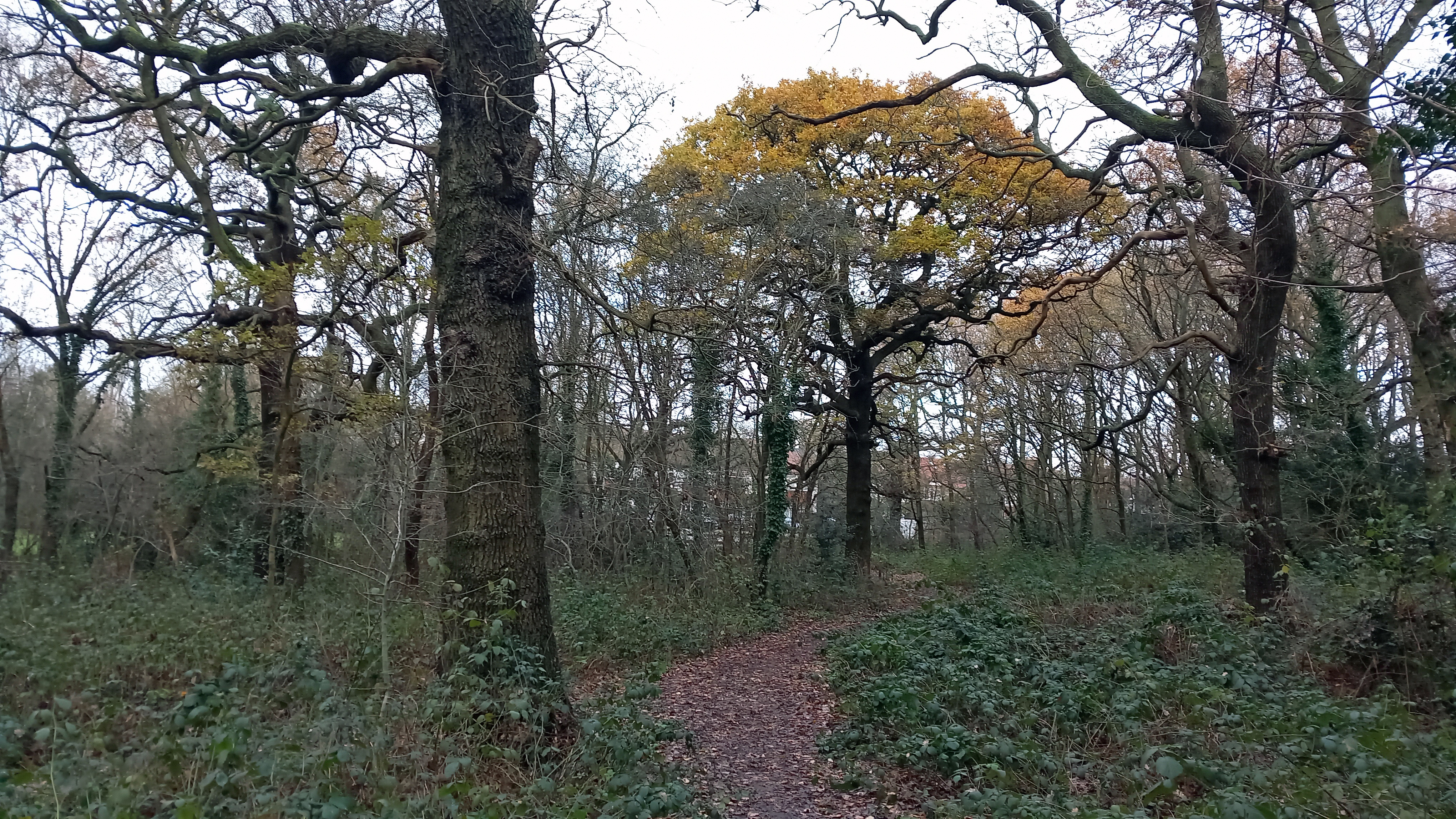
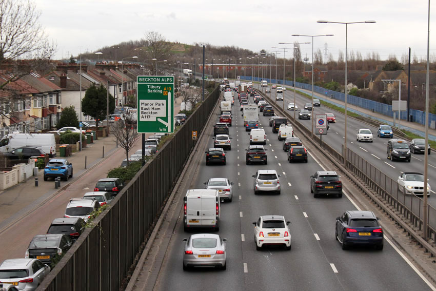
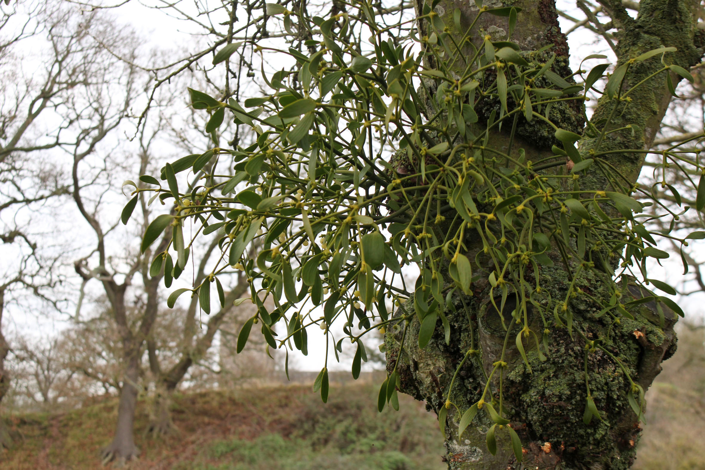
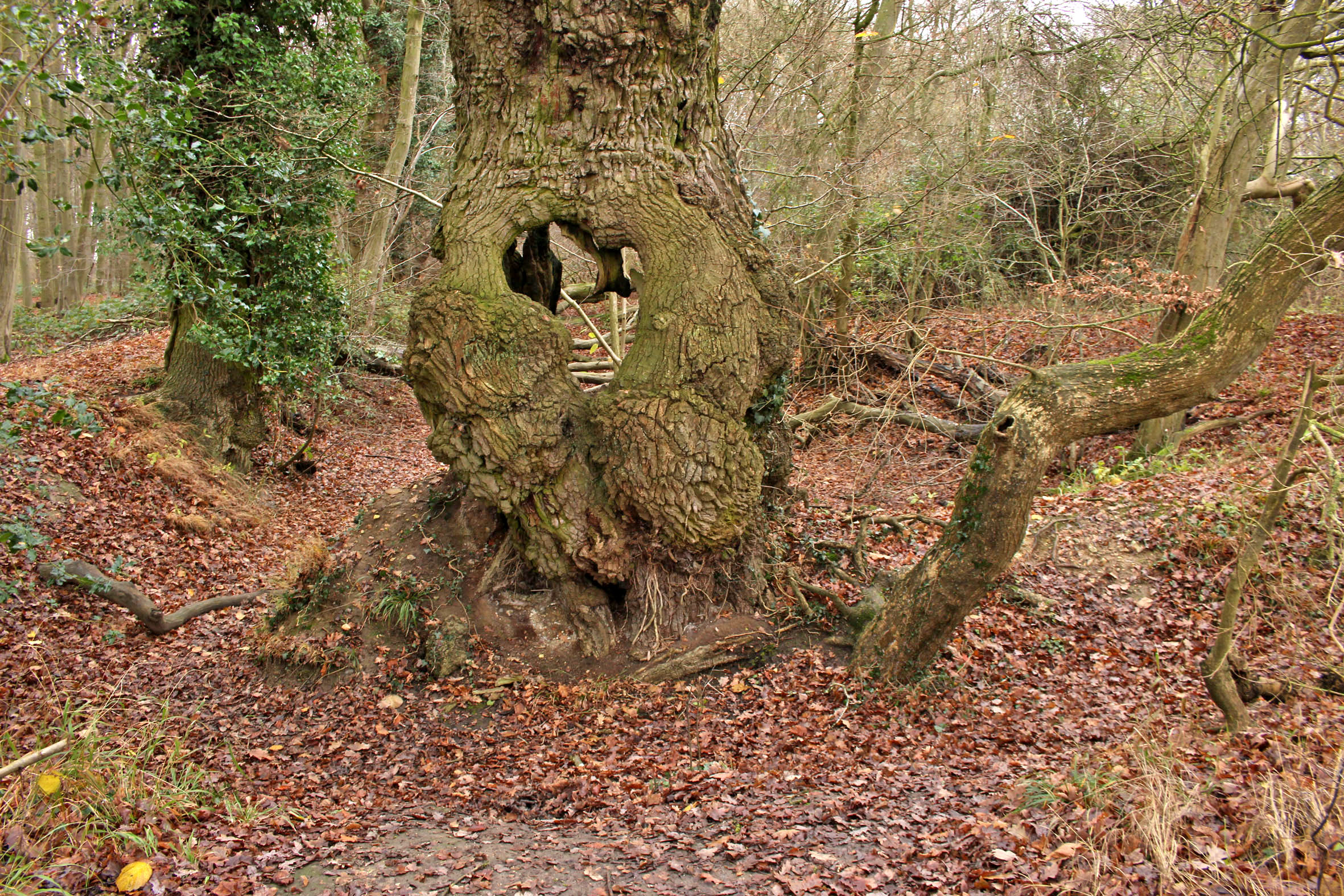
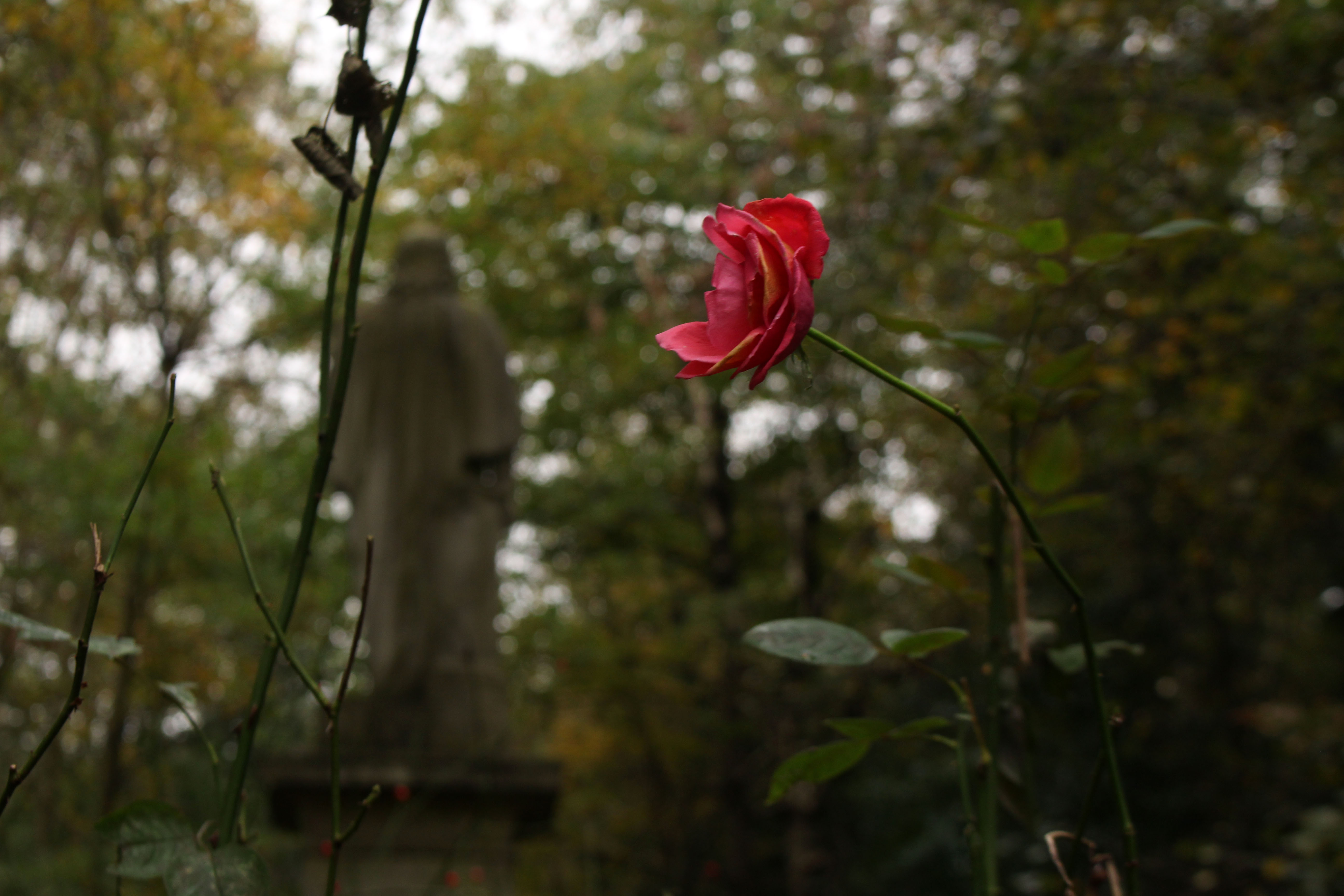
The very mention of the village of Happisburgh in Norfolk brings to mind all manner of prehistoric associations and connections with long-extinct ancestors. The early years of this current century have revealed exciting local evidence of the presence of earliest hominins in northwest Europe: Homo antecessor (‘Pioneer Man’) – near million-year-old clues in the form of flint tools and muddy footprints. Early humans walked these shores in the early Pleistocene, except it wasn’t so much a shore then as a river estuary: the Thames in an earlier incarnation when it flowed further north than its current course. Political boundaries were yet to exist, 800,000 years ago; the land mass that was Britain was still connected to Eurasia.

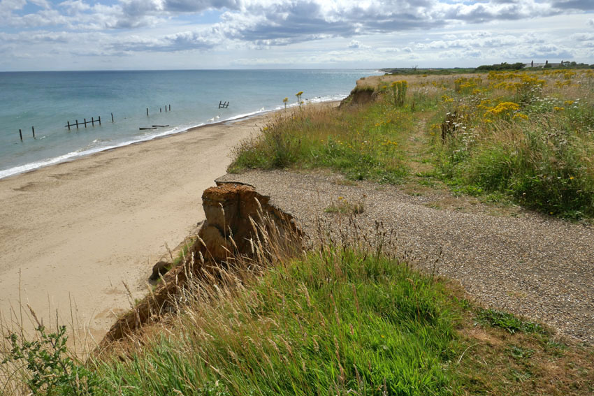
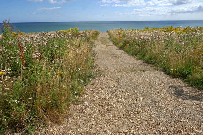
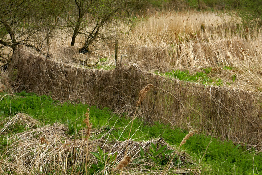
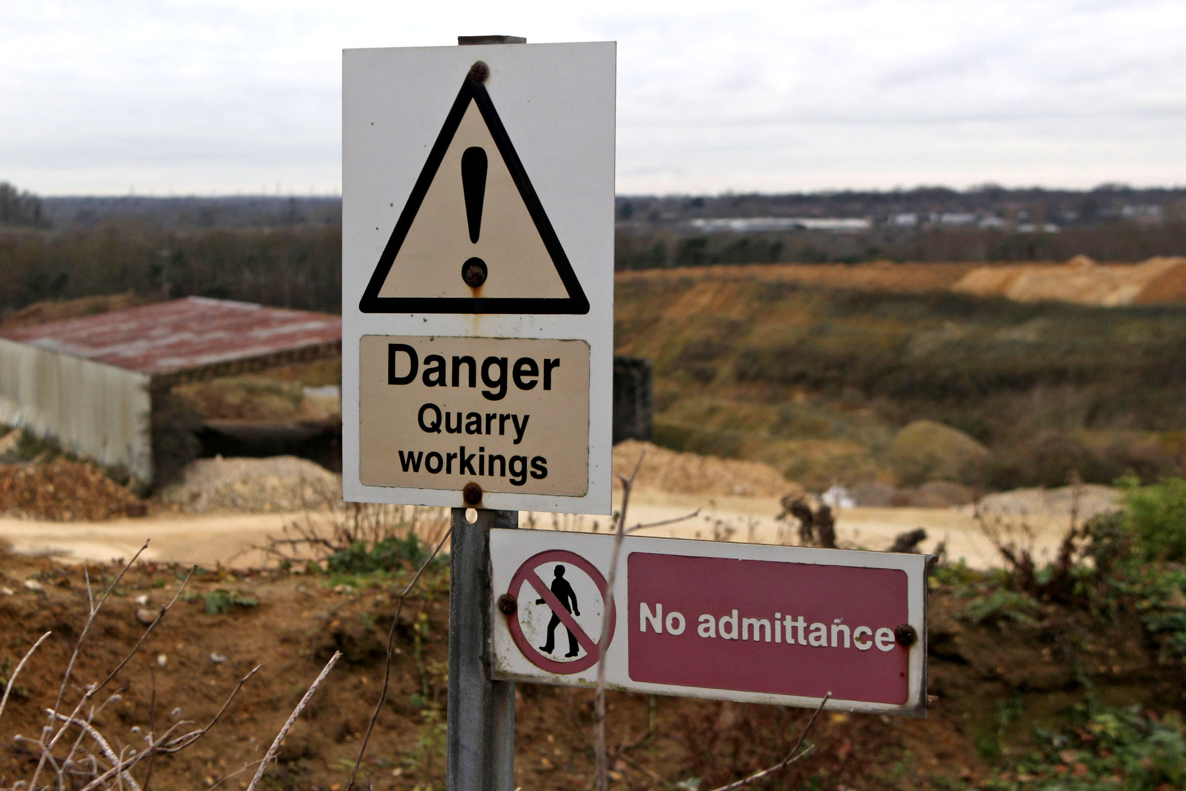
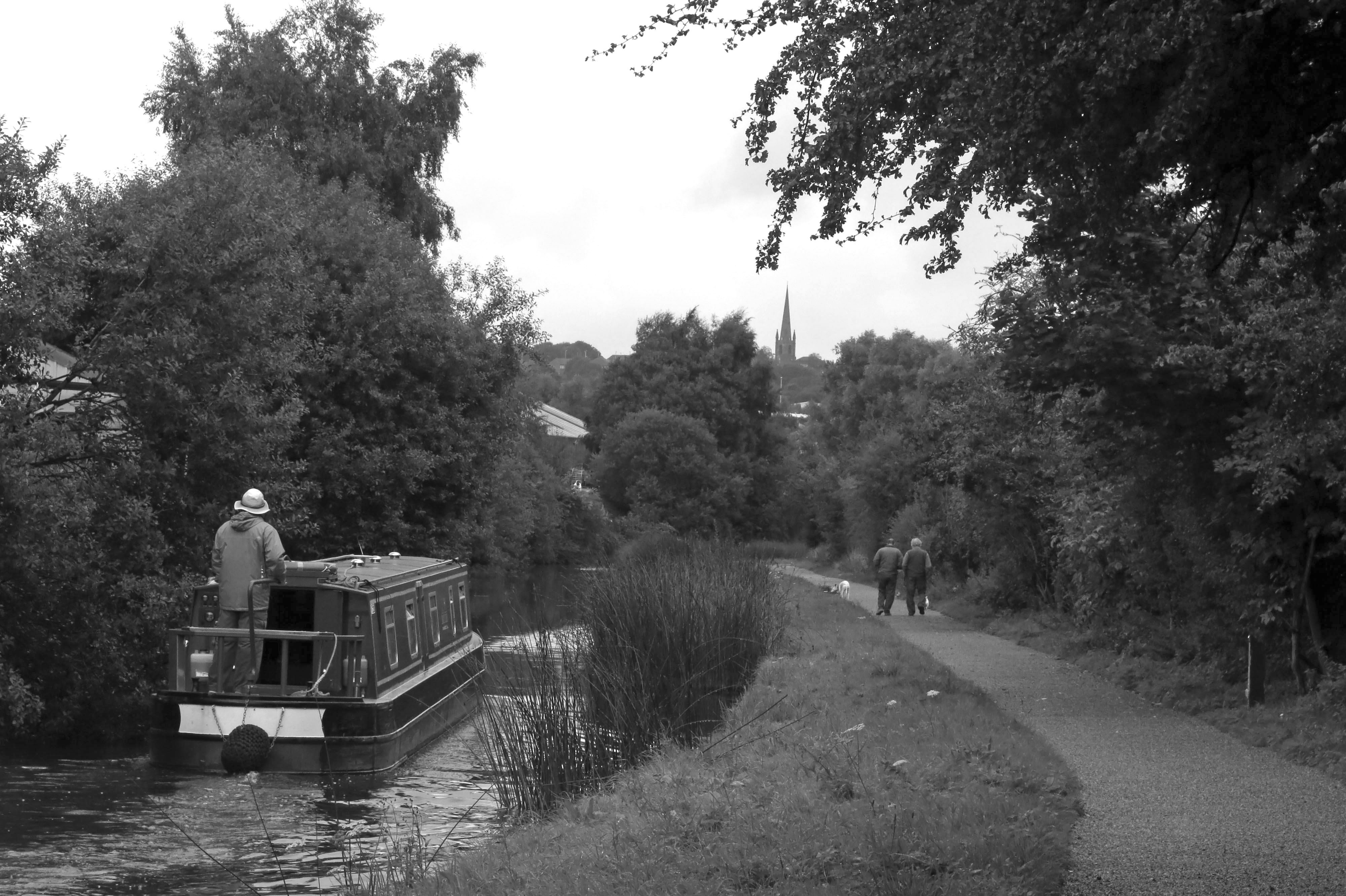
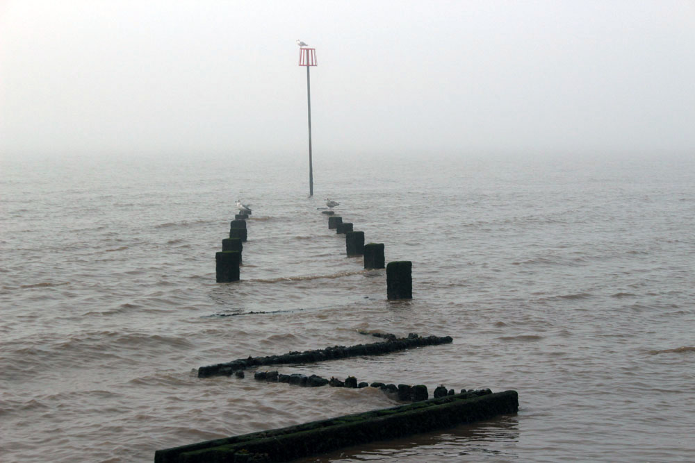
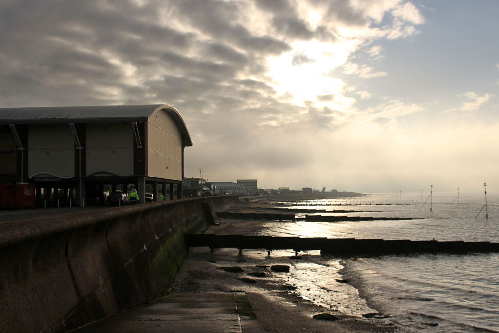
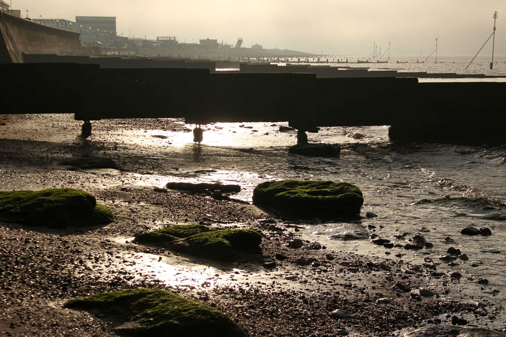
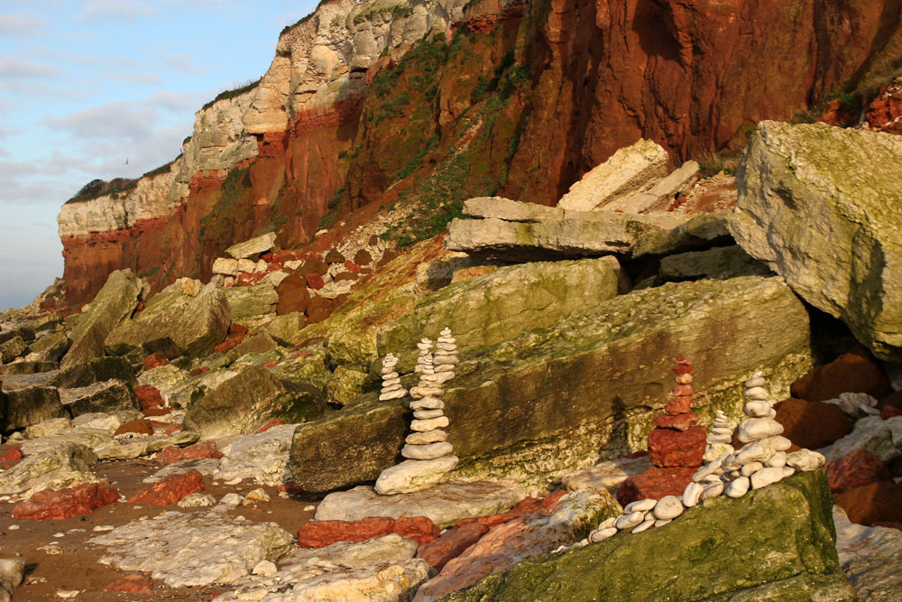
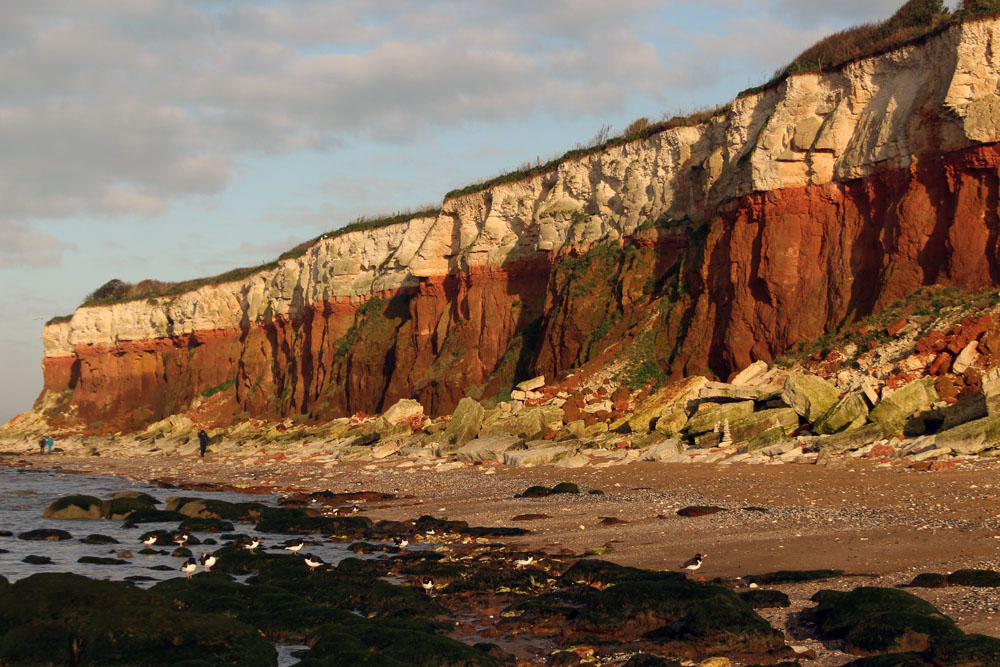
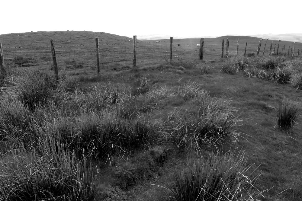
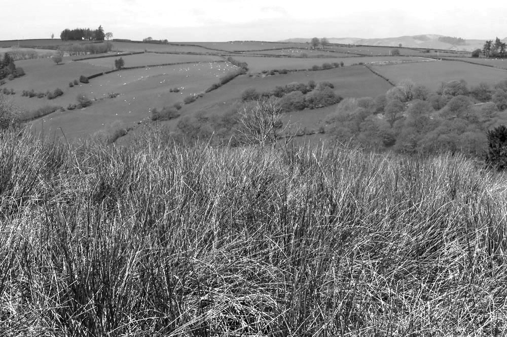
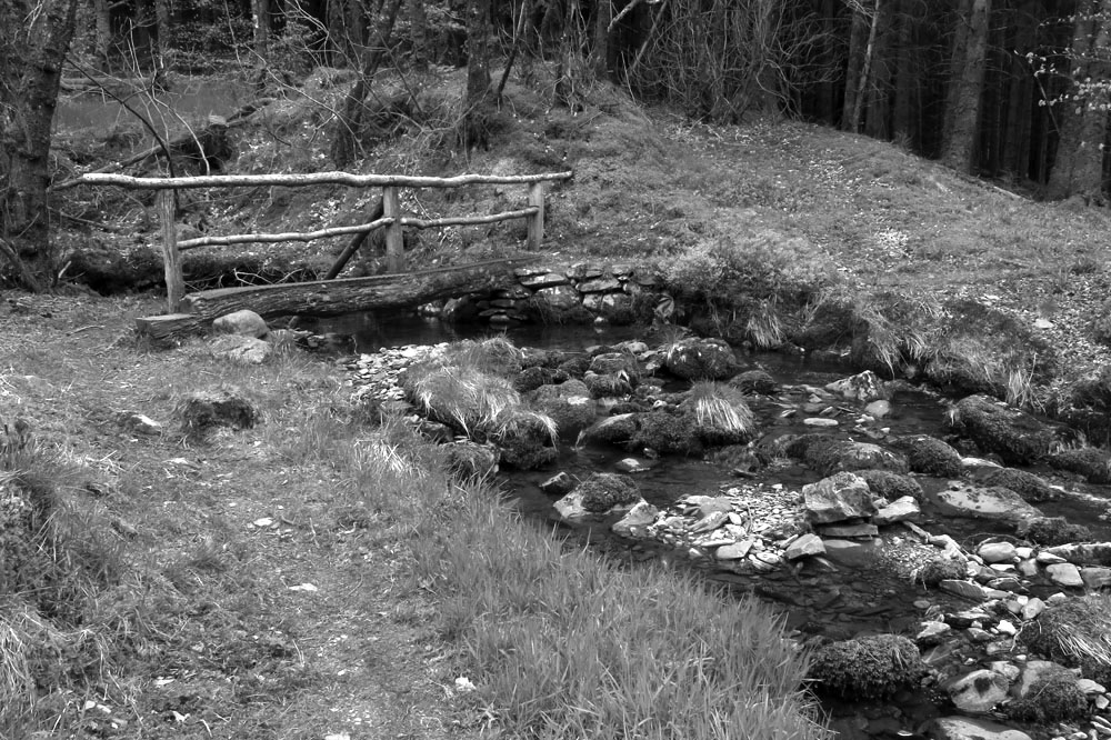
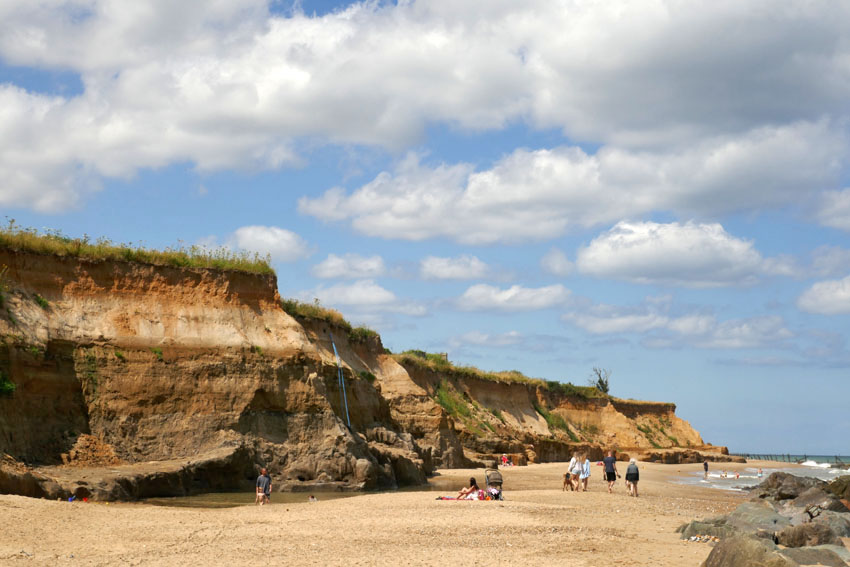
Prehistory aside, Happisburgh (pronounced ‘Haze-bruh’ to those who know) is also well known for other reasons. Its fame precedes it, although notoriety might be a better term. Nowhere on this coastline is the menace of coastal erosion witnessed more emphatically, although the near-vanished village of Dunwich on the Suffolk coast, once a thriving medieval port, might come close. For Dunwich the damage wreaked by the ever-invading North Sea is the past; in Happisburgh it is the present and future. Continually losing territory to the North Sea, there is visible evidence of the dynamic shifting shoreline to be seen everywhere here. Cliffs can be witnessed crumbling on a regular basis. Houses that were once located comfortably inland now perch perilously close to cliff edges; some have already succumbed and their remains litter the beach. Roads and tracks can be seen dramatically truncated along the cliff edge – streets that have become roads to nowhere, roads that lead to oblivion.

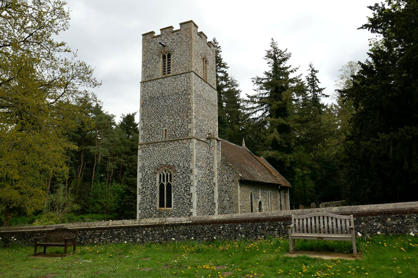
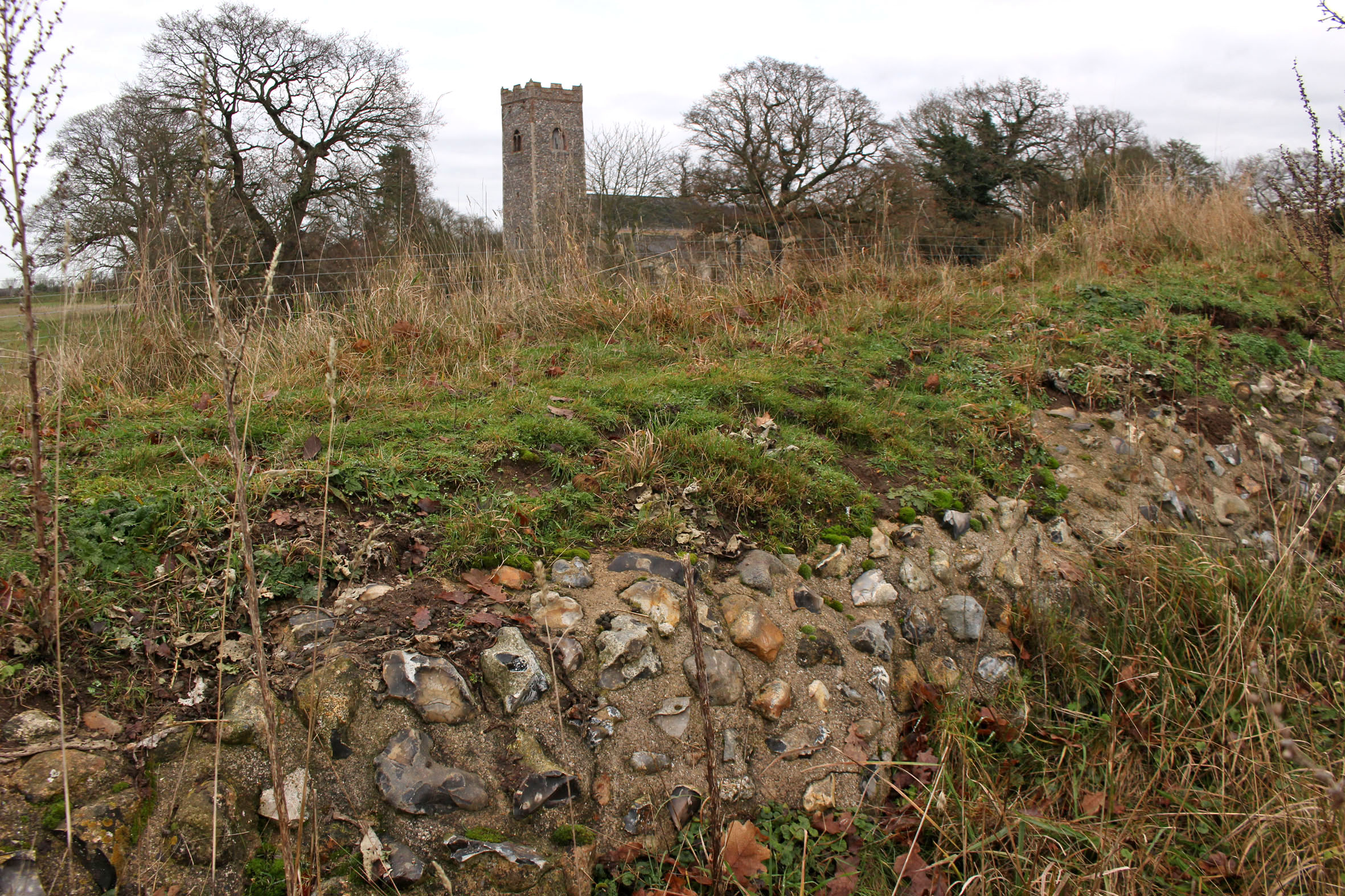
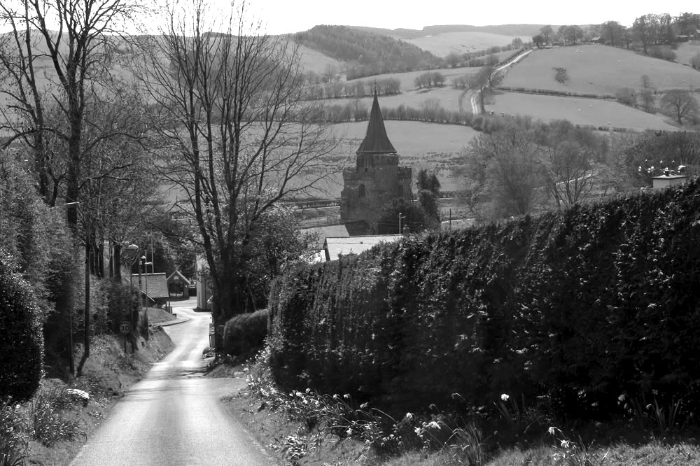
Even the village’s longstanding icons – the 15th-century St Mary’s church with its commandingly tall tower, the second highest in the county, and the equally imposing red-banded Trinity lighthouse built in 1790, Norfolk’s oldest – are both numbered in their days and probably won’t see this century out. The writing has been on the wall for a long time now – this northwest stretch of the Norfolk littoral is, after all, a fast-eroding coastline where such things can only be expected. Even so, the terrifying spectre of irreversible climate change does nothing but hasten the inevitable. Bold efforts have been made to ameliorate the threat: large chunks of alien geology have been transported here to be deposited on the beach – stone barriers to hold back the tide – yet somehow it feels like the wrong sort of folk tale: a village boy taking up a slingshot against a giant ogre, a near-futile King Cnut-like gesture.

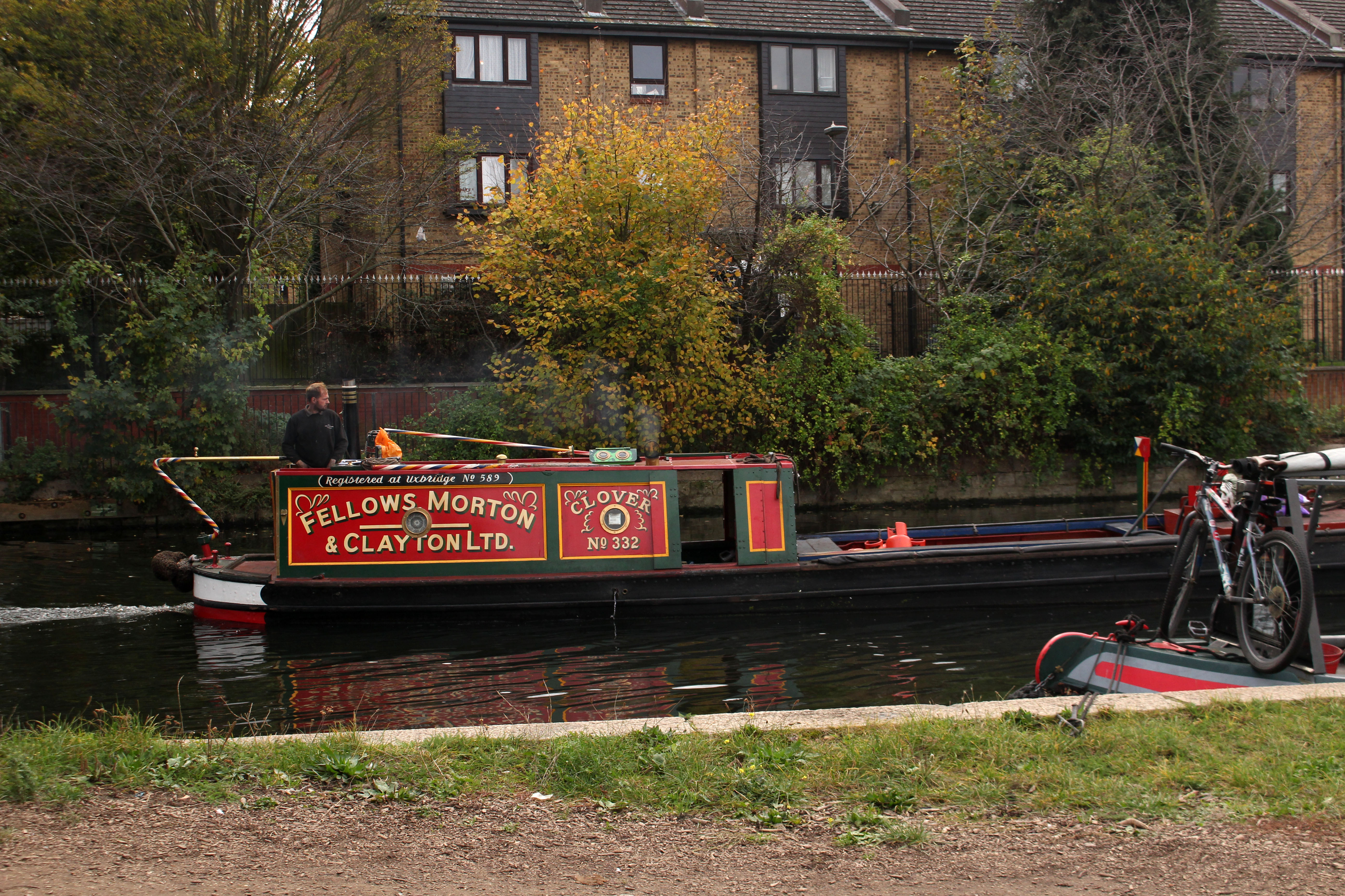
So, there is plenty to say about Happisburgh but what of Ostend, its immediate neighbour to the north? Walking the coast here recently in preparation for a new book on short walks in Norfolk, I tried to find out more about the small settlement that shares its name with the better known Belgian resort. Information was elusive, other than it belonged to the parish of Walcott and was effectively an area of holiday properties appended to the south of that village. The name intrigued me, though, and I wondered whether there was a historical connection as there are several Waterloo farms scattered around Norfolk that commemorate the final victory over Napoleon close to the Belgian town of that name. Until 2001, when it was finally demolished, there used to be an early 17th century house in the village was called Ostend House. There may possibly be a connection here but was it always called Ostend House, or did the name come with the rebuild that took place in the 19th century?

Looking further for information, Wikipedia informed me that in June 2002 a rare Cuvier’s beaked whale was stranded on the beach here. This was the same species of whale that Kathleen Jamie describes being on display in Bergen’s Whale Museum. The Bergen whale was found choked by plastic bags that the unfortunate animal had probably mistakenly recognised as squid, its prime food source. As I had only just (twice) read Jamie’s latest book Cairn,which describes her return visit to the Norwegian museum, there was an immediate connection for me here, although it was nothing to do with the name of the place.

The whale was named by the French scientist Georges Cuvier (1769—1832)*, a polymath who was the first to coin the term ‘extinction’. In 1796 Cuvier presented a paper to the National Institute of Science and Arts in Paris, where he compared the anatomy of living and fossil elephants to prove that extinction was a fact and proposed that the now-extinct elephants had been wiped out by periodic catastrophic flooding events. Although a proponent of catastrophism in geology, Cuvier rejected the idea of organic evolution. As an essentialist he believed that plants and animals were created for particular roles and niches in the world environment and subsequently remained unchanged throughout their existence. In Cuvier’s thinking, as soon as one species became extinct as the result of geological upheaval, another would be divinely created to replace it. It would be Charles Darwin, of course, who would set the record straight some 65 years later with the publication of his On the Origin of Species. What Darwin would have made of the 21st-century discovery of evidence of a long-extinct ancestor, Homo antecessor, on a sea-battered English shoreline we can only imagine. Evolution to extinction: such a surprisingly short distance of time and space linking the two.

*[Alas, Cuvier’s name has also been linked with scientific racism, although we might excuse him for being, as the cliché goes, ‘a man of his time’. Of course, modern-day racists should not be forgiven in the same way – they are not men (or women) of their time. We might, I suppose, call them dinosaurs but to do that would be a disservice to palaeontology.]

The Ghost of a River – The Walbrook

Of all London’s lost rivers it is the Walbrook that is the most irrefutably lost: lost to time, lost to place… well, almost. An important source of water in Roman times, when its banks were lined with the workshops of Roman industry – tanneries, potteries and glass workshops – the river has not been visible on the surface since the 15th century when the last open sections were vaulted over. Ghosting the boundary of Roman London, its confluence with the Thames lay close to what is now Cannon Street Station Bridge. Where the Walbrook began is less certain, although what is clear is that its course flowed between the City of London’s two principle hills – Ludgate and Cornhill. Some say its source was a spring close to what is now Shoreditch High Street, while others point to higher ground at Islington.

Lost to time, perhaps, but there clues to place – in street names, in signs, in places of worship, in the Roman street plan. The walking route tracing the Walbrook’s course that I describe here is faithful to that given in Tom Bolton’s excellent London’s Lost Rivers: a Walker’s Guide Volume 1.

I begin on Curtain Road that runs south from Shoreditch. Holywell Road that abuts it to the east is an intimation of the location of the aforementioned spring. Curtain Street leads to Appold Street and through Broadgate Circle, an upmarket shopping and leisure hub that until 1984 served as a railway station and which was formerly a burial ground for the Bethlehem Royal Hospital, better known as Bedlam.  It also served as a mass grave for victims of the various bubonic plague outbreaks in pre-Fire London – grim, no doubt, but dig down almost anywhere in central London and you will find human bones sooner or later. The River Walbrook would have passed through here before flowing along what is now Bloomfield Street to reach the Roman-built London Wall, which served as the boundary of the City until the 18th century. The Walbrook is believed to have flowed through a hole in the wall at an aqueduct close to where Bloomfield Street meets the Wall.

Channelling the disappeared river, I pass through elegant iron gates of the Wall into Throckmorton Avenue, then turn right and left into an alleyway opposite a barber’s shop that seems incongruous amidst all this high-rise estate of capital. But even financiers need to be shaved and shorn occasionally – sharp haircuts and a regular supply of barista coffee are the basic necessities of life in the City. The alleyway leads into to the narrow passageway of Tokenhouse Yard, at the end of which is the reflected light of the north wall of the Bank of England, the building’s Portland stone preternaturally aglow in the gloom of an overcast November day. The magnetic pull of capital here is almost spiritual: money buys, Jesus saves, sinners spend. Sir John Soane, the Bank of England architect, surveys the scene from his statue recessed high into the wall, while the ghost of the river traverses beneath the building, symbolically moistening – perhaps laundering – the horded lucre in the vaults beneath.

Riverwards, beyond the Bank, lies the Church of St Stephen’s Walbrook and a street of the same name. The elusive river is acknowledged at last. The church, originally situated on the bank of the Thames, was moved here in the 14th century. The Walbrook would have flowed just west of here. The street is dominated by the block-length, Norman Foster-designed Bloomberg building, which has an undulating profile that hints at the vanished river. On its ground floor, an etched glass door leads into the London Mithraeum, a museum dedicated to the Mithras temple that once stood on the banks of the Walbrook nearby. A place where Mithras and Bacchus were once worshipped by Roman soldiers, Mammon has since taken over as chief deity on this patch of expensive real estate.

Just south of here, within sight of Cannon Street Station, is the Church of St Michael Paternoster Royal. Alongside are Whittington Gardens, named after the famous cat-loving, four-time Lord Mayor of the city who is buried here. This was the original location of confluence of the Walbrook with the Thames – the mighty river has shifted south in the two millennia that has passed since Roman times.  Upper Thames Street now flows with traffic where once the tidal river lapped. The modern confluence, theoretical as it may be, lies not far away along Cousin Lane, a narrow street that traces the long wall of Cannon Street Station down to the railway bridge over the Thames. Here there is a pub and steps leading down to the water. There is also a river path that leads west along Walbrook Wharf, where black barges lie tilted on the shore awaiting the incoming tide.  

The tide is out and so I descend to the beach, which is covered with assorted pebbles, water-blunted bricks and a few rusted scraps of iron. Scattered among the pebbles, a small piece of pottery reveals itself at my feet – curved, brown; reassuringly rustic. Roman? Who knows, probably not, but somehow it feels right. A votive offering – it marks the place where London began.

Little Ouse, little bird

For a number of reasons it had been weeks since I had ventured out of the city for a walk. Cities are fine but brick, concrete and tarmac can get monotonous: too much noise, too much body swerving of fellow humans and traffic. I wanted water and trees, a church or two maybe; breeze and birdsong, a chance to breathe. So I took the train to Brandon in the Brecks.

Leaving the station I walk south along the main road towards the town centre and then, after crossing the Little Ouse River and the county boundary into Suffolk, turn left down a minor road called White Hart Lane. Here, almost immediately, is an edgeland of newly built bungalows on one side of the street and fenced paddocks on the other, although the separation between urban and rural is fluid in places like this.. Beyond the paddocks is a line of trees that hides the river. Brandon lies in the midst of a large forested expanse – the vast conifer plantations of Thetford Forest – and a sort of unthreatening wolf border rings the town. The forest is relatively new, though: just over a hundred years old – considerably less than the life span of many trees. Before the intervention of the Forestry Commission in the 1920s and 30s, this expanse of southwest Norfolk and northwest Suffolk was a relatively infertile, sand-blown region where the main industries were flint mining and raising rabbits for the fur trade. Indeed it was overgrazing by large rabbit warrens that was partly responsible for the poverty of its soil in this dry region known as the Brecks.

White Hart Lane gives way to Gas House Drove, a narrow lane that traces the back walls of gardens. More paddocks stretch away towards the river to the left; ponies graze unworriedly. There are notices attached to field gates that request visitors not to feed the horses; other signs inform would-be horse thieves that the animals are electronically tagged and fully traceable – the equine equivalent of ‘no cash left in this vehicle overnight’. Further on, beaten up caravans and abandoned rusting cars enhance the edgeland feel – a seldom observed zone where the accepted rules of orderliness do not apply.

The track narrows further as it threads through tall pines. Crossing a wide woodland ride I come across man on a mobility scooter walking his dog. ‘Is it straight on to Santon Downham?’ I ask. ‘It is if you want to take the scenic route,’ comes the cheerful reply. So I take the ‘scenic route’ and soon arrive at a cluster of houses around a large green – the village of Santon Downham – where a telephone box has been repurposed as a booth for a defibrillator. The box also serves as a library. I scan the books, Len Deighton’s mostly, but there is also a DVD of Sexy Beast, a personal favourite that stars Ben Kingsley as a sociopath gangster in a role that is a far cry from the actor’s portrayal of Gandhi earlier in his career.

The Church of St Mary’s, the self-titled ‘Church in the Forest’, is on the far side of the green. I venture inside to find the bright unfussy interior illuminated by dappled forest light filtered through stained glass. One window featuring St Francis is particularly charming as it depicts the saint surrounded by the sort of birds that are local to the Brecks – crossbill, golden pheasant, kingfisher, heron and barn owl. While it is endearing, it doesn’t flinch from realism – the owl is shown holding a freshly killed mouse in its beak.

The river is not far away and I end up at the footbridge by the St Helens Picnic Site on the Norfolk bank. A group of youths with rucksacks are lounging by the water and I identity them as Duke of Edinburgh award initiates although I could be wrong. A few minutes later they march off together in an easterly direction, some individuals clearly more enthusiastic than those who straggle at the rear. A little further along the road is Santon House where the tiny Church of All Saints stands complete with tiny turreted tower. I take a quick look inside before sitting on a bench outside to eat the sandwich I had brought with me. A chaffinch sings perched on the very top of a pine tree, cock of the walk, although the jackdaws shuffling proprietorially around the picnic site probably think differently.

Back at the St Helen’s footbridge, instead of crossing back to the Suffolk side I follow the path that leads west along the river’s north bank. A few hairy Highland cattle are slumped in the long grass of the meadow between the road and river. Mature willows line the riverbank; it looks like perfect otter territory but these are elusive creatures and I see no sign of them. Reaching the bridge at Santon Downham I decide to continue along same river bank all the way back to Brandon. Although the path is well-defined and firm underfoot, the surrounding landscape is pleasingly unkempt, with plenty of rotting timber and tangled dead grass that has weaved itself into a carpet over posts and fences. Nature, I am told, thrives on untidiness such as this.

I meet a group of birders coming the other way: green-clad middle-aged men with sensible outdoor clothing and expensive German optics; one of them carries a heavy tripod with mounted SLR. They tell me they are on the lookout for lesser spotted woodpeckers. This stretch of riverbank woodland is supposedly one of the most likely places to see these elusive birds in East Anglia. They have had no luck as yet but they accept their failure gracefully. We compare notes. I have seen the mandarin duck and grey wagtail they mention, and had heard greater spotted woodpeckers drumming away unseen on my way to Stanton Downham on the Suffolk side, but lesser spotted…no.

Lesser spotted woodpecker: it sounds like a made-up name, the sort of thing a non-birder might come up with to make fun of those with an interest in birds. While to some ears it might sound prissy and pedantic, to the average birder it is merely a precise non-Latin description of appearance and habit.

Thoughts of the bird transport me far away in space and in time. I tell the birders that I have not seen a ‘lesser spot’ for decades but this is not strictly true. A memory comes back of a trip to Japan in 2015 where, walking a trail through cedar forest south of Osaka, a lesser spotted woodpecker flew down to a low branch close to where I had sat down for a rest. It was a fleeting view but an unexpected one in a country where birds, other than ubiquitous large-billed crows, seemed quite elusive. Much of Japan is anything but unkempt and nature is contained and controlled – topiary is unbounded, trees are pruned within an inch of their lives, rivers are canalised. Then I thought back to a time decades earlier in south Norfolk where a lesser spotted woodpecker had nested in a branch above a footpath close to my rented cottage, a place that I called home for three years. A small, undemonstrative black and white bird:  like so much else they had become rare and were now one of our fastest declining species. Who would have thought a shy, sparrow-sized bird could evoke such a sense of loss and trigger that sense of emotional distress associated with environmental change known as solastalgia*? At least, here in the untidy, bird-rich woodland that flanks the Little Ouse River, there was still hope. After all, nature thrives on untidiness.

*Solastalgia – a neologism coined by philosopher Glenn Albrecht in 2005, which he describes as ‘the homesickness you have when you are still at home’ and is usually related to environmental change in a home environment.

A midwinter walk – Horsenden Hill to Harrow-on-the-Hill

In the past I have chosen a rural walk to celebrate the turning of the year; this year though, I have opted for something more urban. Together with my friend, Nigel Roberts, I continued along the route we had both been following for some time: London’s Capital Ring. For this midwinter walk it would be the moderately hilly stretch that lies between Greenford and South Kenton in London’s northwest outer suburbs.

We convene at the small coffee bar at Greenford Underground station. The low winter sun is unseasonably bright in our faces, intense enough to require squinting. Light counts for everything at this time of year. Setting off under the railway arches we walk past the appropriately named Rising Sun pub and the entrance to a massive retail park. Soon, we reach the path that will take us up Horsenden Hill. The hill is one of the highest points in north London, and even halfway up the slope the view opens up to the west in the direction of Heathrow, an aerial procession of slowly descending aircraft confirming the hill’s location on the approach flight path.

The hill was once an Iron Age settlement, and before this it was sometimes frequented by Neolithic flint knappers. The summit is furnished with a concrete trig point and a few benches – most have the seat part absent, rotted away or stolen for firewood. Up here, it is countryside quiet with no hint of city clamour although we do come across a few fellow wanderers: the men we see are mostly seated alone on benches with a can of lager in hand; the women, in contrast, tend to be walking purposefully, avoiding eye contact as they stride ahead. Who can blame them? Lone figures in the landscape engender a sense of melancholia and it is easy to assume that these are people with the weight of the world on their shoulders. But I know that when I am out walking on my own a casual observer may well think the same about me. The truth is: I enjoy walking alone sometimes; it is a pleasure, however it might appear.

The path leads us downhill through woods of oak and beech. Parakeets screech in the branches overhead. The birds are ubiquitous now and certainly, within the orbit of London’s suburbs, they are rarely out of sight or earshot. I had seen my first of the day hours earlier whilst entraining to London that morning, a sleek green figure that swooped over the carriage as we passed over the M25 on our way to Liverpool Street. Parakeets, corvids – magpies, crows, jackdaws – woodpigeons: these are the birds that have taken over the green spaces of the capital. Small birds have been chased away to find sanctuary in suburban gardens. It comes as a relief to hear the passive-aggressive song of a robin holding firmly to its territory.

The route descends Horsenden Hill to Sudbury Hill before climbing again to Harrow-on-the-Hill. Harrow is as conspicuously wealthy as we imagined – huge house and gardens, security gates, high fences, a smattering of Arts and Crafts among the stylish mansions. Harrow – of Saxon derivation meaning ‘sacred grove’ – seems like a displaced Chilterns village: far enough from central London to give an impression of rurality; close enough to make commutes into the City feasible. It’s handy for the eponymous school too, of course. The various school buildings dominate the upper part of the village: crow step gables, decorative brickwork, signs announcing private property and CCTV. There’s a restaurant called Old Etonian that looks closed (even Harrow has to settle for being second best sometimes) and a specialist outfitters’ that displays various uniform items in its windows. The gaps between the buildings afford hazy views of the glass hi-rises of City of London, ten miles distant – a view that for many of the students is not so much aspirational but more a matter of destiny: inherited wealth, uncles that work  in City trading; money, old and new, that regularly takes itself on holiday to the Caribbean.

The flamboyance of the school buildings is one thing but it is on the playing fields that we pass through where the sense of privilege really hits home. Of course, to contemplate such things might be seen to participate in the politics of envy. But really it is the politics of inequality. The sheer scale of the sports facilities is breathtaking – a huge area with tennis courts, athletics tracks and so many football pitches that the widely scattered goal posts seem like hoops for a giant-sized game of croquet.

Eventually we leave the school premises behind to follow a track that traces the boundary of a hospital complex. Hemmed in behind lopsided Leylandii and a chain link fence, the side of the path is littered with disposable masks and drinks cans. In places there are signs of fly-tipping: old mattresses, a bin bag stuffed with large cuddly toys. When future archaeologists dig down to find the stratum that represents the Anthropocene what will they make of the artefacts they find there – the blue Covid masks, the slim energy drink cans and nitrous oxide canisters? Votive goods of some sort, or items connected with ritual use?

The underground station at South Kenton, our anticipated end point, is closed for repairs. So we walk to Preston Road then take the Metropolitan line to Baker Street. After beers and a Lebanese meal we head to Oxford Circus for our respective tube lines. Oxford Street, unlike the near lifeless streets of the outer suburbs we encountered earlier, is frantically busy with shoppers. Christmas lights in the form of brightly illuminated snowflakes span the street above our heads. Light is returning. As reliable as ever, the year has turned. 

The Greenway

Picking up from where we left off, back in November, my friend Nigel Roberts and I travelled to London on Wednesday* to walk Section 14 of the Capital Ring. We arrive at our starting point at Hackney Wick by way of the 26 bus from Liverpool Street Station, whose upper deck gives excellent views of upwardly and downwardly mobile Shoreditch and Hackney along the way.

Hackney Wick, an East London zone heavily revamped by the 2012 Olympics, is already starting to develop a distinct patina – a place that is part bohemia and part industrial estate, with pleasing, professionally executed murals amid rag-tag graffiti.  We require sustenance before we set off, so bacon and egg rolls are purchased from a snack van near the station. The rolls, amply filled and luxuriously lubricated with brown sauce, are excellent value and of sufficient deliciousness that I am tempted to adopt them as an alternative monetary unit – a BER (Bacon and Egg Roll), a benchmark by which to compare prices. As I sit on a bench gnawing away, Nigel – always one to document every detail en route – Milibands me with his phone camera, capturing my awkward mastication for the benefit, no doubt, of his thousands of Facebook followers and leaving my political career in tatters even before it is begun.

From the station we cross a bridge over the Lea Navigation (Hackney Cut) and follow the towpath south for a short distance before veering off left to join the route of The Greenway. The Greenway, well signposted and walker-friendly, is a six-mile-long pedestrian and cycle route that sits on top of the Northern Outfall Sewage embankment (N.O.S.E), directly above the 1860s Joseph Bazalgette-built sewer that shifts vast quantities of London sewage to a treatment plant in Beckton where, once purified, it is released into the Thames. Had Situationists ever trodden its well-maintained path they might have declared, ‘Sous les pavés, la merde!’ While Tony Blair once recommended a centrist Third Way, here, we are following something akin to a turd way, although the official name, The Greenway, undoubtedly has a more fragrant ring to it. 

Queening it over Queen Elizabeth Olympic Park to our left is the London Stadium, now the claret and blue home of West Ham FC, along with the fantasy fairground ride that is Anish Kapoor’s ArcellorMittal Orbit sculpture. Further on, just before reaching the railway line, we come to the View Tube Café & Bar, where we stop for a coffee (1.2 BER for a polystyrene cupful) but pass on the cocktails on offer (1 mojito = 4 BER).

Suitably caffeinated, we follow the ramps that take us beneath the multiple tracks of the former Great Eastern Railway before returning to The Greenway again. We cross Waterworks River and then Stratford High Street, which is busy with traffic and lined with gleaming new office blocks. One of these bears a mural of a Victorian woman with baskets of lavender – a memorial to the onetime Yardley soap factory that stood nearby. Equally intriguing is a strange tower that stands a little way down the street by the river. It is something I have seen from the train many times before and had always wondered about. The Stratford East Tower, on close inspection, is built of timber and mimics an elongated (and leaky) ice cream cone. What it really represents, of course, is an Olympic torch – another architectural heirloom of the glory days of 2012. These days, more prosaically, it also houses a mobile phone mast hidden within.

Back on The Greenway, a Thames Water crew is carrying out some sort of maintenance of the sewer below. Aluminium ladders lead underground through open manholes that offer our noses a mild hint of that which flows beneath. Just beyond here, down a slope to the right, stands the quite magnificent edifice of the Abbey Mills pumping station behind high razor wire fencing. Constructed by Bazalgette in the 1860s, it originally housed the beam engines required to pump city sewage 40 feet up to the height of the Northern Outfall Sewer. Byzantine-style, and yellow brick with cupolas, it resembles nothing less than a cathedral, Bulgarian Orthodox perhaps? St Bazalgette’s? Or maybe even Catholic? – Spain already has its own Our Lady of the Sewers**, so it is not such a far-fetched notion.

A little way beyond the pumping station is Abbey Creek The tide is out, leaving a grey expanse of mud stippled with fragments of wire netting, dead shopping trolleys and other Anthropocene detritus. Overlooking the creek is another relic of the pumping station: a curious piece of ironwork that resembles a giant nautilus fossil… or maybe a super-sized tuba, a fiendish instrument that can only be blown by the foul breath of the sewer beneath.

Back on The Greenway itself, a little further on, large white letters on the wall spell out:

L O N G   L I V E   C O M M U N I S M

Nigel, channelling revolutionary БРСМ*** spirit, poses for a photograph with a raised fist. It feels anachronistic. Perhaps, by way of balance, or simply to bring it up to date, there should also be another that says:    

D E A T H   T O   N E O L I B E R A L I S M    and/or 

O B S E R V E   T H E   D E A T H   T H R O W S   O F   

L A T E   C A P I T A L I S M

Such slogans are absent, although they are easily brought to mind by a head swivel across to the silhouetted high-rises that mark the distant City of London – the sky-piercing monoliths of Canary Wharf Tower and The Shard being the most familiar of the cluster. Here, encapsulated in glass, steel and concrete, are the architectural marker stones of the London Launderette, the machinery of which is currently rinsing roubles on fast cycle. Londongrad: an established playground for oligarchs, kleptocrats, KGB cathedral fanciers and Premiership billionaires – bullion for bricks, gas for glass, irony for iron, gold for goalkeepers; cash for condos, cash for honours, cash for tennis. Another hidden sewer: the secret culvert of dirty money that seeps unseen into The City.

We cross another railway line and then have views through trees to the stones and avenues of the East London Cemetery. Next we pass Newham University Hospital and some giant concrete balls at the junction with Boundary Lane. At a primary school playground a little further on we leave The Greenway behind, heading south to reach the ramps that take us across the dual-carriageway of the A13. Looking east beyond the red brake lights of queued traffic is the modest rise of Becton Alp, a fake hill made by piling the toxic spoil of a former gas works. It is no Silbury but at 36 metres is still the highest artificial mound in London.

Our walk ends with a meander through Beckton District Park. This area feels more Ballardian suburb than gritty city edge. Nigel observes, ‘This could be Worcester, you know.’ And he is right, it could be almost anywhere. The trees planted in the park come from far and wide, each bearing a sign to identify species and provenance. Tired and footsore by now, we forget to look until the last one – Algerian Ash.

The DLR from Royal Albert Station speeds us back into central London – a driverless train through the heart of The City providing all the metaphors you might possibly need. Later, over beers in a Soho pub (1 pint = 2BER), we discuss prog bands we saw back in the glory days of the last century. A man at the next table joins in the conversation. He tells us he likes visiting pubs that come with a bit of history. Currently he is on a tour of George Orwell haunts in the city. After a quick chat about The Road to Wigan Pier, a book we both admire, I ask: ‘So did Orwell used to frequent this place.’ His reply was unexpected, ‘No, but Dennis Nilsen used to come here to look for victims, I think.’

* Wednesday, February 23 – the day after ‘Palindrome Day’ 22.02.2022; the day before Russia’s invasion of Ukraine 24.02.2022

** see Paul Richardson’s Our Lady of the Sewers and other Adventures in Deep Spain 1998

 *** БРСМ = Belarusian Republican Youth Union (…only kidding, although Nigel is undoubtedly a Belarus pioneer of sorts)

A Solstice Walk – Boudicca Way

In recent years I have got into the habit of taking a walk on the day of the winter solstice, December 21. Yesterday’s walk was along the section of the Boudicca Way that lies between Venta Icenorum and Norwich.

Venta Icenorum, which lies a few miles south of the city close to the village of Caistor St Edmund, was a walled Romano-British settlement that served as the civitas or capital of the Iceni tribe. The town was laid out sometime after Boudicca’s violent uprising against Roman rule in the winter of AD61 and so there is no chance that the famously vengeful Iceni queen was ever connected with the settlement itself. It is also debatable that Boudicca ever walked this precise territory but the Iceni queen is certainly local enough to at least deserve a mention.

Like many recently, it is a drearily grey day and there are few other visitors to the Roman town. I walk a little way along the walls before leaving the site to head uphill along one of High Ash Farm’s permissive paths. Damp and dreich, low cloud has largely expunged any colour from the landscape. The fields are harvested and bare, and the sense of midwinter inertia is strong despite the reasonably mild temperature and lack of snow. Light is at a premium; but the days are changing and more light will be here soon.

At the top of the hill a planting of Scots pine marks the site of an Anglo-Saxon graveyard, a situation that offers views down to St Edmund’s church and the low flint and brick walls of the Roman town. The Southern Bypass buzzes with cars and lorries in the distance. Beyond this, the impassive concrete cuboid of Norfolk County Hall marks the entrance to the city for traffic from the southeast.

The way traces a minor road for a while before dipping downhill into a valley. It then follows a footpath uphill to arrive at Caistor Lane and the curiously named French Church Farm. Another footpath leads north away from the road climbing gently up the valley side. Here, I pass a family – mum, dad, granddad, two kids – eating sandwiches on a bench halfway up. These are about the only walkers I have seen so far. In a field to the right, keeping well away from the mobbing crows that predominate the landscape around here, is a lone pair of Egyptian geese. At the top I emerge at Hallback Lane, a delightfully green, ancient trackway lined with coppiced hazel and ancient oaks. Halfway along is a wizened old oak that is familiar to many who live around here. Dubbed ‘the Africa Tree’, it bears a hollow in its trunk that delineates a fairly accurate outline of the Dark Continent. French Church, Africa Tree, Egyptian geese – something seems slightly out of kilter here.

A path to the right takes me up around the top of Caistor Chalk Quarry, close to the fence that protects it from public intrusion. The quarry is far larger than I had imagined. Steep sandy cliffs frame a deep hole and wide expanse of scarred earth; scattered extraction apparatus, storage hangars and piles of gravel and flint sit on the exposed chalk bedrock. The quarry, I later learn, is the last remaining inland section of the Beeston Chalk formation of the Upper Cretaceous. The exposed seam here is directly connected to the chalk pavement seen thirty miles away at Beeston Regis on the north Norfolk coast. Although this is the first time that I have actually seen it, I already have a connection with this place – a few echinoid fossils gifted to me over 30 years ago by an erstwhile neighbour, a lovely man called Russell who used to work at the quarry.

I join the Arminghall Road and follow it over the Southern Bypass, which is, as always, frantic with commuter traffic. Soon after, I leave this behind to take a footpath across a damp meadow towards the Arminghall henge. Truth be told, the Bronze Age henge probably looks a lot more impressive seen crow-eyed from a drone overhead. Originally, a horseshoe of wooden posts open to the southwest, now it is little more than a symbol on the OS map, a vague rise and depression in a pylon-spanned field. There has been a suggestion* that the henge may be orientated to the winter sunset over Chapel Hill to the southwest. Today though, no sun is visible, and the summit of the low hill, which once bore a church dedicated, like that at the Venta Icenorum site, to St Edmund, is engulfed by the Norwich to London railway line.

A footpath leads along the River Tas behind the large electricity substation that occupies the field next to the henge. A little way along this, the brutalist bulk of County Hall emerges through the trees beyond the railway line that hugs the opposite bank. I pass under the graffiti-adorned pillars of the rattling A146 to emerge just shy of the bridge at Trowse Millgate. Across the ring road roundabout, is Bracondale and my route into the city centre. I am almost home now. Only 3.30pm and darkness is starting to fall, Tomorrow, at least, there will be a little more light.

*See: https://archive.uea.ac.uk/~jwmp/CAA2003.pdf

Walking the Ring: Stoke Newington to Hackney Wick

Stoke Newington, London N6. We are here to walk part of the Capital Ring that circuits the capital by way of 15 stages. Slightly perversely we decide to begin at Stage 13, which links Stoke Newington with Hackney Wick by means of a park and a path alongside the River Lea and Lea River Navigation. Less defiantly, we will follow the overall route clockwise as suggested. To go widdershins might be an enticement but we are civilised men not maniacs.

Firstly though, Abney Park cemetery beckons. The main Egyptian Gate on the high street is closed but there is a way round the side that funnels us between barriers into the non-conformist boneyard. The park, as much arboretum as cemetery, is quiet – dense foliage neutralising the din of traffic from the roads that surround it; just a few muffled barks from exercising dogs and the jungle shriek of an unseen parakeet. Quiet or not, the tree-lined paths are fairly busy with strollers and dog-walkers. We come across one woman who has no less than seven small lead-dragging dogs in her charge, including a one-eyed pooch that clearly bears a grudge against binocular humans.

We have no purpose or aim other than just to wander and take it all in – the trees, the gravestones, the gothic atmosphere, the knowledge that this cemetery was the inspiration for the hidden fragment of Paradise that Arthur Machen wrote about in his short story N. We find no such paradise garden but instead plenty of interesting angel-perched tombs and several oddities – a wooden marker that asserts mysteriously ‘Elvis put his hand on my shoulder’ and the simple stone gravestone with the legend: ‘Thomas Caulker 1846—1859 Son of the King of Bompey’. Bompey, we later discover, was an early 19th century West African chiefdom that was eventually incorporated into Sierra Leone in 1888. The stone looks like a fairly modern replacement. What is curious is that the 160-year-old grave is still attended – a single flower has been recently placed upon it.

We exit the park to join the Ring; a sign right outside the cemetery confirms we are on the right path. My companion Nigel takes a photograph of me in front of the sign and as he does this a cheerful Black woman pushing an empty shopping trolley offers to take a snap of the two of us – she assumes we are tourists, and in many ways she is right. We head up Cazenove Road, where a fading ghost sign on a gable advertises a discontinued brand of whisky and an abandoned charity shop, as niche as you like, boasts a Bosnia & Herzegovina connection. It is all comfortingly multicultural – orthodox Jewish men in black hats and long coats rub shoulders with Muslims in white skullcaps and shalwar kameez. Looking at our map to check the route, one of the latter, a helpful elderly Pakistani, asks if we need directions and points us towards Springfield Park. There is no denying it – we really do look like tourists.

At the rise of the park the Lea Valley suddenly comes into view beyond – a proper valley, a river-carved ha-ha that slopes down to the water and sharply up again. A sign at a viewpoint helpfully informs us that we are standing on Hackney gravel, below that is London clay. Another parakeet screeches, this one perched in a tree, lurid green, channeling the tropics.

A more at home, native species – a heron – stands guard on a houseboat close to the footbridge at the bottom of the park. It sees us but looks unperturbed. We cross over the river to the east bank and start walking south. Walthamstow Marsh stretches away to the east, all reed, sedge and soggy pasture; rising above the marsh, beyond the railway, stands an island of modern development that may or may not be offices. There is an almost endless line of houseboats moored to both banks. Nothing too chi-chi – vaguely counter-cultural but mostly no-nonsense make do and mend: heaps of burner firewood, car batteries, plants in plots, well-used bicycles; a few seasoned boat dwellers going about daily chores, clenched roll-ups, dreadlocks piled high.

Across the water, a little further along, is a pub with outside trestle tables stacked for winter: The Anchor & Hope. Not the Hope & Anchor, the historic pub rock venue in Islington that we remember hearing tales of in our youth. Anchor & Hope – Anchor (or at least moor) and Hope your boat doesn’t sink? Anger and Hope maybe? There seems to be plenty of anger about but hope can be elusive; as they say, it is the hope that kills.

Approaching Clapham Junction Viaduct we hear the two-stroke put-put of a barge on the move. Another barge comes from the rear to slowly overtake and the two boatmen exchange chummy bargee greetings as they pass on the water. A sign under the viaduct arches indicates that this is the original location of A V Roe’s workshop where the first all-British powered flying craft, a precarious-looking tri-plane held together with wire and glue, was built in 1909. Inspired by the Wright Brothers’ achievement of just six years earlier, the aeronaut successfully managed a short wobbling flight across the adjacent marshes, a sight that must have given the local herons quite a start.

At Lea Valley Ice Centre the path diverts along the canalised Lea River Navigation, the wide green expanse of Hackney Marshes stretching invitingly to our left. We detour briefly to view the former site of the Middlesex Filter Beds, now a designated nature reserve, where we find the granite blocks that once held the pumping engine in place rearranged into what has become known as the ‘Ackney Enge’. A little further on we find the hope we had been looking for back at the waterside pub: a footbridge over the water has a draped banner that proclaims BELIEVE IN OUR COLLECTIVE IMAGINATION on one side, and on the other, DARE TO DREAM BEYOND CAPITALISM. Hope indeed.

Shortly before reaching Hackney Wick we pass beneath a roadway where the supporting concrete arches have been comprehensively decorated with all manner of found objects – bottle tops, cans, bits of wire, keys, keyboards, electronic components, beer cans – all lovingly glued in place and spray-painted. As I stop to take a photograph, a man on a bike appears out of nowhere to inform me that the artist, a lovely fellow by all accounts, was a friend of his who had died quite recently. He pedals off back into the shadows as quickly as he arrived. Then I notice a portrait of the artist attached to the second of the pillars. The artist in question looks remarkably like the man I have just spoken to. Could this be a ghost artist obliged to return and show visitors around his urban art gallery, a revenant on a bicycle?

Our walk ends at Hackney Wick. We know we have arrived when we see West Ham’s London Stadium at Queen Elizabeth Olympic Park in the distance, the deranged helter-skelter of Anish Kapoor’s ArcelorMittal Orbit alongside it. Somewhat disoriented by the glare of the new development that engulfs us on all sides, we look for the bus stop we need for the service back to central London. I know that it is close to the Church of St Mary at Eton but its location proves to be elusive. My A to Z is well out of date, the streets marked on it have since been redacted; new ones with new names have taken their place. Nigel employs his smart phone to engage with a satellite to find the correct route and we beat a path past Hackney Wick Overground station and along streets parallel to the thrumming A12. Despite the nearby traffic frenzy, the area is relatively quiet and uncluttered by commerce, just a scattering of car body repair shops and the occasional cafe. A random sign offers sourdough pizza – you can almost hear self-respecting Neapolitans crying in anguish. But nothing is sacred and change is inevitable: the deeply layered lasagne that is East London has had its time-honoured béchamel topping scraped away and replaced with something considered to be more wholesome. As ever, the city is a palimpsest.

Black Country

Here is another brief extract from my book Westering that was published earlier this year by Saraband. This time it concerns my transit on foot through the territory of the Black Country that lies to the west of Birmingham. I have included a few black and white images to illustrate the text here. These are not in the book itself but might help give a flavour of what the area is like.

Extract from Chapter 15 – City of Metal

Here was the Black Country and now I was walking on sunshine: the sunshine that lay captured in carbon in the earth below. The sunshine trapped by swampy tropical forests of trees and ferns that, over tens of millions of years of compression, had transformed to a solid energy-rich fuel source; the black rock that set the Industrial Revolution in motion around two hundred years ago – a period of time that on the geological scale of things was little more than a blink of an eye.

Thanks to the thirty-foot-thick seam of coal beneath the ground, Oldbury was at the forefront of the Industrial Revolution. Four blast furnaces operated in its vicinity between the 1780s and 1860s but, as the fortunes of coal mining and steel-making declined in the region in the late 19th century, brick-making took over, exploiting the deposits of Etruria marl that were also found in abundance beneath the coal seam. The town’s underlying geology was generous to a fault: the clay was perfect for manufacturing Staffordshire blue brick, a hard-wearing, non-porous brick ideal for use in foundations, bridges, steps and tunnels – the essential hardware of Black Country business. Tar distilling, chemical manufacturing and boiler-making industries also took root in the district later on. The inevitable result was a besmirched landscape – a ‘black country’ – an environment littered with spoil heaps, abandoned quarries, cavernous marl pits and unbridled chemical pollution. In its heyday, the Black Country had been highly productive – a soot-blasted territory of glowing foundries and clanging metal – but now that energy has drained away.

Extract from Chapter 16 – Black over Bill’s Mother’s

At Brierley Hill I came across a new waterfront development complex that was named, somewhat unimaginatively, The Waterfront. It still did not seem quite finished and many of the individuals milling round the car park sported hard hats and high-visibility jackets: surveyors, property developers and the like – the storm troopers of real estate. Merry Hill, a little further along the canal, had a large hotel advertising FAIRYTALE WEDDINGS, a promotion reinforced by a giant love heart inscribed WILL YOU MARRY ME? On the opposite bank was Brewer’s Wharf, a Victorian pub complex that looked as if it had been there since the time that navvies had come over from Ireland to dig the canals. Its tall chimney bore the legend BANKS’S in bold white lettering. Banks’s, the Wolverhampton ale that quenched many a nail-maker’s thirst in these parts – it seemed a shame that the secretive Banksy could not be employed to make some sort of joint venture with his own art here: a Banksy Banks’s.

The vast Merry Hill shopping centre is probably the Black Country’s biggest draw for anyone with a car and a credit card. It has been in business long enough – since the 1980s – for the shopping complex to be as much a fixture on the mental map of those who live in the area as somewhere with deeper historic entitlement, such as Dudley Castle. More like a diurnal new town than a shopping complex, Merry Hill is defiantly self-absorbed – a world unto itself that has little to do with the canal that passes it by or the industrial heritage of the area. Its retail workers know nothing of lung-clogging coal dust or searing hot metal. Their world is one of special offers, stock-taking and refund protocol.

Further along the canal, Nine-Locks Bridge marks the beginning of Delph Locks, a flight of locks – originally nine but eight now – that cascades downhill to the lower country around Stourbridge, whose sprawl of rooftops could now be seen below.

At the bottom was a pub appropriately called The Tenth Lock. This was prime territory for murder ballads. The dark watery world of the locks was a fine setting for tales of drowning and lovers’ trysts gone badly wrong: a Victorian world of smoke and reeking factories, of hard lives; a polluted monochrome world, of choking industrial fogs that played tricks with the vision and mind.

Fogbound: Heacham to Old Hunstanton

Earlier this week we walked from Heacham to Old Hunstanton along the seawall. To say that it was a bit foggy would be an understatement as the whole of northwest Norfolk lay shivering under a thick blanket of dense fog – a white-out, or rather ‘grey-out’, that rendered visibility poor in the extreme.

We made our way through Heacham village, past gingerbread carstone cottages and then holiday bungalows and caravan sites before arriving at North Beach, where the previous night’s freeze had created thin blades on the stems and leaves of shoreline plants and shrubs.  

A few distant ghostly figures could be seen out on the wall, walking dogs or just taking exercise. The Wash that lay ahead was an unappetising grey soup that disappeared from view not far beyond the groynes that ran into it. On the far shore lay Lincolnshire; today, it may as well have been Narnia. It is said that on a clear day it is sometimes possible to make out Boston Stump (the soaring tower of Boston’s St Botoph’s church) on the distant shore. Not so today. The tide was going out, its recent turning delineated by a line of seaweed, broken shells and energy drink cans. A washed-up sprig of plastic holly added a timely if lacklustre reminder of the coming festive season.

Approaching Hunstanton, the resort slowly came into focus as the mist started to clear. Soon after, a hazy disc of sun shone through and fragments of blue sky began to piece together overhead. By the time we reached Old Hunstanton the transformation was complete – perfect light to appreciate the banded cliffs that rise here. Some unknown hand had created a piece of citizen landscape art on the beach – a collection of painstakingly assembled cairns of red and white chalk that echoed the cliffs of the backdrop. On the shoreline, oystercatchers perched companionably on seaweed-covered rocks while sanderlings scurried like clockwork toys and turnstones did exactly what their name suggests. A scene to savour, albeit briefly – by the time we turned around to walk back into town fog was already starting to descend once more.


Over the Ofer

IMG_5989

Ofer: Old English word for border or edge

As I have mentioned here before, I have been working on a book project for some time. A book about a walk – a sort of pagan pilgrimage – made across England and Wales, from Great Yarmouth to Aberystwyth. A book that you might find filed under Travel/Memoir in all good bookshops… well, once I find a publisher that is. Anyway, the book is nearly complete and to give a taste I will not post text but instead a series of photographs taken during the last stretch of my journey across central Wales.

Converted into stark monochrome by the wonders of Photoshop, these might be considered to be embedded images that have been temporarily exiled from their place in the narrative. They depict scenes from the road (or track, or footpath) between the Welsh border (Kerry Pole) to the Irish Sea (Aberystwyth). I have also juxtaposed a few apposite quotes  but am working on the assumption that each picture paints a thousand words. So, here are 17,000 words on Wales. Or, if you prefer, 17 stories.

For more on the Ystwyth Valley you might also want to look here or here.


Kerry Ridgeway

You cannot live in the present.                                                                                                          At least not in Wales                                                                                                                             

R S Thomas Welsh Landscape

IMG_5959

IMG_5955

IMG_5948


Llanidloes to Llangurig

Where was it he was born, Ianto? Llanidloes, was it?                                                                  Nah, Llangurig.                                                                                                                                    Well that area anyway. Inland like. Farms and mountains, fuck all else. That’s all there is yer, just farms and mountains.

 Niall Griffiths Sheepshagger

IMG_6034

IMG_6049

IMG_6105

IMG_6122

IMG_6133


Llangurig – Powys to Ceredigion

Hush, not a word. When we’ve finished milking                                                                         And the stars go quiet, we’ll get out the car                                                                                  And go to Llangurig

R S Thomas Border Blues

IMG_6165

IMG_6221

IMG_6236


Ystwyth River

ystwyth (Welsh) adjective:  supple, flexible, pliable

IMG_6242

IMG_6340

IMG_6406


Aberystwyth

The cure for anything is salt water: sweat, tears or the sea.                                                    

Isak Dinesen Seven Gothic Tales

IMG_6511

IMG_6535