Winter Light

IMG_7877

Even in winter, the northeast Norfolk coast has its attractions, especially over the Christmas and New Year period when many flock here to see the grey seals that come to the beaches of Winterton and Horsey to give birth. For many it is an annual outing, an opportunity to walk off seasonal excesses, to get close to nature, to delight in the spectacle of the seals and their pups. Some are tempted to get too close, of course, but these days a dedicated army of volunteers in hi-vis orange jackets ensure that visitors and their naturally curious dogs do not disturb the vulnerable animals on the beach.

IMG_7838

We arrive to find grey seal mothers and their fluffy-coated pups scattered like driftwood along the shoreline. Some are on the sand close to the breaking waves, while others are further inshore along the tideline, or even in the hollows of the dunes that back this coastline. Here and then along the beach, a hefty bull seal waddles in awkwardly from the surf to try his luck with one of the nursing females – this is the season for both breeding and mating.

IMG_7809

IMG_7859

The seals are not the only creatures of interest here today: walking north along the beach, a small flock of snow buntings – perhaps 20 or 30 birds – rise like a flurry of sleet on our approach before setting down again a little further ahead. Winter visitors from much further north in Scandinavia and the Arctic, they resemble frosted sparrows as they peck busily at the seaweed, sticking close together for security.

IMG_7759

IMG_7828

The seals and birds are engaging but the real star this cold January afternoon is the quality of the light, which morphs from gloom to gleaming in the space of half an hour. At first it seems as if the sky is weighed down like stone beneath a dense slate-grey sheet of stratocumulus but cracks soon appear and, like a hagstone held to the eye, an opening forms in the clouds to reveal the blue that lies beyond. As the sun loses height  beneath the cloud layer, shafts of pale golden light break through. The play of light on the dunes invokes a ghostly atmosphere. The wind-bent marram grass of the dunes, caught in the glow, seems almost fluid – an impressionist rendering of a wave-tossed ocean. In the distance, beyond the luminous marram, the Perpendicular tower of Winterton’s Holy Trinity and All Saints’ Church rises loftily above the crouched bungalow roofs of the village. This fleeting serendipity of light gives the scene a numinous quality, an eerie supernatural glimmer. It is a scene that might be co-opted for the cover of a book of ghost stories – a lost work by M.R. James perhaps.

IMG_7735

IMG_7890


IMG_7928

IMG_7991

IMG_7816

IMG_7818

Over the Ofer

IMG_5989

Ofer: Old English word for border or edge

As I have mentioned here before, I have been working on a book project for some time. A book about a walk – a sort of pagan pilgrimage – made across England and Wales, from Great Yarmouth to Aberystwyth. A book that you might find filed under Travel/Memoir in all good bookshops… well, once I find a publisher that is. Anyway, the book is nearly complete and to give a taste I will not post text but instead a series of photographs taken during the last stretch of my journey across central Wales.

Converted into stark monochrome by the wonders of Photoshop, these might be considered to be embedded images that have been temporarily exiled from their place in the narrative. They depict scenes from the road (or track, or footpath) between the Welsh border (Kerry Pole) to the Irish Sea (Aberystwyth). I have also juxtaposed a few apposite quotes  but am working on the assumption that each picture paints a thousand words. So, here are 17,000 words on Wales. Or, if you prefer, 17 stories.

For more on the Ystwyth Valley you might also want to look here or here.


Kerry Ridgeway

You cannot live in the present.                                                                                                          At least not in Wales                                                                                                                             

R S Thomas Welsh Landscape

IMG_5959

IMG_5955

IMG_5948


Llanidloes to Llangurig

Where was it he was born, Ianto? Llanidloes, was it?                                                                  Nah, Llangurig.                                                                                                                                    Well that area anyway. Inland like. Farms and mountains, fuck all else. That’s all there is yer, just farms and mountains.

 Niall Griffiths Sheepshagger

IMG_6034

IMG_6049

IMG_6105

IMG_6122

IMG_6133


Llangurig – Powys to Ceredigion

Hush, not a word. When we’ve finished milking                                                                         And the stars go quiet, we’ll get out the car                                                                                  And go to Llangurig

R S Thomas Border Blues

IMG_6165

IMG_6221

IMG_6236


Ystwyth River

ystwyth (Welsh) adjective:  supple, flexible, pliable

IMG_6242

IMG_6340

IMG_6406


Aberystwyth

The cure for anything is salt water: sweat, tears or the sea.                                                    

Isak Dinesen Seven Gothic Tales

IMG_6511

IMG_6535

Black Sea, Blue Sky – Balkan Rain

IMG_5898

This rain that has been falling almost incessantly here for the past 48 72 hours seems to have followed me back home from the Balkans. Travelling coast to coast, from Adriatic to Black Sea, over a three week period I experienced completely rain-free days only at the very beginning and end of my trip.

After a sunny start in Zadar on the Croatian coast a low blanket of rain cloud followed me all the way from Dalmatia to Srem, then eastwards to the Serbian capital. Rainfall dampened most of my days in Belgrade, pooling the pot-holed pavements of the Old Town, swelling the Danube and Sava rivers, soaking my inadequately-clad feet. The view from my apartment window was drear, smeared by a greasy film of droplets forever abseiling earthwards. Rain’s moist music filled my ears: gurgling drainpipes, the subliminal hiss of drizzle; the soft tintinnabulation of raindrops on roof tiles whenever it started to fall a little more heavily; in the distance, the rhythmic swish of car tyres riding wet cobbles. Any ventures outdoors necessitated frequent dodging into doorways and regular respite of strong coffee in smoky kafanas. Smudged ink in notebooks, vital scribblings rendered Rorschach by an ever-leaky sky – uninterpretable, beyond analysis. Water dissolvingand water removing, the song goes. There is water at the bottom of the ocean! Yes, but there was water in the streets too; thoroughfares transmogrified to shallow streams, solid surface rendered fluid.

I followed the Danube east then south along the Romanian border, enjoying a brief interregnum of fine weather before thick cloud and more rain greeted me at the east Serbian city of Zaječar. Reaching Niš, a balmy afternoon gave way to a brutal evening storm, with rainfall as dramatic and sudden as an opened sluice, lightning flashes illuminating the street like magnesium flares. Southern Serbia was a little better – just drizzle in Vranje and hazy sunshine in Pirot, although after dark it rained some more. Railroading into Bulgaria I thought I might have finally left the bad weather behind me but it was sheeting down in Sofia when I arrived, too wet to venture far from the shelter of the railway station while I waited for the overnight train to Burgas.

Mercifully, I finally managed to escape the rain on the Black Sea coast. I took a minibus to Ahtopol, the most southerly town on the Bulgarian littoral. By my reckoning this would be about as far away as possible from the concrete over-development that plagues much of the coastline. Ahtopol turned out to be refreshingly low-key: a quiet resort that still possessed a modest fishing fleet and a measure of unspoiled charm. Although summer had arrived the town was still locked in preseason inertia. The town’s beaches were virtually deserted, serried ranks of sunshades still unfurled. The sky – at long last – was blue, as was the water (not black at all). Tiny boats bobbed out to sea on gentle waves. Wild flowers bloomed on the cliff tops. Hyperactive flocks of house martins swooped low along the shore collecting flies to feed their young. In the overgrown scrubby area that led down to the beach, hidden nightingales sang, their joyous bubbling out-competing the construction noise of  workmen trying to coax a new-build hotel into service for the season.

I had a couple of days before my flight home and so made the most of this long-awaited clement weather. Even so, I scanned every passing cloud, even the most flimsy and innocent-looking, for any sign of rain to come.

IMG_6009

Ghosts of Mattancherry

IMG_4085

The best of India is often seen in the slow hours before breakfast, the time of day when the subcontinent’s multitude of people and gods stir themselves in the cool mercury light that follows dawn.

On my last day in India I rose early to retrace steps from a walk I had made the day before. Down to the Mattancherry shore, to the narrow streets of the area known as Jew Town, a small waterside enclave of the port city of Kochi. The name was self-explanatory, although very few Jews now lived in the vicinity as most had left for a new life in Israel in the 1940s.

IMG_4020

In the midday heat of the previous day there had been the usual noise and mayhem, the customary bluster that accompanied daily life in any Indian city: pavements blocked with vendors and parked motorbikes, auto rickshaws tuk-tuk-ing incessantly up and down as their drivers looked for fares and nonchalantly swerved around any pedestrian foolish enough to get in their way. Jew Town lay next to the shore, beyond the compound of Mattancherry Palace. A gently touristified quarter of souvenir shops, Kashmiri-run gift emporia and restaurants serving the appetizing alchemy of rice, coconut and spices that was Keralan cuisine, there were few reminders that this quarter of the city was historically Jewish apart from a pristine, albeit virtually redundant, 16th-century synagogue.

IMG_4021

The sun had barely risen above the coconut palms and low-rise stucco of Fort Cochin as I set off down Mattancherry Palace Road. Even at this early hour the Hindu temple on the corner was buzzing with activity, with bare-chested drummers welcoming a procession led by a dhoti-clad priest clutching an offering of fragrant flowers in a coconut half. Most of the businesses that lined the road were still shuttered but a few shopkeepers were already at work outside their premises brushing the pavement in preparation for the day ahead. There was little traffic apart from a few cyclists determinedly peddling somewhere. Whether they were on their way to work, or perhaps heading home after a night shift, there was no way of knowing. In modern India motorbikes are the preferred means of transport for those wealthy enough to afford one yet here in Kochi it seemed that bicycles still had an important role to play.

IMG_3963   IMG_3966

I passed a lorry being emptied of its load of bananas on a side street. It was hard to imagine life here in Kerala without bananas. Or, even more essentially, coconuts, whose flesh and milk flavoured almost every meal, whose oil glistened in most women’s hair, whose swaying palms cooled almost every street. Every street, that is, apart from those close to the shore, where ancient rain trees cast huge penumbras of shade – massive, branching moss-hung trees that looked like as if they had been directly transplanted from a rainforest.

IMG_4009

Curiosity led me down another inviting side street but after about five minutes it ended abruptly and so I turned around to return to the main road to continue east towards the water. I soon reached Mattancherry Palace and skirted its grounds along a road that took me past a jail, a newly built mosque and a post sorting office. This curved round to reach the main waterside drag of Jew Town Road. On my previous visit the road had been busy with gift shops, souvenir hawkers and sunburned tourists coached-in from coastal resorts. At this early hour, though, it was a very different place, a somnolent neighbourhood where the stalls were unmanned, the coach park empty, the touts still deep in slumber. In the sprawling branches of rain trees above the road white egrets were perched in anticipation of the free meal that might come later when the food stalls were set up for business. Below them on the electricity wires pigeons had spread themselves out like notes on the stave – a serendipitous score for a morning raga.

IMG_4025

IMG_4037

IMG_4070   IMG_4066

I wandered down to a deserted quay to get a view to Willingdon Island across the water. Faded remnants of advertising were still visible on some of the walls although a ferry had not run from here for years. Back on the main street I walked south through the small tourist enclave into an altogether more quotidian world that declined in prosperity as I continued. What had once been a prosperous Jewish neighbourhood had since become a less affluent Muslim one. Cavernous godowns – spice warehouses – lay behind peeling sky-blue doors. A few were still operating as such while others had been given over to businesses like motorcycle repair workshops. Some of the walls had been painted with colourful murals – public art with text in Hebrew and curling Malayalam script that celebrated Kochi’s maritime heritage. One building that caught my attention had an open entrance behind a pile of rubble. Inside a half-collapsed porch stood another portal, a ragged blue cloth dangling in the space where a door would once have been. It was a synagogue – or what remained of one – its roof aerated by enough missing tiles to allow light and rainwater to penetrate the interior, a void filled with broken bricks, rotting beams and a thick carpet of guano. The throat-searing ammoniacal stench of pigeon shit was so overwhelming that mere inhalation felt hazardous. This sorry wreck of a building was a long way from the lovingly maintained Paradesi Synagogue I had witnessed the day before – the officially sanctioned tourist sight just up the road beyond the gift shops. Here in this neglected, unloved ruin the sense of wholesale abandonment of a community was tangible: here was a place whose ghosts whispered of sorrow and loss.

IMG_4088   IMG_4097

IMG_4090

IMG_4078

IMG_4109

IMG_4114

IMG_4028.JPG   IMG_4034

IMG_3989   IMG_3998

Palani – a temple town


Palani, a temple town in western Tamil Nadu, barely gets a mention in the guidebooks. Too close to the hill resort of Kodaikanal to be of much interest other than as a transport hub, the town was a necessary stopover on our rail journey between the Kerala coast and the hyperactive Tamil city of Madurai.

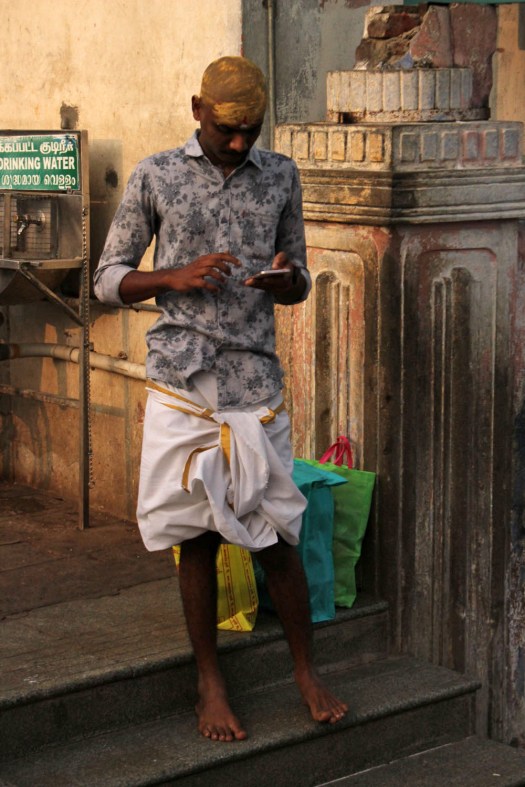
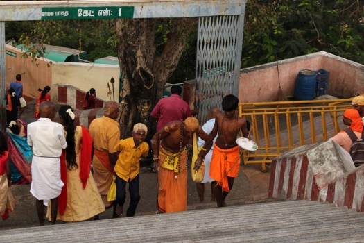
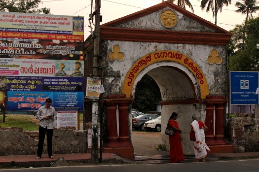
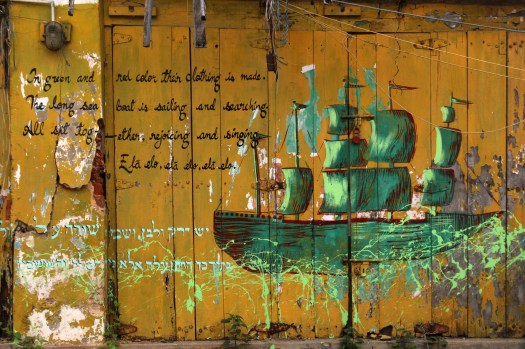
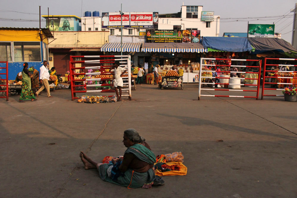
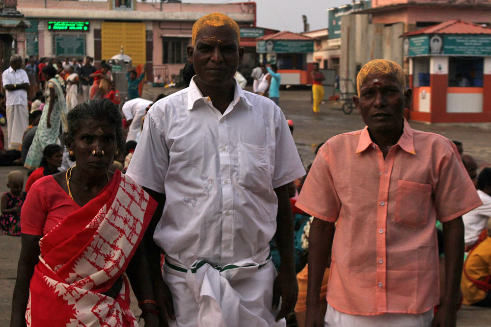
We arrived in the town just as it was starting to get dark – enough time to have something to eat and wander around the market stalls that stood at the base of the steps that led up to the hilltop temple. The temple, dedicated to the god Murugan, was clearly a big draw for south Indian pilgrims and all the necessary facilities were in place to service their needs. As well as numerous ‘hotels’ offering ‘Pure Veg’ food and a mass of stalls selling mass-produced trinkets and cheap jewellery, a large sign outside a booth offered an ‘Ear Boring’ service, while another advertised itself as ‘Tonsure Centre’, a place dedicated to providing the correct sort of haircut – head shaven with an application of sandalwood paste – for dutiful pilgrims.

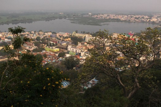
The Murugan Temple – Arulmigu Dandayudhapani Swami Temple to give its full glorious name – stands on a hill above the town. Murugan – aka Muruga, Kartikeya, Skanda, Kumara, Subrahmanya – is a Hindu god of war, a philosopher-warrior figure, son of Parvati and Shiva, who is particularly popular in the southern part of the Indian subcontinent. The temple at Palani is one of six ‘abodes’ (actually, temples) in the southern Indian state of Tamil Nadu that are dedicated to Murugan. A long flight of stone steps lead up to the top, as does a meandering path for elephants and winched cable car that takes a different, more direct route around the back of the mound.

A little too hot in my hotel room, even under the swishing fan, I dreamed that night of Mark E Smith of The Fall, who in my dream was performing a solo outdoor gig in a Norwich back garden. In the dream world, as in life, Smith was as rambunctious and curmudgeonly as you might expect. He also looked painfully thin, as well he might, and before I woke I recalled mentioning this to someone else present, saying, “I know he’s dead so I suppose this is a dream isn’t it?”

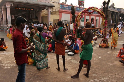
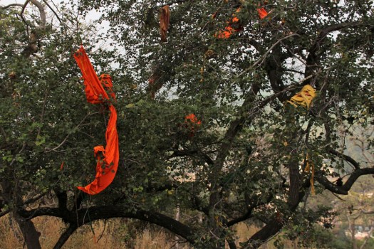
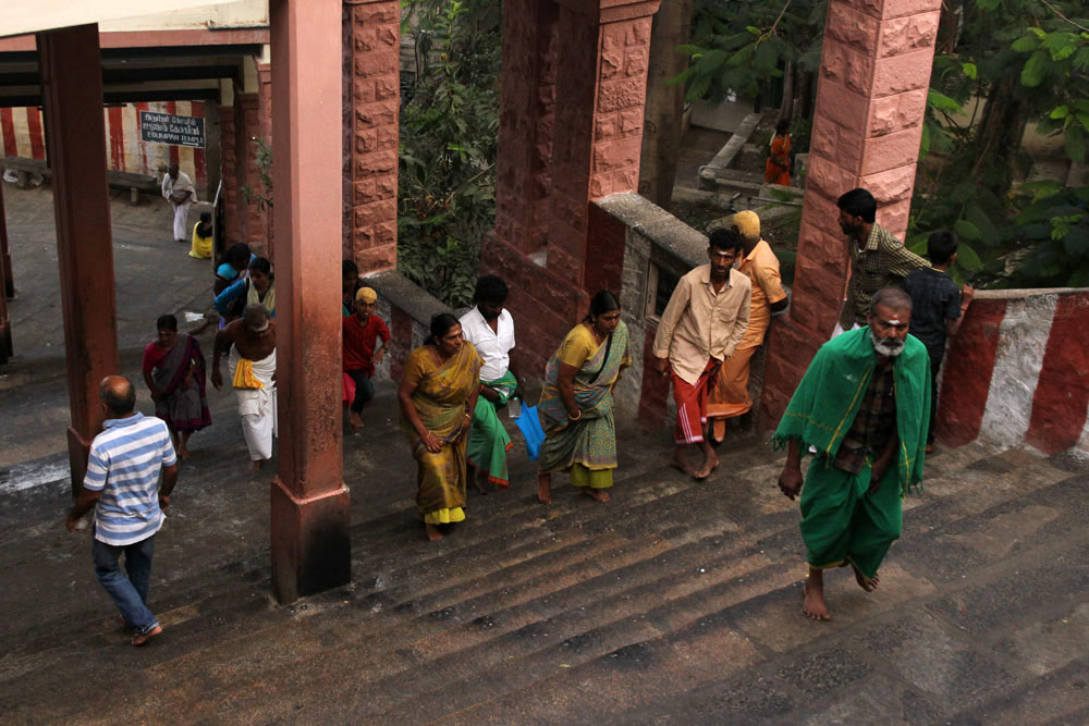
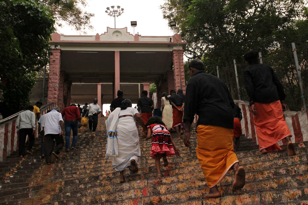
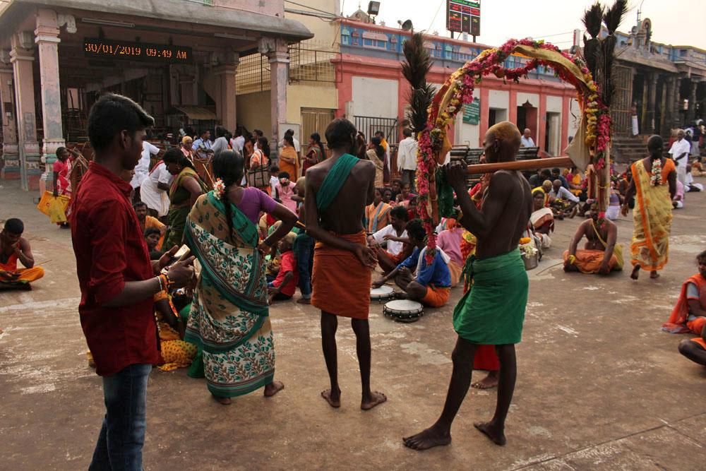
We stepped out into the streets at dawn next morning to make our way to the steps that led up to the temple, leaving our sandals at the bottom before we started the ascent. A line of orange-clad saddhus flanked the base of the steps and scattered by the wayside at various stages of the ascent were gift sellers who touted garlands and puja offerings to present of the shrines above. We were the only foreigners, the only obvious non-Hindus present, yet we were welcomed without fuss. Amplified music of devotional singing accompanied our climb, and mobile phones blazed away around us as we made our way uphill with the other visitors. As everywhere in India, there were numerous friendly requests for selfies – group photos that included us in the frame as some sort of Euro-exotica. This seemed fair exchange, and it was pleasing to know that somewhere out there in the digital ether, in a parallel world to this posting, there existed no small number of images on Instagram and Facebook that included our own heat-flushed faces.

The steps to the top – I did not count them but estimates range between 550—700 – are rock-cut into the hillside. For those unused to it, it can be oddly sensuous walking barefoot for any distance, especially on stone that is deeply embedded with the patina of human activity – a layering of daubed sandalwood paste and windblown dust compounded by the devout footfall of countless pilgrims. Heading uphill we passed chalked mandalas, small shrines and intriguing side temples with attendant bare-chested priests. Macaque monkeys frolicked in the trees that overhung the steps; a solitary owlet stood sentinel on a branch overlooking the plain below. Some of the more elderly pilgrims struggled with the effort of climbing, and a few reluctant children dragged along by parents complained noisily, but overall the atmosphere was cheerful and relaxed – more holiday fun than holy day solemnity.


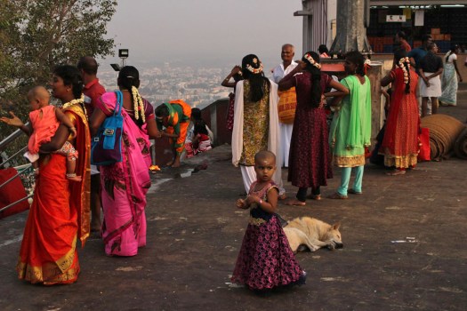
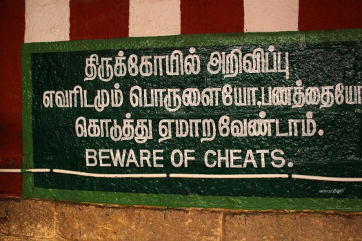
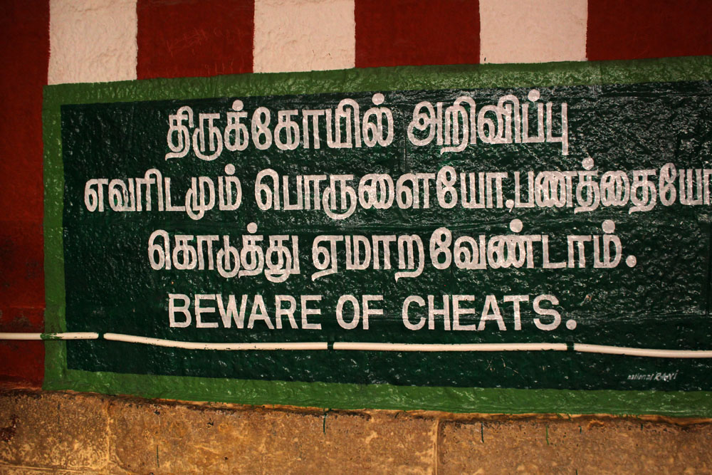
At the top, groups of people were scattered around, snapping family pictures on their phones, eating snacks, waiting patiently for their turn for darshan (a view of the sculpted deity) within the temple itself. Large signs carried warnings about thieves and cheats. We circumambulated the temple clockwise, the scent of incense, jasmine and wood smoke permeating the clear, bright air. This intoxicating cocktail – so evocative, so quintessentially Indian – was my madeleine. Here was the India of old that I knew and loved, a deeply felt nostalgia rooted in time and place that touched a nerve, or rather, caressed it tenderly. Here was something that invoked the emotional memory of previous visits made decades earlier: an echo of that indescribable early morning magic when the deep, ancient culture of the subcontinent seemed to manifest itself in a mysterious yet timeless way. To adopt the epithet used by the late John Peel to describe his favourite band, The Fall, whose erstwhile leader I had so peculiarly dreamed about the previous night, India was ‘always different, always the same’. And it was true, despite rampant modernisation in recent years, India at heart was always different, always the same.

IMG_3015IMG_3007IMG_3016IMG_3028IMG_3020


A Berlin Interlude

img_1874
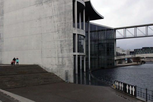
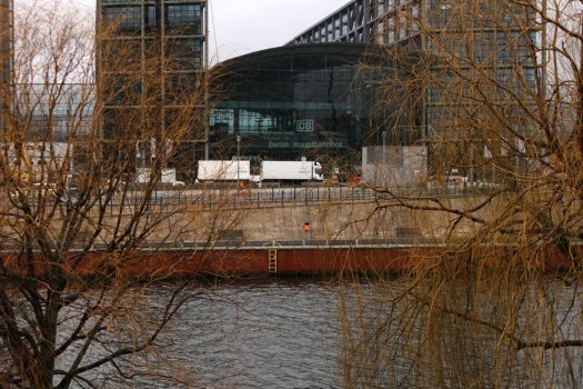
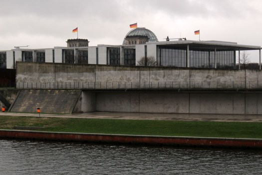
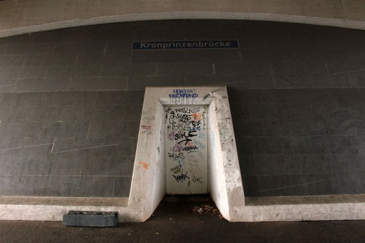
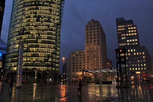
What do you do on a drizzly grey day in Berlin? A midwinter day when the sun is enfeebled and hidden, cowering somewhere beneath a thick duvet of cloud. What do you do in a city that you do not know well and only have experience of in winter?

img_1875

In early January the detritus of Christmas can still be seen in the streets – fairy lights cling obstinately to avenues of artificial trees, and discarded Christmas trees litter the pavements awaiting collection for recycling. The year has turned and spirituality and festivities will soon give way to politics. In less than a week, Berliners of a left-leaning persuasion will be attending another regular winter event, the commemoration of the deaths of the Spartakusbund (Spartacist League) leaders, Karl Liebknecht and Rosa Luxemburg, who were summarily executed during the uprising of January 1919. Each year on the second Sunday in January Berliners gather at the Memorial to the Socialists at Friedrichsfelde Cemetery to commemorate Luxemburg, Liebknecht and others who perished at the hands of the right wing Freikorps. This year is the centenary.

img_1883

img_1859img_1864

I am a few days too early for this event so I decide instead to take a walk along the main body of water that flows through central Berlin, the River Spree. I walk out of Berlin Hauptbahnhof railway station and cross the river to its south bank to follow the path to Museuminsel (Museum Island), from where I will strike west away from the river towards Alexanderplatz. Light rain and dense cloud renders the urban landscape almost monochrome. Such colour that there is stands out for its rarity – traffic lights, bright umbrellas, the hi-vis orange jackets worn by street workers. Although this is the heart of a populous capital city there are few other walkers to be seen – the poor weather has seen to that – but here and there is a jogger, a strolling couple, a woman pushing a pram. Tracing the river, I pass a succession of ultra-modern waterside buildings – enterprise temples of concrete and glass that give the impression of being hermetically sealed from the gloom outside. Office workers in a brightly lit dining canteen pay me no attention as I walk past on the other side of the glass wall that separates us. The Foster-designed glass dome of the Reichstag makes an appearance above the surrounding buildings as I progress; black, red and yellow flags flutter in the breeze.

img_1858img_1855

img_1865

Leaving the canal behind after traversing Museuminsel, the lofty TV tower of the Fernsehturm at Alexanderplatz comes into view, as eventually do the twin Communist period tiered towers that flank Karl-Marx-Allee. At Alexanderplatz I descend underground to catch the U-bahn and a few stops later emerge once again at Potsdamer Platz where I cross the square to enter the railway station. Past sunset by now, the sky squid-ink black, the fluorescent blaze from the office blocks that fringe the square throws up reflected light from the rain-wet pavement. After colour-robbed days such as this the bright lights of human endeavour contrasted against the intense darkness of night can seem almost a comfort.

img_1932

img_1912


The Rule of Home

IMG_2198

As a few of you may know, I have been working on a much longer project, a book in fact, for quite some time. This work is centred on a walk made coast to coast across England and Wales, from Great Yarmouth in Norfolk to Aberystwyth on the Welsh coast. The idea was to follow a route that traced familiar haunts and places of personal significance, to join up the dots and connect the places along the way with a line made by walking – a pagan pilgrimage, if you like.

An edited fragment of my slog through the Fens appeared on the Burning House Press online journal when it was selected by guest editor C.C. O’Hanlon back in April.

This month’s guest editor, Rachael de Moravia, chose another piece of mine that will eventually find its home in the book in some form or other. This extract, entitled The Green, Green Grass of Ceredigion, comes from near the end of my journey as I approach Aberystwyth. It muses over ideas of home and the Welsh notion of hiraeth. It is also about roots and routes, and the desire paths of personal topography. You can read it here.

PS: I recommend spending some time perusing the Burning House Press website, which is themed monthly under the auspices of various guest editors. There is plenty to enjoy here, with a wide range of writers and artists venturing off into different and sometimes starkly contrasting spheres of the poetic.

Beside Song-Köl Lake

IMG_1182
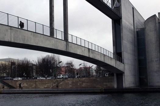
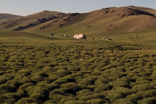
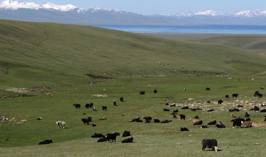
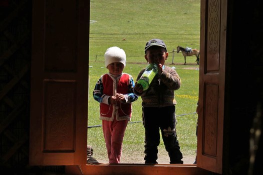
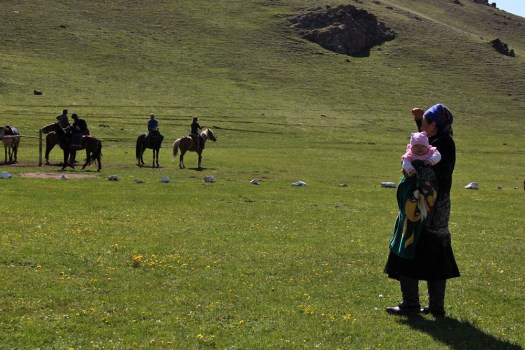
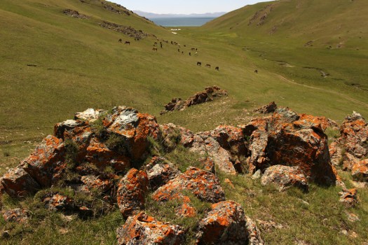
There are places that stay in the mind long after visiting. Places that haunt the mind’s memory cache to prevail even years after having set foot there. Such places might be mountains, or rivers, or stretches of coastline; or even villages that charm and bejewel the bedrock of a singular landscape. Usually though, it is a combination of factors that constitutes the essence of such places – earth, sky, water, topography, the patina of a human occupation that beautifies rather than despoils. One such place is Lake Song-Köl in central Kyrgyzstan, the poster girl of a country that has occasionally, and not unreasonably, been described as the most beautiful in the world.

IMG_1082IMG_1136

It had been a long time – twelve years in fact – since I had last visited. My assumption was that it hadn’t changed much in the interim. I was right – the landscape was as I remembered it, almost exactly. If anything, it was I who had changed: a dozen winters of freeze and thaw had affected me more profoundly than it had the pasture of the lake’s hinterland, the ever-renewing grazing pasture that justified its seasonal occupation.

IMG_0995IMG_1007

There are several ways to approach the lake, set high at over 3,000 metres in Naryn province in what is more or less the dead centre of Kyrgyzstan. We drove up from the east, through stark, tightly folded valleys and arid badlands, until the lake finally revealed itself as a blue sliver beyond meadows grazed by yak herds.

The yurt camp where we stayed seemed familiar, although they all tend to look much the same – a cluster of yurts, an isolated toilet cubicle, a hitching place for horses. For all I knew this may well have been where I had stayed before. Its location was certainly very similar: up along the lake’s north-eastern shore away from the main concentration of yurts close to the approach road. The camp was overseen by a cheerful baboushka*, who exercised gentle rule over her son, daughter and daughter-in-law, and fussed over her laughing grandchildren who looked so at home here on the jailoo* that you might imagined that this was the only world they ever knew, although outside the summer months they would probably be town-dwellers like the rest of us. As ever in Kyrgyzstan, we were welcomed with tea and bread… and jam, and honey, boiled sweets and biscuits – just a token snack before lunch – plov*, salad, more chai – which would be ready in an hour. There was just time for a quick walk up the broad, green valley where a drift of chestnut horses were grazing the thin grass of its slopes.

IMG_1043IMG_1018IMG_1040IMG_1173IMG_1060

After lunch, we went horse-riding with the baboushka’s son for the best part of three hours, two hours longer than my habitually non-equestrian body was comfortable with. Later, stiff and sore, and thankful to return to bipedal ways, we hiked up above the valley before descending down to the lake water where horses were lined up drinking. A small marshy area close to the shore revealed a solitary redshank and a grey wagtail. We had hoped for birds of prey but, other than a single circling buzzard, raptors were shy in revealing themselves. Wheatears, on the other hand, seemed to be almost everywhere, flashing white as they cocked their tails flitting from rock to rock. And skylarks too, an improbable density of them jangling the sky – the birds had flown up in such abundance from unseen nests whilst on horseback earlier I had been concerned that we might trample eggs beneath our inexpertly guided hooves.

IMG_1065IMG_1052IMG_1120

After dinner – fish from the lake fried in batter, more bread, more chai – another brief walk to watch the full moon rise. A band of pink cloud humbugged the darkening sky like a vein of quartz in rock as definition blurred and colour drained from the land. Above us, hovering low in the sky, as if serenading – or perhaps, scolding – the rising orb, a single skylark clattered its song in the ebbing light.

*baboushka – grandmother

*jailoo – alpine meadow providing seasonal grazing

*plov – Central Asian dish made with mutton and rice

IMG_1146IMG_1153

Kyrgyzstan railway wagons

IMG_7265
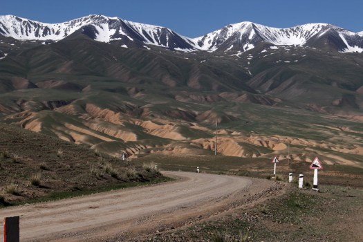
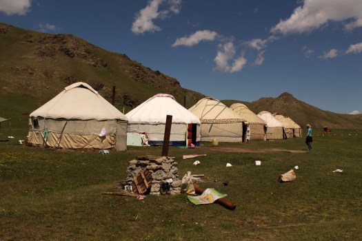
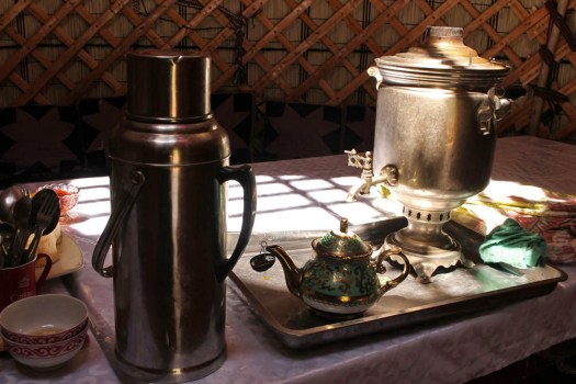
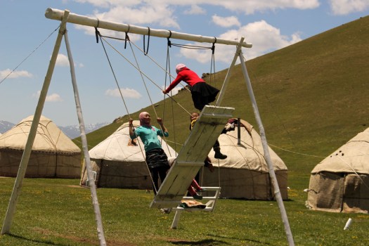
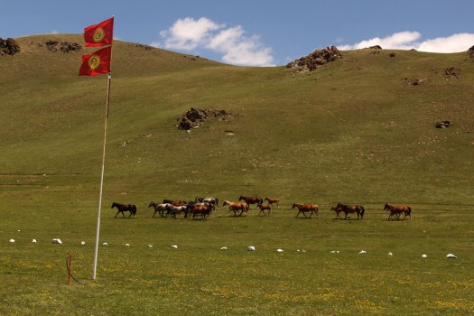
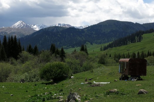
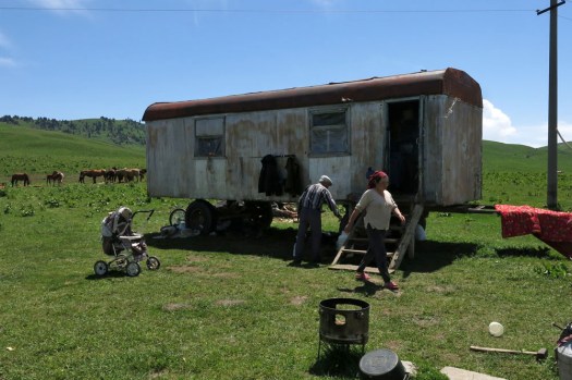
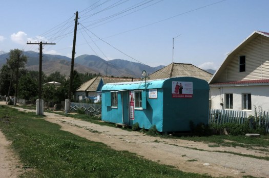
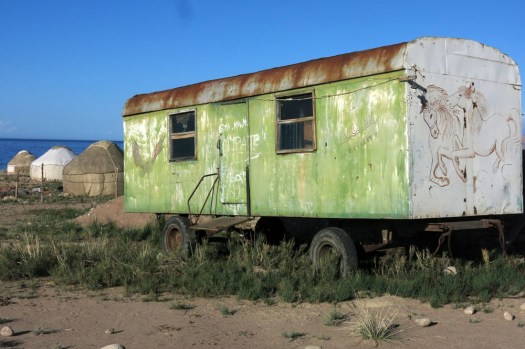
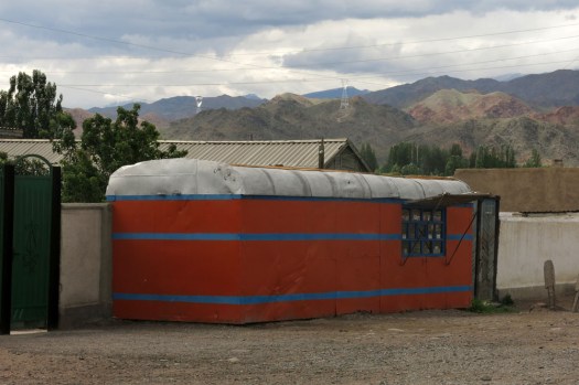
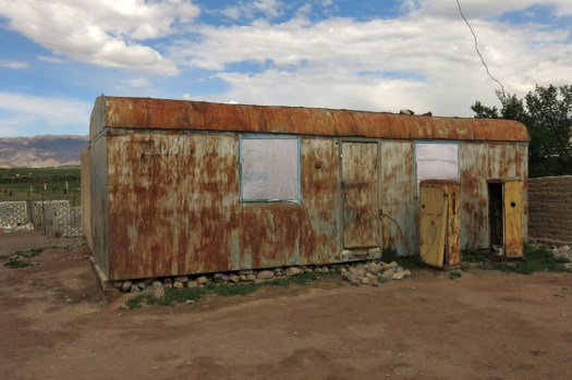
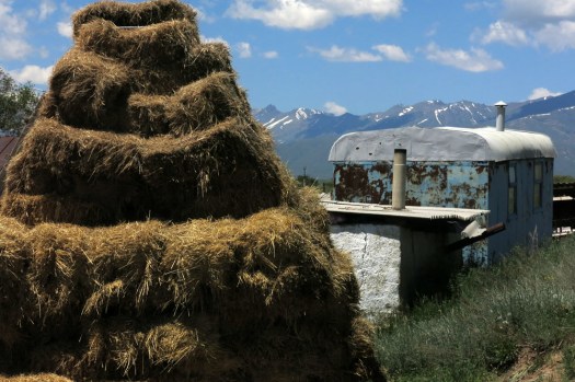
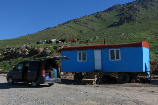
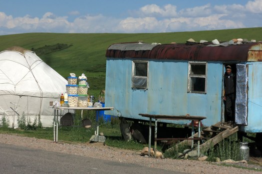
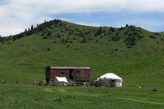
Kyrgyzstan does not have much of a railway system. A branch line from Moscow extends down from Kazakhstan to Bishkek, the Kyrgyzstan capital; another offers an excruciatingly slow service to Balykchy on Lake Issyk-Kul. Another line extends from Jalal-Abad in the south into Uzbekistan, although trains no longer run on this one. All of these routes date back to Soviet times but even then, Kyrgyzstan, or the the Kyrgyz Soviet Socialist Republic as it was in those days, sat on the outer fringes of the USSR, closer to China than to Moscow. All the more surprising then that, wherever you go in post-independence Kyrgyzstan, you tend to see Soviet-era railway carriages re-located and re-purposed as dwellings, shops, storerooms and even roadside tea-houses. What is most striking is how these are often located far away from a railway line or anything that even resembles a serviceable road. Bump along a rough stony track up to an isolated jailoo (alpine meadow with summer grazing) and the chances are that the nomadic family you meet there will have use of a rusting railway wagon parked somewhere near their yurt. Yurts are ubiquitous in the mountains in summer, and so central to the Kyrgyz way of life that the tunduk, the circular wooden centrepiece  of the roof, appears on the national flag.  But recycled decommissioned railway wagons have their part to play too, even if rusted metal is less aesthetically pleasing than white felt. In poor countries undergoing rapid transition like Kyrgyzstan, such a resource is too useful to be wasted.

IMG_7308IMG_7317IMG_7352IMG_7623IMG_7822IMG_7987IMG_7996IMG_8572IMG_8701IMG_9678

All the above images ©Laurence Mitchell.

From top to bottom: 1 – 4  Karkara valley, close to Kazakhstan border; 5 Tamga village, Lake Issyk-Kul ; 6 Bel-Tam, Lake Issyk-Kul; 7, 8 Kochkor, Naryn province; 9 Suusumayr village, Chuy province; 10 Roadside near Too-Ashuu Pass; 11 Roadside near Ala-Bel Pass


The Bridge to Nowhere and the Bays Road

IMG_7499
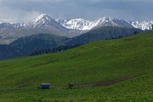
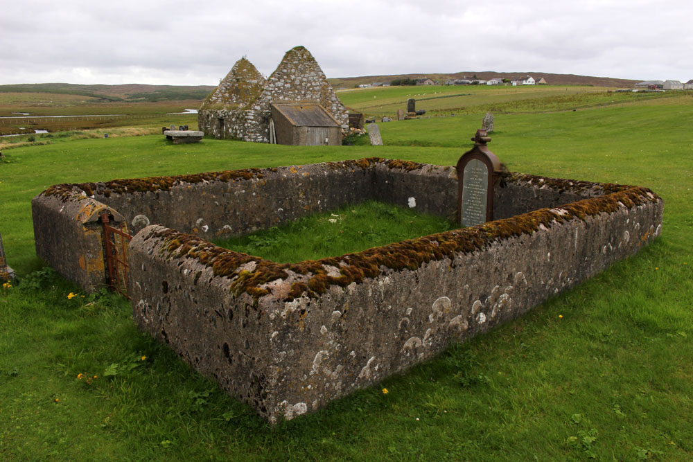
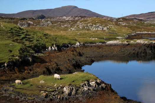
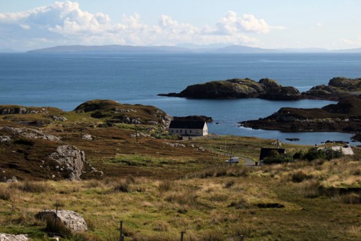
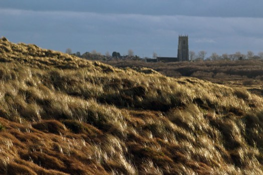
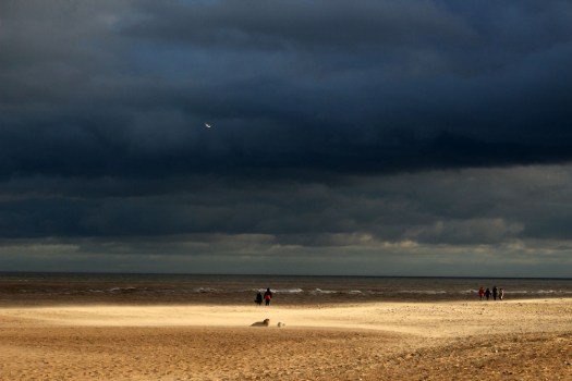
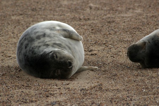
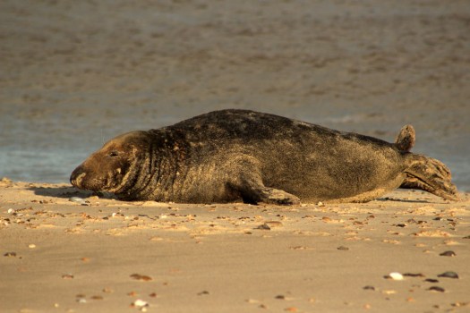
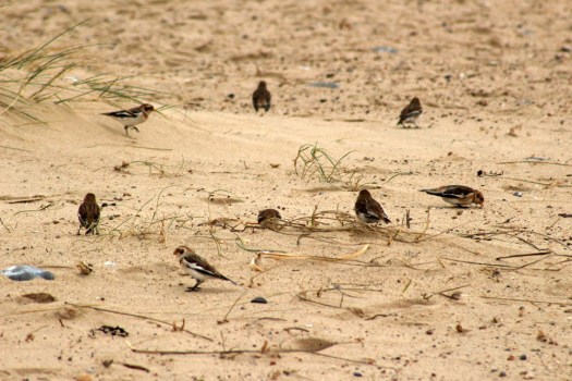
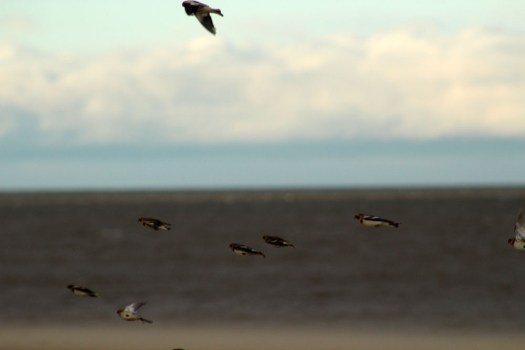
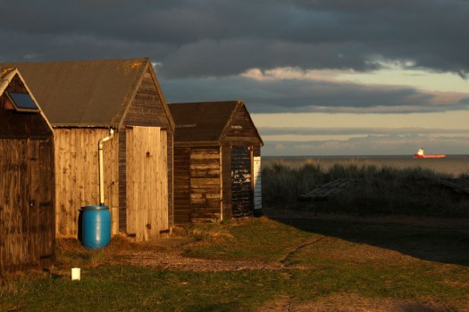
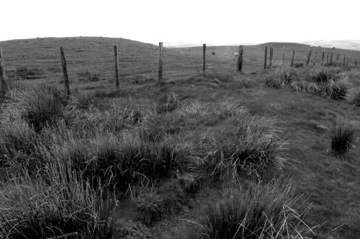
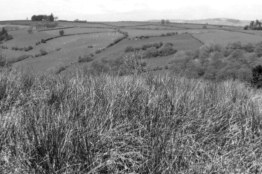
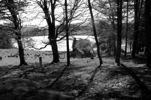
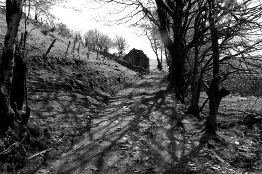
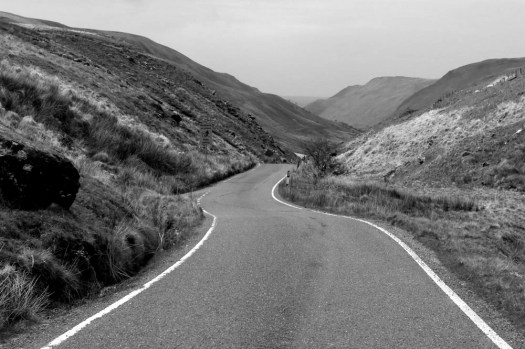
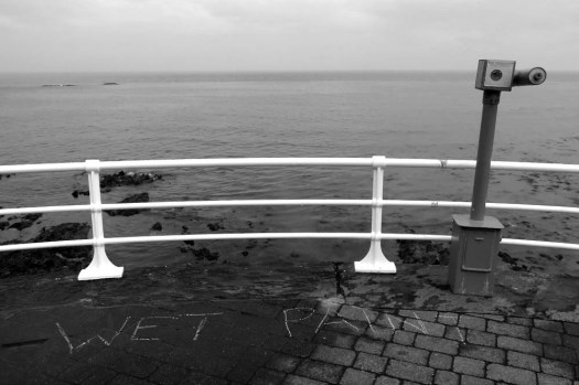
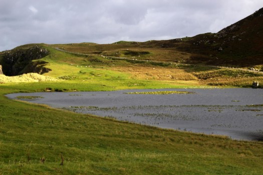
Just three main roads radiate out of Stornoway, the capital of the Isle of Lewis. One heads across mountains towards Tarbet and Harris to the south; another goes east past the island’s airport and along the Eye Peninsula to come to halt at the lighthouse at Tiumpan Head, while a third leads across the island’s moorland interior to reach its west coast. A little way along this last road is the turn-off to Tolsta, a minor road with the most unexpected of endings. The road passes bungalow settlements and sea-facing graveyards as it leads north. In Hebridean terms, this is relatively densely populated terrain — one settlement merging into the next in a loose sprawl known collectively as Back. This stretch of Stornoway’s hinterland might elsewhere be termed green belt were it not a fact that pretty well anywhere on Lewis and Harris could be described as ‘green’.

Some fifteen miles from Stornoway, a little way beyond the small coastal village of Tolsta, is Garry Beach, a quiet sandy beach with its own car park. A few campervans are parked up here and a rusty caravan is tethered in a boggy field alongside, more likely a base for itinerant workers than a low-rent holiday home. A couple, well wrapped-up against the cool on-shore breeze, are exercising their dog on the beach. A couple of jagged sea stacks rise vertiginously just offshore; half a dozen oystercatchers methodically work the tideline, red beaks wrestling with molluscs. The asphalt road, single track since Tolsta, ends abruptly at the car park and continues only as a rough peat-digging track that winds up the hillside towards a concrete structure. Walk up here and you soon come to it — a bridge over a narrow gorge that, counter-intuitively, appears to be the very end of the road.

The Bridge to Nowhere, as it is generally known, was constructed by Lord Leverhulme, one-time owner of the island, as part of a project to build a road that connected Stornaway with Ness, a fishing village at the northern tip of the island. Like many of Leverhume’s ambitious schemes, good intentions went awry and for a number of reasons the road was never completed. Even today, the only direct way between Tolsta and Ness is on foot, a weary ten-mile slog through soggy moorland that for most people makes the longer, circuitous trip by road via Stornaway and Barvas a more attractive option.  The original vision was to build three large farms that would provide dairy produce for fish cannery workers. Alas, the fish canning empire never came to fruition and a lack of both funds and enthusiasm resulted in the road never extended beyond the bridge at Garry Beach.

IMG_7517IMG_7522

Head south of Stornoway, over the North Harris Hills to Tarbet and then across the isthmus into South Harris, and you have two options to reach to the ferry port of Leverburgh at the southern tip of this, the largest of the Hebridean islands. The road that skirts the west coast is relatively wide and easy to navigate but the road that runs parallel to the east coast, circumscribing many rocky inlets along the way, is of a very different character. The two coasts of South Harris have strikingly contrasting landscapes. While the west road swoops smoothly past enormous tidal sandy beaches like that at Luskentyre, the narrow east road weaves erratically around rugged inlets and rocky outcrops.

IMG_8170

Rough country, largely soil-less, infertile, with very little land suitable for grazing or farming — you might wonder why people might live here in the first case. The reason, of course, as in so many places in the Scottish highland and islands, is because of widespread clearance in the late 18th and early 19th centuries. The extensive land clearances of Harris were enforced by the Macleod family who once owned the island and who, to make way for their profitable sheep enterprises, forcibly moved many crofters off the relatively fertile land of the west coast to the far poorer, rocky terrain of the east. As a result, many families migrated to Canada to seek a better, more secure life, while those who remained struggled to survive by digging ‘lazy beds’ for potato-growing — labour-intensive raised beds in which the thin poor soil was bulked out and enriched with seaweed and straw. Never was the word ‘lazy’ so misappropriated.

IMG_8213

To travel the Bays Road, as the C79 east coast road is better known, is to witness a dramatic sweep of exposed gneiss, sky and water, with ever-changing glimpses of narrow rocky inlets, dark reed-filled pools and peat-stained streams the colour of strong-brewed tea. The road is not for drivers of a nervous disposition – narrow even for a single lane, with a general allocation of passing spaces, it is a constantly winding tour-de-force where each mile covered seems more like five. Stark, barren, primeval: the landscape is far from bucolic but it is undeniably beautiful. Sheep wander across the road with impunity; white-tailed eagles and buzzards spiral slowly overhead; curious ravens perch on rocks eyeing the sporadic passing traffic like pensioners on a park bench. For the briefest of moments, a pair of golden eagles make an appearance silhouetted high above a ridge. At the road’s highest point, the peaks and headlands of the Isle of Skye show themselves to the east across the wave-flecked Little Minch. The sea is translucent, deepest blue; a CalMac ferry is halfway across the channel steadfastly plying its twice-daily journey to Uig on Skye. In the diamond-clear light, the far-distant Cuillin Hills can be seen glinting crystalline in the sun. Deprived of a decent livelihood by uncaring landlords, you can only reflect that the crofters who were banished to this unwelcoming, unworkable terrain were at least given possession of some of the finest viewpoints in the kingdom.

IMG_8214IMG_8218