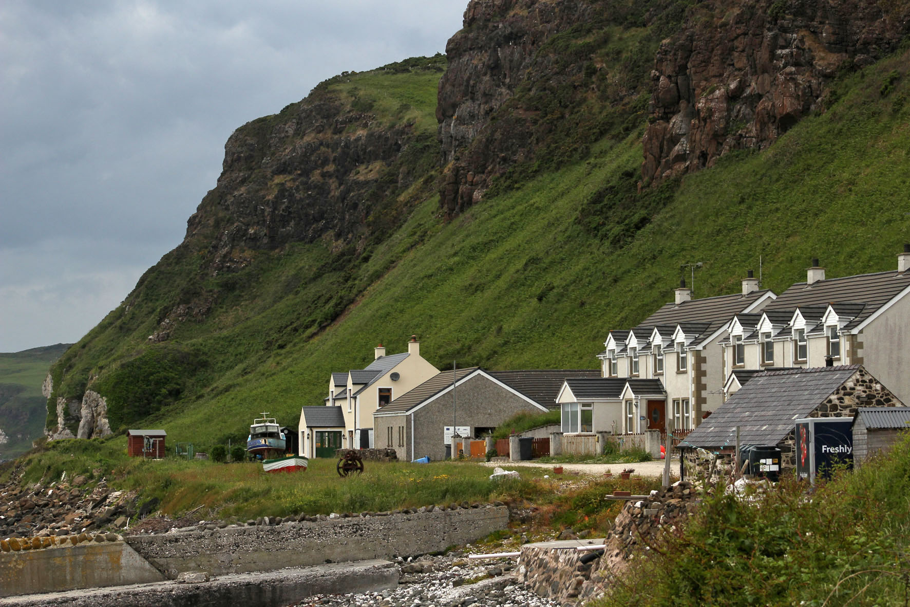
For one week this June this small island off the Antrim coast was a constant presence. The cottage we had rented stood high on a hill a couple of miles outside the resort of Ballycastle and the view to the north was an uninterrupted panorama of sea, sky and the long, low profile of Northern Ireland’s only inhabited island. The view depended on the weather, of course, which was something that changed constantly and wavered between overcast and mixed spells of sunshine and showers.
The L-shaped island that hugged the northern horizon was always visible, although in less clement weather it was sometimes little more than a hazy grey outline, a vague smudge that sat on the water. Sun or shine, two of the island’s three lighthouses were always in view, winking at intervals to alert shipping – the waters around Rathlin Island have a long history of shipwrecks and the remains of many unsuspecting vessels lie gathering barnacles at the bottom of the Atlantic close to its shore.
On sunnier days, more detail became evident and the island’s magpie cliffs of basalt and chalk could be clearly discerned, as could the houses and church of the village by the harbour. It was on these brighter days that other landforms also took shape on the horizon. Most days we could make out the southern end of the Scottish peninsula that is the Mull of Kintyre but now and then, far beyond the island, more distant places came into view – the hills of Islay and the unmistakable rise of the Paps of Jura.
From our perspective the island appeared to be at the edge of things. The most northerly point in Northern Ireland, it was the place where the island of Ireland gave way to the Atlantic. A small island that lay off the coast of another larger island, it seemed to be more an outlier than a stepping stone to anywhere else. But it was a place that had not always been so peripheral: long before today’s national divisions had come into play Rathlin had been central to the ancient Gaelic kingdom of Dal Riada, a political entity that included the coast of Argyll in western Scotland as well as part of what is now County Antrim in Northern Ireland.
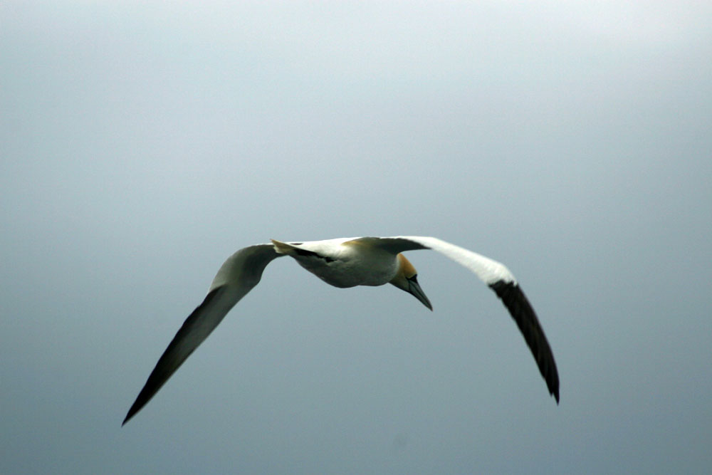
Some days we could make out the ferry, Spirit of Rathlin, plying its way between Ballycastle and the island. On a day that promised to be calmer and sunnier than most we made the journey ourselves. As we drew closer to the harbour at Rathlin an increasing number of seabirds could be seen bobbing about on the water – a taste of what we would soon be seeing on the island itself. These were mostly guillemots but there were also small parties of gannets flying low over the waves, identifiable even at distance with their butter-coloured necks and long ink-dipped wings.
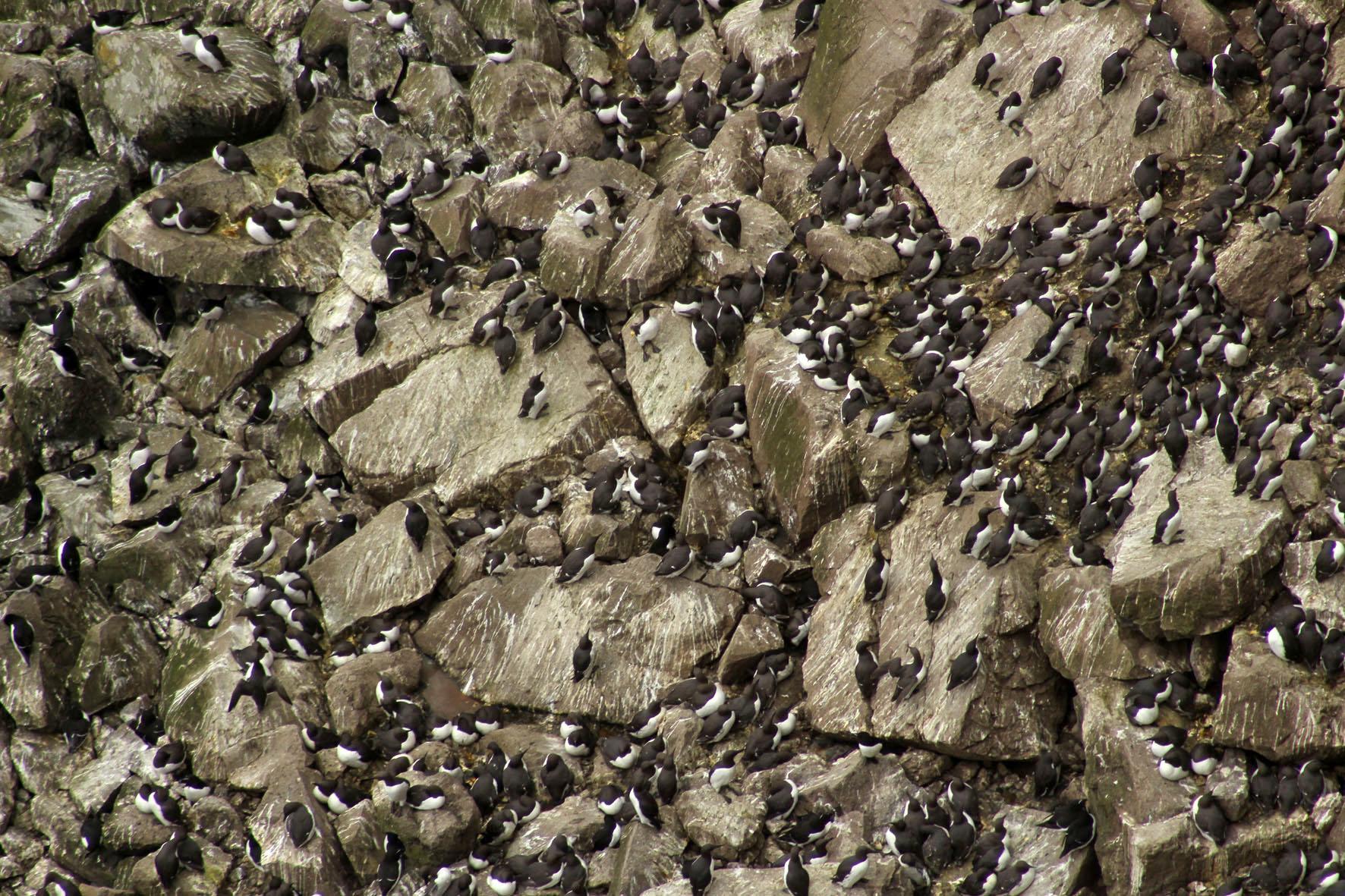
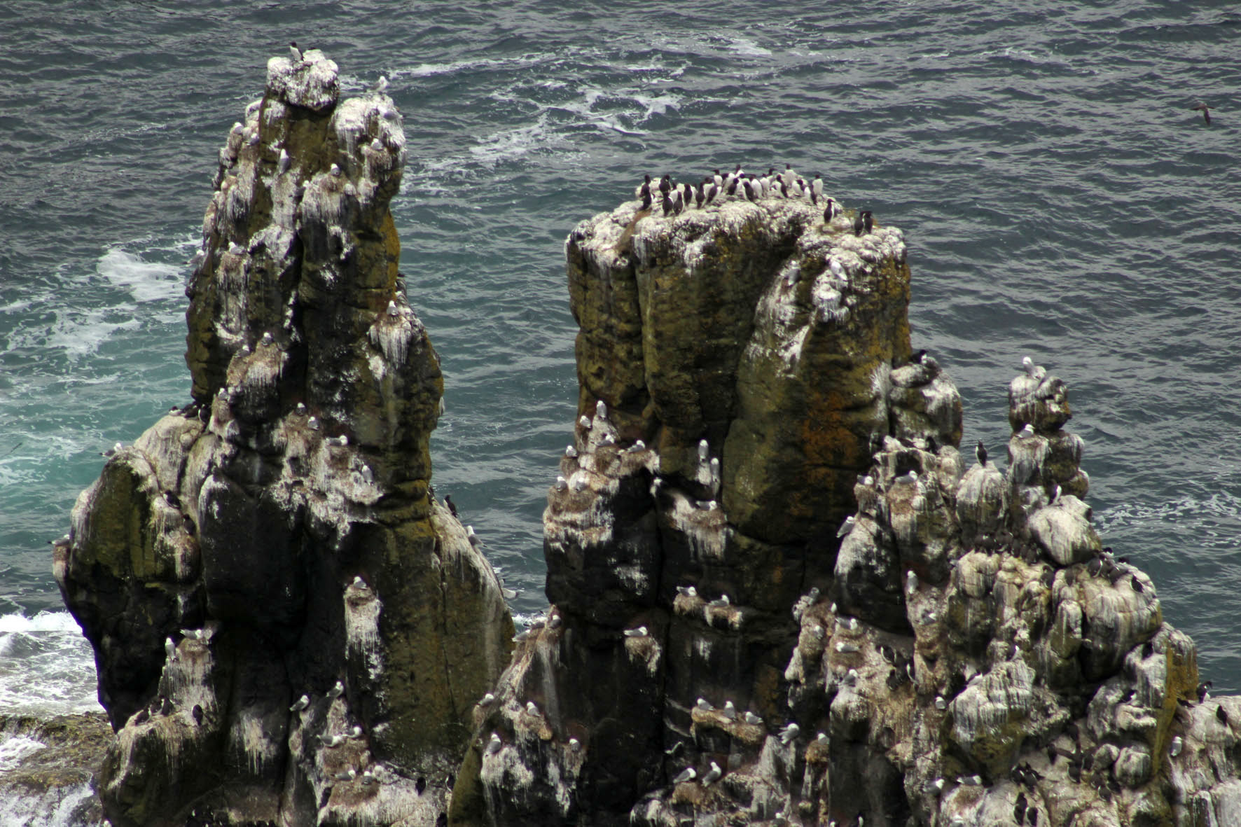
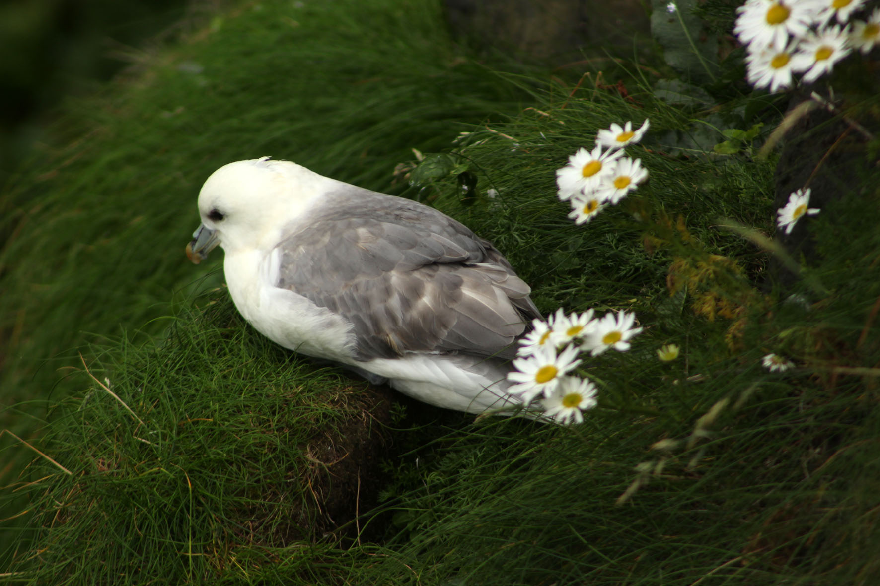
At Rathlin harbour, a bus – the ‘Puffin Express’ – was waiting to drive passengers across the island to the RSPB bird reserve at its western point. Here, steps led down to a viewing platform opposite the cliffs and stacks where the seabirds nested. The malodorous smell of guano grew increasingly strong as we descended – observing seabirds up close is undoubtedly one of the least glamorous aspects of bird watching. From the viewing platform vast numbers of seabirds could be seen at their nests opposite on the rocks – as closely packed as an urban high-rise but with distinctly separate enclaves of guillemot and razorbill, kittiwake and puffin. Closer to the viewing platform, a few fulmars, contemptuous of the excitable human presence and unperturbed by the relentless glint of expensive optics, had made their nests in the grass just beyond the barrier.

Driving back to the village, past fields of sheep and grazing cattle, our driver stopped the bus briefly to point out a cave to our left. It was the entrance, he said, to the stone axe mine that had existed on the island in Neolithic times.
In Belfast, a few days earlier, I had gone to see the so-called Malone Hoard at the Ulster Museum. The hoard was a collection of 19 beautifully polished stone axes that had been discovered on Malone Road close to the museum. The axes were around 6,000 years old and clearly ceremonial objects of some kind: not only were they too large to be of practical use for chopping trees but when they were discovered some of the stones had been found aligned vertically in the ground. Even behind glass, they were undeniably beautiful objects and had a curvy heft about them that seemed to invite handling. Given the understandable restrictions imposed by museums, this, of course, was not possible.
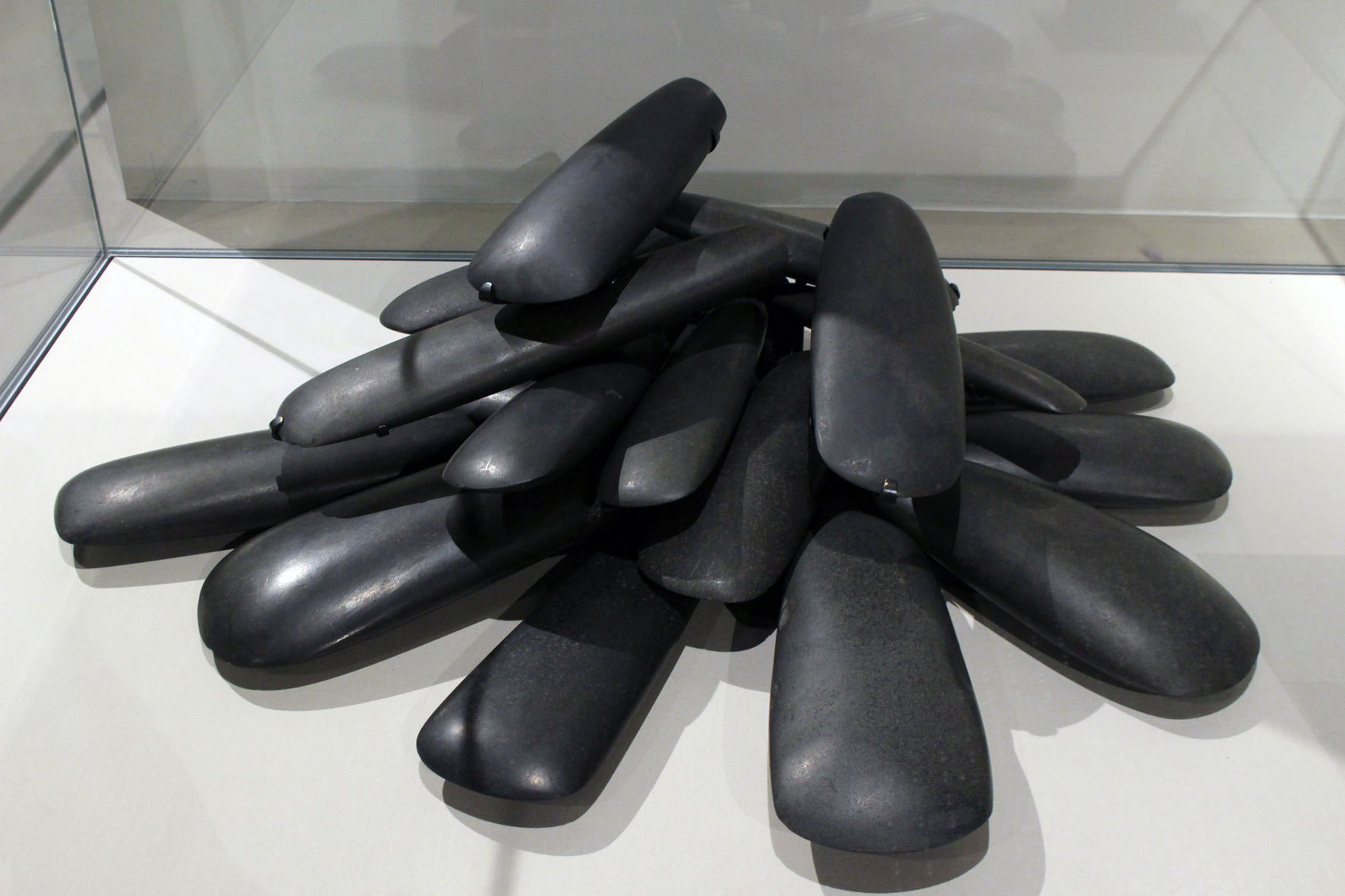
The axes had been identified as being made from a rock called porcellanite, a hard, dense impure variety of chert so-named because of its physical similarity to unglazed porcelain. Unlike flint, porcellanite does not flake easily and has a texture that accepts a fine polish and keen edge. There were only two possible sources of this scarce rock in Northern Ireland. Both were in Antrim. One was at Tievebulliagh, a 402-metre mountain in the Glens of Antrim; the other was on Rathlin Island. Both sources yielded rock of exactly the same physical and chemical makeup so it was impossible to tell which had been used for the Malone Road axes. For reasons of romance rather than anything more scientific, I preferred to think that these precious objects had originated here on the island.
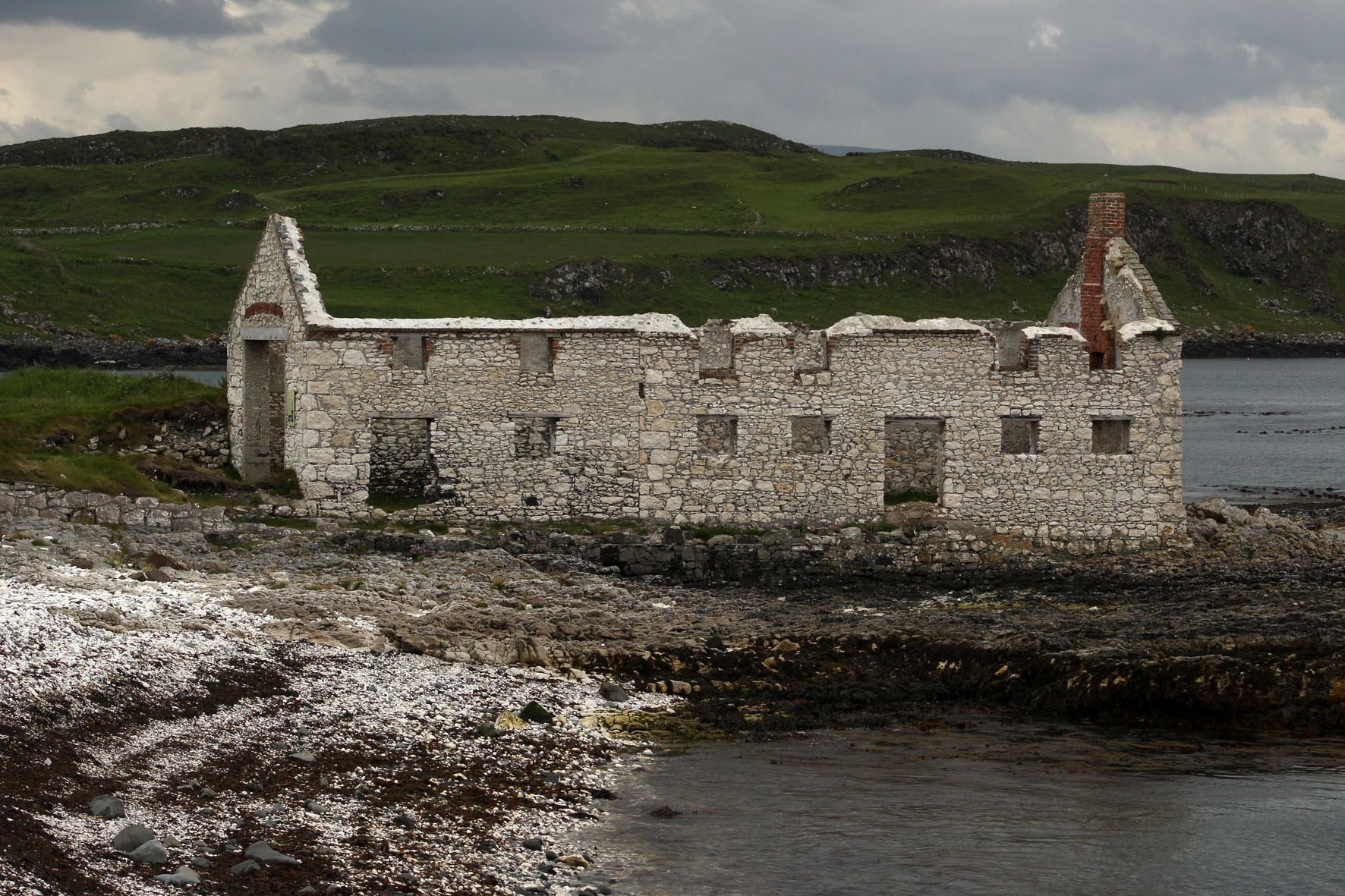
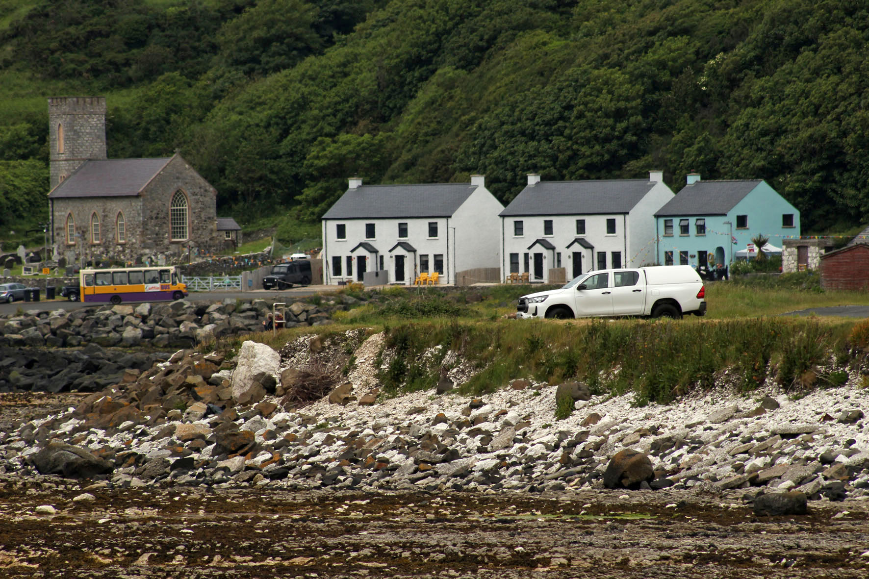
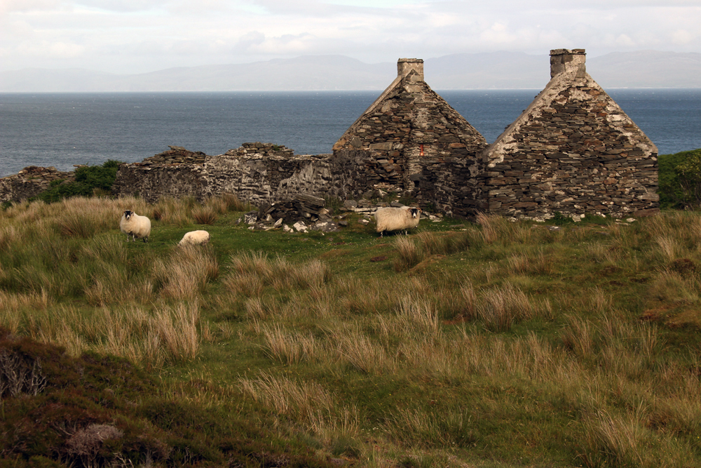
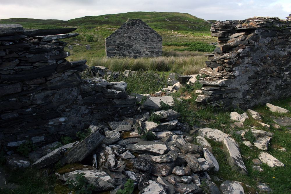
Back off the bus, we sat on the beach at Mill Bay listening to the piping of oystercatchers and watching grey seals as they made forays through the rafts of seaweed that lay just offshore. Seaweed was once a profitable business here. A little further on towards the harbour, an abandoned kelp barn stood roofless next to the shore. It was built of blocks of the same Cretaceous chalk that make up the white cliffs we could see from our rental cottage on the mainland.
After an unproductive listen for corncrakes in a field we had been told about by an RSPB warden we made our way to the jetty to wait for the ferry back to Ballycastle. Notwithstanding the lack of corncrakes, it had been a satisfying few hours. We were by now brim-full with all the wonders that Rathlin Island had to offer: the seabirds – the smell, the noise, the frantic flying about; the wider natural history of the place – the seals, the kelp, the garden flowers that had gone feral and colonised the island’s dry stone walls. Then there was the geology – the Cretaceous chalk and Tertiary basalt of the cliffs, the flints on the beach, the cave with its supply of elusive porcellanite. It would have been nice to have taken a peek inside the cave where the stone axe mine had been but it did not really matter. Prehistory, myth and memory are all intertwined and we make our own emotional truths. Whatever the true archaeological facts of it, in my mind at least the Malone Hoard axes would always be associated with this place on the edge of things.


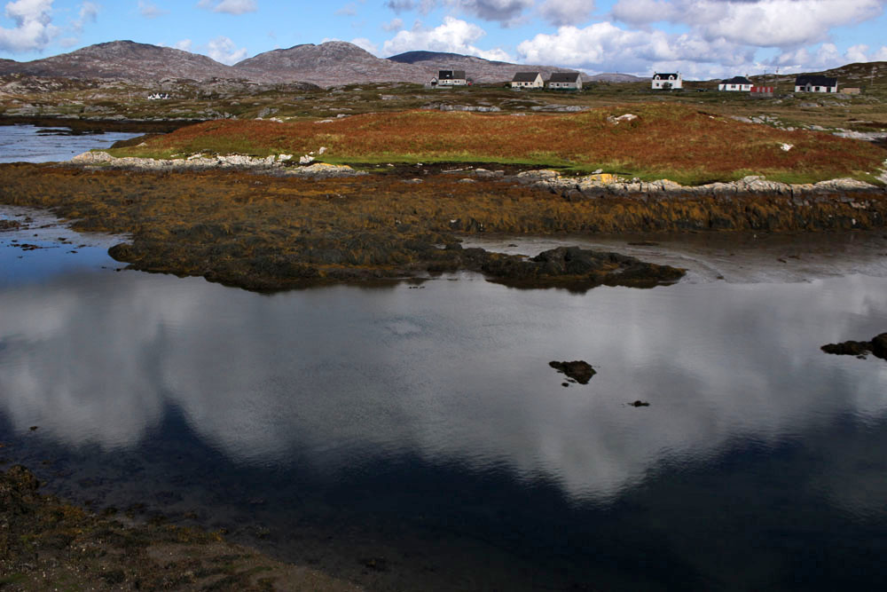
 Just three main roads radiate out of Stornoway, the capital of the Isle of Lewis. One heads across mountains towards Tarbet and Harris to the south; another goes east past the island’s airport and along the Eye Peninsula to come to halt at the lighthouse at Tiumpan Head, while a third leads across the island’s moorland interior to reach its west coast. A little way along this last road is the turn-off to Tolsta, a minor road with the most unexpected of endings. The road passes bungalow settlements and sea-facing graveyards as it leads north. In Hebridean terms, this is relatively densely populated terrain — one settlement merging into the next in a loose sprawl known collectively as Back. This stretch of Stornoway’s hinterland might elsewhere be termed green belt were it not a fact that pretty well anywhere on Lewis and Harris could be described as ‘green’.
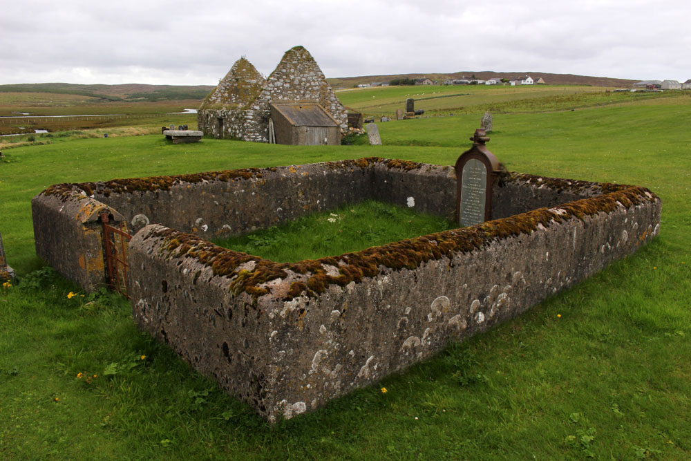
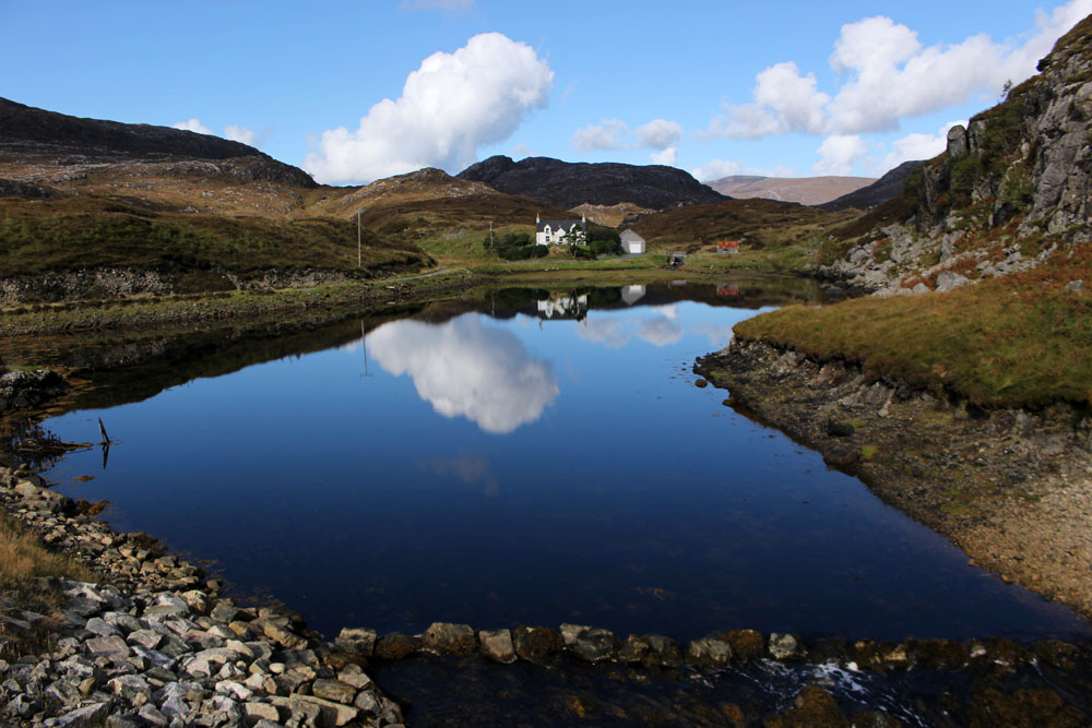

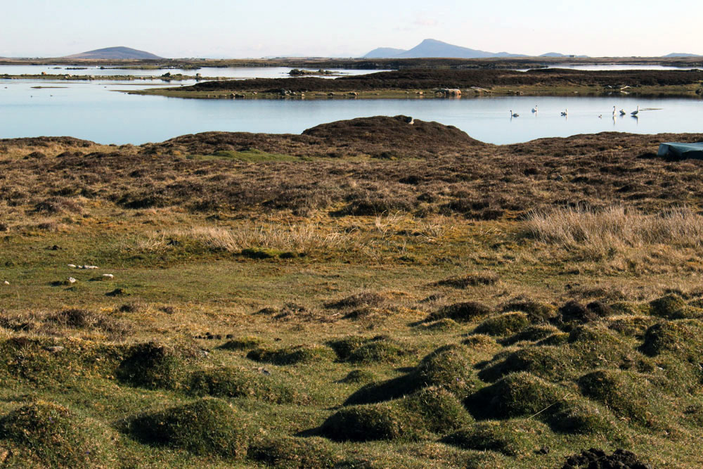
 Eleven miles east of the main road, six from the nearest shop (closed on the Sabbath), two miles from the open sea as the raven flies. Glen Gravir – a slender thread of houses stretching up a glen, just four more unoccupied dwellings beyond ours before the road abruptly terminates at a fence, nothing but rough wet grazing, soggy peat and unseen lochans beyond. This was our home for the week, a holiday rental in the Park (South Lochs) district of the Isle of Lewis in the Outer Hebrides.
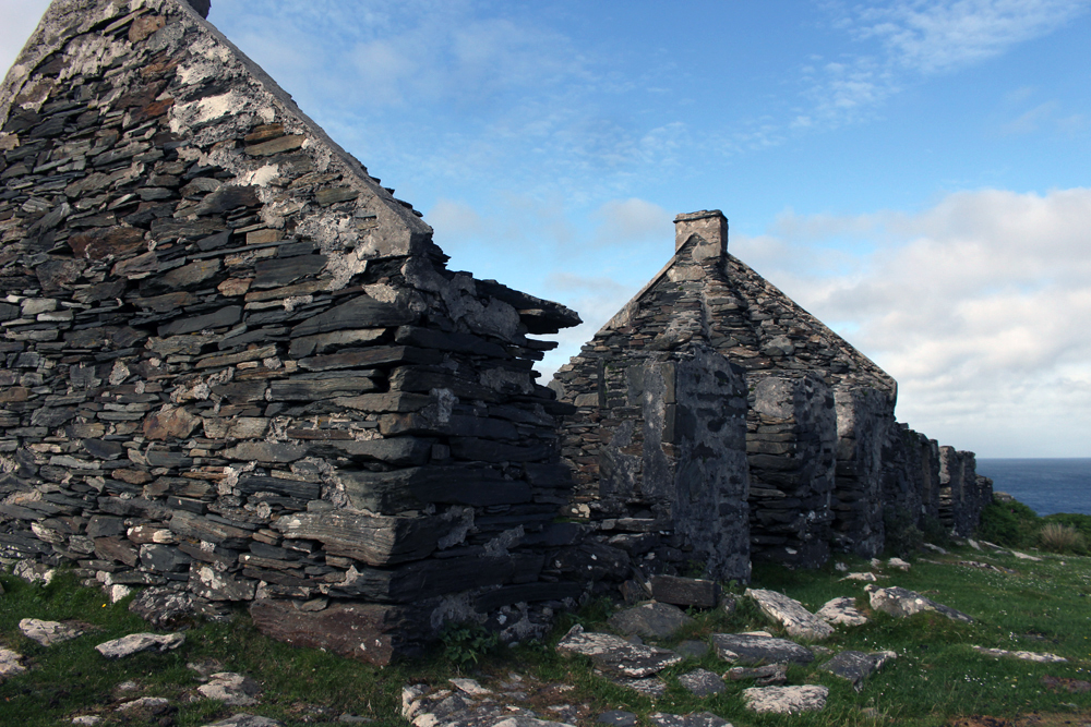
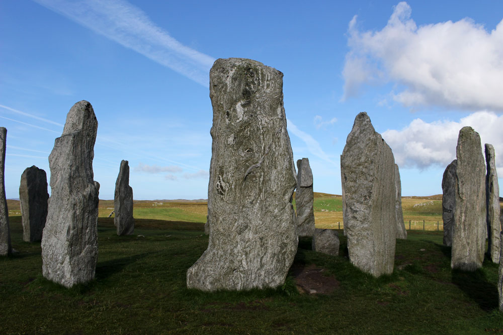
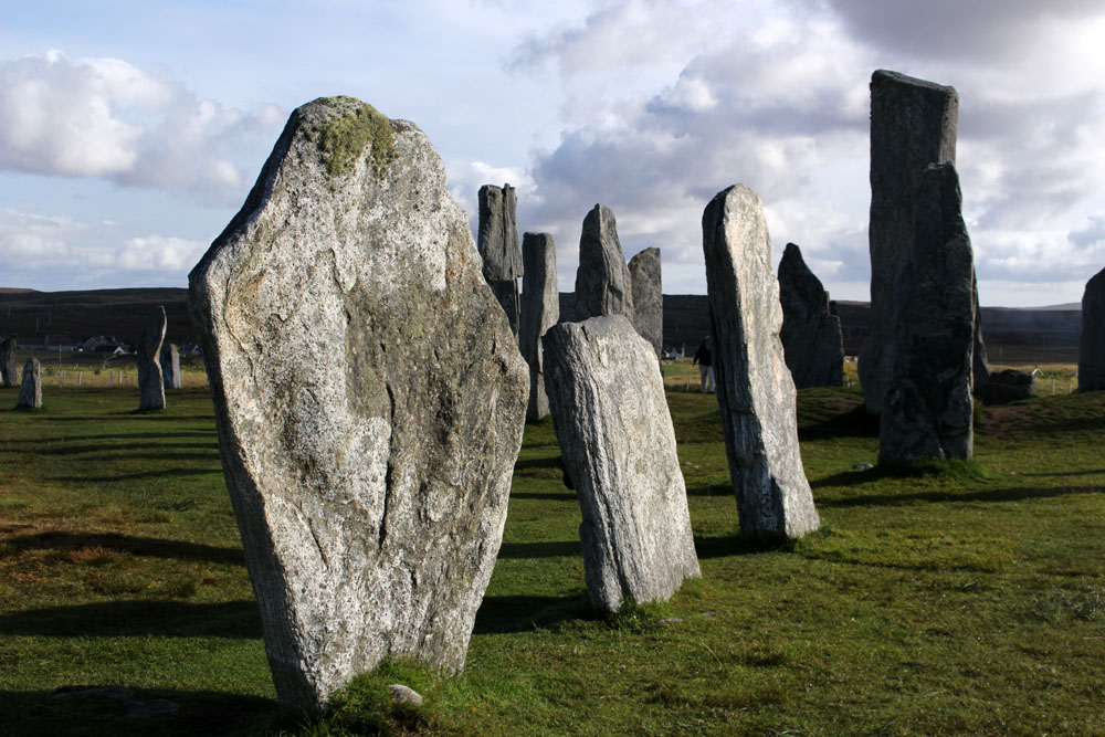
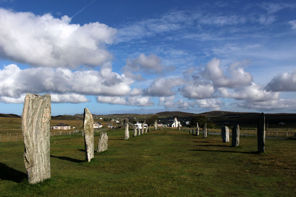
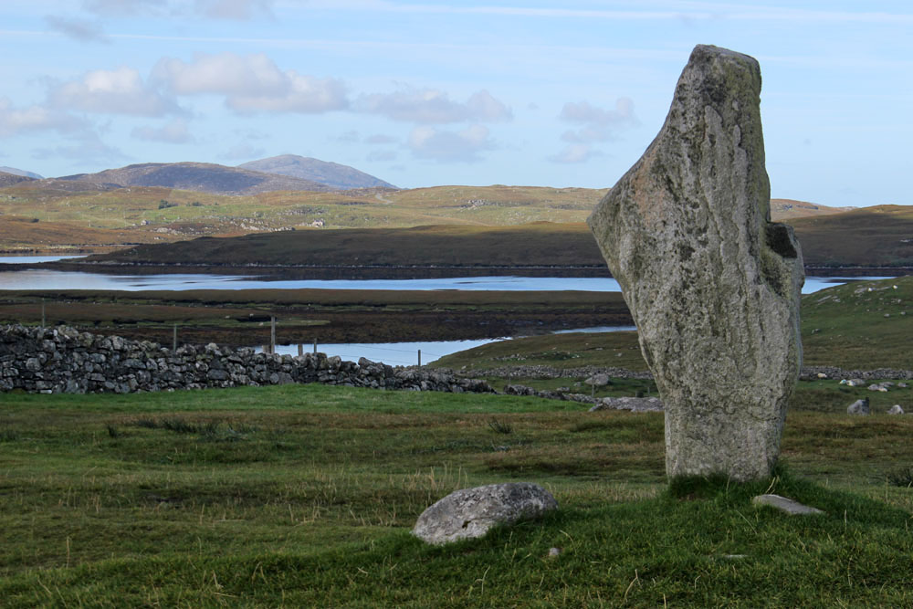
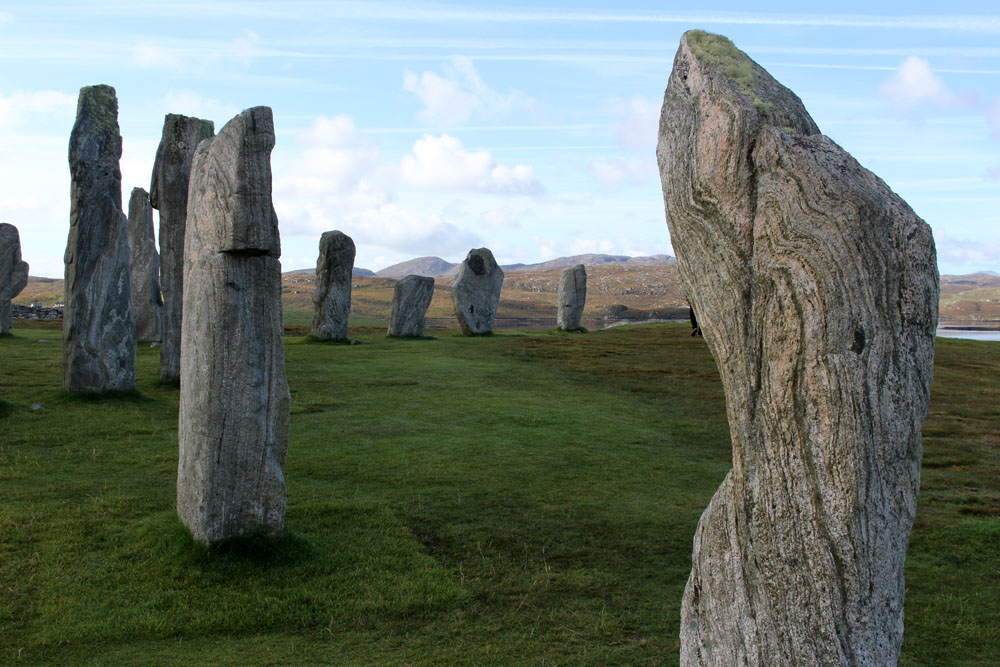
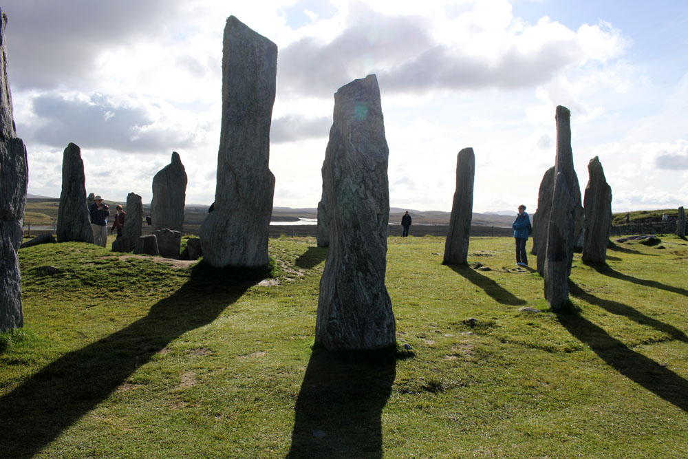
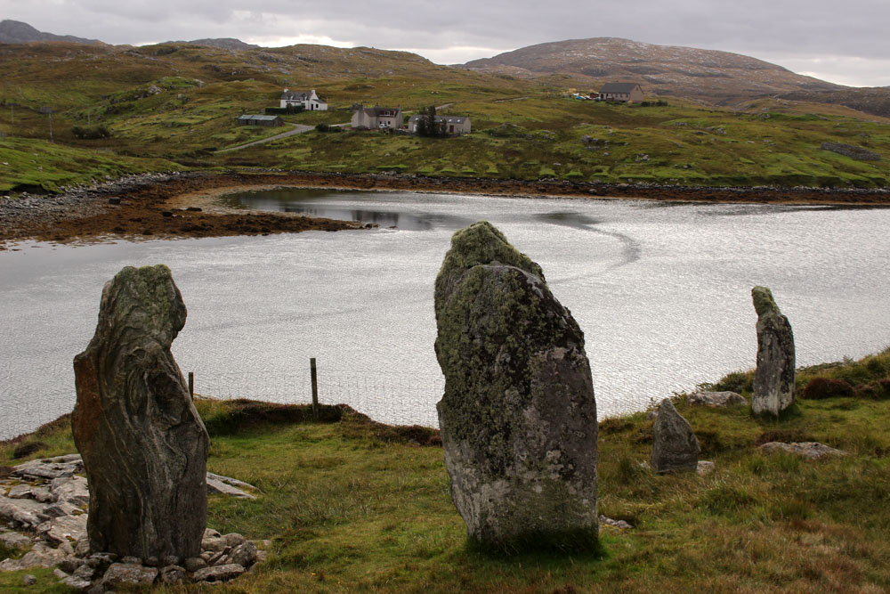
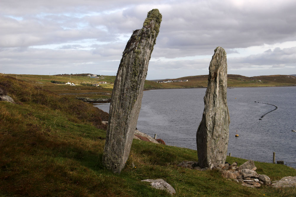
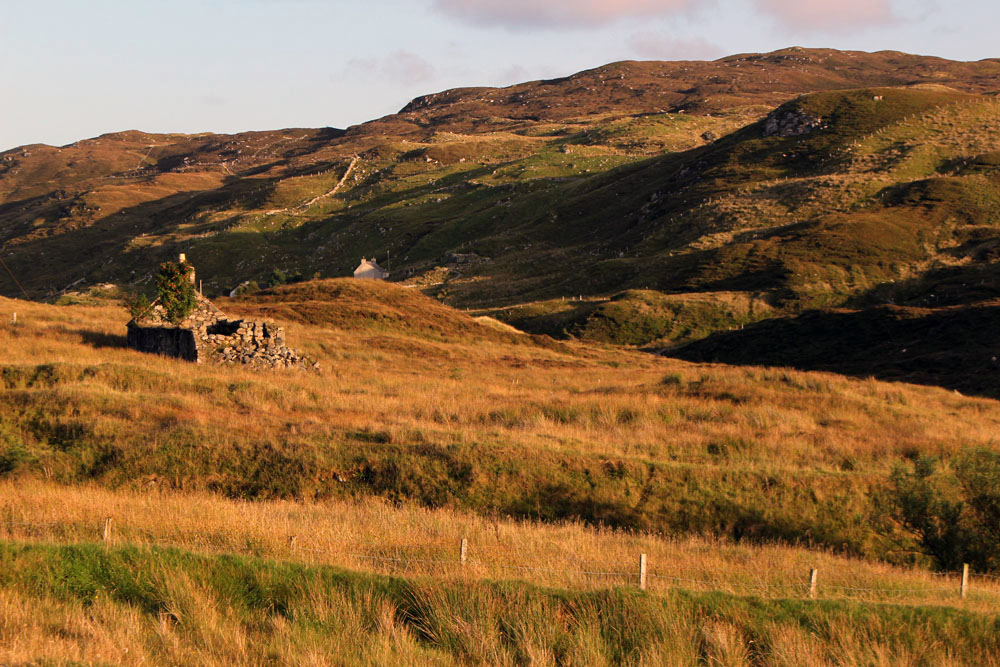 Gravir, of which Glen Gravir is but an outpost, is large enough to feature on the map, albeit in its Gaelic form, Grabhair. The village – more a loose straggle of houses and plots – possesses a school, a fire station and a church but no shop. A road from the junction with Glenside next to the church winds its way unhurriedly downhill to the sea inlet of Loch Odhairn where there is a small jetty for boats. Some of the houses are clearly empty; others occupied by crofters and incomers, their occupants largely unseen. Others are long ruined, tenanted only by raven and opportunist rowan trees, with roofs absent and little more than chimney stacks and gable walls surviving. It is only a matter of time before the stones that have been laid to construct the walls will be indistinguishable from the native gneiss that underlies the island, surfacing above the bog here and there in outcrops like human-raised cairns. Lewisian gneiss is the oldest rock in Britain. Three billion years old, two-thirds the age of our planet, it is as hard as…well, gneiss. It is the same tough unyielding rock that five thousand years ago was painstakingly worked and positioned at the Callanish stone circle close to Lewis’s western shore; the same rock used to build the island’s churches, which occupy the same sacred sites, the same fixed points of genii loci that had been identified long before Presbyterianism or any another monotheistic faith arrived in these isolated north-western isles.
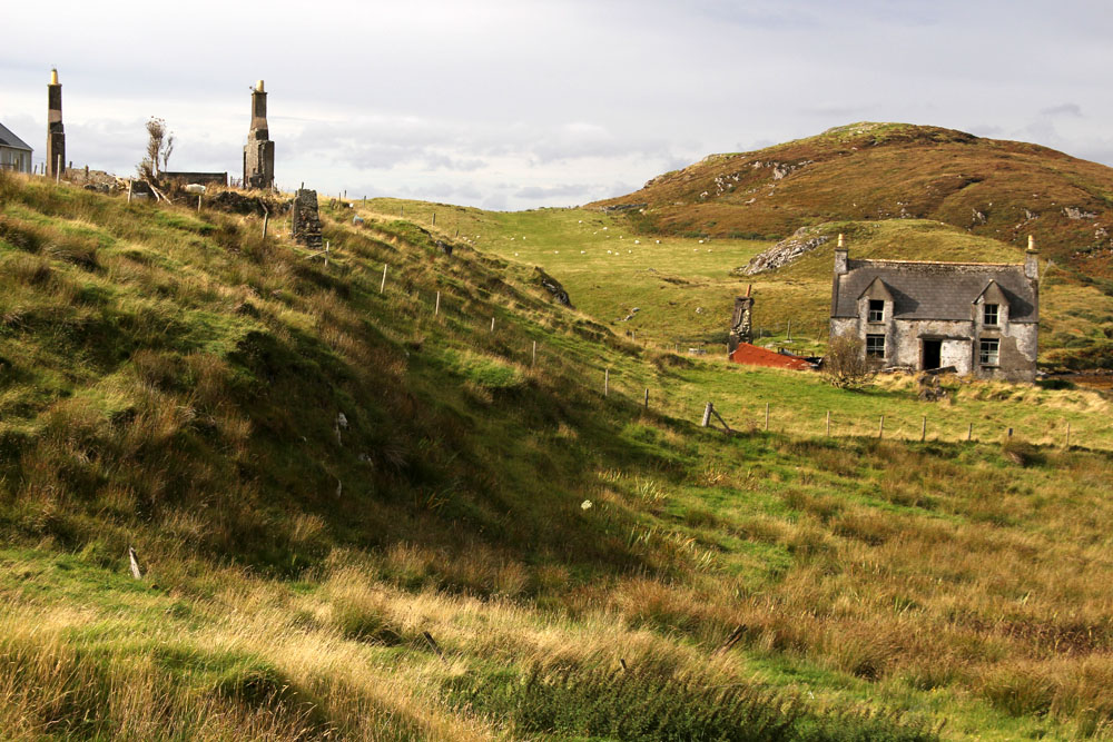
 Ancient hard rock (as in metamorphic) may underlie Lewis, but religion is another bedrock of the island. Despite a respectable number of dwellings the only people we ever really see in the village are those who come in number on Sunday. The Hebridean Wee Free tradition guarantees a full car park on the Sabbath when smartly and soberly dressed folk from the wider locality congregate at Grabhair’s church, which, grave, grey and impressively large, is the only place of worship in this eastern part of the South Lochs district.
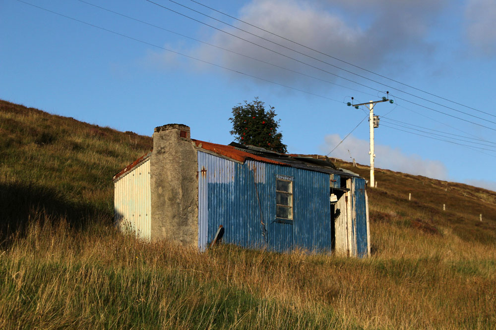
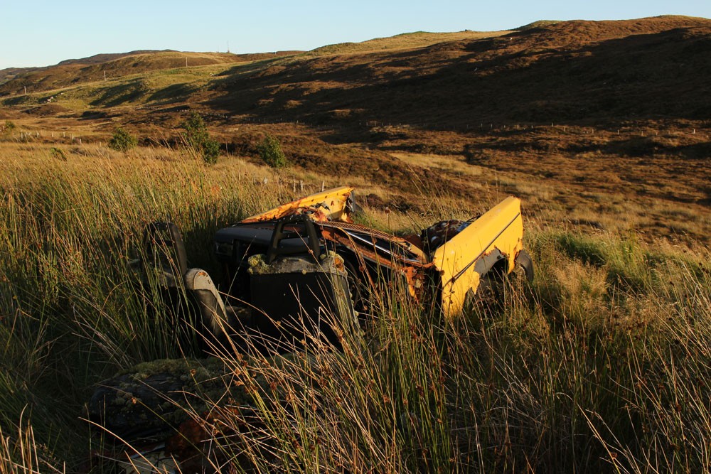
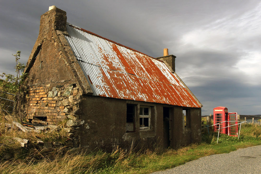
 At the bottom of the lane beneath the hillside graveyard next to the church are a couple of recycling containers for villagers to deposit their empties and waste paper. Larger items of material consumption are left to their own devices. Rain, wind and thin acidic soil are the natural agents of decay here. Beside the roadside further up from our house lie four long-abandoned vehicles in various stages of decomposition. Engines are laid bare; bodywork and chassis, buckled and distressed, rust-coated in mimicry of the colour of lichen and autumn-faded heather. Cushions of moss have colonised the seating fabric. The rubber tyres remain surprisingly intact, the longest survivor of abandonment. Sharp-edged sedges have grown around the rotting car-carcasses as if to hide them from prying eyes, preserving some modicum of dignity as the wrecks decay into the roadside bog, all glamour expunged from a lifetime spent negotiating the island’s narrow single track roads. On Lewis, vehicles die of natural causes, not geriatric intervention.
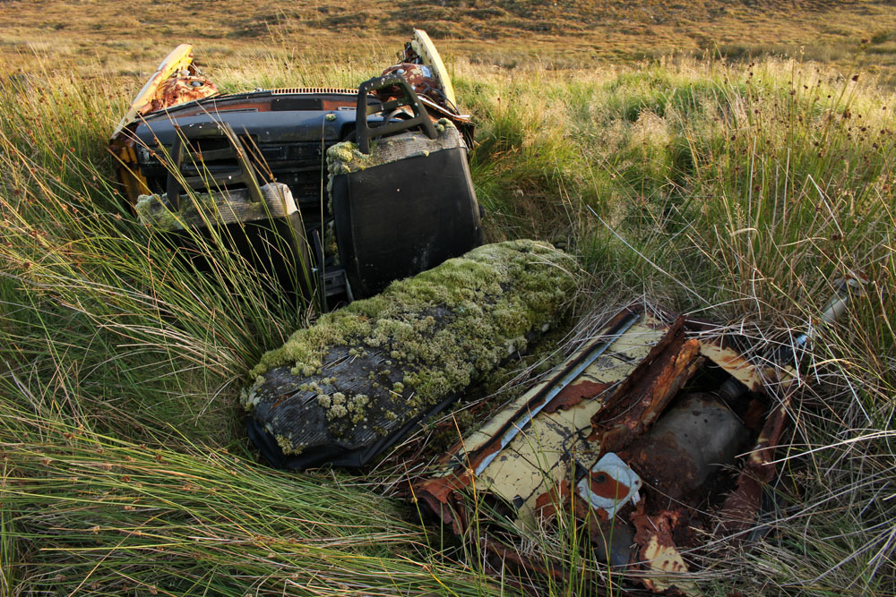
 Our cottage was rented as an island base: a place to eat, rest and sleep before setting off each morning on a long drive to visit one of Lewis’s far flung corners. Happily, it feels like a home, albeit a temporary one – a domestic cocoon of cosiness with all the modest comforts we require. Its small garden is a haven. As everywhere on the island, tangerine spikes of montbretia arch like welder’s sparks from the grass. Rabbits scamper about on the lawn, colour-flushed parties of goldfinches feed on the seed heads of knapweed outside the kitchen window. Robins, wrens and blackbirds flit around the trees and shrubs that envelop the cottage – non-native plants that have adapted to the harsh weather conditions of this north-western island, softening an outlook that on a grey, wind-blown day, with a gloomy frame of mind, might be considered bleak.
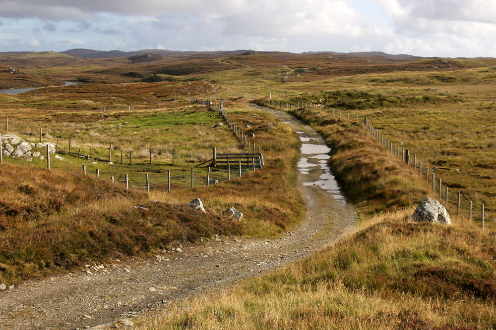 Most days on our jaunts around the island we would see an eagle or two, golden or white-tailed, sometimes both. The majority of these sighting are in more mountainous Harris, or in that southern part of Lewis that lay close to the North Harris Hills, but on our last day on Lewis we see a white-tailed eagle fly over Orinsay, a village relatively close to where we have been staying. An hour later we spot another bird swoop along the sea loch at Cromore, a coastal village that lies a few miles to the north. It might well be the same bird. White-tailed eagles are very large and hard to miss, and their feeding range is enormous. But that is exactly how Lewis seems – enormous, almost unknowable despite its modest geographical area. A place larger than the shape on the map – a mutable landscape of rock, sky and water that does not easily lend itself to the reductionism of two-dimensional cartography.


 Today is St Patrick’s Day and March 17 is the supposed date of the 5th-century missionary’s death. Patrick was the forerunner of many early missionaries who came to Irish shores to preach Christianity, the island more receptive to new ideas about religion than its larger neighbour to the east across the Irish Sea. Consequently Ireland abounds with relics and ruins of early Christianity, sometimes in the most improbable of places.
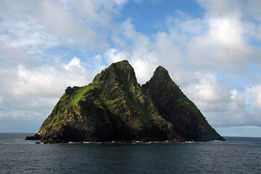
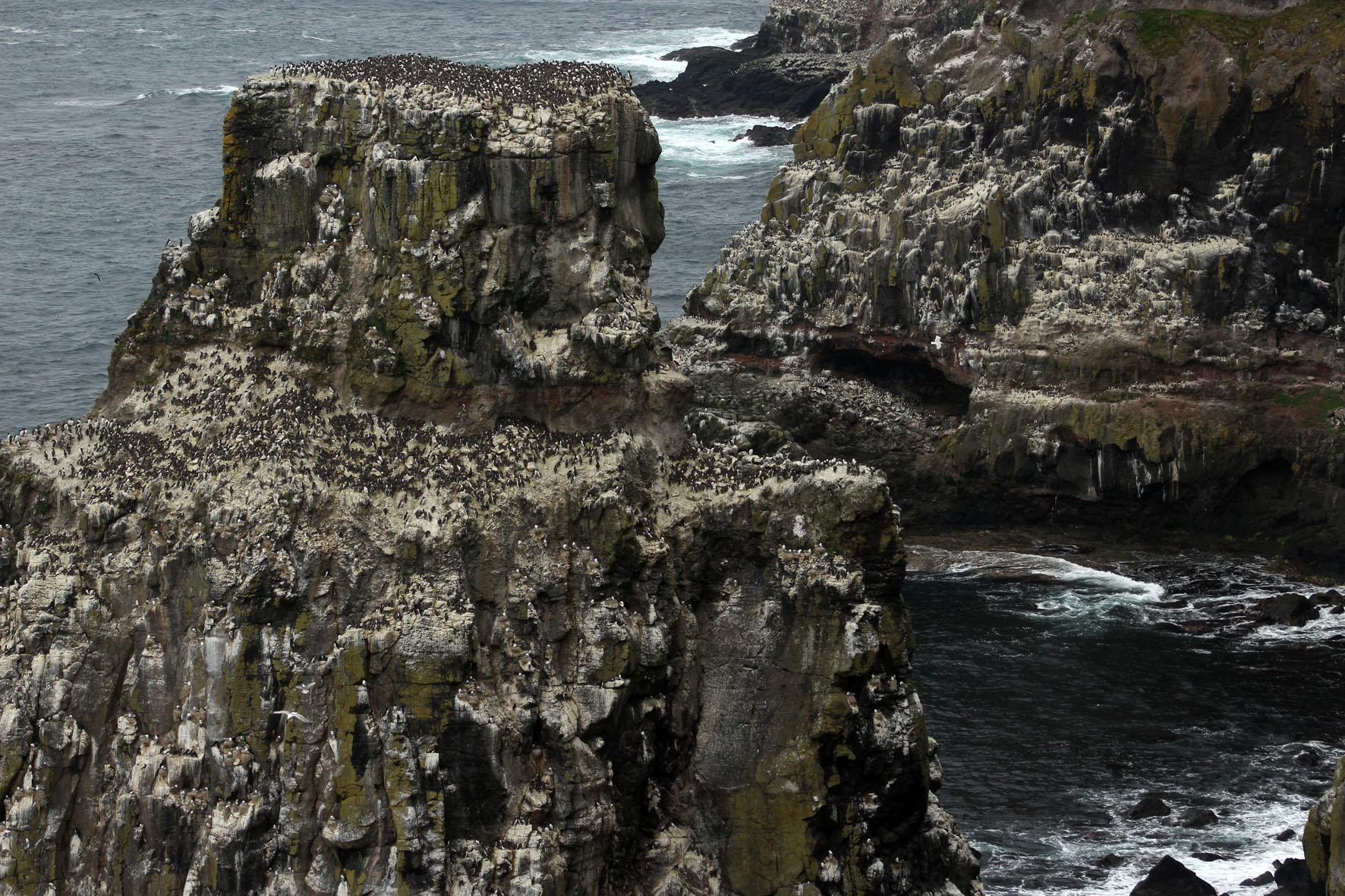
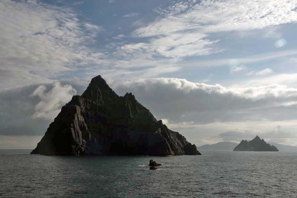
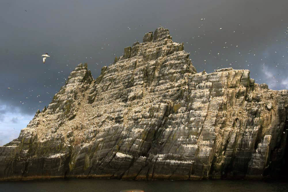 Sailing around Ireland’s southwest coast, skirting the peninsulas that splay out from the Kerry coast, the two islands of the Skelligs come into view after rounding Bolus Head at the end of the Inveragh Peninsula. Both islands are sheer, with sharp-finned summits that resemble inverted boat keels. The smaller of the two appears largely white at first but increasing proximity reveals that the albino effect is down to a combination of nesting gannets and guano. The acrid tang of ammonia on the breeze and distant cacophony announce the presence of the birds well before the identity of any individual can be confirmed by binoculars.
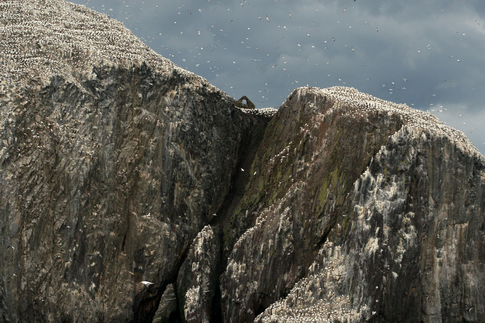
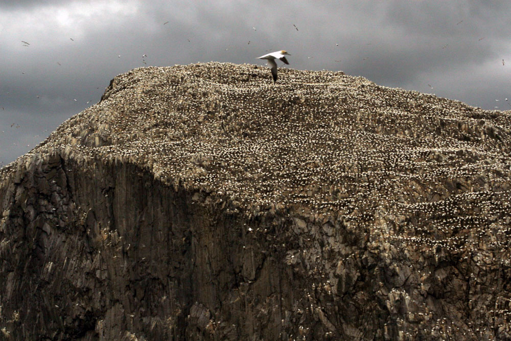
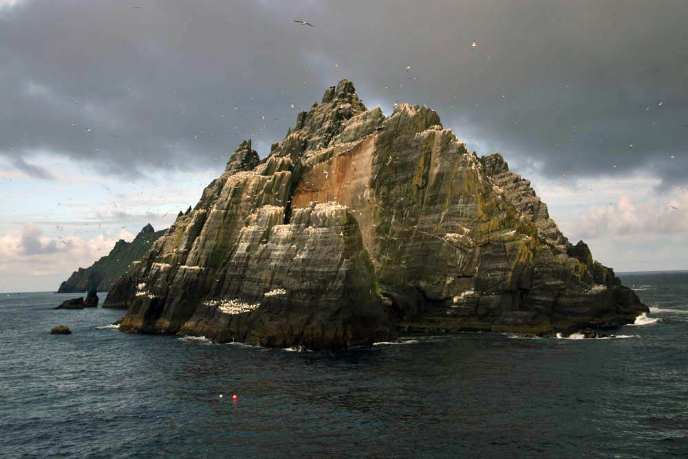 As the boat draws closer, the sheer volume of birds – gannets, fulmars, puffins, terns – becomes plain to see. With something like 70,000 birds, Little Skellig is the second largest gannet colony in the world. But on the larger island of Skellig Michael, although seabirds abound here too, there is also the suggestion of a human presence, albeit an historic one. High up in the rocks, small stone structures can be discerned: rounded domes that are clearly man-made and which soften the jagged silhouette of the island’s summit. These are beehive cells, the dry-stone oratories favoured by early Irish monks for their meditation. Sitting aloft the island on a high terrace, commanding a panoramic view over the Atlantic Ocean in one direction and the fractal Kerry coast in the other, these simple stone cells came without windows – the business was one of prayer and meditation not horizon-gazing. Such isolation was necessary for reasons of both safety and spirituality. And Skellig Michael was the acme of isolation. In the early Christian milieu the Skellig Islands, facing the seemingly limitless Atlantic off the southwest coast of Ireland, were more than merely remote: they were at the very edge of the known world.
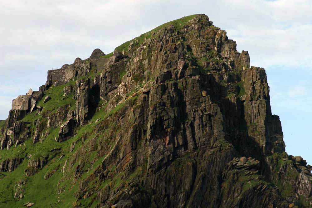 The island’s monastic site is infused with mystery, as all good ruins are, but is thought to have been established in the 6th century by Saint Fionán. Consisting of six beehive cells, two oratories and a later medieval church, the site occupies a stone terrace 600 feet above the swirling green waters of the sea below.
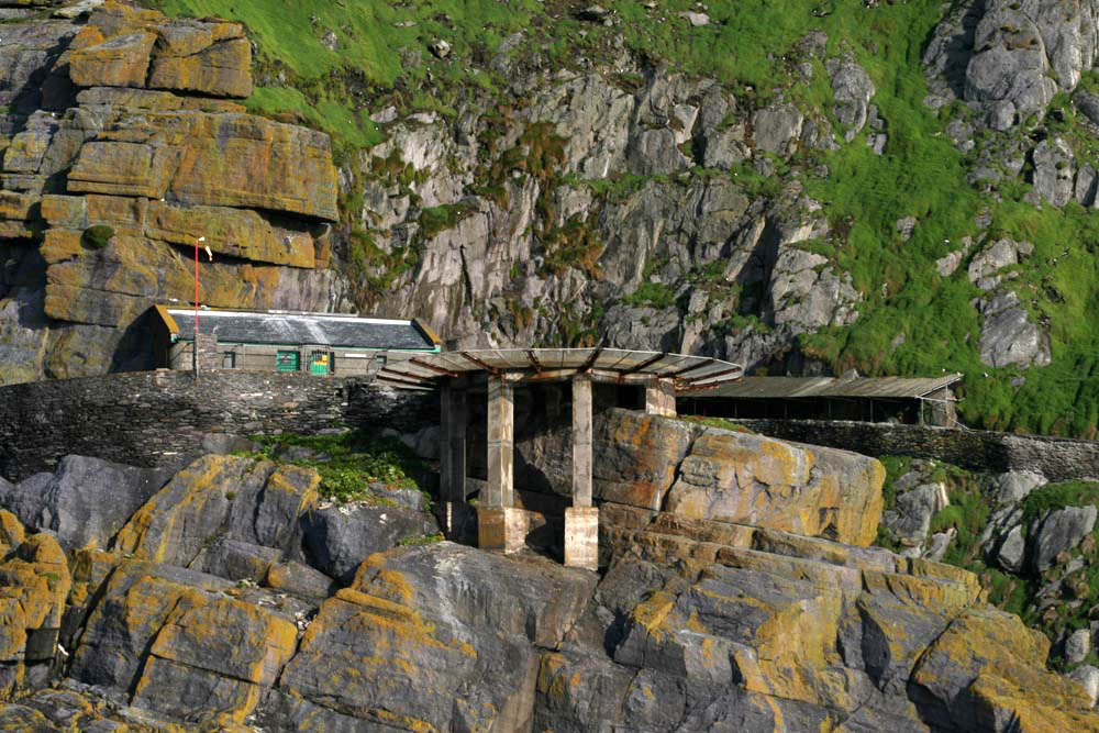 Skirting Skellig Michael, a landing stage with a helicopter pad comes into view. A vertiginous path of stone steps leads up towards the beehive huts close to the island’s mountain-like summit. We do not disembark. Instead we keep sailing, bound for a safer harbour in Glengarriff in County Cork. No matter, the sight of the rocks, the winding, climbing path and the austere cells on the terrace at the top is already imprinted on our memory.
 Without doubt this was a life of supreme hardship: the isolation, the relentless diet of fish and seabird eggs, the ever-battering wind and salt-spray. Such was the isolation, and so extreme the privations of this beatific pursuit, that one might assume that the monks would have been left in peace to practice their calling. This was not to be. Viking raiders arrived here in the early 9th century and took the trouble to land, scale the island’s heights and attack the monks. For most of us it is probably difficult to comprehend the blind-rage fury of the raiders, the wrath invoked in them by pious upstarts with their new Christian God. Easier perhaps is to imagine the dread that must have been felt by the monks as the Vikings approached their spiritual eyrie.