Beneath a Concrete Sky – to Gravelly Hill Interchange by canal

IMG_0016

Where’s Birmingham river? Sunk.

Which river was it? Two. More or

Less.

 Birmingham River Roy Fisher

The idea was to follow the Birmingham canal system north to Spaghetti Junction. I had already traversed the city by means of the Grand Union Canal a couple of years earlier, following the canal path west to arrive at the meeting of the waters at Gas Street Basin. That time I had turned left at Aston Junction but I knew that returning to that same point it would be possible to follow the Birmingham & Fazeley Canal north to reach Salford Junction directly beneath the Gravelly Hill Interchange.

IMG_9962

Accompanying me on this venture was my friend Nigel Roberts, a fellow Bradt author devoted to Belarus and Blues (Birmingham City FC) in equal measure, who gamely agreed to come along despite our planned route veering close enough to Aston Villa’s turf to risk bringing him out in hives.

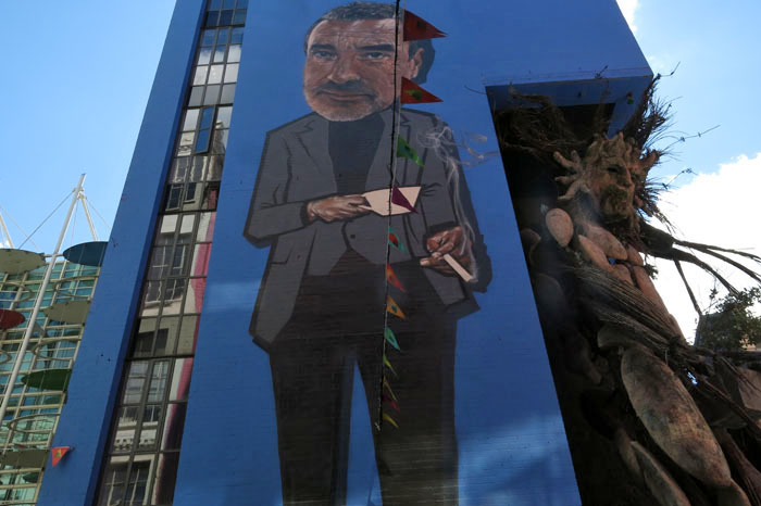
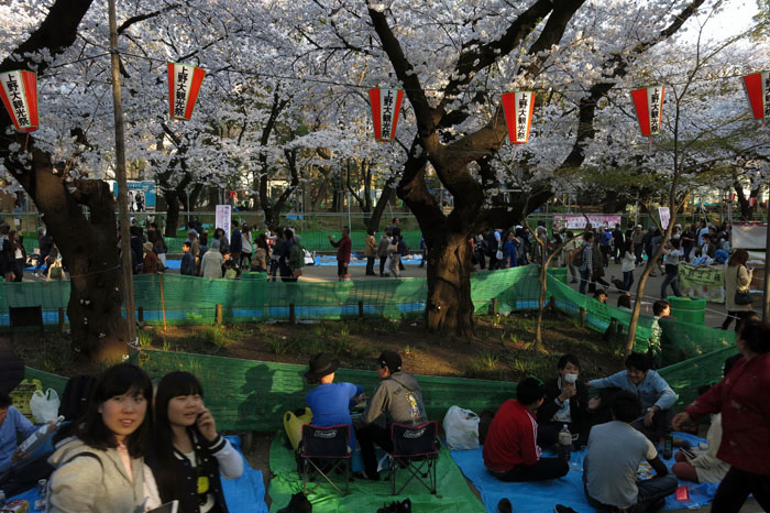
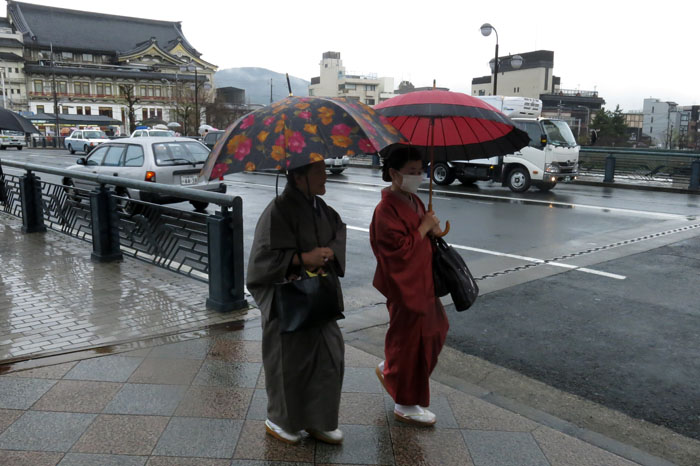
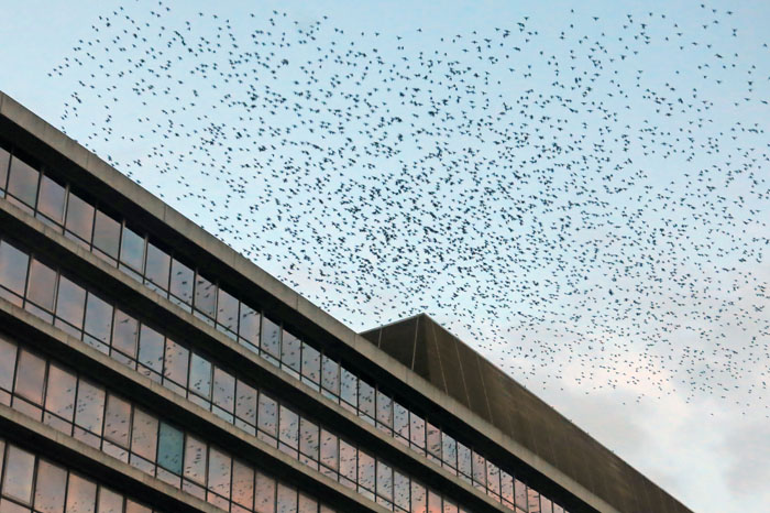
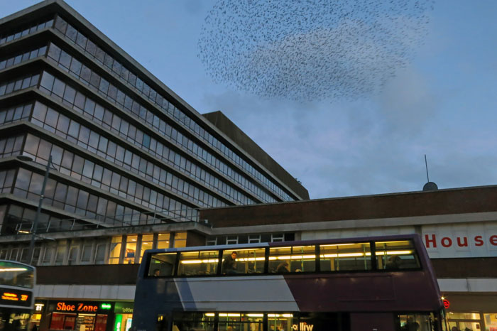
We rendezvoused in the gleaming concourse of New Street Station before making our way to Gas Street Basin by way of Victoria Square with its Queen Vic and Iron:Man  statues. A notice on the ever-present temporary fencing that characterises Paradise Circus gave notice that Antony Gormley’s  Iron:Man was soon to be moved to a new home. How, I wondered, might this effect the city’s sacred geometry, its unchartered leys that converged at Victoria Square? But Birmingham (motto: ‘Forward’) was always a city that messed with its past, forever rearranging the deckchairs, refurbishing the urban fabric, reinventing the wheel and then re-forging it by means of a Brummagem hammer. It always seemed a place where time not so much stood still as had a frequent lie-down, a place that lump-hammered the past into something that never quite made it to the future.

IMG_9971

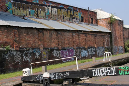
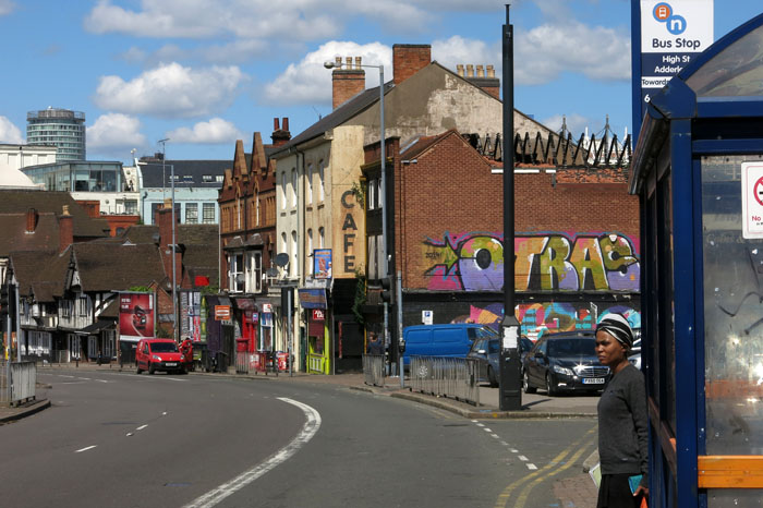
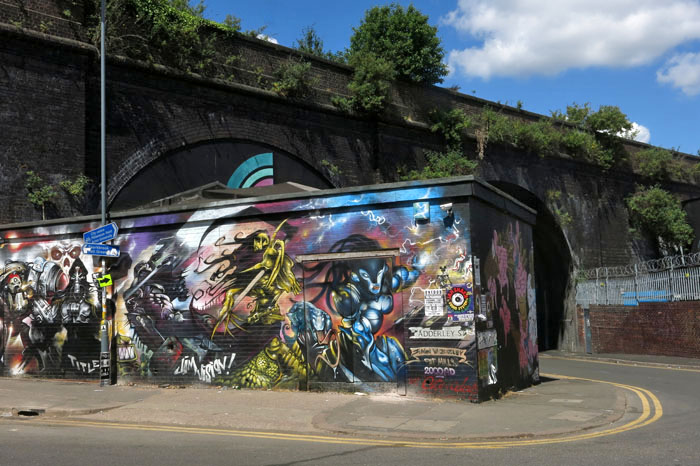
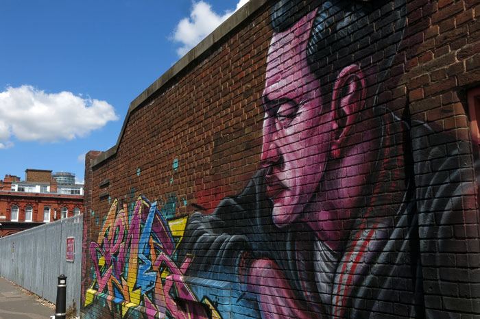
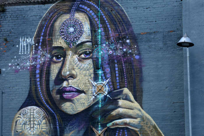
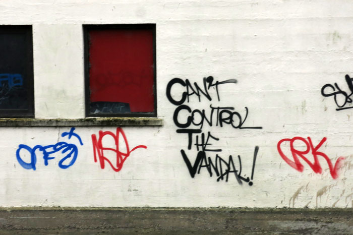
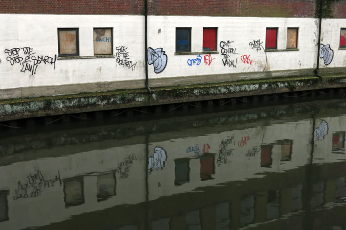
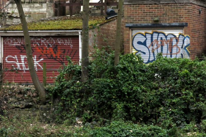
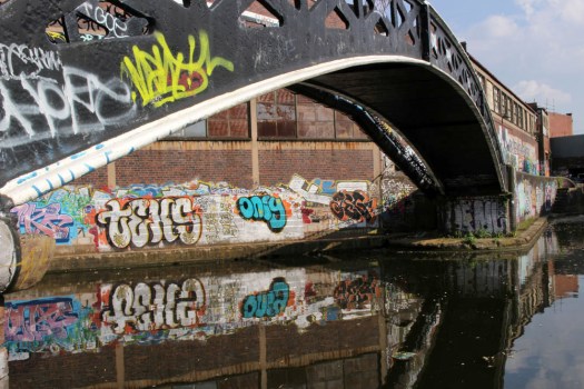
After a swift half-pint and perusal of the map at the Malt House pub opposite the geographically incongruous Sealife Centre we set off along the Birmingham & Fazeley branch towards Aston Junction. The day is atypically glorious, warm, blue-skied – peak May, the time of year you might happily be time-locked in were it at all possible. Cow parsley froths alongside the canal path, complimenting the blossoming hawthorn. Oxlips, red campion and broom compete for attention with the lurid graffiti that seems to embellish almost any available wall space. Above a lock, daubed high on a factory wall, eponymous Roof Top Vandals have left their mark in neat, bold lettering – a noteworthy combination of art and athleticism. Passing beneath the bridge that feeds railway lines into Snow Hill Station, the shimmering reflected light from the water dances like an electrocardiograph on the concrete above.

IMG_9966

Approaching Aston, we pass the red and blue holders of the Saltley Gas Works, scene of the Battle of Saltley Gate some 46 years earlier when the fuel storage depot was mass picketed during a national miners’ strike.

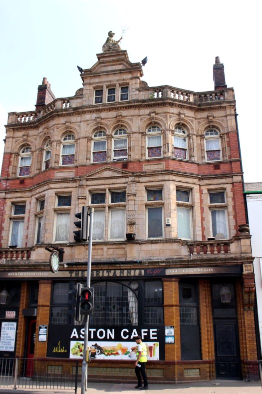
A little further on, we become aware of a familiar figure atop a building – Britannia, complete with trident, excised from the back of a fifty pence piece, supersized and raised to roof level. It seems churlish not to investigate. We detour from the canal to seek out the building and head for the Lichfield Road in the wake of two teenage girls who swig beer from cans and swap yarns in rich Brummo-Caribbean argot. It is, as we thought, a pub; no longer operating as The Britannia but as The Aston Cafe. We are now perilously close to Villa Park, or Vile Park as my companion prefers to call it. It does not bother me either way – I am agnostic in such matters – but Nigel has started to sense that he is well behind enemy lines.

IMG_9982

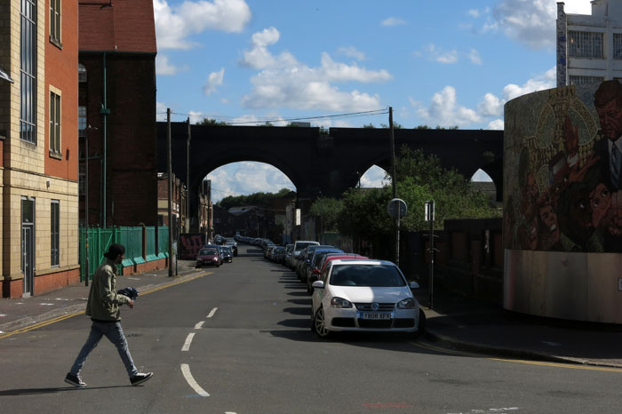
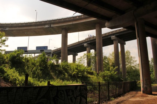
Returning to the canal to press on north, the Gravelly Hill Interchange aka Spaghetti Junction is already clearly visible ahead. The last house before the tangle of overlapping roadways takes over has iron railings decked in Union Jack flags – patriotism doing battle with traffic pollution. Just beyond, a defiant stand of purple lupins, garden escapes gone feral, announces our arrival at Salford Junction. Here we detour left for a short distance along the Tame Valley Canal, the curving multi-carriageway of the M6 immediately above us, articulated lorries flashing by half-seen above the barriers as they career along in compulsive centripetal motion. Above, spanning the roadways, blue signs point the way to London (M1) and The North (M6), while beside the water a navigational signpost for boats shows the various routes out of here – west to Tipton in the Black Country, north to Tamworth in north Warwickshire, back to the City Centre and Gas Street Basin (3½ miles) from whence we have come. But there are no boats today: the troubled pea-green waters beneath the Gravelly Hill Interchange fail to match most people’s criteria of what constitutes an ideal boating holiday.

IMG_9996

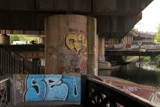
Huge concrete pillars support the roads overhead – 559 in total if you were foolhardy enough to count them. The pillars bring to mind Pharaonic temples in Upper Egypt – Luxor, Karnak – although hieroglyphs and carved lotus capitals are noticeably absent. But this whole chaotic enclave of concrete, water and channelled momentum is an unintentional temple of sorts – a nexus of late capitalism; a dinosaur footprint of transport and industry, an entropic sump. The water beneath, largely deprived of direct sunlight, is an opaque soup that looks incapable of supporting anything other than menace and monsters but here and there the light sneaks in to highlight graffiti, reflect on the water and cast shapes on the wall that mutate with the sun’s arc: accidental light sculpture, the oeuvre of James Turrell; found land art.

IMG_0030

Locked between the various roadways, the trees and bushes of a green island rise defiantly within its looping concrete confines. It is home, no doubt, to all manner of wildlife – birds, pioneering cats… foxes. A Ballardian realm of preposterous nightmares and Sci-fi imaginings, there are probably parts of the Amazon rainforest that are better explored than this singular non-place.

IMG_0022

Satiated with the chiaroscuro experience of this interchange underworld, we return to Salford Junction and take the Grand Union Canal south through Nechells to return to the centre via a route best described as elliptical. We pass the vast entertainment complex of Star City, another latter-day temple to mammon; then an enormous recycling plant that has a conveyor belt receiving the load from a Sisyphean procession of tipper trucks, each crushed metal parcel crashing onto the hill-high mound with a shrill clatter. In uncanny juxtaposition to this unholy clamour, set back from the water is a small pond with reeds, yellow iris, water violet and water lilies – a Monet garden awaiting its artist. But for the deafening backdrop, this might be a scene in leafy Warwickshire. Indeed this whole stretch of canal, just a few minutes’ walk from Spaghetti Junction, has a disconcertingly rural feel to it. What is more, it seems almost completely deserted of people.

IMG_0032

Reaching Garrison Lane in Bordesley we make another brief detour so that Nigel can show me the location of The Garrison, the pub whose fictional 1920s counterpart is centrepiece to the Peaky Blinders television series. There’s not a peaked cap or Shelby brother to be seen but it offers an opportunity for Nigel to fill his lungs with the right sort of air – St Andrews, Birmingham City’s home ground is only a little way up the hill.

IMG_0054

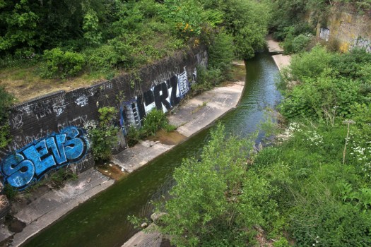
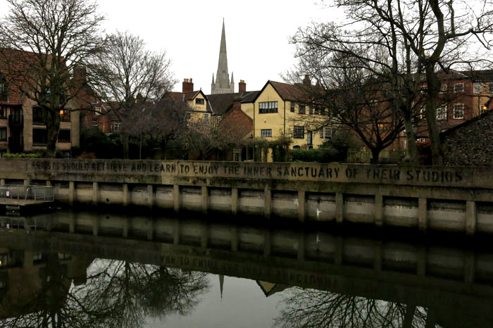
Approaching Digbeth, we finally come upon the elusive River Rea – a shallow, sluggish channel beneath the canal viaduct. One of Birmingham’s two rivers, the other being the River Tame that it merges with close to Gravelly Hill Interchange, the Rea (pronounced ‘Ray’) spends much of its course through the city below ground out of sight. As the poet Roy Fisher claims in Birmingham River, the Rea does little to draw attention to itself: a ‘petty river’ without memory seems about right.

a slow, petty river with no memory

of an ancient

 name;  a river called Rea, meaning

river,               

and misspelt at that.

IMG_0057


Digbeth

IMG_2326

Passing through Birmingham recently I had a little time on my hands and so decided to visit the Digbeth area, a shortish walk from New Street Station. Head south from the futuristic silver button bulwark that is the Selfridges building and you will soon arrive here. Hitherto, I had known of Digbeth coach station – which is still here, revamped and now known as Birmingham Coach Station (opened by Fabio Capello, no less, in 2009) – but somehow whatever else lay in this industrial area close to the city centre had mostly escaped my attention.

IMG_2306IMG_2440Typhoo Tea once had a factory here, as did the Birmingham Battery and Metal Company before it decamped to Selly Oak, but probably the most famous of Digbeth’s buildings is the imposing Devonshire Works, better known as The Custard Factory. It was here that Alfred Bird & Sons manufactured their innovative egg-less custard powder, a buttercup-coloured product, which combined with hot milk, provided the nation with the necessary lubricant for its stewed rhubarb and apple crumble. An illuminated sign still hangs over its entrance to remind us of the building’s former use, although these days the complex has found new life as a centre for arts, small businesses and independent retailers.

IMG_2501IMG_2372The Custard Factory stands as a slightly self-consciously gritty beacon of culture amidst the quotidian surroundings of Digbeth High Street. Digbeth, which clearly still has some industrial dirt beneath the finger nails of its clever hands, does ‘gritty’ quite well. Beyond the high street, narrow streets lead down to the railway bridges and embankments that bisect the district east to west. The tropes of inner city cultural re-purposing are clear to see: the graffiti is mostly of a high standard; the converted galleries have a homespun, do-it-yourself air about them; the pubs remain authentic-looking despite their reinvention as hip places to drink.

IMG_2329

IMG_2400It is widely thought that Digbeth was the focal point from which England’s second city developed when Berma’s Saxon tribe chose to settle the valley of the River Rea in the 7th century. Digbeth, which now tends to incorporate the old parish of Deritend at its eastern end, later became the manufacturing heart of the city when Birmingham rapidly expanded during the Industrial Revolution. Evidence of this industrial heritage can still be seen everywhere, although these days it is marked more by conspicuous absence than thriving activity.

IMG_2315

IMG_2361Flanked by the Irish Quarter to the south and Eastside to the north, Digbeth was mostly cleared of its poor housing in the 1950s and ‘60s to become a factory zone that has slowly atrophied into a wasteland of disused industrial buildings and car parks, some of its more edgy-looking pubs now standing solitary and alone like isolated fortresses. Now, the area is an edgeland of sorts – a buffer zone between the shiny new architecture of the CBD and the residential areas of the inner city. Surprisingly, this formerly industrial quarter is also where Birmingham’s oldest secular building, The Old Crown, may be found: a Tudor period timber-framed inn that began life as a private house and would look more at home in genteel Stratford-upon-Avon than here wedged between the old factories and viaducts. There is more pre-industrial history if you look for it: a blue plaque next to the Irish Centre commemorates Bible translator John Rogers, who was born in Deritend in 1507 and burned at the stake at Smithfield, London in 1555, the first victim of the Marian persecution waged during Queen Mary’s reign. Whether or not a plaque that commemorates a Protestant martyr should be placed quite so close to a (Catholic) Irish institution is perhaps a moot point.

IMG_2394IMG_2487For all its atmosphere of gentle dereliction, Digbeth is clearly on the rise once more. The Custard Factory has its shops, studios and workshops, its bars are busy at weekends and there’s a burgeoning electronic music scene centered around some of the clubs.  On the up, certainly, but Hoxton-style hipsters have yet to take over (better try Moseley instead) and, rather than fashionable full beards, most of the facial hair that you will witness on the street here tends to be the henna-died chin whiskers of elderly Pakistanis who pass through Digbeth on their way to the Southside markets.IMG_2439

IMG_2428IMG_2525IMG_2533

Hanami

IMG_0419

The Japanese have a word for it – hanami. The full meaning of hanami is difficult to translate accurately but in literal terms it means ‘flower viewing’ and normally refers to sakura, the blossom of cherry trees in spring.  Incorporated within this meaning is also the notion of transient beauty, the appreciation of something rare and fleeting that will not last for long. Hanami is a hugely important aspect of Japanese culture and the period between late March and early May – cherry blossom time, naturally – is the season in which it is practised.IMG_0417

A predictive blossom forecast is announced by the national weather bureau each year, with expected dates of first bloom and peak blossom made for the entire archipelago. The blossoming starts in Okinawa in the far south as early as February before moving like a slow-moving weather front northwards through the islands of Kyushu, Shikoku and Honshu to conclude in cooler Hokkaido in May. For a number of reasons that are mainly to do with micro-climates and urban heat bubbles, sakura in Tokyo arrives earlier than might be expected for such a northerly latitude, climaxing at the end of March and the first week of April.IMG_0455

The arrival of sakura is celebrated with gusto throughout Japan. In Tokyo, Ueno Park with its long avenues of cherry trees is a highly popular spot for hanami revellers, who assemble here with friends, family and work colleagues to sit in large groups beneath the trees to eat, drink and have fun. As it gets dark the paper lanterns that hang like bunting between the trees are switched on to create a delightful festival-like ambience.

IMG_0494

IMG_0595Another sakura epicentre in the Japanese capital is along the Meguro-gawa riverbank at Nakameguro in the south of the city. Here the branches of the cherry trees on either bank almost touch across the water, blocking out the sky with their delicate blossoms. Such is this neighbourhood’s popularity in late March that the bridges that cross the river become packed with Tokyoites armed with cameras and mobile phones. The bridges make the ideal location for group photos and, of course, selfies. They are also the place from which to witness that most exquisite manifestation of hanami: the fall and drift of white petals on dark water.

IMG_0699

IMG_0746We have no real equivalent in the West – certainly not in the United Kingdom. Winter snowdrop walks, spring daffodils and bluebell woods have, perhaps, some sort of equivalence but their draw is generally limited. But in Japan during the sakura season the appeal is almost universal, and you will find all walks of life – pensioners, teenagers, young families, office workers, labourers – standing side by side taking in the view and enjoying the convivial atmosphere, all united in the appreciation of the singular cultural phenomenon that is hanami.

IMG_0810

IMG_0737IMG_0724IMG_0734

Rainy Day Kyoto

IMG_7038

A  rainy morning in Kyoto. The immediate reaction is one of disappointment – a damper on photographic aspirations for the day. But umbrellas have their own aesthetic charm, as do rain-washed streets and silvery skies. The kimono-clad young women who throng the streets of the old city do not seem at all phased by such inclement weather, so why should a camera-toting gaijin?

IMG_7094

IMG_7142IMG_7065IMG_7080IMG_7131IMG_7272

Another Place

IMG_5282

To reach Another Place you have to start in Liverpool. At least that is what we did, taking a Crosby-bound number 53 bus from the city’s Queen Square terminus. Leaving the Victorian magnificence of the city centre behind, the route leads through the edgelands of north Liverpool, in sight of huge abandoned red-brick warehouses that fringe the wide silver Mersey below. Away from the revitalised city centre and the heritage revamping of Albert Dock, this is a zone of substandard housing and broken dreams; a place where most of the pubs are boarded up and semi-ruined now that the dockers who once would have drank in them no longer have wage packets to fritter. The whole area seems partly abandoned to buddleia and the memory of better days although, here and there, like red-brick phoenixes, are signs of identikit housing development: new-build semi-detached homes with small gardens and big aspirations.

IMG_5244

Things seem to degenerate at the southern fringe of Bootle where the principal pub lacks not only clientele but also a roof. Narrow Victorian terrace streets slope away from the main road, their grim countenance softened by the names of flowers: Daisy Street, Woodbine Street, Harebell Street, and even a Pansy Street, which is perhaps a problematic address for a burly Scouse docker. After passing through Bootle, whose main centre of social interaction appears to be a bar located in the lower storey of a massive concrete complex that looks like it has been transported wholesale from Bratislava or New Belgrade, things start to look up, socio-economically speaking. Waterloo, where we alight next to the Merseyrail station seems altogether more prosperous, with a handful of smart cafes and a long marine parade of white-painted houses equipped with dormer windows to peer over the dunes to the beach and sea beyond.

IMG_5212

At the end of South Road, the road gives way to a track past a man-made lake behind sand dunes. Oyster catchers, gulls and ducks have taken refuge here and have arranged themselves in tightly-packed groups to brace against the bitterly cold north-westerly wind blowing across the Irish Sea. Climbing slightly to reach the dunes and a coast path, the beach and sea are revealed. As are several of the one hundred life-sized cast iron sculptures that dot the foreshore here between Waterloo and Blundellsands, and which constitute the Antony Gormley landscape installation that is Another Place (although here they are more prosaically referred to as simply ‘The Iron Men’). It is a bright, if brutally windy, afternoon and there a few people about, strolling on the beach, walking their dogs, weaving nonchalantly between the iron men that punctuate the beach like sentinels.IMG_5249

IMG_5182

The Gormley figures (modelled on the artist himself) stretch as far as the eye can see, each one staring out to sea isolated from the others: a statement on the human condition that refutes the John Donne position that ‘no man is an island’. Here, it would appear, every man is. The beauty of the figures is that, seen from afar, it is sometimes hard to distinguish those which are iron from those which are human. Covered and uncovered by each successive tide, the installation clearly points towards the relationship that exists between man and nature. Perhaps, silhouetted against the backdrop of Liverpool Dock’s cranes, it also alludes to the historical connection that links man and the seafaring trade in these parts?IMG_5177IMG_5326IMG_5260IMG_5259

IMG_5265

All Shook Up

IMG_4261On a dismal February afternoon in Norwich, taking a walk is done as much for exercise as it is for any other more worthy or creative reason. The raw, grey day makes the city seem gloomy, uninviting even, but at least it is an opportunity to leave the house for a while and check if the world is still turning. Uncertain where to go – whether to explore new streets or let my feet follow repeated steps – I choose to follow a familiar route: down to the river then eastwards, crisscrossing by bridges the fluvial divide that separates the city’s southern half from Norwich Over the Water, its Anglo-Saxon core.

IMG_4247Low cloud and a dull pewter sky has already put a lid on what remains of the day. The thin gruel that is the late winter light seems to be sucked in by the black river water with just a ghost of a reflection. Such paucity of photons means that serious photography is out of the question. I venture past the Norwich School of Art where brightly lit Victorian windows silhouette busy students in the act of creation – painting, sketching, etching, shaping, cutting and pasting in earnest. On the river wall, a little further on, a legend is stencilled in bold upper case: ARTISTS SHOULD RETRIEVE AND LEARN TO ENJOY THE INNER SANCTUARY OF THEIR STUDIOS. Whether a piece of work itself or merely a well-placed instruction to would-be artists in unclear, but it seems like sound advice. Either way, there’s an avuncular tone to the words that suggests a concern about privilege and responsibility.

IMG_4251Further west along the river I had already witnessed daubing of a more untutored stripe: a graffito that taunted the efficacy of urban CCTV with the ironic legend: CAN’T CONTROL THE VANDAL, its capital letters redefining the acronym, alongside an anarchist declaration of SICK OF THE POLITRIX! This is both social comment and poetry of a sort. Mostly though, the urban graffiti is not political or culture-busting but just simple tagging – guerrilla spray painting that derives from some atavistic urge to mark territories and serves much the same purpose as a dog’s instinctive leg-cocking.

IMG_4308One of the most ubiquitous taggers is ‘Shook’, who if nothing else certainly gets around. Shook’s five-letter cipher can be seen all over the city – north and south, east and west, on walls and bridges, on fences and lampposts. I suspect that Shook has a bicycle. Or perhaps even a rail pass – I once even saw his tag on a wall approaching Cambridge station, well outside his usual homeboy patch. Shook, although enthusiastic and clearly determined, is no Banksy. True, he has no sanctuary to enjoy – the streets are his studio – but I wish he (I can only presume his gender) would exercise a little more imagination and realise that mere territoriality is not the be-all and end-all. Shook, it’s time to raise your game.


Murmuration

IMG_3939Norwich, mid January. At dusk over the past few weeks an avian spectacular has been witnessed taking place in the sky over St Stephen’s Street. As the daylight dwindles around the four o’clock mark a swirling murmuration of roosting starlings may often be seen in the sky above this busy city centre shopping street. There’s a pleasing degree of unpredictability to such behaviour, and some afternoons the starlings seem to be conspicuously absent, but as a rule the birds circumscribe a giddy figure eight in the sky above the old Norwich Union office block, Surrey Street bus station, the Marsh Insurance building and Queens Road.

IMG_3933For many of the shoppers and workers hurrying home on the bus this phenomena takes place virtually unnoticed. Even so, there are those who stop to look and wonder at such wild exuberance in what is to them a familiar and quotidian urban environment. While shopping is bought and buses are boarded in the street below the massed starlings dance above – a joyous ensemble piece that twists and turns like a single organism, choreographed by some sort of instinctive group consciousness. As the light fails the birds finally settle, with what seems like a collective spontaneous decision, on the roof of a disused office building where they will spend the night. Darkness falls: the spectacle is over for another day.

IMG_3980

True, this is not a particularly grand example of the murmuration phenomenon – perhaps just a thousand birds or so: it is hard to say – but beauty and wonder is relative and this modest display has a personal dimension in that it can even be glimpsed from the windows of my home. Such a spectacle within a stone’s throw of one’s own doorstep can only be seen as a gift.