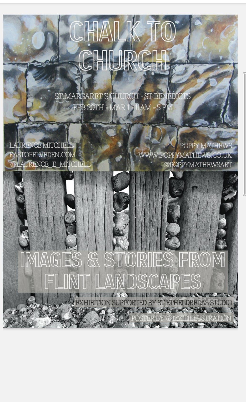
I am currently involved in an art exhibition at St Margaret’s Gallery, St Benedicts St, Norwich. The exhibition is mixed media, with paintings by Poppy Mathews (@poppymathewsart) and photographs and text by me. It is all very flint-themed and, for my part at least, relates closely to my recent book. Some of the text is taken from the book, Flint Country; some was written specifically for the exhibition.
Here is a small sample of what you can see at the exhibition. Of course, if you just happen to find yourself in the Norwich area over the next week then please drop in to have a look. Chalk to Church is open 11.00-17.00 daily and will run until Sunday, March 1st.
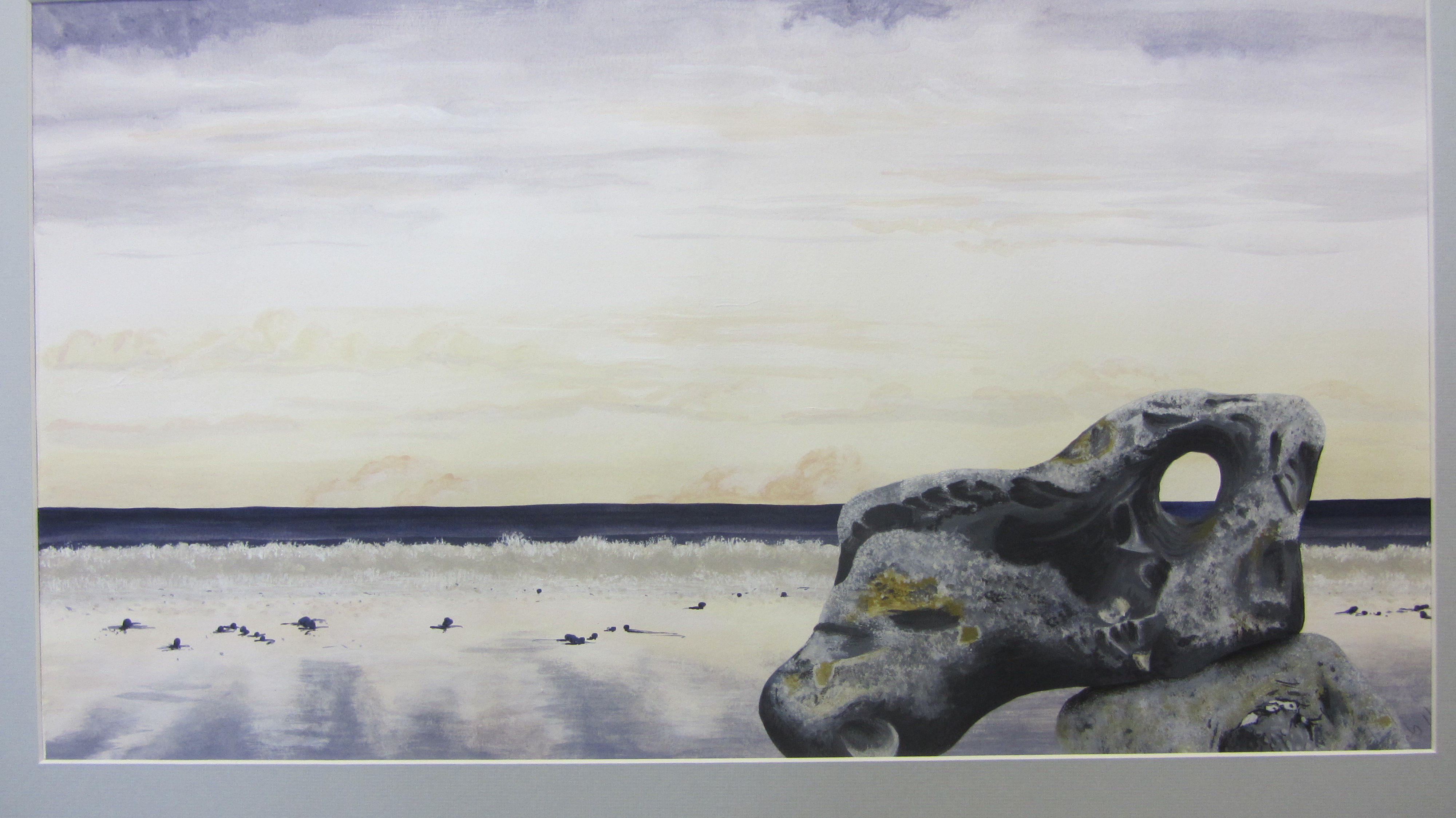
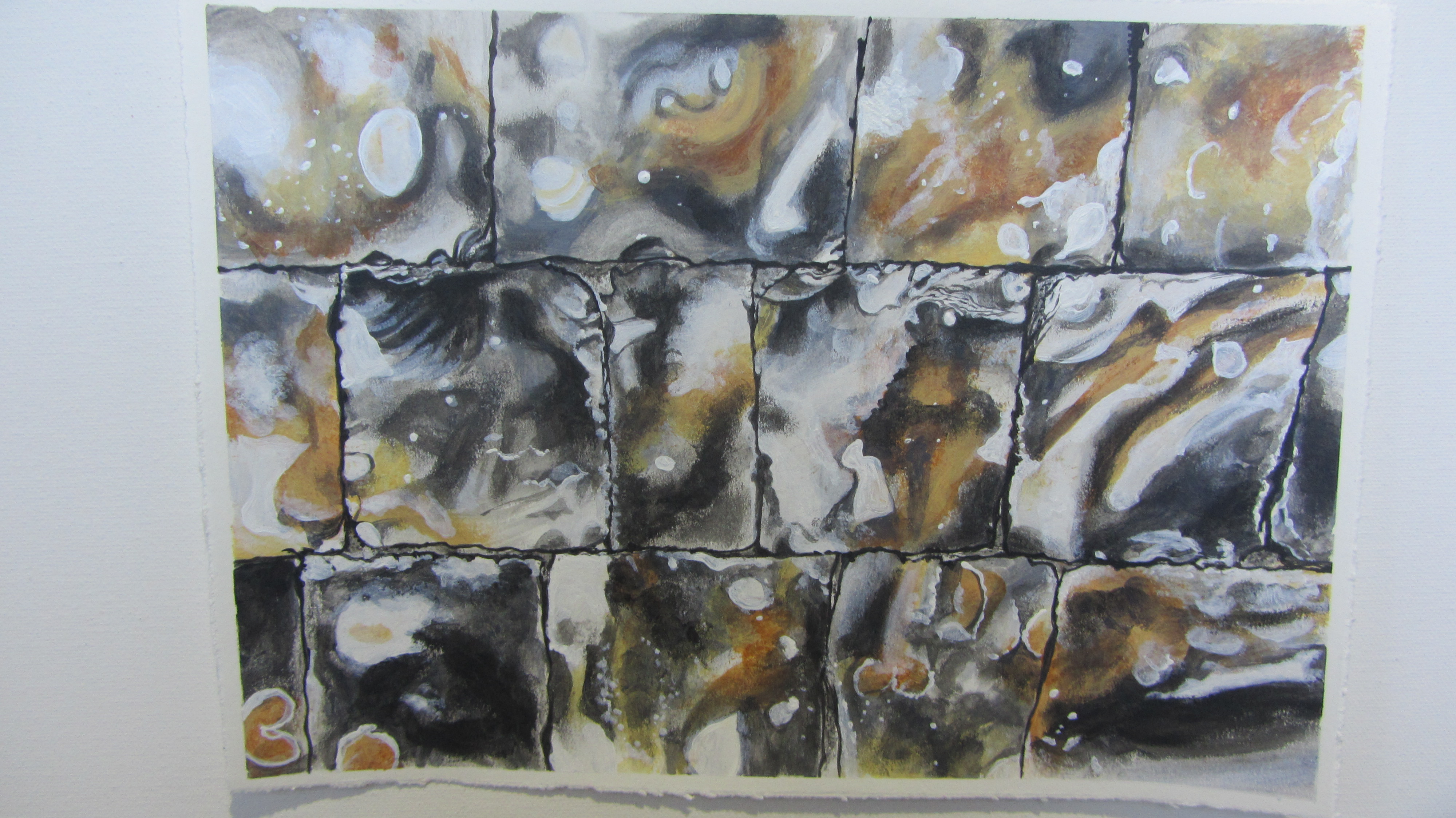
Flint 1 – Poppy Mathews
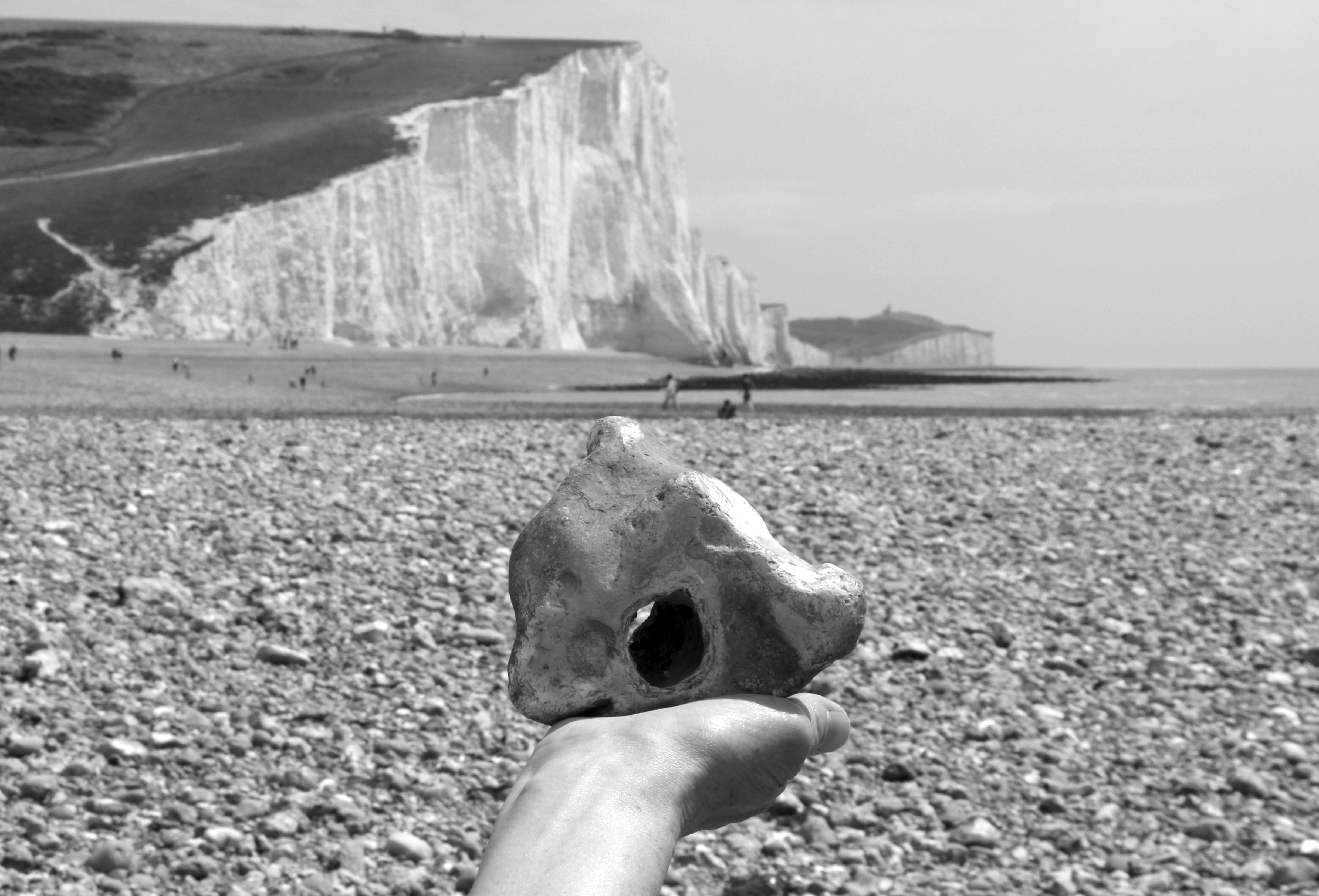
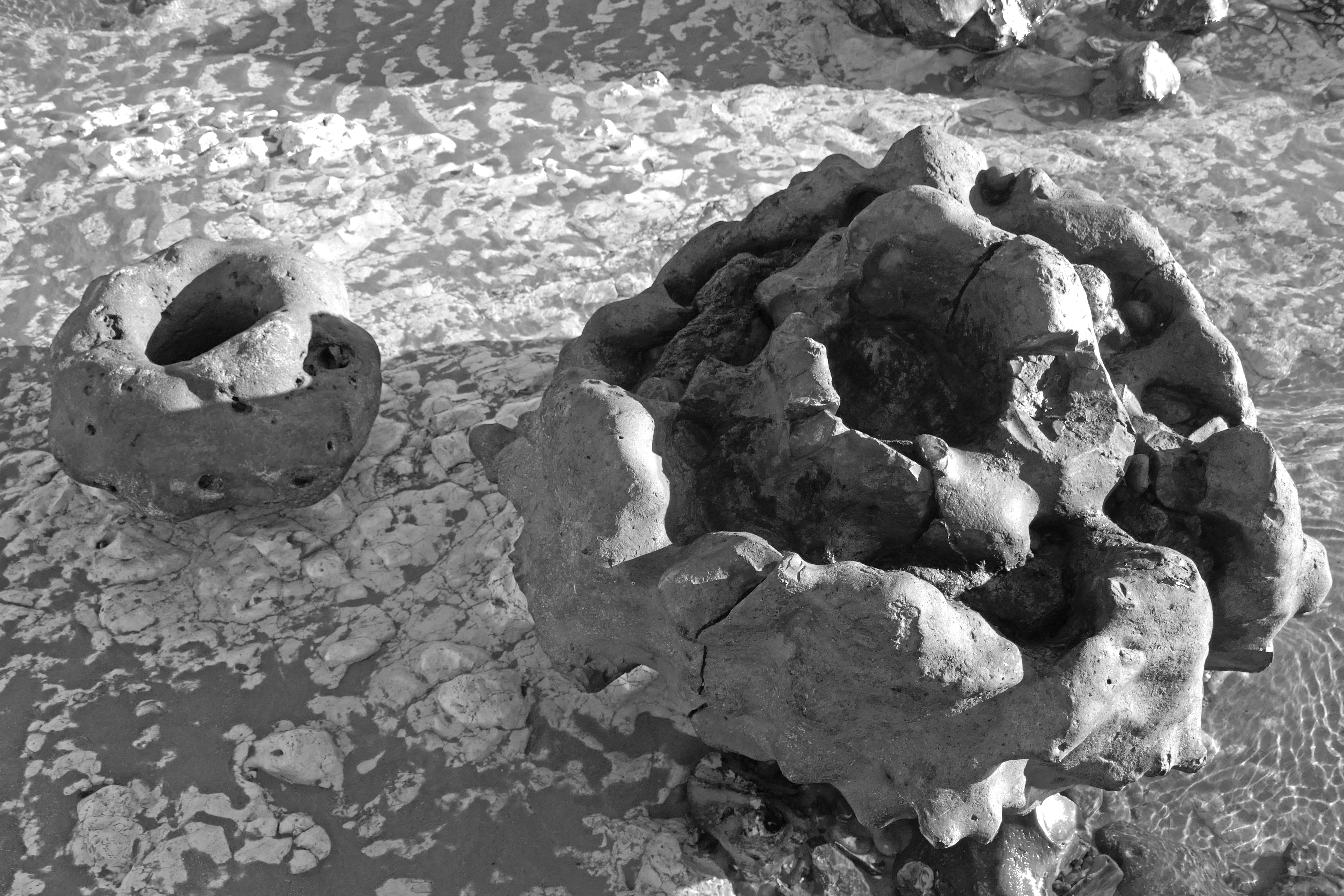
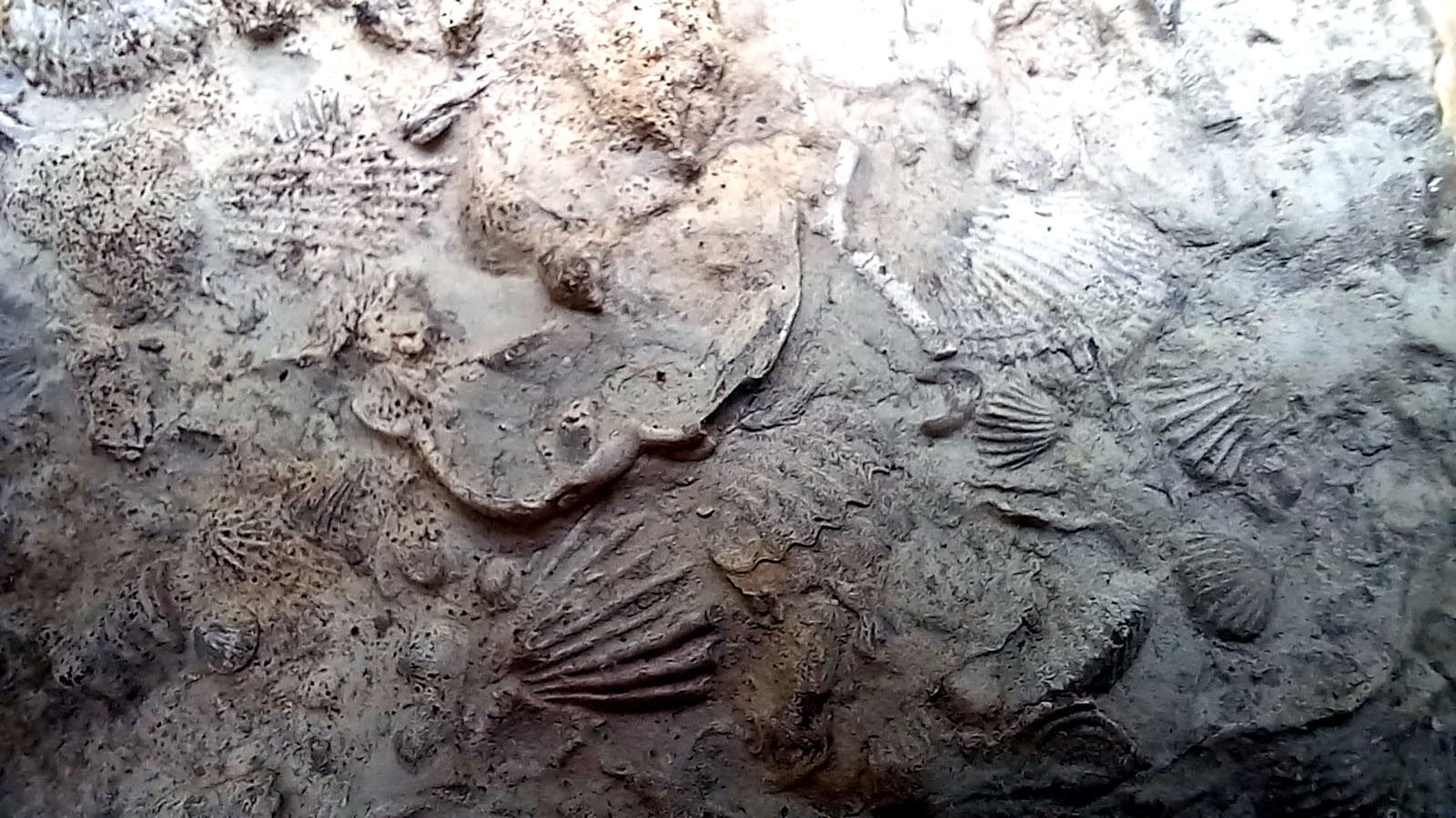
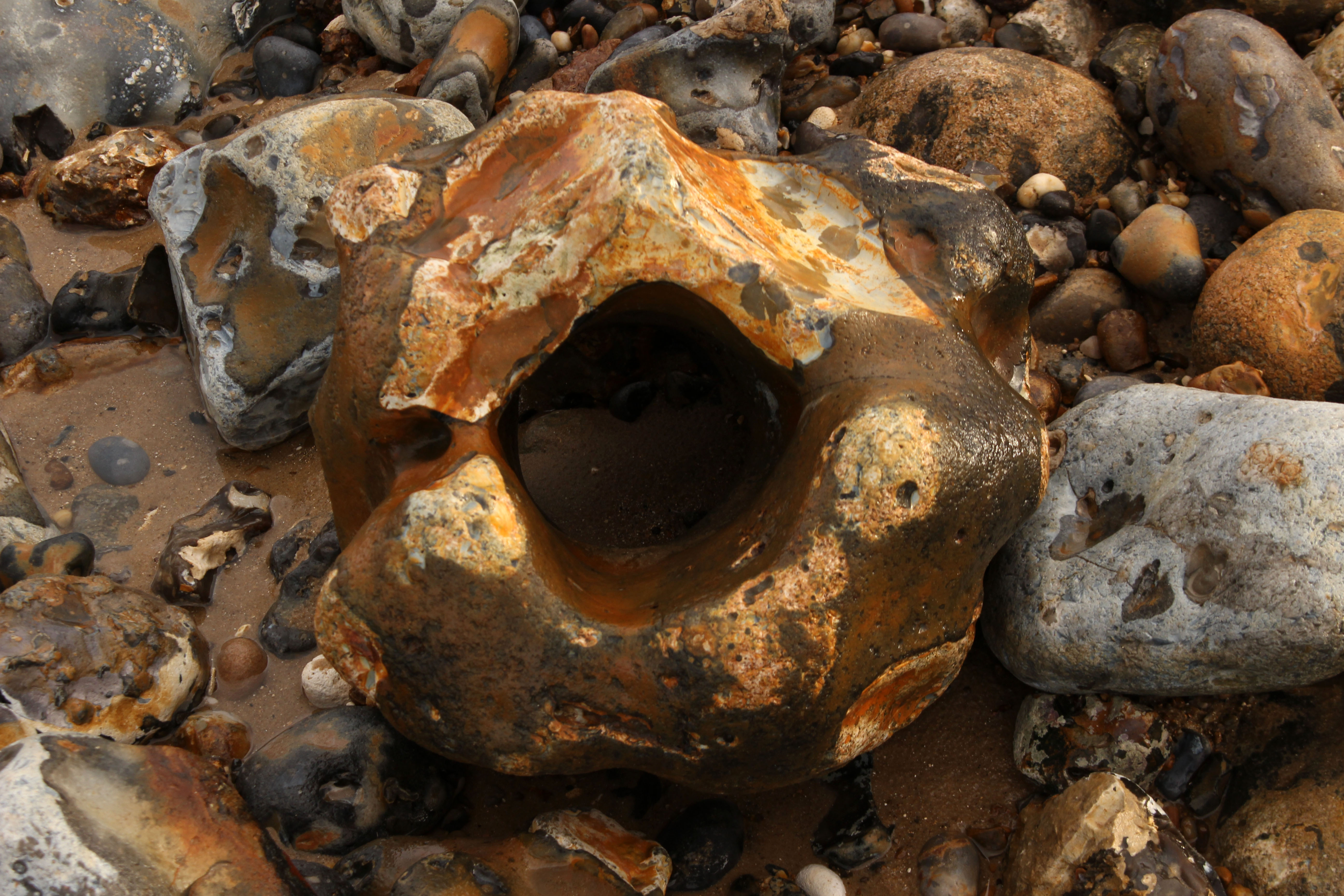
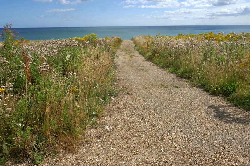
Paramoudras, West Runton Beach, Norfolk
Flint sometimes naturally takes the shape of a nest-like structure in the form of a paramoudra. It is the sort of nest that you might imagine a small dragon laying a clutch of eggs in.
Many of the larger flints that lay scattered were paramoudra – tubular in shape and either hollow in the middle or filled with chalk like a sculptured vol-au-vent.
The name paramoudra is Irish, deriving from the Gaelic peura muireach, meaning ‘sea pears’. They have also been called ‘ugly Paddies’ in the past, which seems a little harsh, even racist. They are beautiful in their own way. Their Norfolk name of ‘potstones’ makes more sense, as some of the better formed ones could easily be adapted to serve as plant containers. Paramoudra, like all flints, are actually pseudofossils. They are generally thought to be fossilised barrel sponges but the precise process of their formation is not fully understood.
Flint Country
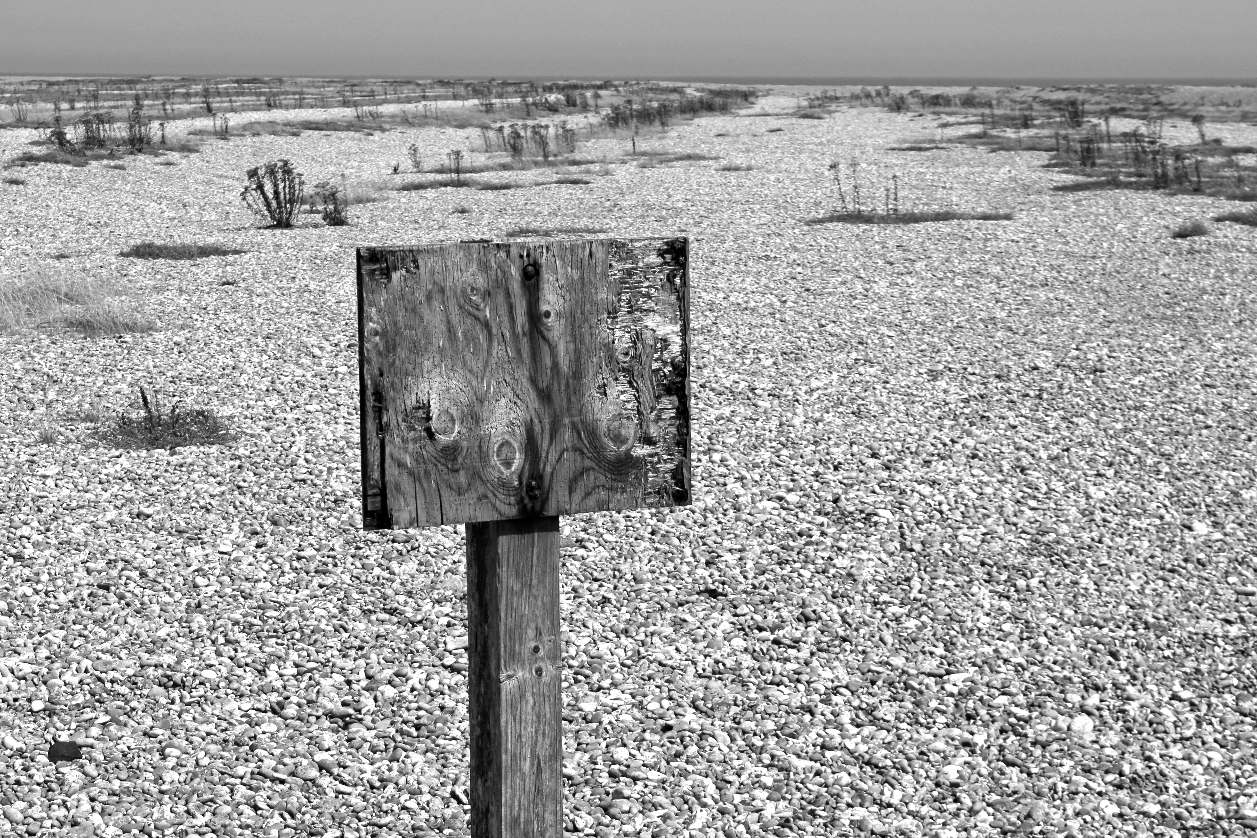
Orford Ness, Suffolk
A warning, its message lost to the shingle
Stray Cold War ordnance? Or tide?
This secret place, its geography both cause and effect
A zone of intrigue, longshore drift and flint music
Liminal, littoral, literal
A spit that resembles an island yet is called a ‘ness’ – an Anglo-Saxon word for ‘nose’ that describes a headland or promontory – Orford Ness is a luminous landscape of shingle, birds and secrecy. A one-time top secret weapons testing site, it continues to exude an air of secrecy sufficient to make even the modern-day visitor feel as if that they are standing on forbidden territory. Its former exclusion from the public gaze is now part of its appeal but, even without this, Orford Ness is a highly evocative sort of place. In recent years, the spit’s unique combination of dark history and melancholy landscape has resulted in it becoming a holy ground for a particularly niche variety of art and literature. All have tried to tap into the Ness’s peculiar genius loci.
Flint Country
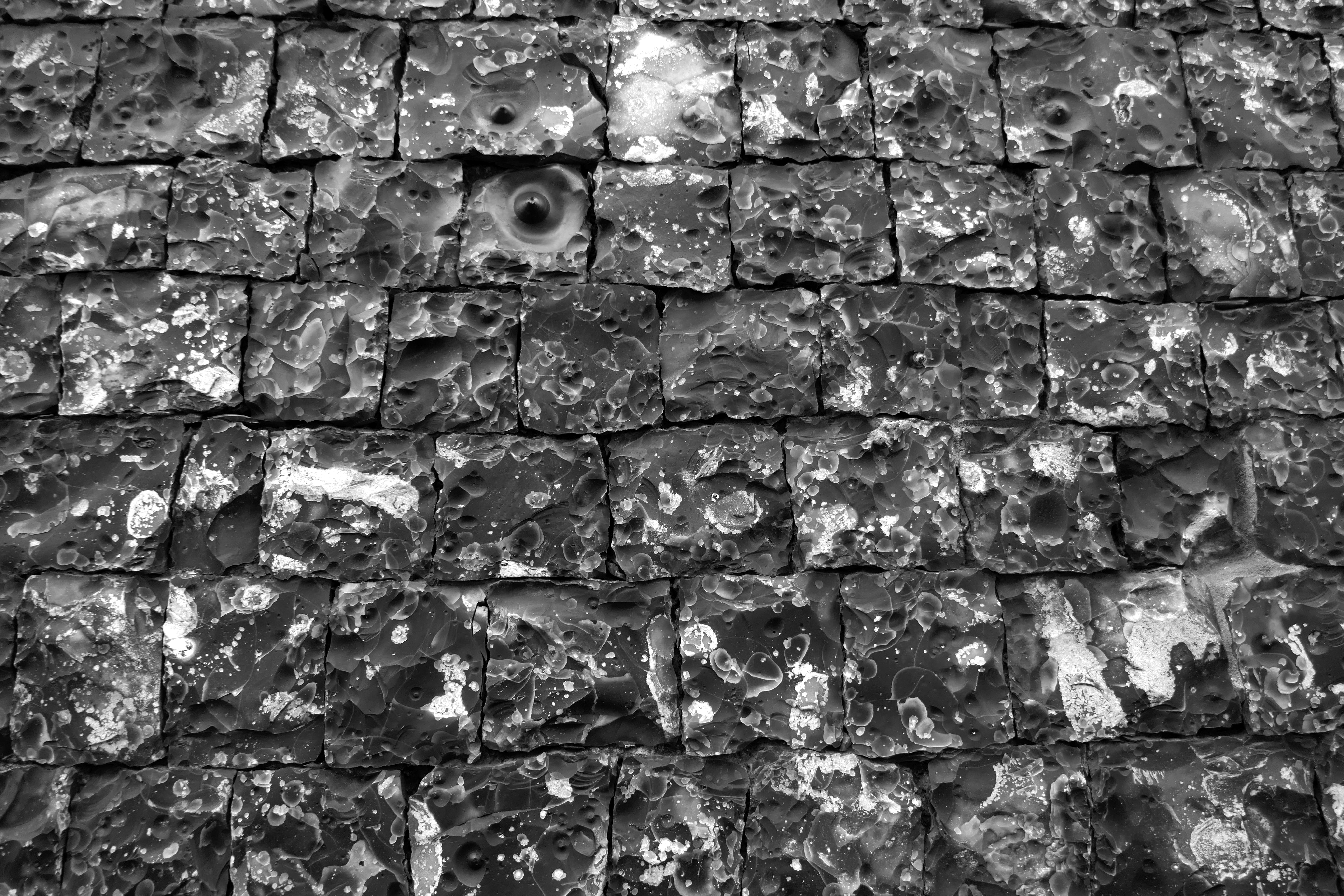
Guildhall – Poppy Mathews
Flint wall, Museum of Norwich at the Bridewell
A night-black wall, early medieval
Its joints, Inca-snug, four-square
Yet not quite square
A thousand faces to the world, a mosaic of time-lost oceans
Visitors to Norwich have long noted the abundance and splendour of its flint buildings. The equestrian traveller Celia Fiennes visiting the city in 1698 observed that Norwich, in addition to having ‘a great number of dissenters’ was ‘a rich, thriving industrious place’:
… by one of the churches there is a wall made of flints that is headed very finely and cut so exactly square and even to shut in one to another that the whole wall is made without cement at all they say… it looks well, very smooth shining and black.
The building whose wall Celia Fiennes was so impressed with still stands and for almost a century has served as the city’s Bridewell Museum. As the plaque by the museum entrance confirms, it has long been considered ‘the finest piece of flintwork in England’.
Flint Country
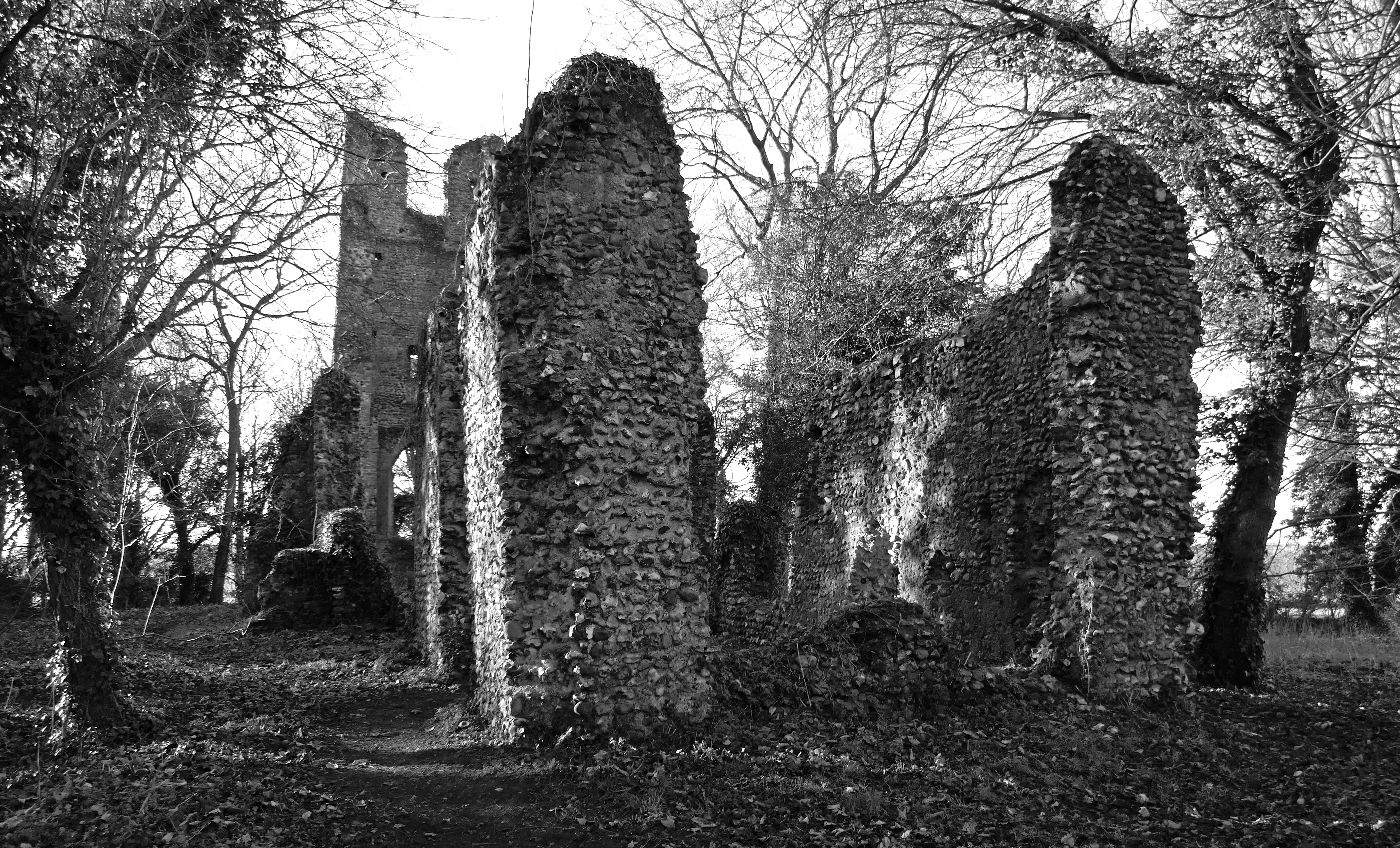
Ruin of St Mary’s Church, Saxlingham Thorpe, Norfolk
Given sufficient time, ruins can blend into the landscape and accumulate folklore along with the ivy and bramble. A ruin invariably provokes a sense of melancholy – a psychological linkage of place and emotion that has been recognised since antiquity. There is even an Old English word for it: dustsceawung, which translates as ‘the contemplation of dust’, although ‘dust’ here should be considered in the broader sense of that which remains after destruction, along with the concomitant awareness that all things go this way eventually.
Norfolk has more than its fair share of ruins. In particular, it abounds with a wealth of long-abandoned flint-built churches. Mostly these ended up as ruins because of abandonment and their subsequent deterioration over the centuries that followed. Others were deliberately dismantled, partially at least for the building stone they held, which would then be recycled for use in new churches, houses and farm buildings.
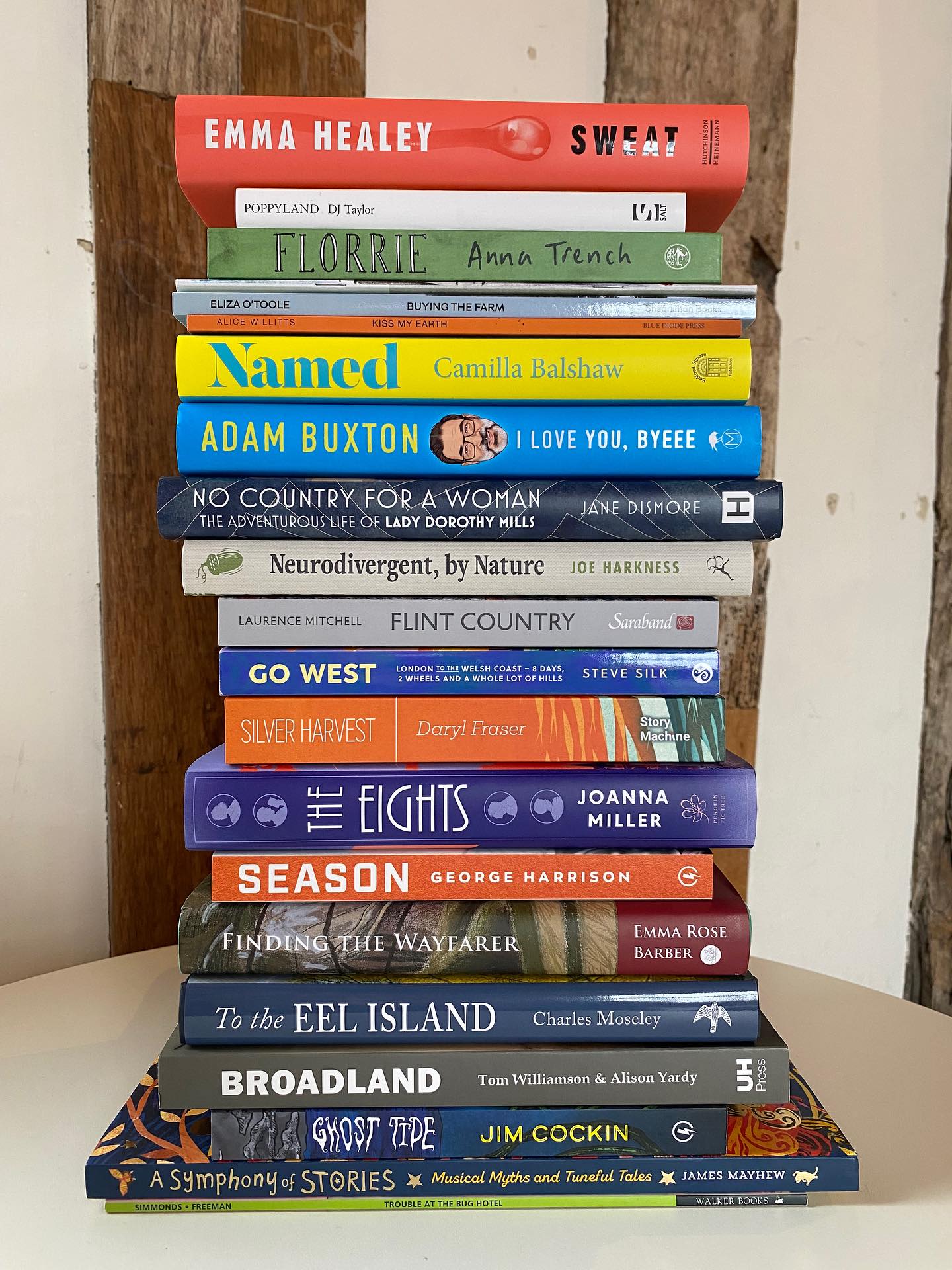
I’m delighted to announce that Flint Country has won the the General Non-Fiction category for the 2025 East Anglian Book Awards. It was up against some very worthy opposition and I am thrilled that it has been chosen by the prize committee.
The 2025 category winners are:
Biography & Memoir: Named: A Story of Names and Reclaiming Who We Are by Camilla Balshaw (Bedford Square Publishers)
Debut Novel:Silver Harvest by Daryl Fraser (Story Machine)
History & Tradition:Finding the Wayfarer: Physical, Spiritual and Poetic Survival by Emma Rose Barber (Tandem Publishing)
Poetry: Buying the Farm by Eliza O’Toole (Shearsman Books)
Fiction:Florrie: A Football Love Story by Anna Trench (Jonathan Cape)
Children’s Books:Ghost Tide by Jim Cockin (Lightning Books)
General Non-Fiction:Flint Country: A Stone Journey by Laurence Mitchell (Saraband)
I’m delighted to announce that Flint Country has been shortlisted in the General Non-fiction category for the East Anglia Book Awards 2025. The winners of each of the seven categories will be announced early next year.
It’s gratifying to see it here, midstratum in this literary Jenga Tower, its spine a silvery – dare-I-say, flinty – grey. A distinct, rock-solid layer in a cliff face of words and syntax.
I have made a few updates to East of Elveden recently so you might wish to take a look. The site is now thankfully ad-free, so the only thing I am promoting or trying to sell here here is my own work. There are now separate pages featuring my various Books and Other Writing, including links to reviews and purchase options (on East of Elveden banner above). There are also links to some of the places where my writing can be read for free online. Please have a look. Bear in mind that although links to a site named after a famous South American river might feature here, there is absolutely no compunction to buy from there – it is simply a useful link for reviews and for ‘read sample’ features.
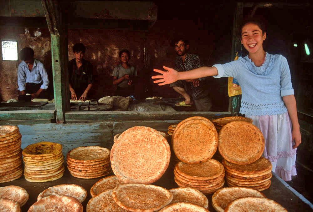
The photograph above has absolutely no connection with the site update. It just makes me happy. It was taken in September 2001, a week or so before the events of the 11th of that month turned the world upside down. Besides, I can still recall the wonderful taste and smell of that still-warm bread.
We were driving home from North Wales, and it is a long way to East Anglia from there. So we were looking for a break in the journey somewhere: a place to rest overnight before A14-ing onwards to Norwich? While it might not be everybody’s destination of choice, Dudley, de facto capital of England’s Black Country, has some points in its favour, its West Midlands location midway between coasts being one of them. Besides, I wanted to have a look at Wren’s Nest, the geopark on the town outskirts, where all manner of weird and wonderful fossils from the Silurian period might be found.
I had been here before, several years earlier, a brief stop on a coast to coast pilgrimage that I wrote about in my book Westering. Back then I had passed through Dudley as I traced my way through the Birmingham – Black Country conurbation by way of its extensive canal network; an interesting route, although Venice didn’t spring very much to mind as I traipsed westwards through a decayed, post-industrial landscape.
I wrote then:
I arrived at a large, five-way roundabout and a dual-carriageway, which I followed further uphill towards Dudley Castle, which I could see, noble but not entirely fairytale, flying its flag on top of the hill ahead. The next roundabout held several large, Black Country-themed sculptures: a steel crucible, bronze cannon, heraldic lion and medieval plough. It looked as if Dudley was doing its best to make the most of its industrial heritage. I wanted to take a closer look but was stuck on the wrong side of the dual carriageway with no safe means of crossing. Eventually, I spotted a footbridge ahead that conveniently led me straight to Dudley’s bus station at the foot of Castle Hill, an outcrop of the Wenlock Group limestone that had played a significant part in the town’s industrial development.
This time, coming from Wales by way of Shrewsbury and Telford, we came upon this same roundabout as we were driving around looking for the hotel we had booked for the night. Travelodge found, and bags deposited, we went off in search of food and drink. A peremptory Google search of the vicinity revealed a pub close to the castle that might be a possibility but when we arrived at the Fellows things didn’t look very promising. A tribute singer was belting out a cover of Red Red Wine by UB40 at deafening volume and the courtyard was packed with smokers who were intent on avoiding the aural onslaught inside. Besides, it was Sunday evening and the availability of lunchtime roasts had been and gone. It looked as if we would have to try elsewhere.
On the way up to the Fellows we had passed an even more unpromising establishment on Castle Hill, a single-roomed place that called itself the Star Bar, which resembled more a garage lock-up than a place for food and drink, although the former was clearly available as boisterous yam yam* voices echoed from behind it half-closed metal portal. Also on Castle Hill was a once-splendid Art Deco cinema that now served as a Jehovah’s Witness Kingdom Hall. Next door, a Tudor Gothic pile had similarly been converted to serve as a place of worship for the town’s Muslim community: Dudley Central Mosque. The building, I found out later, was Grade II-listed and had once been a school.
* yam yam = Black Country dialect
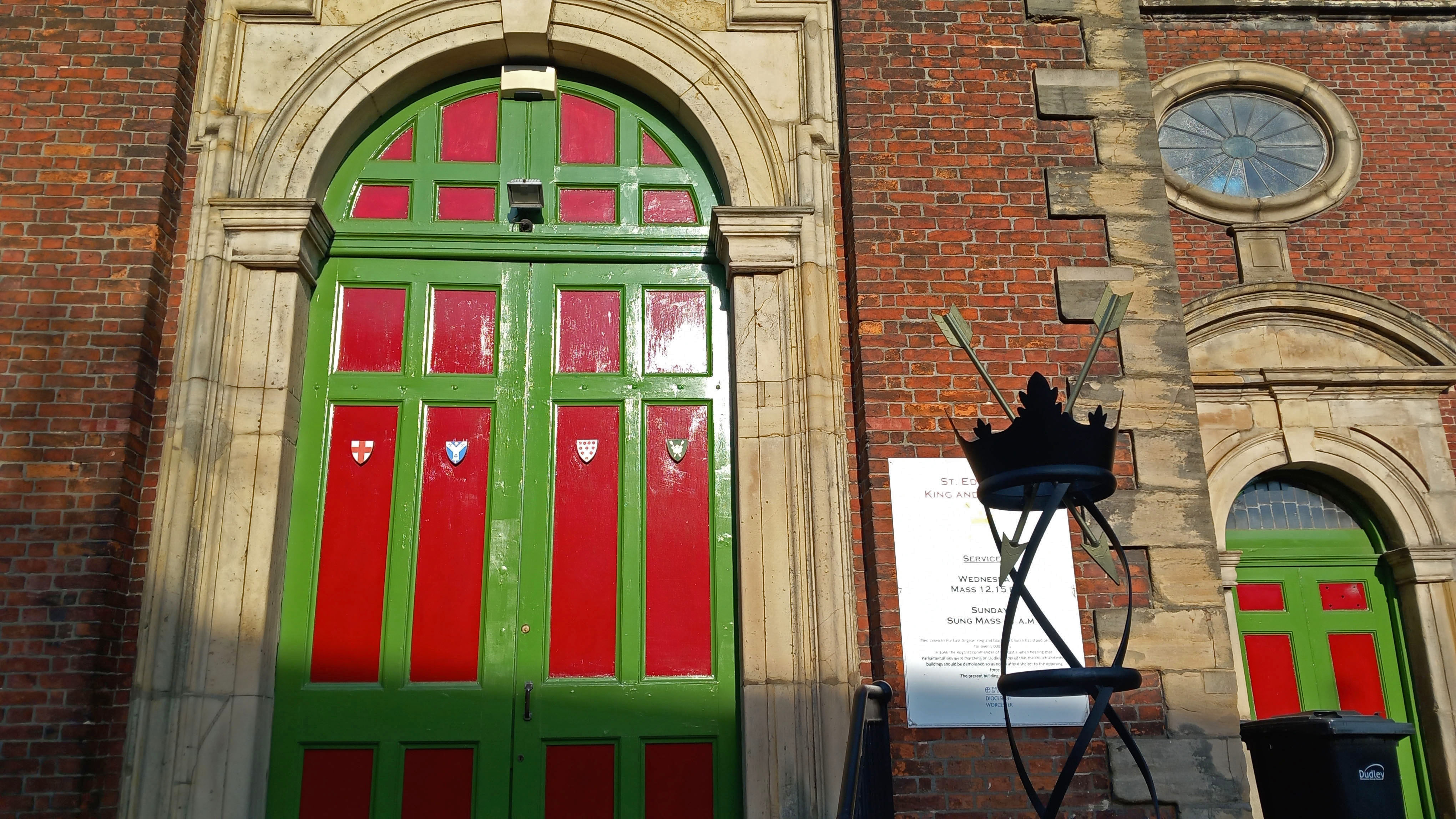
Across the road from the Fellows, a grand statue of the First Earl of Dudley stood at the top of the town’s pedestrianised shopping zone and market place. A little further on we passed St Edmund’s Church, an 18th-century replacement of earlier place of worship of Anglo-Saxon origin destroyed in the Civil War. To symbolise its dedication, twin crowns and the arrows of the saint’s martyrdom were on display in front of the church entrance.
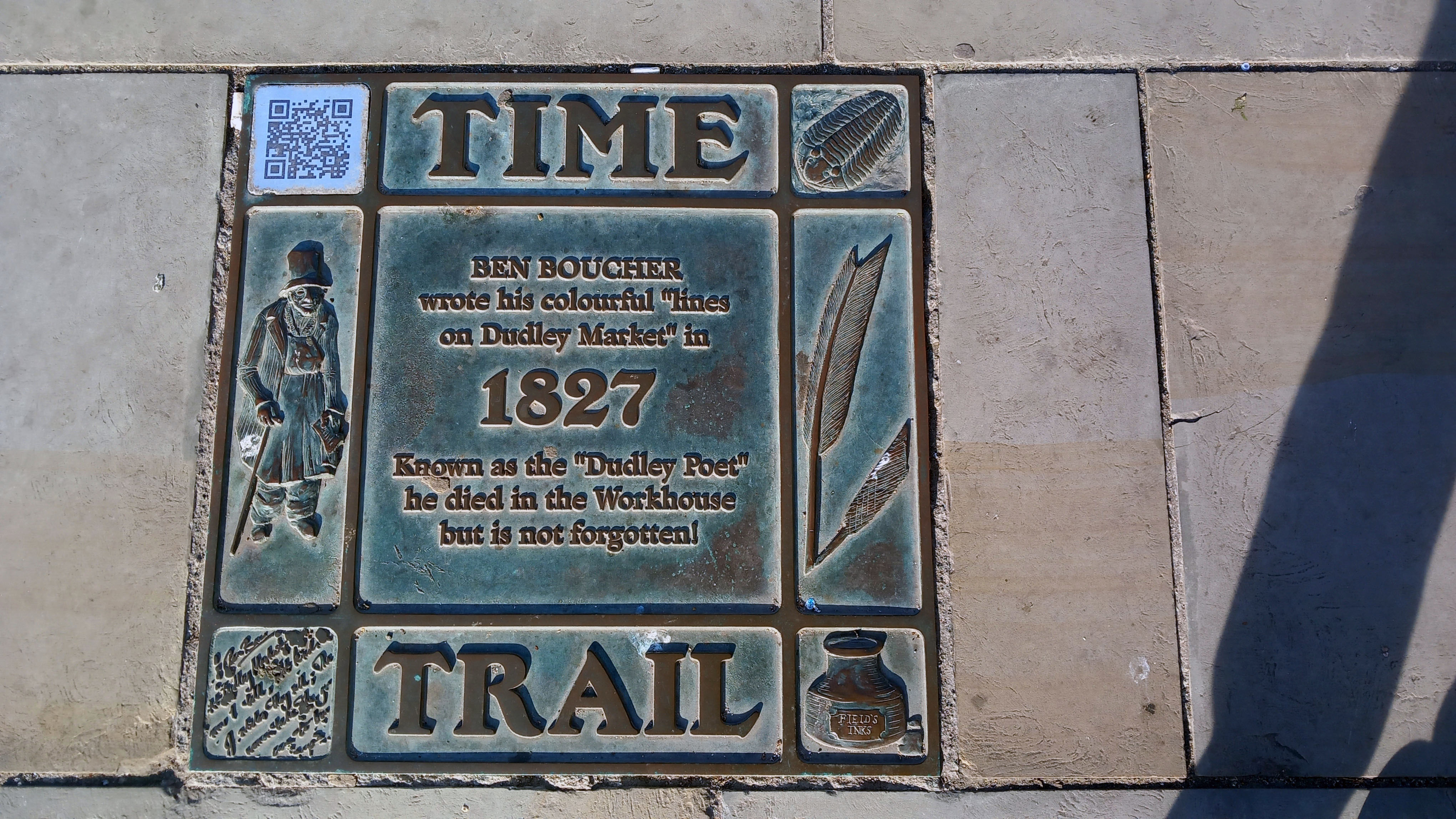
This being Sunday evening, the area was largely deserted; its market stalls locked up, although some of the shop fronts gave the impression of having been closed up for some time. There were several interesting statues scattered about to restore some sense of civic pride. Most notable of these was that of local football hero Duncan Edwards. Born in Dudley in 1936, Edwards had been a Manchester United ‘Busby Babe’ and highly respected England defender before dying tragically, aged just 21, from injuries sustained in the 1958 Munich Air Disaster. Further down, just beyond the market place, was a life-size bronze statue of a top-hatted Victorian gentleman sitting on a bench: the poet Ben Boucher (1769 – 1851), who wrote ‘Lines on Dudley Market’, some of which were etched into the curved Portland stone bench. While Boucher lived a much longer life than the unfortunate footballer, the Dudley Poet’s own sad fate was to end up impoverished in the town workhouse.
This brief glimpse of the town centre reinforced the impression I had taken from my previous visit: one of decline and closure, one of faded glory. The re-purposing of grand old buildings; the closure of town centre shops and department stores – out-competed ever since the opening of Merry Hill Shopping Centre at nearby Brierley Hill towards the end of the last century. Counter to this sense of decline were the upbeat Town Trail pavement plaques that told with pride the town’s unique geological and industrial history. It was here in the Black Country that the Industrial Revolution had originated and then swiftly gained momentum in the late 18th century. A serendipitous convergence of factors had come into play. The area had all the necessary raw materials – coal, limestone and iron ore. It had – or, rather, soon acquired – the labour, skills and engineering talent. It also had the means of distribution – canals, and later railways. It could even be argued that the Anthropocene – the recent epoch in which human activity has been the dominant factor in changing the world around us – began hereabouts. I touch upon this in the final chapter of my recent book Flint Country, where I write:
The precise date of its onset remains a matter of debate. James Lovecock, originator of the Gaia concept, claims that the Anthropocene started with the Industrial Revolution in the early nineteenth century, the period in modern history when the use of fossil fuels for manufacturing and transport got fully underway. Fine-tuning this connection between the dominance of human influence and technological progress, it could even be said that the Anthropocene began with the invention of Thomas Newcomen’s steam-powered pump, a machine first used to remove water from a coal mine near Dudley in the English Black Country in 1712.
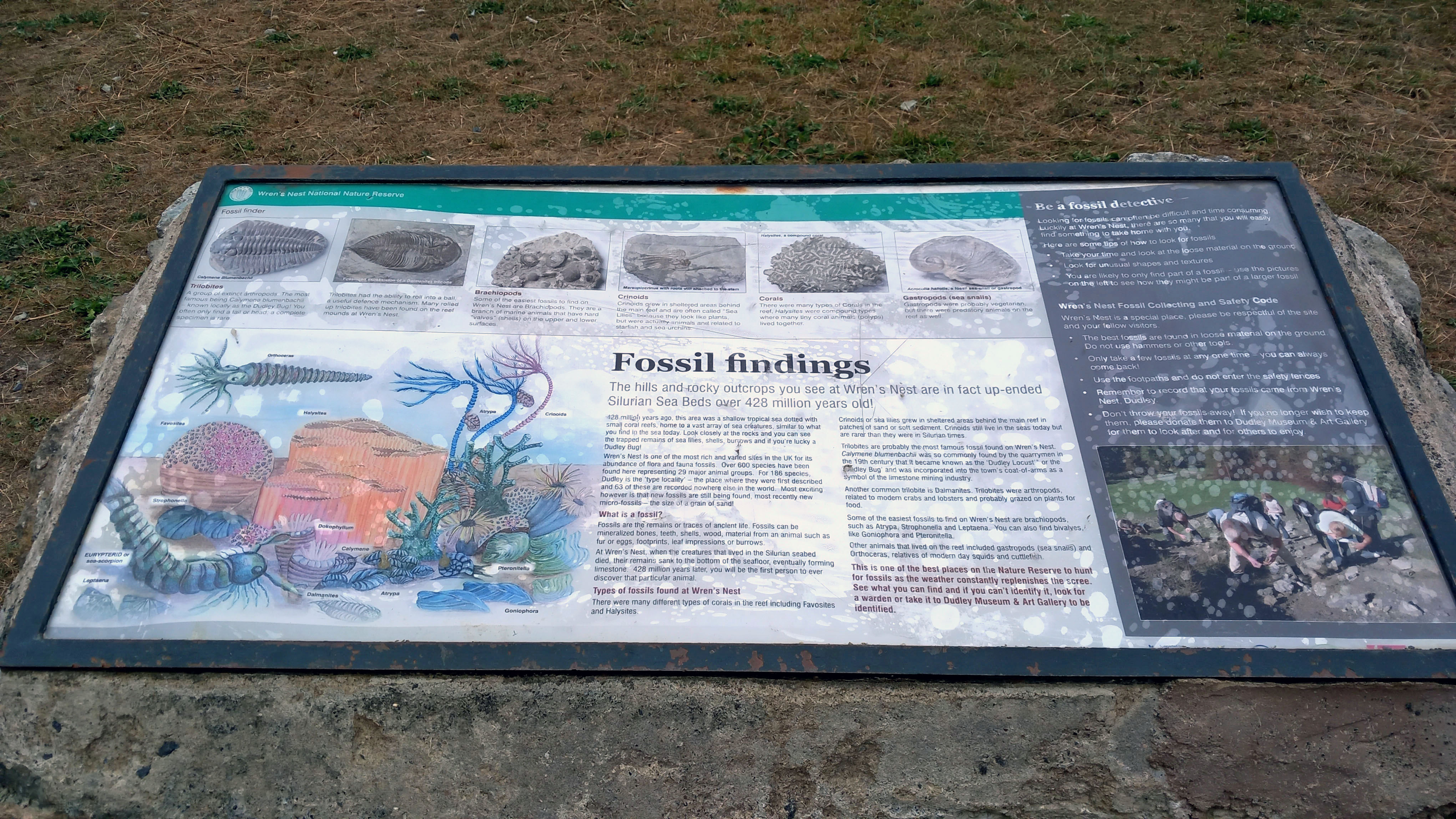
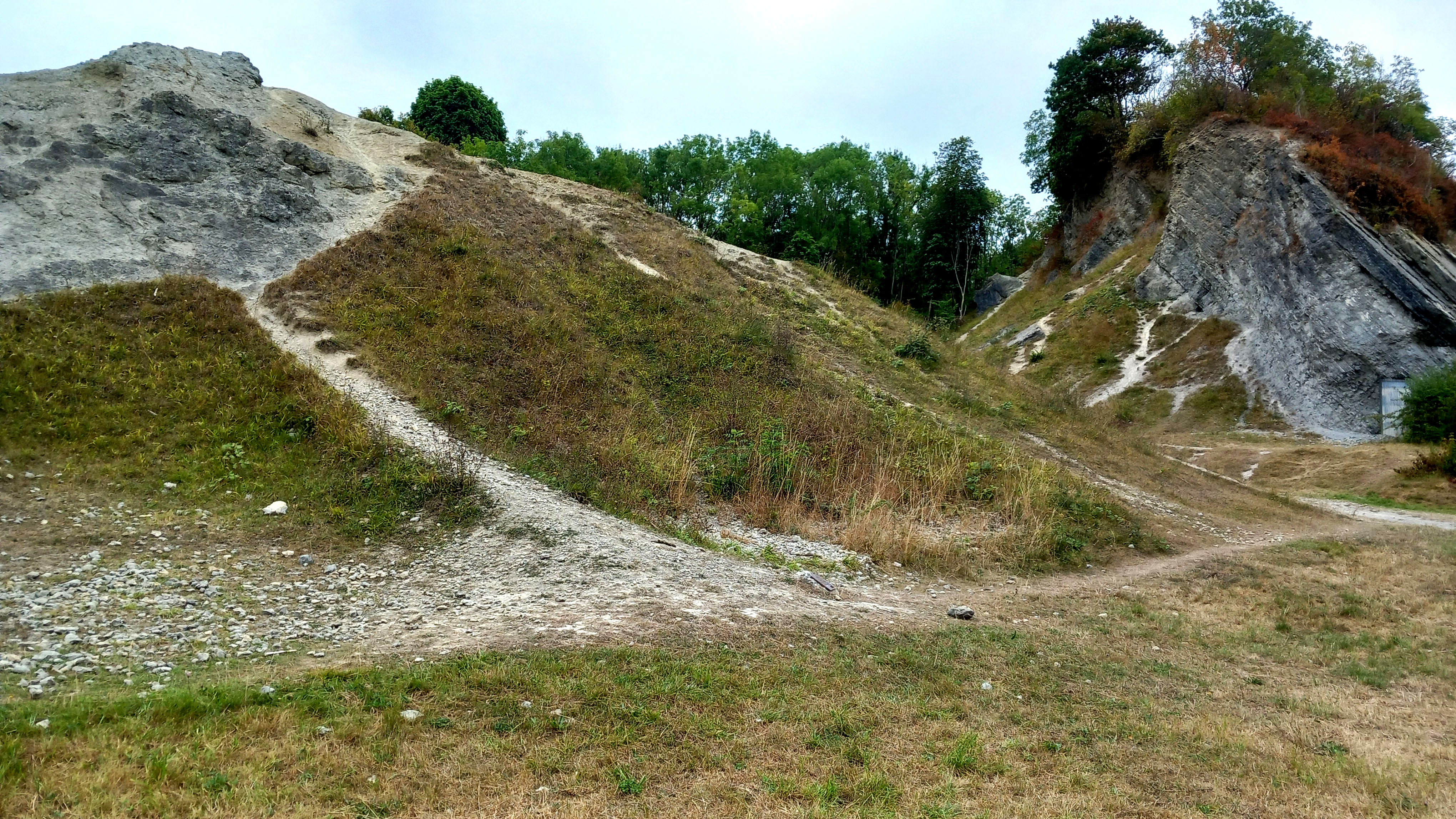
Next morning we made our way to Wren’s Nest, where I noticed that the suburban streets approaching the site had pleasingly apposite names like Silurian Mews and Fossil View. It was a grey, overcast, not-very-warm-for-August sort of day, and the site was fairly quiet apart from a couple of dog-walkers and kids on bikes. At the entrance, an information board gave us the lowdown on the site’s remarkable geological pedigree. Wren’s Nest is effectively a 428 million-year-old tropical seabed that was once covered by coral reefs and uplifted within the Much Wenlock limestone that gifted this region its industrial resources.
The prize fossil here is a species of trilobite, Calymene bumenbachii, known colloquially as the ‘Dudley Bug’, which looks like a scarily, super-sized woodlice, although it is more closely related to modern day crabs. To find one of these would have made me very happy but they proved to be elusive. What I did find after an hour and a half of turning over scree were several bits of coral and all manner of fossilised brachiopod shells. Best of all was a small flat piece of rock embedded with dozens of tiny shells: a fragment of ancient sea floor that revealed a microcosm of life 428 million years ago, a time when the existing continents were yet to separate and the territory of what would become the British Isles lay south of the Equator. To contemplate such scales of time and distance takes the breath away. William Blake wrote of seeing ‘the world in a grain of sand’. Here you could see a long-vanished world in a small piece of rock.
We left the car park and drove northeast through Tipton and Wednesbury to reach the M6 with its relentless parade of thundering traffic. It was a timely reminder that we were now firmly back in the age of man and machine, the Anthropocene. In comparison with the aeons that had passed since the fossils of Wren’s Nest were deposited at the bottom of a tropical ocean, the 19th-century heyday of the Industrial Revolution in the Black Country with its smoke, red-sky furnaces and metal-clanging workshops was as if just yesterday.
My latest book Flint Country was published a couple of weeks ago. I would just like to share this generous blog post about it by Klausbernd Vollmar and Hanne Siebers. It also includes some of Hanne’s lovely images of Cley next the Sea on the North Norfolk coast.
My new book Flint Country: a stone journey will be published on July 10th. Here’s a link to the blog post I wrote about it for the publisher, Saraband.
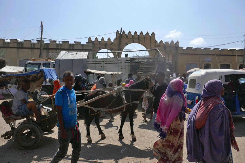
The road to Dirē Dawa is a long one: an eight-hour drive from Addis Ababa, or so we are told.
We left Addis Ababa at dawn, our bus rattling through empty streets shadowed by new-build office blocks. As with almost everywhere currently in Ethiopia, the pavements were piled with concrete rubble, the result of Prime Minister Abiy Ahmed’s ambitious nationwide road-widening project, a controversial scheme that had already demolished parts of some poorer city districts and displaced many residents in its wake.
For the first hour or so we sped along a pristine tarmacked dual carriageway, the brightening horizon ahead weighed down by clouds the colour of watermelon juice. We could have been almost anywhere; or, at least, anywhere that comes blessed with a backdrop of purple-shadowed mountains and lush tropical greenery. Eventually the freeway morphed into a narrow two-lane highway, which meandered around the heads of valleys as we plied our way eastwards. Traffic was heavy in both directions. Coming towards us was an endless stream of heavily laden trucks from Djibouti, each one towing a trailer, vehicle and driver bonded in lockstep like driven cattle. We slotted into a gap in the fast moving crocodile of trucks that were heading east towards the coast, some of which were piggybacking another truck strapped to their flatbed.
As elsewhere in the country there were checkpoints and roadblocks to slow things down. We had already experienced these travelling the roads of the south, especially in Oromia state, although they had rarely delayed us for long. Sometimes they were administered by the Ethiopian army but more often than not they were manned by local militia who wanted to keep an eye on who was coming into their territory. It had not taken long in the country to come to the conclusion that, rather than the unified sense of national identity promoted by the government, Ethiopia was in the process of becoming increasingly fragmented by region, language, culture and political persuasion.
Before our arrival in Ethiopia we had made firm decisions as to our itinerary. These were based on information gleaned from online travel forums and British FCO warnings regarding more unstable areas of the country. Much of the north – the highlands of Amhara and part of Tigray – was considered unsafe because of rebel activity and kidnappings. Similarly, part of the large sprawling region of Oromia that fans south, west and east from Addis Ababa also came with similar warnings about safety. The FCO had produced a map of the country that divided the country into three zones according to perceived safety: red (‘Advise against all travel’), amber (‘Advise against all but essential travel’) and green (‘see our travel advice before travelling’). I had consulted the updated map frequently throughout the second half of 2024 in the vain hope that brotherly love might prevail throughout the land but the map did not appear to change very much. Much of the south, in particularly the area around Hawassa where we had spent the previous week, was largely amber and therefore considered relatively safe. The highway between Addis Ababa and Dirē Dawa appeared to pass through both amber and green zones, nudging the red briefly between the Oromia towns of Welenchiti and Metehara.
Road blocks and heavy traffic aside, the other barrier to easy progress was roaming animals – donkeys, goats and camels. The donkeys especially were a law unto themselves, totally unfazed by the vehicles that swerved around them as they pottered along oblivious to any danger. It seemed almost as if the animals understood the fast and loose rules of the road – fully aware that if they were harmed then their owners would require compensation from the guilty driver. On a couple of occasions I actually saw one cross the road using a zebra crossing. Camels were a different matter though, large enough to call the shots, they were generally unwilling to step aside or allow any vehicle to manoeuvre past them.
We passed through an endless parade of villages that had little to differentiate themselves from one other: a blurred flash-by of roadside settlements, all flimsy housing and lean-do shops thrown together out of scrap wood, plastic sheets and corrugated iron. The goods on sale – fruit and vegetables, flyblown meat, second hand clothes, spare parts for vehicles – were the bread and butter (or, perhaps, injera) of everyday life. As always in the Global South, it was intriguing how such a base-level financial system managed to thrive, a poor man’s economy in which ragged ten birr notes continually changed hands until all the value had been squeezed out of them.
There was another product on sale that seemed to be ubiquitous in this part of the world – we had seen it on display along almost every roadside in southern Ethiopia the previous week. Khat, the stimulant of choice across much of the Horn of Africa, is an innocuous looking leaf that resembles bay or privet. Legal throughout the region, khat is, as many Ethiopians will attest, less a stimulant, more a way of life. Our driver was clearly an aficionado; as was our guide, a young man who kept his own counsel throughout the journey and did not utter a word of information about the foreign (to us) country that lay beyond the window. The pair just stared ahead for the whole way, locked in herbal reverie as they slowly worked through the pile of leaves that lay at their elbow.
Khat seems to be very much a driving drug, an herbal alternative to the so-called energy drinks whose slim cans over-caffeinated motorists toss out of their windows along Britain’s motorways. It might even be considered to be a green alternative to caffeine, although there is absolutely no shortage of coffee in this land of stay-awake plenty. A week earlier, motoring through the coffee-rich Sidama region of the south, our previous guide, Wonde (‘Wander’), had regaled us with horror stories about khat-crazed drivers careering off the road due to lack of sleep and/or poor decision-making. It seemed perfectly believable. Between Addis and Dirē Dawa I counted at least eight trucks that had crashed and gone off-the-road; some lay forlornly on their side, while others had ended up completely upside down with wheels akimbo. It was unclear as to what had become of the drivers, although it did not look as if they would have escaped unscathed.
One crashed truck that we passed had unleashed a load of crated beer bottles onto the slope beside the road. Slowing down to make our way around the crowd that had gathered around the wrecked vehicle, the air smelled as malty as a Sunday morning pub. A couple of armed men were guarding the booty as approved wreckers sifted through the debris, placing the unbroken bottles in crates ready for resale. Who the men with guns were was anybody’s guess. It was the same at some of the checkpoints we were obliged to stop at, where youths with rifles peered inside the bus before lowering the barrier – no more than a rope stretched across the road – to allow us to pass. A single word from the driver, ‘Turist’, and a glance at our pale well-fed faces within, was usually sufficient for us to be waved on.
While khat consumption is widespread, it was something that was shared with other countries in the region like Somalia. Other aspects of Ethiopian culture are decidedly more unique. One is the country’s unorthodox calendar, which is seven or eight years behind the rest of the world. While the year elsewhere might be 2024 according to the Gregorian calendar, in Ethiopia it is currently 2017. ‘Welcome to Ethiopia, and congratulations,’ we had been told more than once, ‘here you are seven years younger.’ Another Ethiopian curiosity is the music that is played loud and proud almost everywhere, which whether traditional, pop, or the rather wonderful Ethio-Jazz that I had already developed a taste for, uses a pentatonic scale that has a distinctive modal sound to it. A world away from other African music that is generally more accessible to Western ears, Ethiopian music has a tendency to sound rather other-worldly and even a little Chinese at times.
Another facet of Ethiopian culture that sets the country apart is the food, which is quite unlike anywhere else. The mainstay of the diet is a sour spongy pancake called injera, which is made from an ancient indigenous grain called teff. This is eaten along with small helpings of spicy vegetable or meat sauces. For many Ethiopians, if they can afford it, kitfo (spicy raw beef) is the preferred accompaniment, although, perhaps counter-intuitively, there are actually two days of the week, Wednesday and Friday, when restaurants are obliged to serve only ‘fasting’ food, which is strictly vegan. Whether meat or vegetable, raw or cooked, freshness is probably the most important factor in regards to health, and I believe it was the suspicious, rather tired-looking sauce that came with the injera I had eaten the previous night in Addis that had been the cause of the stomach cramps that troubled me throughout the long journey.
We pulled into Dirē Dawa just as it was becoming dark, the onset of the city’s flickering neon countering the rapid tropical plunge into night. The journey had taken twelve hours – sunrise to sunset. Considerably lower in altitude than where we had come from, the city felt hot and humid compared to Addis’s fresher, spring-like climate. But it was as bustling and noisy as the capital, with a honking stream of three–wheel bajajs (tuk-tuks) plying Dirē Dawa’s wide boulevards. Tomorrow there would be the opportunity to visit the city’s sights, such as they were. Tonight though, after a day of unremitting motion, it was the promise of laying still on an immobile bed that held the greatest appeal.
The very mention of the village of Happisburgh in Norfolk brings to mind all manner of prehistoric associations and connections with long-extinct ancestors. The early years of this current century have revealed exciting local evidence of the presence of earliest hominins in northwest Europe: Homo antecessor (‘Pioneer Man’) – near million-year-old clues in the form of flint tools and muddy footprints. Early humans walked these shores in the early Pleistocene, except it wasn’t so much a shore then as a river estuary: the Thames in an earlier incarnation when it flowed further north than its current course. Political boundaries were yet to exist, 800,000 years ago; the land mass that was Britain was still connected to Eurasia.
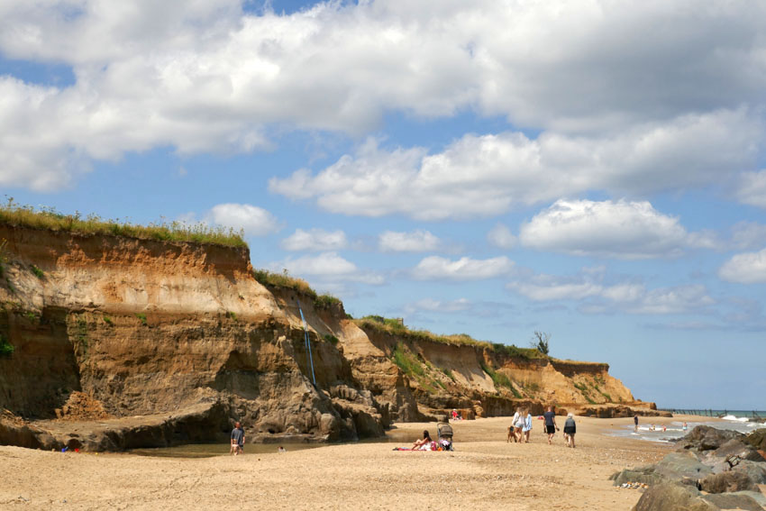
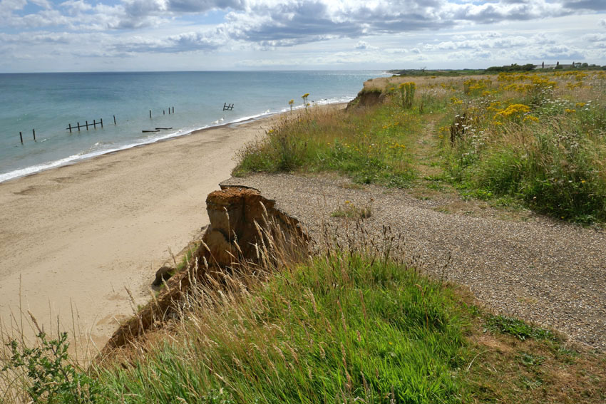
Prehistory aside, Happisburgh (pronounced ‘Haze-bruh’ to those who know) is also well known for other reasons. Its fame precedes it, although notoriety might be a better term. Nowhere on this coastline is the menace of coastal erosion witnessed more emphatically, although the near-vanished village of Dunwich on the Suffolk coast, once a thriving medieval port, might come close. For Dunwich the damage wreaked by the ever-invading North Sea is the past; in Happisburgh it is the present and future. Continually losing territory to the North Sea, there is visible evidence of the dynamic shifting shoreline to be seen everywhere here. Cliffs can be witnessed crumbling on a regular basis. Houses that were once located comfortably inland now perch perilously close to cliff edges; some have already succumbed and their remains litter the beach. Roads and tracks can be seen dramatically truncated along the cliff edge – streets that have become roads to nowhere, roads that lead to oblivion.
Even the village’s longstanding icons – the 15th-century St Mary’s church with its commandingly tall tower, the second highest in the county, and the equally imposing red-banded Trinity lighthouse built in 1790, Norfolk’s oldest – are both numbered in their days and probably won’t see this century out. The writing has been on the wall for a long time now – this northwest stretch of the Norfolk littoral is, after all, a fast-eroding coastline where such things can only be expected. Even so, the terrifying spectre of irreversible climate change does nothing but hasten the inevitable. Bold efforts have been made to ameliorate the threat: large chunks of alien geology have been transported here to be deposited on the beach – stone barriers to hold back the tide – yet somehow it feels like the wrong sort of folk tale: a village boy taking up a slingshot against a giant ogre, a near-futile King Cnut-like gesture.
So, there is plenty to say about Happisburgh but what of Ostend, its immediate neighbour to the north? Walking the coast here recently in preparation for a new book on short walks in Norfolk, I tried to find out more about the small settlement that shares its name with the better known Belgian resort. Information was elusive, other than it belonged to the parish of Walcott and was effectively an area of holiday properties appended to the south of that village. The name intrigued me, though, and I wondered whether there was a historical connection as there are several Waterloo farms scattered around Norfolk that commemorate the final victory over Napoleon close to the Belgian town of that name. Until 2001, when it was finally demolished, there used to be an early 17th century house in the village was called Ostend House. There may possibly be a connection here but was it always called Ostend House, or did the name come with the rebuild that took place in the 19th century?
Looking further for information, Wikipedia informed me that in June 2002 a rare Cuvier’s beaked whale was stranded on the beach here. This was the same species of whale that Kathleen Jamie describes being on display in Bergen’s Whale Museum. The Bergen whale was found choked by plastic bags that the unfortunate animal had probably mistakenly recognised as squid, its prime food source. As I had only just (twice) read Jamie’s latest book Cairn,which describes her return visit to the Norwegian museum, there was an immediate connection for me here, although it was nothing to do with the name of the place.
The whale was named by the French scientist Georges Cuvier (1769—1832)*, a polymath who was the first to coin the term ‘extinction’. In 1796 Cuvier presented a paper to the National Institute of Science and Arts in Paris, where he compared the anatomy of living and fossil elephants to prove that extinction was a fact and proposed that the now-extinct elephants had been wiped out by periodic catastrophic flooding events. Although a proponent of catastrophism in geology, Cuvier rejected the idea of organic evolution. As an essentialist he believed that plants and animals were created for particular roles and niches in the world environment and subsequently remained unchanged throughout their existence. In Cuvier’s thinking, as soon as one species became extinct as the result of geological upheaval, another would be divinely created to replace it. It would be Charles Darwin, of course, who would set the record straight some 65 years later with the publication of his On the Origin of Species. What Darwin would have made of the 21st-century discovery of evidence of a long-extinct ancestor, Homo antecessor, on a sea-battered English shoreline we can only imagine. Evolution to extinction: such a surprisingly short distance of time and space linking the two.
*[Alas, Cuvier’s name has also been linked with scientific racism, although we might excuse him for being, as the cliché goes, ‘a man of his time’. Of course, modern-day racists should not be forgiven in the same way – they are not men (or women) of their time. We might, I suppose, call them dinosaurs but to do that would be a disservice to palaeontology.]
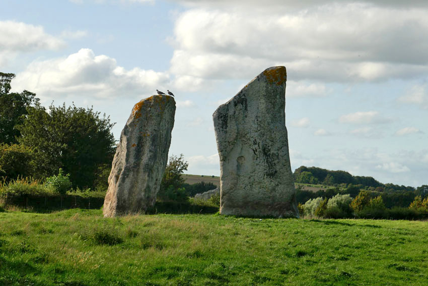
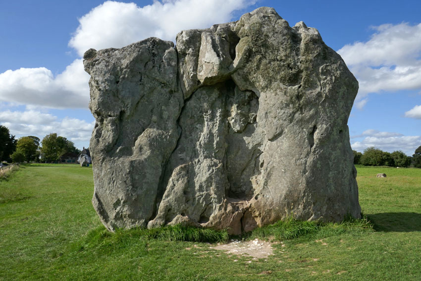
A Journey to Avebury is the name of a short silent film made by Derek Jarman made in 1971. Shot in wobbly Super 8, and saturated with burnt orange hues, it has an otherworldly eldritch atmosphere that is hard to describe. Suffice to say it is hardly be the sort of thing that the then English Tourist Board might have chosen to promote the stone-encircled Wiltshire village. Too painterly and surreal by half for such considerations, the film is both beautiful and slightly disturbing, and has the feel of a psychedelic adventure about to go wrong. With wind-blown trees and shifting clouds against Martian skies, A Journey to Avebury evokes the strangeness of a landscape that is already inherently deeply weird. The weirdness owes much to the implacable monoliths that dominate the village, although Jarman’s focus on the rolling Wiltshire landscape that surrounds the village, with its bare fields and isolated clumps of trees, is equally suggestive of a territory that exists outside the usual constraints of time and space.
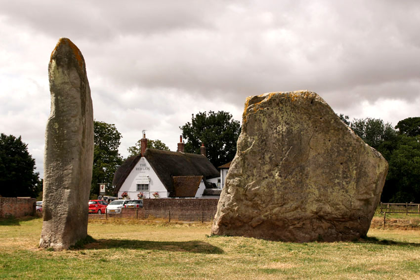
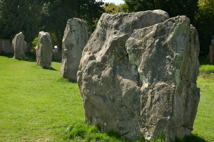
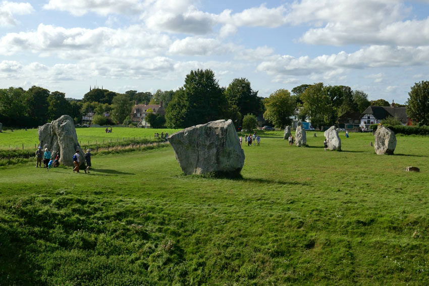
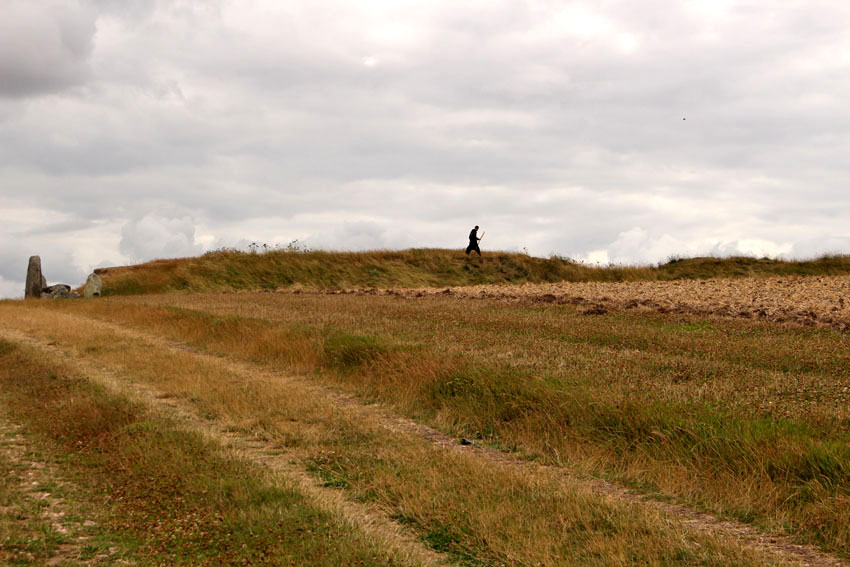
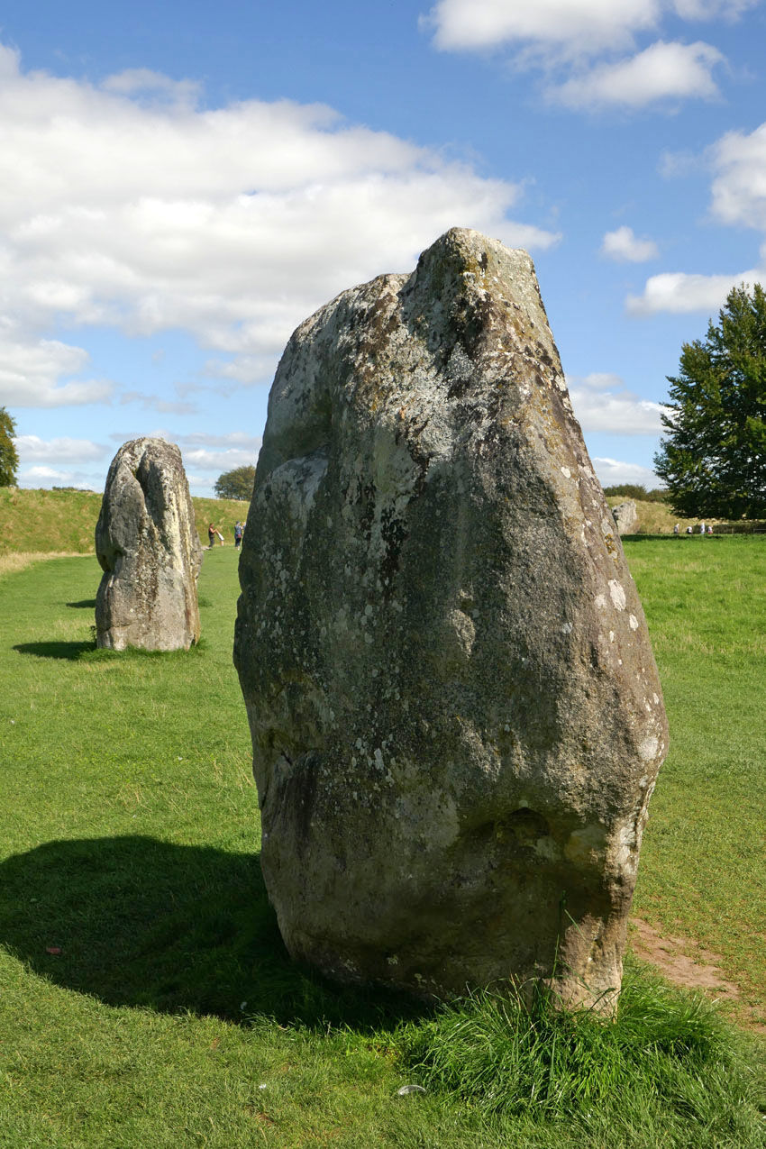
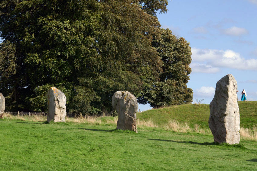
Avebury is undoubtedly an extraordinary place – a village that not only lies at the heart of a sacred Neolithic landscape but one that uniquely sits within the sweep of a stone circle. Not surprisingly it is a much visited location, especially in the summer months, as visitors that range from newly retired to New Age travellers come to walk the circle of stones and pay tribute to this ancient, stone-bound place. After several visits to the village myself, its megaliths and raised banks, pathways and lanes have become firmly imprinted in my mind. Some places fade quickly but Avebury is somewhere that etches itself on the memory.
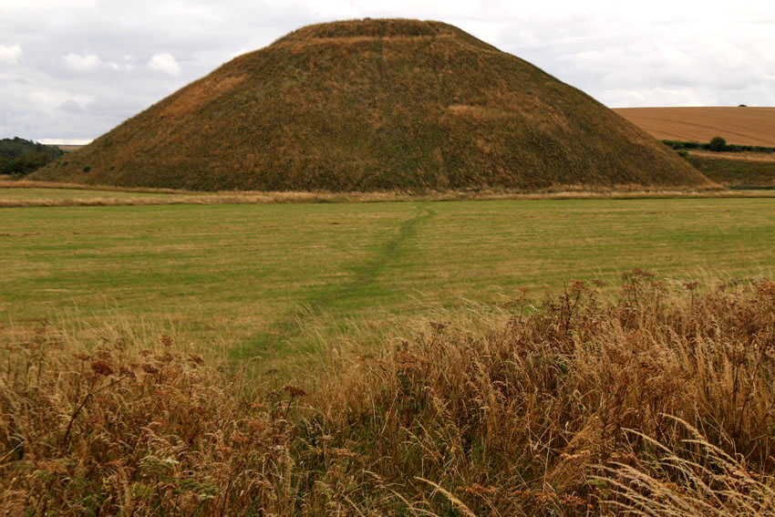
Even in prehistoric, monument-rich Wiltshire, Avebury has a particular gravity. It feels as if it is at the centre of things, a focal point for the megalith-strewn landscape that surrounds it. Nearby are other, even older monuments that put the stone circle and avenues of Avebury into context: the destroyed stone and timber circle of The Sanctuary, the chambered West Kennet Long Barrow and, most remarkable of all, the man-made chalk Mount Fuji that is Silbury Hill. These are all connected, by footpaths, tracks and, as many believe, ley lines, although it is the monument of Avebury that gives the impression of lying at the beating heart of it all.
Visiting Avebury is like going to meet an old friend from the past. Last summer, I did just that: arranging to meet a friend whom I had not seen for decades at the village. We sat at a bench in the churchyard of and reminisced about shared memories from forty years ago. Time stretched and compressed obligingly – but perhaps the location helped.
Like Stonehenge, the megaliths of Avebury were likely associated with ritual and social gatherings. They may also have functioned as some sort of solar calendar. But if Avebury is a place of measured time, it is also a place that stands outside time. The past, present and future rest easy here, although in the right light the village with its New Age atmosphere can appear to be perpetually locked in the 1970s – perhaps 1971, the same year that Jarman came here to make his film.
A Journey to Avebury (1971) by Derek Jarman
Also, this excellent fantasy drama TV series for children, broadcast on ITV in 1977, was filmed almost entirely at Avebury. Children of the Stones by Jeremy Burnham and Trevor Ray